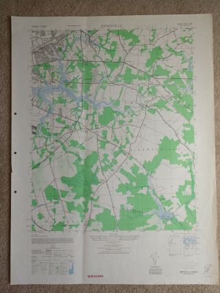
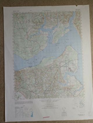
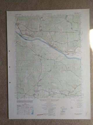
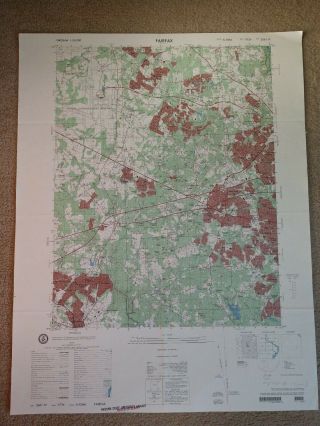
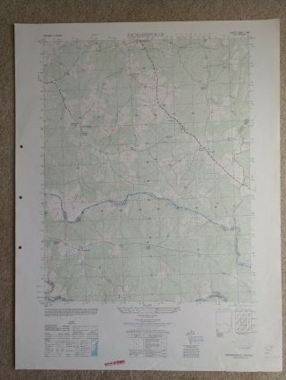
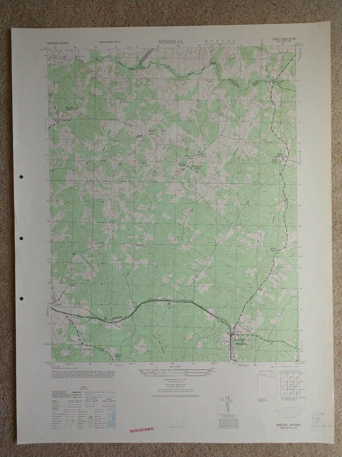
Large 28x221946 Topo Map Mineral, Virginia Louisa Ellisville Wares Cross Roads
Item History & Price
| Reference Number: Avaluer:19895771 | Topic: Maps |
| Year: 1946 | Features: Vintage |
| US State: Virginia | Original/Reproduction: Vintage Original |
| Country/Region: United States of America | Type: Topographical Map |
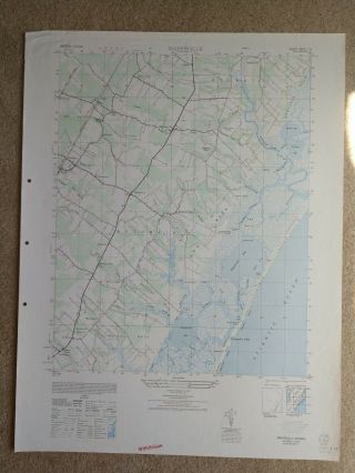
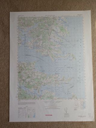
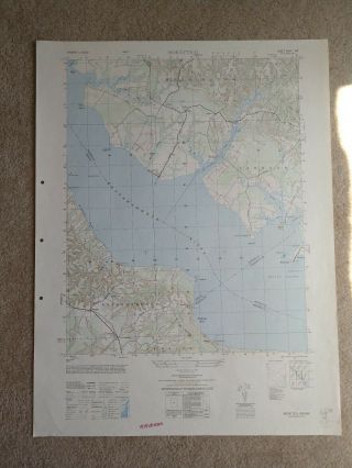
This map created by the USGS and distributed to the Arizona State University library. It may bear a stamp indicating that it is from the Arizona State University, Arizona Normal School or from the Arizona Territory or another school. This stamp may look like a black, blue or red institutional rubber stamp and/or there may be writing in the margin relating to cataloging - please see the photograph. These topo maps present elevation (contour lines), hydrography, geographic place names, a...nd a variety of cultural features.
This map is a window into topographical details which have no doubt changed with the passage of time.
A picture is worth a thousand words. The zoomable image is a major part of the item description. Please examine closely, as what you see is what we will send you.
These maps have been stored flat since printing and will be shipped in a sturdy shipping tube.
The map in the photo is the actual map you will receive. This sale is for my only copy of this map.
This map was printed on quality paper which has slightly and naturally age-toned, but the map is sound, mostly very clean and well preserved.
The map is detailed and worthy of display- a chart not often seen and no longer printed on paper by the Government.
On old sheets of paper, short edge splits (which are often carefully repaired with discrete small pieces of archival tape), light foxing, minor age discoloration, etc. are all things to expect. It's often unrealistic to expect an old sheet of paper to survive looking like new or without flaws. The key to any printed sheet is the overall visual appeal of the piece. Often small signs of age do not distract but rather they often add to the overall visual character.
Keep in mind when you receive your item that you are not handling a modern copy, nor some clever modern reprint, or so on. You are holding a genuine piece of printed graphic history, an old sheet of paper that was printed long ago and will, with some basic proper care, be around for a long time yet to come. In the meantime, you can visually enjoy it in your portfolio, hang it on your wall, give it as a present, etc.
We really do try to note any visually significant flaws in the description. Less noticeable, subtle or common minor age flaw characteristics may not be specifically mentioned, although often they are clearly visible within the zoomable scans or close-ups provided. Please look closely, do your research if needed, and ponder it before you click the buy-it button.
Virtually all old sheets of paper display some sort of visible age wear somewhere, and any attempt to capture every last one of them in words would just end in either mental or physical grid-lock. Short minor closed edge splits, uneven blank side margins (of no significance 99% time), obvious narrow margins, light typical scattered age spotting, inoffensive light dampstaining in blank margins, etc. are all often not commented upon, as they are mostly not worthy of specific mention. Map is sold as-is.
Specifically on this map there are some minor edge rips and wrinkles.
**Important information for International Buyers**
You may be charged customs/taxes/import duty by your country when your item arrives.