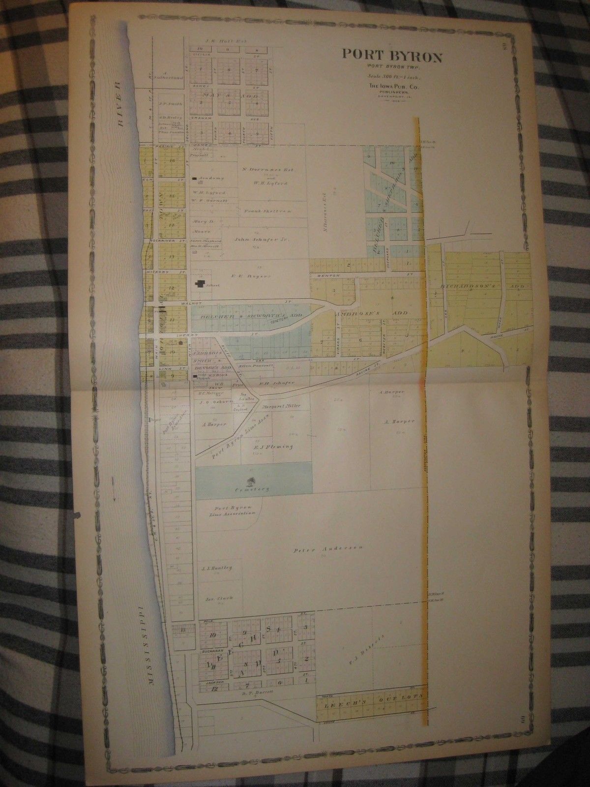
ANTIQUE 1905 CORDOVA PORT BYRON HILLSDALE ROCK ISLAND COUNTY ILLINOIS HNDCLR MAP
Item History & Price
| Reference Number: Avaluer:19917746 | Type: Map |

| Reference Number: Avaluer:19917746 | Type: Map |
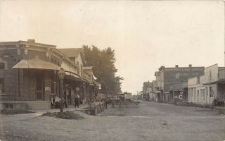
Il - 1908 Rare Main Street Centennial Port Byron, Illinois - Rock Island County
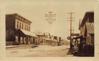
Il - 1928 Rare Main Street Centennial Port Byron, Illinois - Rock Island County
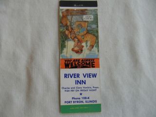
Port Byron Illinois Rock Island County Food & Beverage Inn Low 108 Matchbook
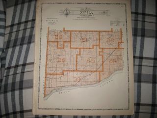
Antique 1905 Zuma Township Center Osborn Rock Island County Illinois Map
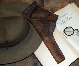
Antique Pre Wwi Regulation Holster Stamped Rock Island Arsenal 1910 H. E. K.
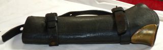
Antique 1890 ' S Us Model 1887 Rock Island Arsenal Carbine Boot
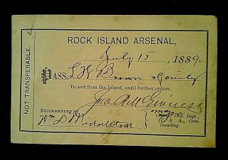
Antique, Visitor ' S Permit/pass To Rock Island Arsenal, July 15, 1889 Historical
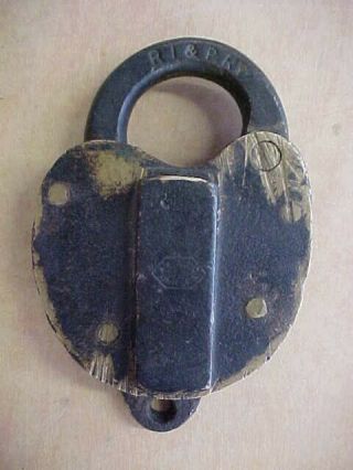
Antique Brass Ri&pry Railroad Lock Rock Island & Peoria Railway 1877 - 1902

1860 Mitchell Hand Colored Map Colorado, Nebraska & Kansas - Civil War Era

18th Century French Map Of North America

Las Vegas Nevada Vintage 1967 Us Geological Survey Quadrangle Map 4 Panels

Rare Antique 1845 Maps United States Exploring Expedition Book Antartica Hawaii

Vintage 1926 Map Hollywood From The Best Surveys Of The Time

American Continent (western Hemisphere) 1747 Bowen Antique Copper Engraved Map

Gulf Coast Florida Texas United States 1705 De Fer Unusual Antique Engraved Map

California As Island United States 1700 De Fer Unusual First Edition Antique Map