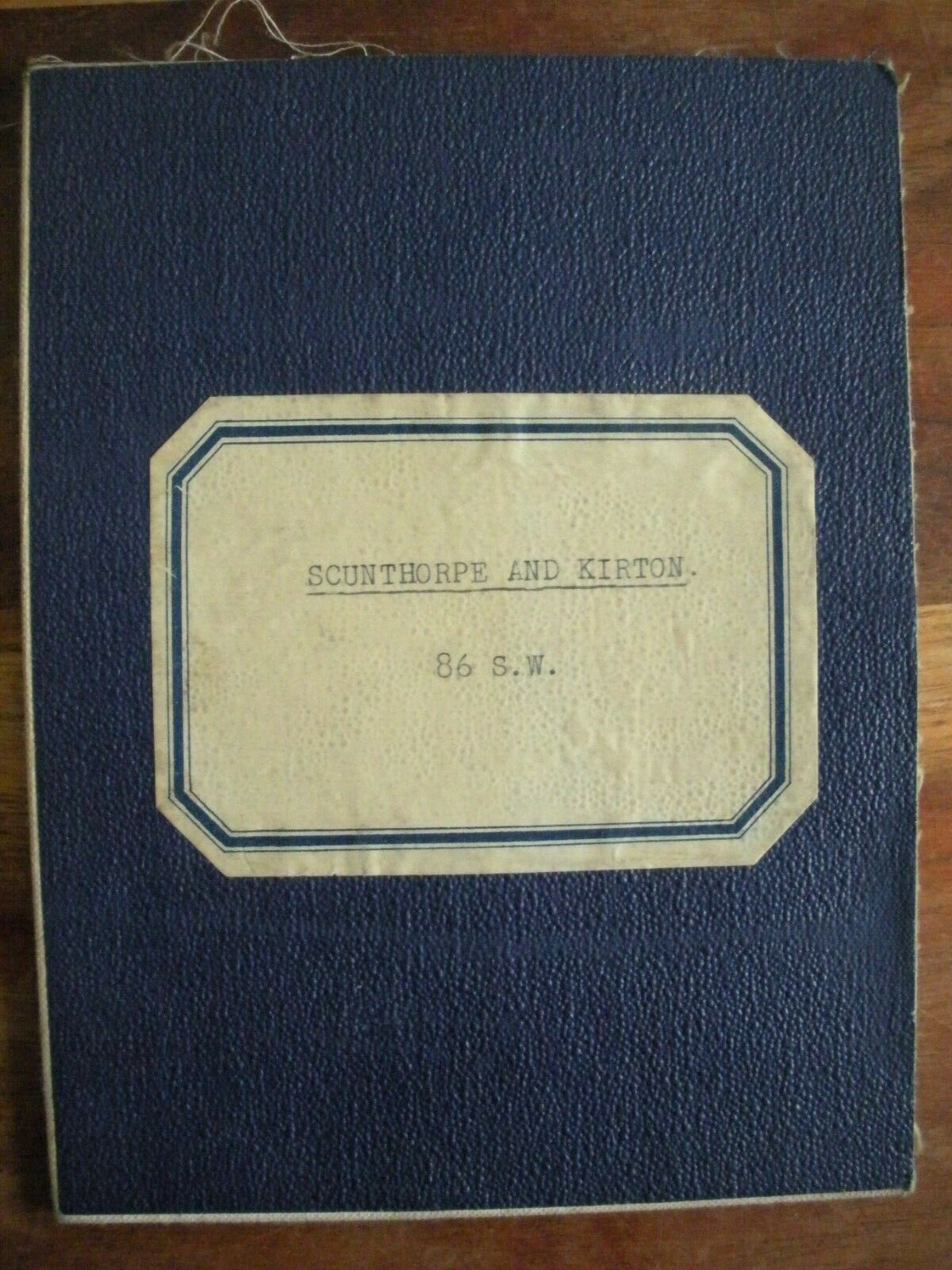
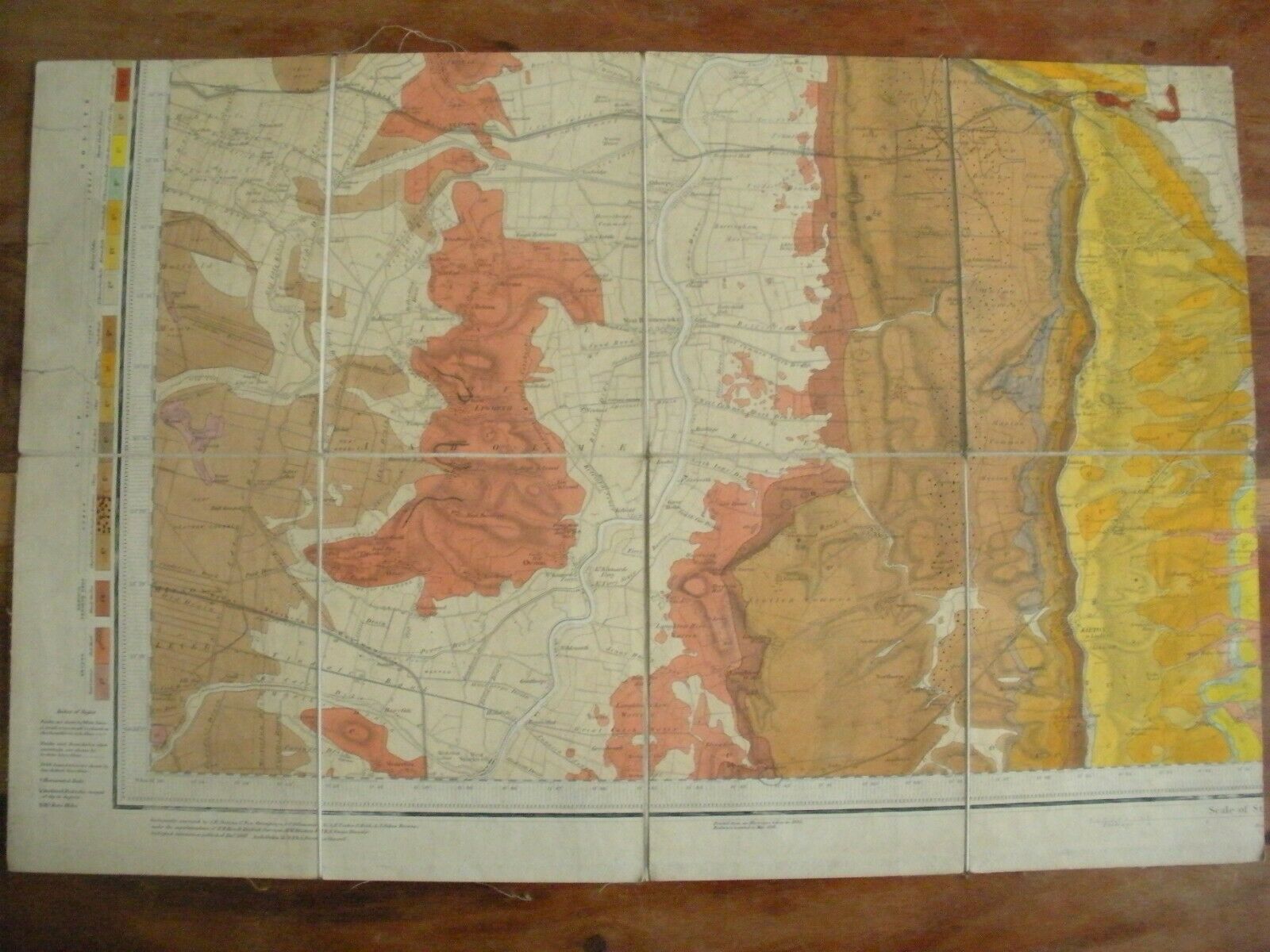
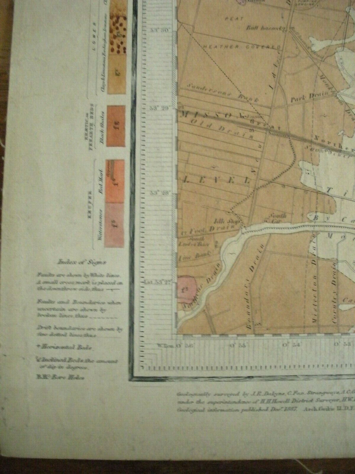
Scunthorpe & Kirton 86 S. W. Hand Coloured Geological Map Ordnance Survey 1891


Item History & Price

Information:
Reference Number: Avaluer:20176027Date Range: 1800-1899
Format: Folding MapOriginal/Reproduction: Antique Original
Cartographer/Publisher: Ordnance SurveyCountry/Region: United Kingdom
Type: Ordnance Survey MapEra: 1800s
Year: 1891
Original Description:
Part of a series of antique maps from the ordnance survey offices of the Tower of London.
All appear to be hand-painted. Map size approx. 20" x 13".
Prior owner Sir Peter Kent, British Geologist.
Combined shipping for any other maps mailed at the same time.


    Similar items


  • The Return Of Halley

    The Return Of Halley ' S Comet 1985 - 86 Telescope W/case & Certificate 30x40 Mm

  • S.  W.  A.  1931 Kgv 3d Brown & Blue Bilingual Pair Vfu.  Sg 86.  Sc C5.

    S. W. A. 1931 Kgv 3d Brown & Blue Bilingual Pair Vfu. Sg 86. Sc C5.

  • Nancy Ann Storybook Family Series Doll 86 Bride Vtg

    Nancy Ann Storybook Family Series Doll 86 Bride Vtg ' 40 ' S W Box

  • Complete Clad Proof Washington Quarter Run 1968 - S To 2009 - S W/type 2

    Complete Clad Proof Washington Quarter Run 1968 - S To 2009 - S W/type 2 ' S, 86 Coins

  • 1985 - 86 Abs Holstein Dairy Cattle Sire Directory - S - W - D Valiant,  Sexation,

    1985 - 86 Abs Holstein Dairy Cattle Sire Directory - S - W - D Valiant, Sexation,

  • Emanon - The Baby Beat Box

    Emanon - The Baby Beat Box ' 86 Lp W/keith Haring ' S Artwork Pow Wow Records

  • Vintage Moc Tmnt Krang

    Vintage Moc Tmnt Krang ' S Android Body Action Figure 1994 86 Back W/ Card & Zolo

  • Casio Men

    Casio Men ' S W - 86 - 1vq Black Casual Digital Resin Strap Alarm Watch


    • You might also like


    • Hungary & Romania 1579 (1584) Ortelius Unusual Antique Copper Engraved Map

      Hungary & Romania 1579 (1584) Ortelius Unusual Antique Copper Engraved Map

    • Brussels Bruxelles Belfium 1777 De Ferraris & Dupuis Large Antique Map Sheet Xxi

      Brussels Bruxelles Belfium 1777 De Ferraris & Dupuis Large Antique Map Sheet Xxi

    • 1616 Atlas Map Of Iceland.

      1616 Atlas Map Of Iceland.

    • Kazan Russia 1767 Le Clerc/lespinasse Antique Copper Engraved City View

      Kazan Russia 1767 Le Clerc/lespinasse Antique Copper Engraved City View

    • 1899 Stanford,  Folding Map Of Norwich,  Norfolk,  Arthur Collins,  Jarrold & Sons,

      1899 Stanford, Folding Map Of Norwich, Norfolk, Arthur Collins, Jarrold & Sons,

    • 1948 Vintage Linen Colour Map Geological Survey Ten Mile Of Great Britain

      1948 Vintage Linen Colour Map Geological Survey Ten Mile Of Great Britain

    • 1944 Map Flying Bombs Sussex Ww2 Newspaper Military Kent Courier German V1 V2

      1944 Map Flying Bombs Sussex Ww2 Newspaper Military Kent Courier German V1 V2

    • Dated 1638 Vellum Map Of Icklesham Sussex Showing Land Uses Owners Etc

      Dated 1638 Vellum Map Of Icklesham Sussex Showing Land Uses Owners Etc

Avaluer          About Us          Privacy Policy          Contact Us          UP
© 2022, avaluer.net, Inc. or its affiliates