1950 Antique Animated UTAH State Map Vintage Cartoon Map Of Utah Wall Art 6968


Item History & Price

Information:
Reference Number: Avaluer:20209533North America States & Provinces: Utah
Original/Reproduction: OriginalEra: 1950s
Country/Region: United States of AmericaTopic: Maps
US State: UtahPublication Year: 1950
Format: Travel Book MapFeatures: Antique
Type: Novelty MapDate Range: 1950-1959
Year: 1950
Original Description:
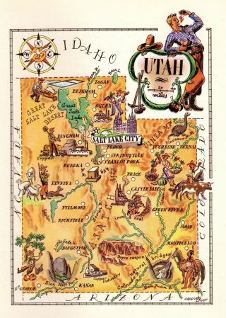
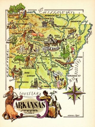
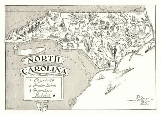
ANTIQUE ANIMATED UTAH STATE MAPThis fun pictorial map features sketches of:  cowboys, miners, iron and coal mining, Zion National Park, and more.  This is an original, not reproduction, vintage picture map which was carefully removed from a 1946 book.  The print measures approximately 4.5" by 6.5" and is in very good condition.   I think it would be fun to frame several of these maps and display them in a group.  A grouping might include your birthpla...ce, places you have visited on vacation or a honeymoon.  These make fun gifts!Click HERE for more Utah maps in my store.Your item will be packaged in a plastic sleeve, with a thin piece of backing, then in a manila envelope with a very stiff and thick piece of cardboard. We happily combine purchases to save on shipping fees.Please email with questions, we will answer your email promptly!Please visit our ebay store, Plaindealing Vintage Paper. 
Powered by eBay Turbo Lister
The free listing tool. List your items fast and easy and manage your active items.


    Similar items


  • 1950 Antique Animated Arkansas State Map Vintage Cartoon Map Of Arkansas 7137

    1950 Antique Animated Arkansas State Map Vintage Cartoon Map Of Arkansas 7137

  • 1950 Antique Animated Utah Picture Map Vintage State Map Of Utah Cartoon 5436

    1950 Antique Animated Utah Picture Map Vintage State Map Of Utah Cartoon 5436

  • 1940s Antique Animated Nevada State Map Vintage Cartoon Map Of Nevada 6622

    1940s Antique Animated Nevada State Map Vintage Cartoon Map Of Nevada 6622

  • 1940s Antique Animated Nevada State Map Vintage Cartoon Map Of Nevada 6852

    1940s Antique Animated Nevada State Map Vintage Cartoon Map Of Nevada 6852

  • 1950s Antique Rhode Island State Map Vintage Picture Map Of Rhode Island 6854

    1950s Antique Rhode Island State Map Vintage Picture Map Of Rhode Island 6854

  • 1950 Antique Arkansas State Map Vintage Cartoon Map Of Arkansas Picture Map 6855

    1950 Antique Arkansas State Map Vintage Cartoon Map Of Arkansas Picture Map 6855

  • 1950s Antique North Carolina State Map Animated Map Of North Carolina Bw 6812

    1950s Antique North Carolina State Map Animated Map Of North Carolina Bw 6812


    • You might also like


    • 1860 Mitchell Hand Colored Map Colorado,  Nebraska & Kansas - Civil War Era

      1860 Mitchell Hand Colored Map Colorado, Nebraska & Kansas - Civil War Era

    • 18th Century French Map Of North America

      18th Century French Map Of North America

    • Las Vegas Nevada Vintage 1967 Us Geological Survey Quadrangle Map 4 Panels

      Las Vegas Nevada Vintage 1967 Us Geological Survey Quadrangle Map 4 Panels

    • Rare Antique 1845 Maps United States Exploring Expedition Book Antartica Hawaii

      Rare Antique 1845 Maps United States Exploring Expedition Book Antartica Hawaii

    • Vintage 1926 Map Hollywood From The Best Surveys Of The Time

      Vintage 1926 Map Hollywood From The Best Surveys Of The Time

    • American Continent (western Hemisphere) 1747 Bowen Antique Copper Engraved Map

      American Continent (western Hemisphere) 1747 Bowen Antique Copper Engraved Map

    • Gulf Coast Florida Texas United States 1705 De Fer Unusual Antique Engraved Map

      Gulf Coast Florida Texas United States 1705 De Fer Unusual Antique Engraved Map

    • California As Island United States 1700 De Fer Unusual First Edition Antique Map

      California As Island United States 1700 De Fer Unusual First Edition Antique Map

Avaluer          About Us          Privacy Policy          Contact Us          UP
© 2022, avaluer.net, Inc. or its affiliates