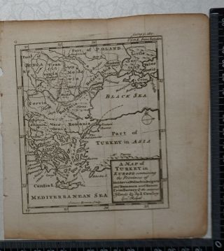
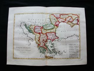
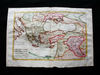
1823 J Russell Map Of Turkey In Europe


Item History & Price

Information:
Reference Number: Avaluer:20363929Cartographer/Publisher: J Russell
Year: 1823Printing Technique: Copper Plate
Date Range: 1800-1899Original/Reproduction: Antique Original
Country/Region: Bosnia and Herzegovina, Bulgaria, Constantinople, Croatia, Greece, Macedonia, Romania, Serbia, TurkeyFormat: Atlas Map
Era: 1800sType: Topographical Map
Original Description:
An original antique hand coloured map of Turkey in Europe from an edition of Barclay's Complete and Universal Dictionary.
Overall page size: 19.5cm x 25cm approxImage size: 17.5 x 24cm approx
Condition: Very good. Please study photograph. 


    Similar items


  • 1823 J Russell Map Of Switzerland

    1823 J Russell Map Of Switzerland

  • Map Of Turkey In Europe By J.  Rapkin Bosphous Constantinople Ali Pasha: C1855

    Map Of Turkey In Europe By J. Rapkin Bosphous Constantinople Ali Pasha: C1855

  • 1767 - Map Of Turkey In Europe - J Cowley / E Bowen

    1767 - Map Of Turkey In Europe - J Cowley / E Bowen

  • 1856 Colton Map Of Turkey In Europe,  Macedonia,  And The Balkans

    1856 Colton Map Of Turkey In Europe, Macedonia, And The Balkans

  • 1789 Bonne - Rare Map Of Turkey In Europe,  Greece,  Balkans,  Macedonia,  Bulgaria

    1789 Bonne - Rare Map Of Turkey In Europe, Greece, Balkans, Macedonia, Bulgaria

  • 1770 Bonne - Orig.  Map Of Turkey In Europe & Asia,  Middle East,  Greece,  Balkans

    1770 Bonne - Orig. Map Of Turkey In Europe & Asia, Middle East, Greece, Balkans

  • Map Of Turkey In Europe & Balkans.  1905.  Serbia.  Bulgaria.  Romania.

    Map Of Turkey In Europe & Balkans. 1905. Serbia. Bulgaria. Romania.

  • 1885 - Map Of Turkey In Europe Greece Roumania Servia & Montenegro Map Of Italy

    1885 - Map Of Turkey In Europe Greece Roumania Servia & Montenegro Map Of Italy


    • You might also like


    • Hungary & Romania 1579 (1584) Ortelius Unusual Antique Copper Engraved Map

      Hungary & Romania 1579 (1584) Ortelius Unusual Antique Copper Engraved Map

    • Brussels Bruxelles Belfium 1777 De Ferraris & Dupuis Large Antique Map Sheet Xxi

      Brussels Bruxelles Belfium 1777 De Ferraris & Dupuis Large Antique Map Sheet Xxi

    • 1616 Atlas Map Of Iceland.

      1616 Atlas Map Of Iceland.

    • Kazan Russia 1767 Le Clerc/lespinasse Antique Copper Engraved City View

      Kazan Russia 1767 Le Clerc/lespinasse Antique Copper Engraved City View

    • 1899 Stanford,  Folding Map Of Norwich,  Norfolk,  Arthur Collins,  Jarrold & Sons,

      1899 Stanford, Folding Map Of Norwich, Norfolk, Arthur Collins, Jarrold & Sons,

    • 1948 Vintage Linen Colour Map Geological Survey Ten Mile Of Great Britain

      1948 Vintage Linen Colour Map Geological Survey Ten Mile Of Great Britain

    • 1944 Map Flying Bombs Sussex Ww2 Newspaper Military Kent Courier German V1 V2

      1944 Map Flying Bombs Sussex Ww2 Newspaper Military Kent Courier German V1 V2

    • Dated 1638 Vellum Map Of Icklesham Sussex Showing Land Uses Owners Etc

      Dated 1638 Vellum Map Of Icklesham Sussex Showing Land Uses Owners Etc

Avaluer          About Us          Privacy Policy          Contact Us          UP
© 2022, avaluer.net, Inc. or its affiliates