1722 Herman MOLL Atlas Map ITALY - SICILY - CORSICA - SARDINIA


Item History & Price

Information:
Reference Number: Avaluer:20467253Printing Technique: Copper Plate
Year: 1722Original/Reproduction: Antique Original
Date Range: 1700-1799
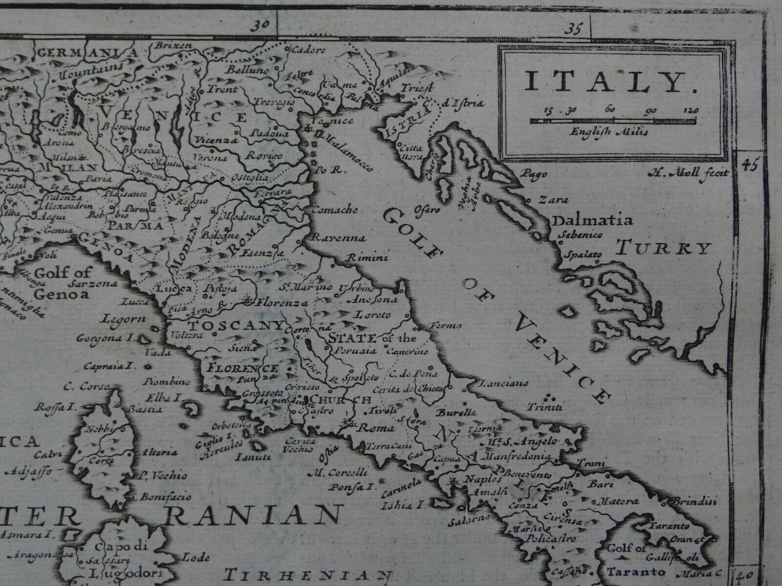
Original Description:
Map title:Italy

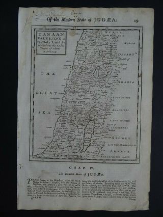
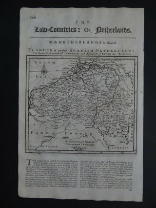
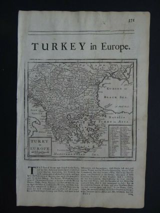
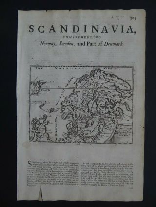
A rare copper engraved antique map of ItalyBy Herman Moll1722
From the book:Thesaurus Geographicus - or the Compleat Geographer - being the Chorography, Topography and History of the EarthBy Herman Moll1722 
See pictures
Page size 33 x 22 cmMap is in good condition for its age, engravings are clear, a couple of brown spotsPaper has some age toning, marginal browning and handling marks, creasing in top corner and couple of tiny tears on lower pa...ge edgeText in EnglishText on reverseUncoloured

Payments by Paypal please.UK postage £4.99Europe £9.99Worldwide £10.50

00047


    Similar items


  • 1722 Herman Moll Atlas Map Savoy - Piedmont Sabaudia Italy France Switzerland

    1722 Herman Moll Atlas Map Savoy - Piedmont Sabaudia Italy France Switzerland

  • 1722 Herman Moll Atlas Map Ireland

    1722 Herman Moll Atlas Map Ireland

  • 1722 Herman Moll Atlas Map Russia - Moscovy - Moscovia Muscovy Russie

    1722 Herman Moll Atlas Map Russia - Moscovy - Moscovia Muscovy Russie

  • 1722 Herman Moll Atlas Map Asia - India - China - Corea - Arabia - Tartary

    1722 Herman Moll Atlas Map Asia - India - China - Corea - Arabia - Tartary

  • 1722 Herman Moll Atlas Map Palestine - Canaan - Holy Land - Israel - Judea

    1722 Herman Moll Atlas Map Palestine - Canaan - Holy Land - Israel - Judea

  • 1722 Herman Moll Atlas Map Belgium - Low Countries - Netherlands

    1722 Herman Moll Atlas Map Belgium - Low Countries - Netherlands

  • 1722 Herman Moll Atlas Map Greece - Turkey In Europe - Crete Bulgaria Macedonia

    1722 Herman Moll Atlas Map Greece - Turkey In Europe - Crete Bulgaria Macedonia

  • 1722 Herman Moll Atlas Map Scandinavia - Norway Sweden Denmark Suede Iceland

    1722 Herman Moll Atlas Map Scandinavia - Norway Sweden Denmark Suede Iceland


    • You might also like


    • Hungary & Romania 1579 (1584) Ortelius Unusual Antique Copper Engraved Map

      Hungary & Romania 1579 (1584) Ortelius Unusual Antique Copper Engraved Map

    • Brussels Bruxelles Belfium 1777 De Ferraris & Dupuis Large Antique Map Sheet Xxi

      Brussels Bruxelles Belfium 1777 De Ferraris & Dupuis Large Antique Map Sheet Xxi

    • 1616 Atlas Map Of Iceland.

      1616 Atlas Map Of Iceland.

    • Kazan Russia 1767 Le Clerc/lespinasse Antique Copper Engraved City View

      Kazan Russia 1767 Le Clerc/lespinasse Antique Copper Engraved City View

    • 1899 Stanford,  Folding Map Of Norwich,  Norfolk,  Arthur Collins,  Jarrold & Sons,

      1899 Stanford, Folding Map Of Norwich, Norfolk, Arthur Collins, Jarrold & Sons,

    • 1948 Vintage Linen Colour Map Geological Survey Ten Mile Of Great Britain

      1948 Vintage Linen Colour Map Geological Survey Ten Mile Of Great Britain

    • 1944 Map Flying Bombs Sussex Ww2 Newspaper Military Kent Courier German V1 V2

      1944 Map Flying Bombs Sussex Ww2 Newspaper Military Kent Courier German V1 V2

    • Dated 1638 Vellum Map Of Icklesham Sussex Showing Land Uses Owners Etc

      Dated 1638 Vellum Map Of Icklesham Sussex Showing Land Uses Owners Etc

Avaluer          About Us          Privacy Policy          Contact Us          UP
© 2022, avaluer.net, Inc. or its affiliates