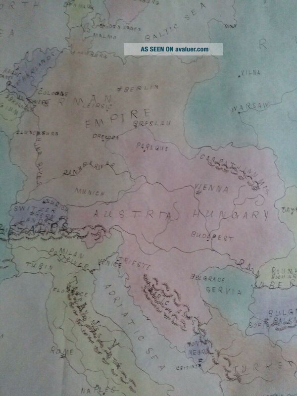
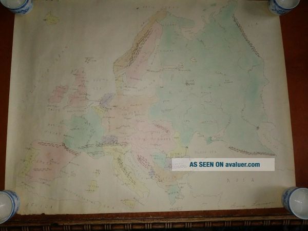
Early 20th Century Hand Drawn School Girl World Map Antique Folk Art Ca. WWI


Item History & Price

Information:
Reference Number: Avaluer:23758276Year: 1914
Country/Region: WorldFormat: School Map
Original Description:
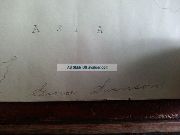
Early 20th Century Hand Drawn School Girl Map Of Minnesota Antique Folk Art . Shipped with USPS Priority Mail.This map is hand drawn and hand colored. Based on countries and cities, this map is cica 1914. (German Empire, Austria-Hungry, Russia, St. Petersburg, Servia, etc.) Overall condition is very good. Light tanning of paper and some wear to edges. Otherwise very nice. Map was created by Gina Swenson (aged 14). Please see all photos for condition and ask questions.Map is rolled and ...will shipped in a tube.


    Similar items


  • Early 20th Century Hand Carved Pine Folk Art Spanish Pub Trade Sign Figure

    Early 20th Century Hand Carved Pine Folk Art Spanish Pub Trade Sign Figure

  • Vintage Folk Art Early 20th Century Hand Made Star,  Diamond Inlaid Desk Box

    Vintage Folk Art Early 20th Century Hand Made Star, Diamond Inlaid Desk Box

  • Unique Early 20th Century Hand Made Brown Wooden Bird Cage

    Unique Early 20th Century Hand Made Brown Wooden Bird Cage

  • Early 20th Century Hand Made Brass Letter Opener

    Early 20th Century Hand Made Brass Letter Opener

  • Porcelain Figurine: Early 20th Century Hand Painted Scotch Terrier Scotty Dogs

    Porcelain Figurine: Early 20th Century Hand Painted Scotch Terrier Scotty Dogs

  • Antique Early 20th Century Hand Carved Small Wooden Pig Figurine Inlaid Wood

    Antique Early 20th Century Hand Carved Small Wooden Pig Figurine Inlaid Wood

  • Antique Early 20th Century Anglo Chinese School Oil Painting Still Life Pheasant

    Antique Early 20th Century Anglo Chinese School Oil Painting Still Life Pheasant

  • Early 20th Century Western American School Signed Indian Canoe Hunting Mountains

    Early 20th Century Western American School Signed Indian Canoe Hunting Mountains


    • You might also like


    • 1860 Mitchell Hand Colored Map Colorado,  Nebraska & Kansas - Civil War Era

      1860 Mitchell Hand Colored Map Colorado, Nebraska & Kansas - Civil War Era

    • 18th Century French Map Of North America

      18th Century French Map Of North America

    • Las Vegas Nevada Vintage 1967 Us Geological Survey Quadrangle Map 4 Panels

      Las Vegas Nevada Vintage 1967 Us Geological Survey Quadrangle Map 4 Panels

    • Rare Antique 1845 Maps United States Exploring Expedition Book Antartica Hawaii

      Rare Antique 1845 Maps United States Exploring Expedition Book Antartica Hawaii

    • Vintage 1926 Map Hollywood From The Best Surveys Of The Time

      Vintage 1926 Map Hollywood From The Best Surveys Of The Time

    • American Continent (western Hemisphere) 1747 Bowen Antique Copper Engraved Map

      American Continent (western Hemisphere) 1747 Bowen Antique Copper Engraved Map

    • Gulf Coast Florida Texas United States 1705 De Fer Unusual Antique Engraved Map

      Gulf Coast Florida Texas United States 1705 De Fer Unusual Antique Engraved Map

    • California As Island United States 1700 De Fer Unusual First Edition Antique Map

      California As Island United States 1700 De Fer Unusual First Edition Antique Map

Avaluer          About Us          Privacy Policy          Contact Us          UP
© 2022, avaluer.net, Inc. or its affiliates