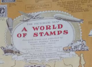
Ernest Dudley Chase, Italy, 1935 Map 19 X 25 In. Black And White Center Fold


Item History & Price

Information:
Reference Number: Avaluer:23761066Cartographer/Publisher: E D Chase
Date Range: 1930-1939Original/Reproduction: Antique Original
Country/Region: maYear: 1936
Original Description:
Bid: One map by Ernest Dudley Chase.This map of Italy was published in 1935 and measures 19 x 25 inches.Printed on Strathmore Japan paper in black and white and has full margins. 
Condition: Please see photos for the condition of the center fold and a few bumps along the margins.The back of the map shows a light crease and is discolored by a bit of dust.


    Similar items


  • Antique Vintage 1947 World Of Stamps Map By Ernest Dudley Chase.  Philately

    Antique Vintage 1947 World Of Stamps Map By Ernest Dudley Chase. Philately

  • 1959 Pictorial Map Alaska Ernest Dudley Chase In Package W Tag

    1959 Pictorial Map Alaska Ernest Dudley Chase In Package W Tag

  • Pristine 1938 Boston Massachusetts Ernest Dudley Chase Signed Map

    Pristine 1938 Boston Massachusetts Ernest Dudley Chase Signed Map

  • Crisp 1950

    Crisp 1950 ' S Pictorial Map Historic Massachusetts - Ernest Dudley Chase

  • Ernest Dudley Chase,  Christmas Greetings From Cape Cod Map - Signed

    Ernest Dudley Chase, Christmas Greetings From Cape Cod Map - Signed

  • 1960 Ernest Dudley Chase Of Cape Cod (with Kennedy Compound) Map

    1960 Ernest Dudley Chase Of Cape Cod (with Kennedy Compound) Map

  • Rare 1945 Pacific Victory Japan Pictorial Wwii Map Ernest Dudley Chase

    Rare 1945 Pacific Victory Japan Pictorial Wwii Map Ernest Dudley Chase

  • 1960 Ernest Dudley Chase Pictoral Map Of The Hawaiian Islands 50th State

    1960 Ernest Dudley Chase Pictoral Map Of The Hawaiian Islands 50th State


    • You might also like


    • 1860 Mitchell Hand Colored Map Colorado,  Nebraska & Kansas - Civil War Era

      1860 Mitchell Hand Colored Map Colorado, Nebraska & Kansas - Civil War Era

    • 18th Century French Map Of North America

      18th Century French Map Of North America

    • Las Vegas Nevada Vintage 1967 Us Geological Survey Quadrangle Map 4 Panels

      Las Vegas Nevada Vintage 1967 Us Geological Survey Quadrangle Map 4 Panels

    • Rare Antique 1845 Maps United States Exploring Expedition Book Antartica Hawaii

      Rare Antique 1845 Maps United States Exploring Expedition Book Antartica Hawaii

    • Vintage 1926 Map Hollywood From The Best Surveys Of The Time

      Vintage 1926 Map Hollywood From The Best Surveys Of The Time

    • American Continent (western Hemisphere) 1747 Bowen Antique Copper Engraved Map

      American Continent (western Hemisphere) 1747 Bowen Antique Copper Engraved Map

    • Gulf Coast Florida Texas United States 1705 De Fer Unusual Antique Engraved Map

      Gulf Coast Florida Texas United States 1705 De Fer Unusual Antique Engraved Map

    • California As Island United States 1700 De Fer Unusual First Edition Antique Map

      California As Island United States 1700 De Fer Unusual First Edition Antique Map

Avaluer          About Us          Privacy Policy          Contact Us          UP
© 2022, avaluer.net, Inc. or its affiliates