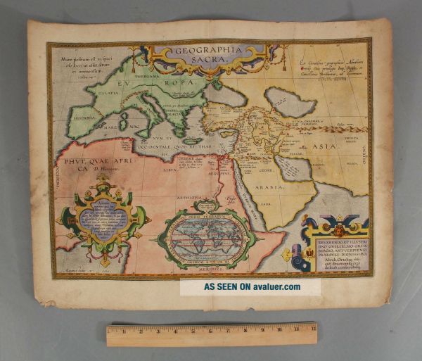
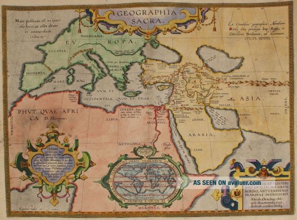
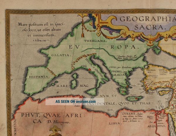
17thC Antique Abraham Ortelius Sacred Geography Copper Engraved Hand Colored Map
Item History & Price
| Reference Number: Avaluer:23763122 | Original/Reproduction: Antique Original |
| UPC: Does Not Apply |

| Reference Number: Avaluer:23763122 | Original/Reproduction: Antique Original |
| UPC: Does Not Apply |
17thc Antique Abraham Ortelius Roman Empire Mediterranean Atlas Map
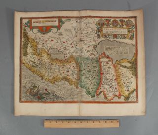
16thc Antique Abraham Ortelius Hand Colored Engraved Map Terra Sancta Holland
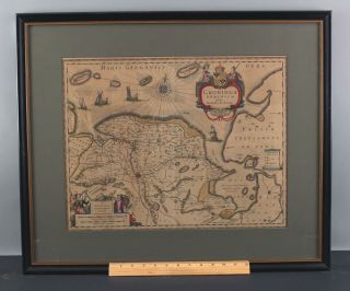
17thc Antique Bartholdo Wincheringe Hand Colored Map Engraving, Netherlands
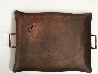
Antique Old Vintage Heavy Hammered Copper Engraved Tray
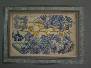
Rare Antique Filippo Arena Botanical Print Copper Engraving 1767 Leucojum Tab 30
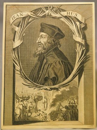
Rare Antique Bernard Picart Jan Hus, Copper Engraving, 1673 - 1733 With Provenance
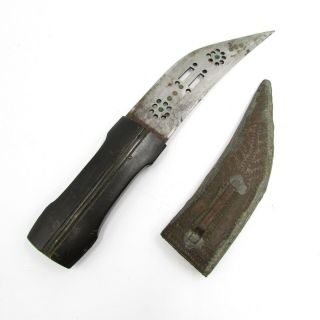
Antique Arab Dagger Black Handle & Copper Engraved Wood Base Sheath Arabic Knife
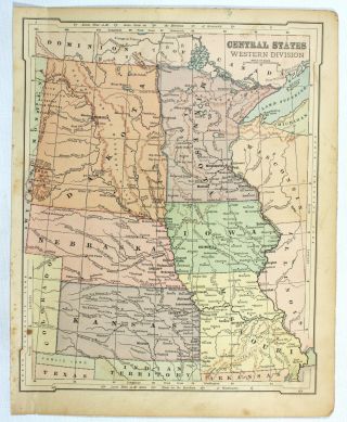
Central States Antique 19c Mitchell ' S Geography Atlas Engraved Midwest State Map

Hungary & Romania 1579 (1584) Ortelius Unusual Antique Copper Engraved Map

Brussels Bruxelles Belfium 1777 De Ferraris & Dupuis Large Antique Map Sheet Xxi

1616 Atlas Map Of Iceland.

Kazan Russia 1767 Le Clerc/lespinasse Antique Copper Engraved City View

1899 Stanford, Folding Map Of Norwich, Norfolk, Arthur Collins, Jarrold & Sons,

1948 Vintage Linen Colour Map Geological Survey Ten Mile Of Great Britain

1944 Map Flying Bombs Sussex Ww2 Newspaper Military Kent Courier German V1 V2

Dated 1638 Vellum Map Of Icklesham Sussex Showing Land Uses Owners Etc