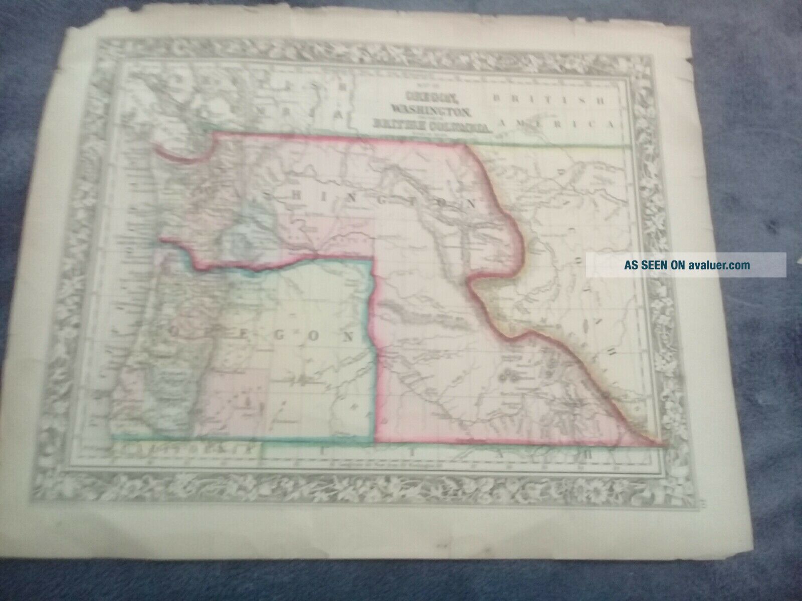
1860 Mitchell ' S General Atlas Map Was Oregon, Washington, British Columbis


Item History & Price

Information:
Reference Number: Avaluer:25518763Format: Atlas Map
Type: Road AtlasUS State: Oregon
Original/Reproduction: Antique OriginalYear: 1860
Date Range: 1800-1899City: Washington
Country/Region: United States of AmericaCartographer/Publisher: S. Augustus Mitchell
Original Description:
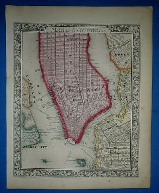
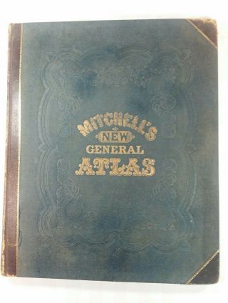
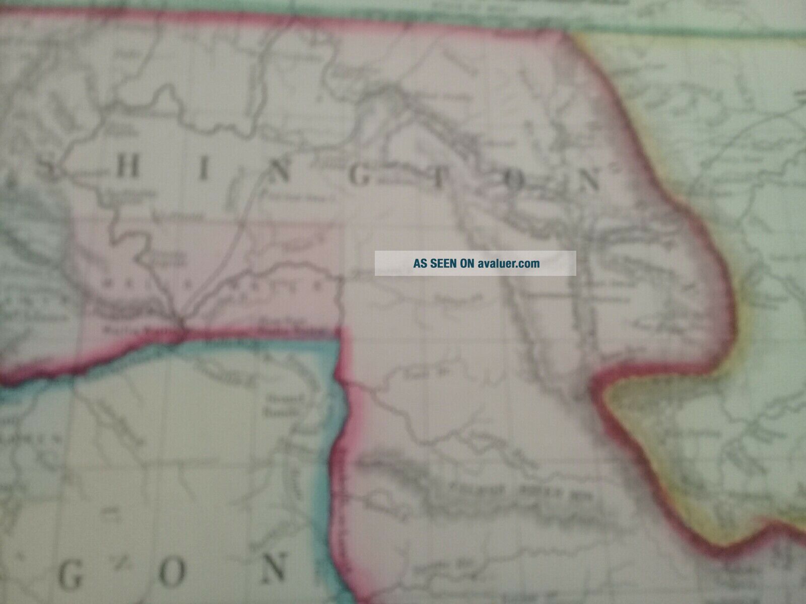
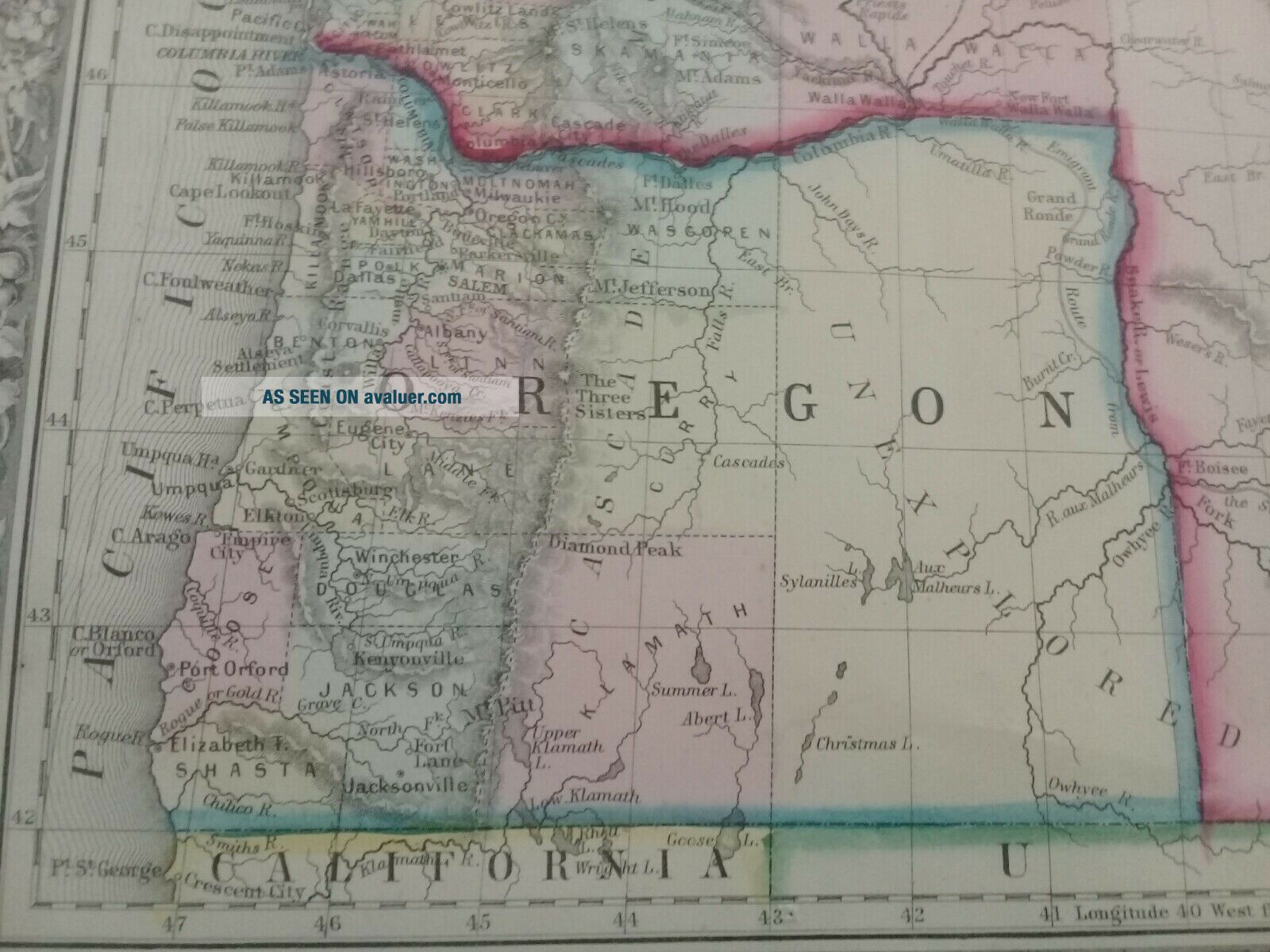
1860 Mitchell's New General Atlas Map Was Oregon, Washington, British Columbia. original hand colored map from 1860 Mitchell atlas 10 5/8" x 13" from the inner margins.good outer blank margins. this map will frame up very nicely  a short closed tear in left blank margin backed with archival tape.  Good conditionthe map is offered fully guaranteed and is returnable a full refund no questions asked.


    Similar items


  • Antique 1863 Mitchell

    Antique 1863 Mitchell ' S General Atlas Map The United States Old Authentic

  • Mitchell

    Mitchell ' S General Atlas Maps And Plans 1875, Philadelphia, York Antique

  • Antique 1863 S A Mitchell

    Antique 1863 S A Mitchell ' S General Atlas Map The World Old Authentic

  • Antique 1863 S A Mitchell,  S General Atlas Map Pennsylvania Old Authentic

    Antique 1863 S A Mitchell, S General Atlas Map Pennsylvania Old Authentic

  • Antique 1863 S A Mitchell

    Antique 1863 S A Mitchell ' S General Atlas Map Massachusetts Old Authentic

  • Antique 1863 S A Mitchell

    Antique 1863 S A Mitchell ' S General Atlas Map York City Old Authentic

  • Antique " Mitchell

    Antique " Mitchell ' S General Atlas " 1874 Edition

  • Mitchell

    Mitchell ' S General Atlas. 1861. Complete. Rebound. Very


    • You might also like


    • 1860 Mitchell Hand Colored Map Colorado,  Nebraska & Kansas - Civil War Era

      1860 Mitchell Hand Colored Map Colorado, Nebraska & Kansas - Civil War Era

    • 18th Century French Map Of North America

      18th Century French Map Of North America

    • Las Vegas Nevada Vintage 1967 Us Geological Survey Quadrangle Map 4 Panels

      Las Vegas Nevada Vintage 1967 Us Geological Survey Quadrangle Map 4 Panels

    • Rare Antique 1845 Maps United States Exploring Expedition Book Antartica Hawaii

      Rare Antique 1845 Maps United States Exploring Expedition Book Antartica Hawaii

    • Vintage 1926 Map Hollywood From The Best Surveys Of The Time

      Vintage 1926 Map Hollywood From The Best Surveys Of The Time

    • American Continent (western Hemisphere) 1747 Bowen Antique Copper Engraved Map

      American Continent (western Hemisphere) 1747 Bowen Antique Copper Engraved Map

    • Gulf Coast Florida Texas United States 1705 De Fer Unusual Antique Engraved Map

      Gulf Coast Florida Texas United States 1705 De Fer Unusual Antique Engraved Map

    • California As Island United States 1700 De Fer Unusual First Edition Antique Map

      California As Island United States 1700 De Fer Unusual First Edition Antique Map

Avaluer          About Us          Privacy Policy          Contact Us          UP
© 2022, avaluer.net, Inc. or its affiliates