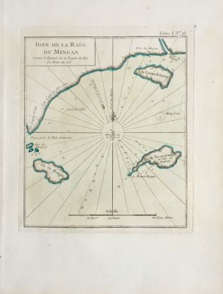
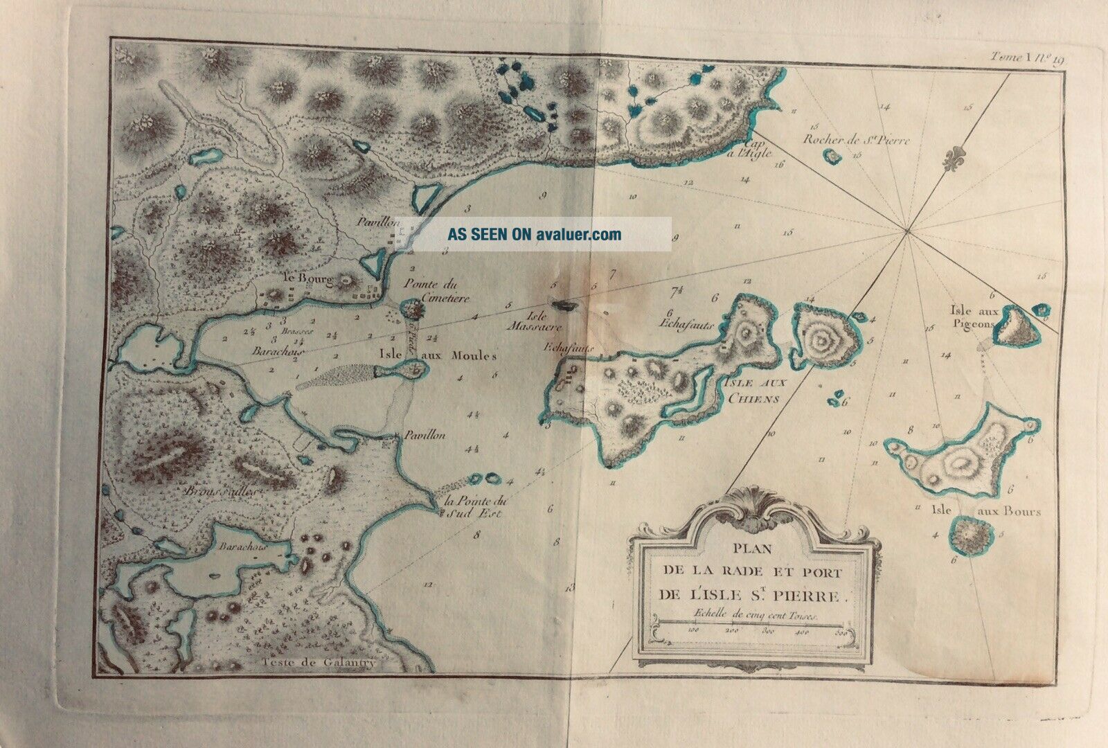
N. Bellin 18th C. Map Plan De La RADE Et PORT De Isle St. PIERRE, CANADA.


Item History & Price

Information:
Reference Number: Avaluer:25518899Country/Region: Canada
Canadian Province: Quebec
Original Description:
Nicolas Bellin 18th Century Map. Dated 1755 , size 12.5 by 17.5 inches with margin. T1 , page 19 . Shipped with USPS First Class. Tracking only if mailed by registered mail or Priority mail.


    Similar items


  • Two Antique 18th C Maps Devonshire 1724 Herman Moll & 1787 John Cary - Devon

    Two Antique 18th C Maps Devonshire 1724 Herman Moll & 1787 John Cary - Devon

  • Usa,  England,  York,  Jersey,  Pennsilvania…map By J.  N.  Bellin,  1757

    Usa, England, York, Jersey, Pennsilvania…map By J. N. Bellin, 1757

  • W Faden Very Large 18th C Map Of London The Country 25 Miles Round London 1796

    W Faden Very Large 18th C Map Of London The Country 25 Miles Round London 1796

  • Framed Carte De La Coste D

    Framed Carte De La Coste D ' Arabie By J. N. Bellin 209

  • 18th C Map By John Senex South America

    18th C Map By John Senex South America

  • Nicolas Bellin 18th Century Map Ille Du Mingan,  Quebec Canada.

    Nicolas Bellin 18th Century Map Ille Du Mingan, Quebec Canada.

  • Old Murray

    Old Murray ' S Handbook - Holland, Belgium, Rhine - 1873, 18th Edit - Maps & Plans

  • Ward Lock Red Guide - Torquay And South Devon - 1950s - 18th Edit - Maps & Plans

    Ward Lock Red Guide - Torquay And South Devon - 1950s - 18th Edit - Maps & Plans


    • You might also like


    • 1860 Mitchell Hand Colored Map Colorado,  Nebraska & Kansas - Civil War Era

      1860 Mitchell Hand Colored Map Colorado, Nebraska & Kansas - Civil War Era

    • 18th Century French Map Of North America

      18th Century French Map Of North America

    • Las Vegas Nevada Vintage 1967 Us Geological Survey Quadrangle Map 4 Panels

      Las Vegas Nevada Vintage 1967 Us Geological Survey Quadrangle Map 4 Panels

    • Rare Antique 1845 Maps United States Exploring Expedition Book Antartica Hawaii

      Rare Antique 1845 Maps United States Exploring Expedition Book Antartica Hawaii

    • Vintage 1926 Map Hollywood From The Best Surveys Of The Time

      Vintage 1926 Map Hollywood From The Best Surveys Of The Time

    • American Continent (western Hemisphere) 1747 Bowen Antique Copper Engraved Map

      American Continent (western Hemisphere) 1747 Bowen Antique Copper Engraved Map

    • Gulf Coast Florida Texas United States 1705 De Fer Unusual Antique Engraved Map

      Gulf Coast Florida Texas United States 1705 De Fer Unusual Antique Engraved Map

    • California As Island United States 1700 De Fer Unusual First Edition Antique Map

      California As Island United States 1700 De Fer Unusual First Edition Antique Map

Avaluer          About Us          Privacy Policy          Contact Us          UP
© 2022, avaluer.net, Inc. or its affiliates