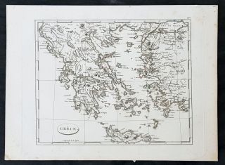
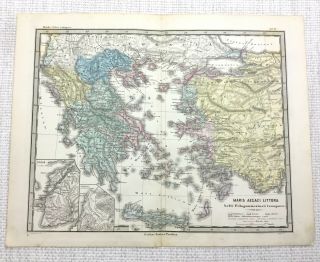
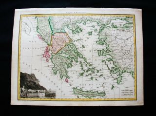
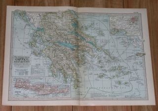
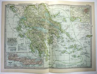
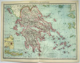
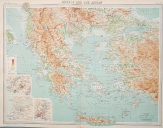
Antique Map Of Greece Crete Laconia Athens Larissa Zante Naxos 1903


Item History & Price

Information:
Reference Number: Avaluer:25522152Original/Reproduction: Antique Original
City: AthensFormat: Atlas Map
Country/Region: GreeceYear: 1903
Era: 1900sDate Range: 1900-1909
Original Description:
PRINT: Map Of Greece  D2
DATE PRINTED: 1903
IMAGE SIZE: Approx 38.0 x 27.0cm, 15 x 10.5 inches
PROVENANCE: Encyclopedia Britannica Adam & Charles Black Edinburgh & LondonVERSO: Plain
FOLD: Single
CONDITION: The Map Is In Good Condition. Please Check The Images Carefully.
POSTAGE: In Card Backed Envelope Or Postal TubePlease email with any questions regarding this item.


    Similar items


  • 1799 Jean Nicolas Buache Antique Map Of Greece,  Crete,  Turkey

    1799 Jean Nicolas Buache Antique Map Of Greece, Crete, Turkey

  • 1865 Antique Map Of Greece Crete Troy Ancient Roman Empire Latin Engraving

    1865 Antique Map Of Greece Crete Troy Ancient Roman Empire Latin Engraving

  • 1810 Lapie - Rare Map Of Greece,  Crete,  Athens,  Turkey,  Bosphorus,  Dardanelles

    1810 Lapie - Rare Map Of Greece, Crete, Athens, Turkey, Bosphorus, Dardanelles

  • 1911 Antique Map Of Greece / Athens Crete / Aegean Sea Peloponnese

    1911 Antique Map Of Greece / Athens Crete / Aegean Sea Peloponnese

  • 1902 Map Of Greece,  Crete & Samos By The Century Company

    1902 Map Of Greece, Crete & Samos By The Century Company

  • 1906 Map Of Greece,  Crete & The Archipelago By George Philip & Son.

    1906 Map Of Greece, Crete & The Archipelago By George Philip & Son.

  • Lovely Atmospheric Vintage Pull Roll Down School Wall Map Of Greece Crete

    Lovely Atmospheric Vintage Pull Roll Down School Wall Map Of Greece Crete

  • Map Of Greece,  Crete,  Western Asia Minor.  Europe.  Peloponnese,  1922.

    Map Of Greece, Crete, Western Asia Minor. Europe. Peloponnese, 1922.


    • You might also like


    • Hungary & Romania 1579 (1584) Ortelius Unusual Antique Copper Engraved Map

      Hungary & Romania 1579 (1584) Ortelius Unusual Antique Copper Engraved Map

    • Brussels Bruxelles Belfium 1777 De Ferraris & Dupuis Large Antique Map Sheet Xxi

      Brussels Bruxelles Belfium 1777 De Ferraris & Dupuis Large Antique Map Sheet Xxi

    • 1616 Atlas Map Of Iceland.

      1616 Atlas Map Of Iceland.

    • Kazan Russia 1767 Le Clerc/lespinasse Antique Copper Engraved City View

      Kazan Russia 1767 Le Clerc/lespinasse Antique Copper Engraved City View

    • 1899 Stanford,  Folding Map Of Norwich,  Norfolk,  Arthur Collins,  Jarrold & Sons,

      1899 Stanford, Folding Map Of Norwich, Norfolk, Arthur Collins, Jarrold & Sons,

    • 1948 Vintage Linen Colour Map Geological Survey Ten Mile Of Great Britain

      1948 Vintage Linen Colour Map Geological Survey Ten Mile Of Great Britain

    • 1944 Map Flying Bombs Sussex Ww2 Newspaper Military Kent Courier German V1 V2

      1944 Map Flying Bombs Sussex Ww2 Newspaper Military Kent Courier German V1 V2

    • Dated 1638 Vellum Map Of Icklesham Sussex Showing Land Uses Owners Etc

      Dated 1638 Vellum Map Of Icklesham Sussex Showing Land Uses Owners Etc

Avaluer          About Us          Privacy Policy          Contact Us          UP
© 2022, avaluer.net, Inc. or its affiliates