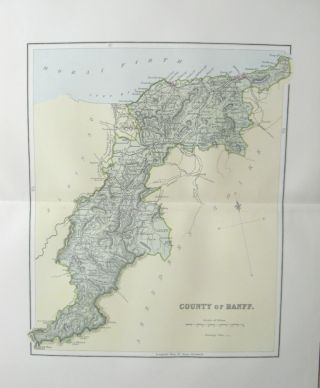
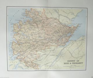
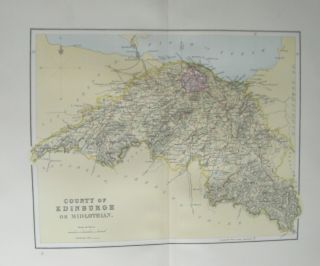
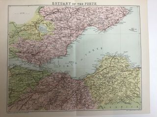
ANTIQUE COLOUR MAP DORSET COUNTY OF DORSETSHIRE 1868

Item History & Price
| Reference Number: Avaluer:25523211 | County: Dorset |
| Year: 1868 | Type: County Map |
ANTIQUE COLOUR FOLDING MAP DORSET COUNTY OF DORSETSHIRE 1868
PROVENANCE: GAZETTEER OF BRITAIN AND IRELAND
PUBLISHED DATE: 1868
VERSO: BLANK
CONDITION: VERY GOOD
SIZE:33CMS X 27CMS (INC MARGIN)
PERFECT ITEM FOR FRAMING
N.B: MAP HAS FOLD CREASE TO CENTRE (SEE PHOTO) WHICH SHOULD PRESS OUT WHEN FRAMED
THIS ITEM HAS BEEN REMOVED FROM A HEAVILY DAMAGEDBOOK/PERIODICAL AND SHOWS SIGNS OF AGE
PLEASE NOTE THAT THESE ARE SINGLE PAGES EITHER BLANK OR TEXTT...O REVERSE (SEE ITEM DESCRIPTION)
EVENT DATE AND PUBLISHED DATE MAY DIFFER
ALL ITEMS ARE SENT IN FILM FRONTED PACKAGING AND BOARD BACKED ENVELOPES
LARGE ITEMS ARE SENT IN POSTAL TUBES
ITEM WILL BE DISPATCHED SAME DAY ON ALL ORDERS RECEIVED BY 1PM
FREE UK "SIGNED FOR" DELIVERY
COMBINED POSTAGE DISCOUNT FOR EUROPE/WORLDWIDE DELIVERY PLEASE CONTACT FOR ACCURATE COST
PLEASE CHECK OUR OTHER ITEMS FOR SALE
WE RESPECTFULLY ASK THAT IF YOU HAVE ANY QUESTIONS REGARDING YOUR ITEM PLEASE CONTACT US BEFORE LEAVING NEGATIVE FEEDBACK AS WE ARE ALWAYS HERE TO HELP
PLEASE NOTE THAT THIS ITEM IS AN ORIGINAL AND NOT A PHOTOCOPY