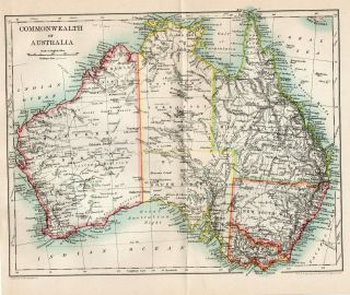
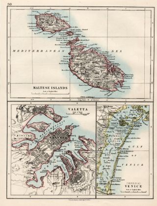
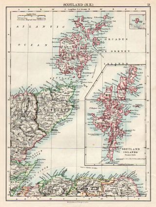
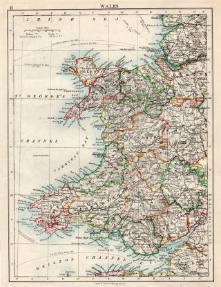
Antique Map Of Malta Maltese Islands Europe W&AK Johnston 1897


Item History & Price

Information:
Reference Number: Avaluer:25525925Original/Reproduction: Antique Original
Date Range: 1800-1899Format: Atlas Map
Country/Region: MaltaYear: 1897
Era: 1800s
Original Description:
PRINT: Map Of Malta Ref D12
DATE PRINTED: 1897
IMAGE SIZE: Approx 16.0 x 11.0cm, 6 x 4.5 inches Plus Border
PROVENANCE: Multum In Parvo Atlas Of The WorldVERSO: Has Description
FOLD: Yes Once
CONDITION: The Map Is In Good Condition. Please Check The Images Carefully.
POSTAGE: In Card Backed Envelope Or Postal TubePlease email with any questions regarding this item.


    Similar items


  • Antique Map Of Japan Korea Formosa C1900 W&ak Johnston

    Antique Map Of Japan Korea Formosa C1900 W&ak Johnston

  • Antique Map Of Australia The Commonwealth C1900 W&ak Johnston

    Antique Map Of Australia The Commonwealth C1900 W&ak Johnston

  • Antique Map Of Zealand North & South C1900 W&ak Johnston

    Antique Map Of Zealand North & South C1900 W&ak Johnston

  • Antique Map Of Malta Valetta Venice Islands Johnston 1892

    Antique Map Of Malta Valetta Venice Islands Johnston 1892

  • 1895 Map Of Austro Hungarian Monarchy By W&ak Johnston.  Austria Antique

    1895 Map Of Austro Hungarian Monarchy By W&ak Johnston. Austria Antique

  • Map Of Scotland Ne Shetland & Orkney W & Ak Johnston 1902 Antique

    Map Of Scotland Ne Shetland & Orkney W & Ak Johnston 1902 Antique

  • Map Of Ireland North Londonderry Antrim W & Ak Johnston 1902 Antique

    Map Of Ireland North Londonderry Antrim W & Ak Johnston 1902 Antique

  • Map Of Wales Anglesey Cardigan Cardiff W & Ak Johnston 1902 Antique

    Map Of Wales Anglesey Cardigan Cardiff W & Ak Johnston 1902 Antique


    • You might also like


    • Hungary & Romania 1579 (1584) Ortelius Unusual Antique Copper Engraved Map

      Hungary & Romania 1579 (1584) Ortelius Unusual Antique Copper Engraved Map

    • Brussels Bruxelles Belfium 1777 De Ferraris & Dupuis Large Antique Map Sheet Xxi

      Brussels Bruxelles Belfium 1777 De Ferraris & Dupuis Large Antique Map Sheet Xxi

    • 1616 Atlas Map Of Iceland.

      1616 Atlas Map Of Iceland.

    • Kazan Russia 1767 Le Clerc/lespinasse Antique Copper Engraved City View

      Kazan Russia 1767 Le Clerc/lespinasse Antique Copper Engraved City View

    • 1899 Stanford,  Folding Map Of Norwich,  Norfolk,  Arthur Collins,  Jarrold & Sons,

      1899 Stanford, Folding Map Of Norwich, Norfolk, Arthur Collins, Jarrold & Sons,

    • 1948 Vintage Linen Colour Map Geological Survey Ten Mile Of Great Britain

      1948 Vintage Linen Colour Map Geological Survey Ten Mile Of Great Britain

    • 1944 Map Flying Bombs Sussex Ww2 Newspaper Military Kent Courier German V1 V2

      1944 Map Flying Bombs Sussex Ww2 Newspaper Military Kent Courier German V1 V2

    • Dated 1638 Vellum Map Of Icklesham Sussex Showing Land Uses Owners Etc

      Dated 1638 Vellum Map Of Icklesham Sussex Showing Land Uses Owners Etc

Avaluer          About Us          Privacy Policy          Contact Us          UP
© 2022, avaluer.net, Inc. or its affiliates