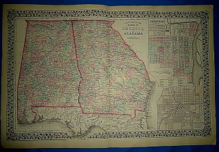
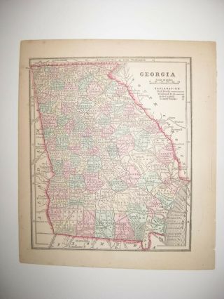
1902 Crowell Map GEORGIA Railroads Savannah Atlanta Columbus Augusta


Item History & Price
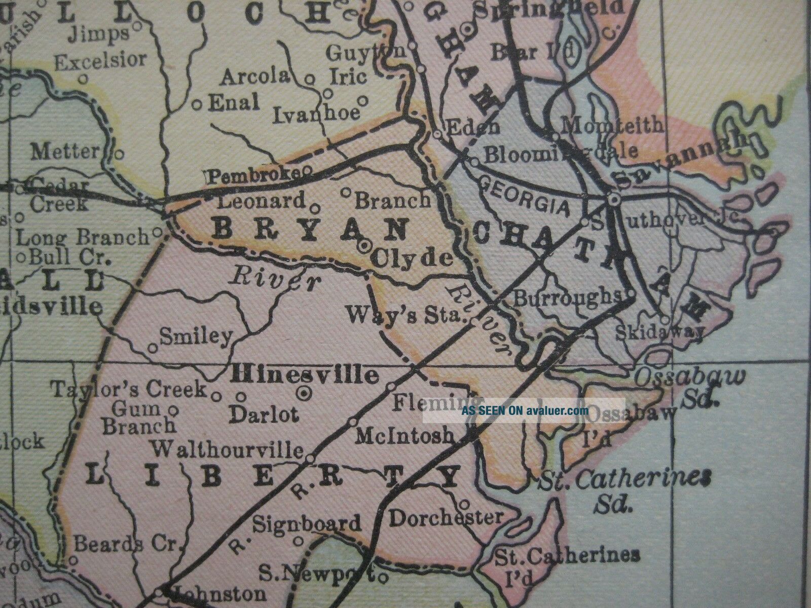
Originalantique color lithographed 1902 map of Georgia, printed more than115yearsago. The map shows towns, countyseats, naturalfeatures, and railroads, including the Florida & Western, East Tennessee, Virginia& Georgia, and Point Royal & Augusta.
Named places and features include Albany, Bainbridge, Valdosta, Dahlonega, Cumberland Island, Atlanta, Columbus, the Savannah River, Griffin, Rome, Decatur, Augusta, andhundreds more.
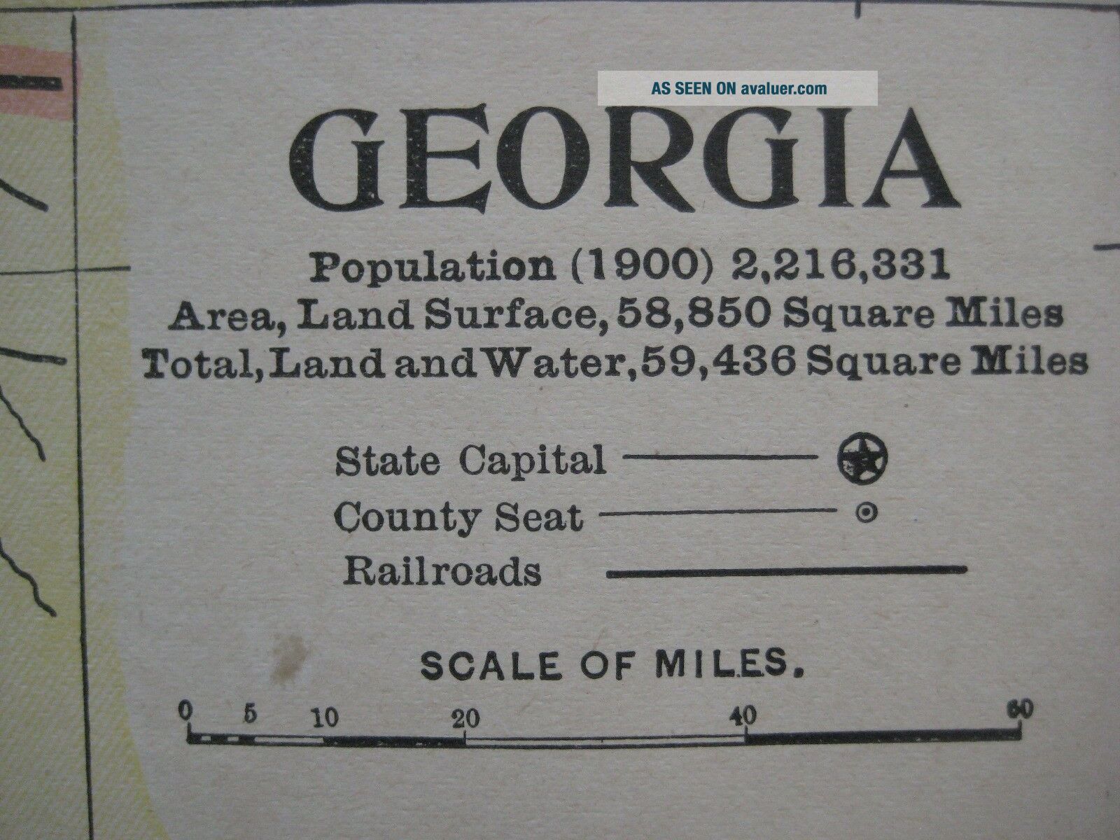
The image area measures 32.5 x 2...5.4 cm [12¾" x 10"], andlongitudeis measured from Greenwich and Washington.
Condition: This map is in excellentcondition, bright and clean, with nomarks, rips, or tears.Please see the scans and feel free to ask anyquestions.
This is an original, authentic antique map, nota reproduction or modern reprint, and it is fully guaranteed to begenuine.
It was issued in The Twentieth CenturyPeerless Atlas and Pictorial Gazetteer of All Lands, published by the Crowell Publishing Company of Springfield, Ohio in1902.
It would make a very handsome display in your denor office.It would also make a perfect gift, and we'll include our helpfulframing tips for your reference, along with a photocopy of the originaltitle page from theatlas in which it was published.
There is a map of North Carolina and South Carolina onthe reverse side.
Buy with confidence! We are always happy to combineshipping on thepurchase of multiple items — just make sure to pay for everythingat one time, not individually.
Powered by SixBit's eCommerce Solution
00614
Named places and features include Albany, Bainbridge, Valdosta, Dahlonega, Cumberland Island, Atlanta, Columbus, the Savannah River, Griffin, Rome, Decatur, Augusta, andhundreds more.
The image area measures 32.5 x 2...5.4 cm [12¾" x 10"], andlongitudeis measured from Greenwich and Washington.
Condition: This map is in excellentcondition, bright and clean, with nomarks, rips, or tears.Please see the scans and feel free to ask anyquestions.
This is an original, authentic antique map, nota reproduction or modern reprint, and it is fully guaranteed to begenuine.
It was issued in The Twentieth CenturyPeerless Atlas and Pictorial Gazetteer of All Lands, published by the Crowell Publishing Company of Springfield, Ohio in1902.
It would make a very handsome display in your denor office.It would also make a perfect gift, and we'll include our helpfulframing tips for your reference, along with a photocopy of the originaltitle page from theatlas in which it was published.
There is a map of North Carolina and South Carolina onthe reverse side.
Buy with confidence! We are always happy to combineshipping on thepurchase of multiple items — just make sure to pay for everythingat one time, not individually.
Powered by SixBit's eCommerce Solution
00614