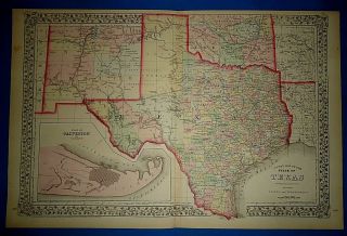
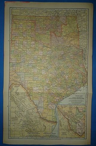
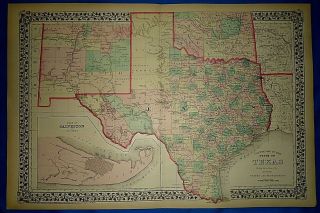
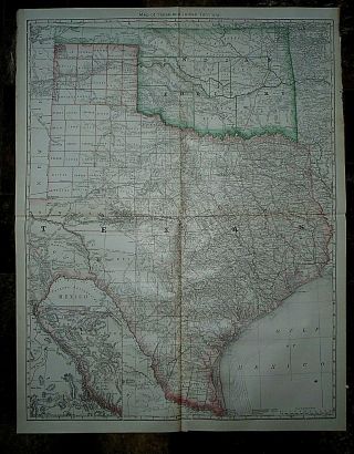
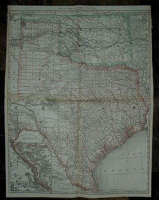
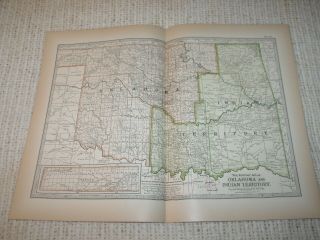
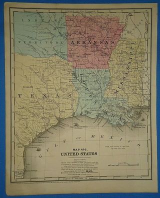
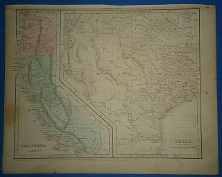
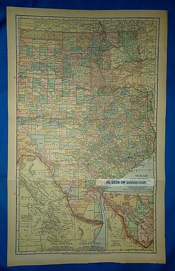
Vintage 1905 MAP TEXAS - INDIAN TERRITORY - OKLAHOMA Old Folio Size


Item History & Price

Information:
Reference Number: Avaluer:27473723REF: REF#PEERLESS1905/043020
Type: Atlas MapCartographer/Publisher: Crowell Publication Co.
Year: 1905Printing Technique: Original Coloring
Date Range: 1900-1909Original/Reproduction: Vintage Original
Country/Region: United States of AmericaFormat: 1905 Atlas Map
Original Description:
 Vintage 1905 Atlas Map ~ Good acceptable condition : see photos for best description ~ Folded Page Approx. 10 1/2" x 21 1/4" ~ Free S&H - USPS First Class ~ Title page is not included with purchase ~ Shipped Within 3 Business Days ~ Shipped Rolled in a Mailing Tube ~ %100 Satisfaction Guaranteed


    Similar items


  • Vintage Circa 1874 Texas - Indian Territory Old Antique Atlas Map

    Vintage Circa 1874 Texas - Indian Territory Old Antique Atlas Map

  • Vintage Circa 1903 Texas - Indian Territory - Oklahoma Map Old Antique

    Vintage Circa 1903 Texas - Indian Territory - Oklahoma Map Old Antique

  • Vintage 1876 Atlas Map Texas - Indian Territory Old Antique S&h

    Vintage 1876 Atlas Map Texas - Indian Territory Old Antique S&h

  • Vintage 1882 Atlas Map Texas - Indian Territory Antique & Authentic S&h

    Vintage 1882 Atlas Map Texas - Indian Territory Antique & Authentic S&h

  • Vintage 1883 Hardesty Atlas Map Texas - Indian Territory Old & Authentic

    Vintage 1883 Hardesty Atlas Map Texas - Indian Territory Old & Authentic

  • Vintage 1897 Map Oklahoma & Indian Territory Century Atlas Double Page

    Vintage 1897 Map Oklahoma & Indian Territory Century Atlas Double Page

  • Vintage 1853 Texas Indian Territory Arkansas Map Antique Hand Colored

    Vintage 1853 Texas Indian Territory Arkansas Map Antique Hand Colored

  • Vintage 1856 Texas - Indian Territory Map Old Antique Atlas Map

    Vintage 1856 Texas - Indian Territory Map Old Antique Atlas Map


    • You might also like


    • 1860 Mitchell Hand Colored Map Colorado,  Nebraska & Kansas - Civil War Era

      1860 Mitchell Hand Colored Map Colorado, Nebraska & Kansas - Civil War Era

    • 18th Century French Map Of North America

      18th Century French Map Of North America

    • Las Vegas Nevada Vintage 1967 Us Geological Survey Quadrangle Map 4 Panels

      Las Vegas Nevada Vintage 1967 Us Geological Survey Quadrangle Map 4 Panels

    • Rare Antique 1845 Maps United States Exploring Expedition Book Antartica Hawaii

      Rare Antique 1845 Maps United States Exploring Expedition Book Antartica Hawaii

    • Vintage 1926 Map Hollywood From The Best Surveys Of The Time

      Vintage 1926 Map Hollywood From The Best Surveys Of The Time

    • American Continent (western Hemisphere) 1747 Bowen Antique Copper Engraved Map

      American Continent (western Hemisphere) 1747 Bowen Antique Copper Engraved Map

    • Gulf Coast Florida Texas United States 1705 De Fer Unusual Antique Engraved Map

      Gulf Coast Florida Texas United States 1705 De Fer Unusual Antique Engraved Map

    • California As Island United States 1700 De Fer Unusual First Edition Antique Map

      California As Island United States 1700 De Fer Unusual First Edition Antique Map

Avaluer          About Us          Privacy Policy          Contact Us          UP
© 2022, avaluer.net, Inc. or its affiliates