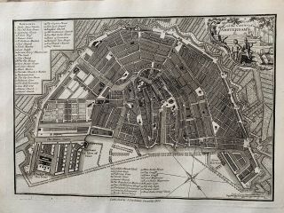
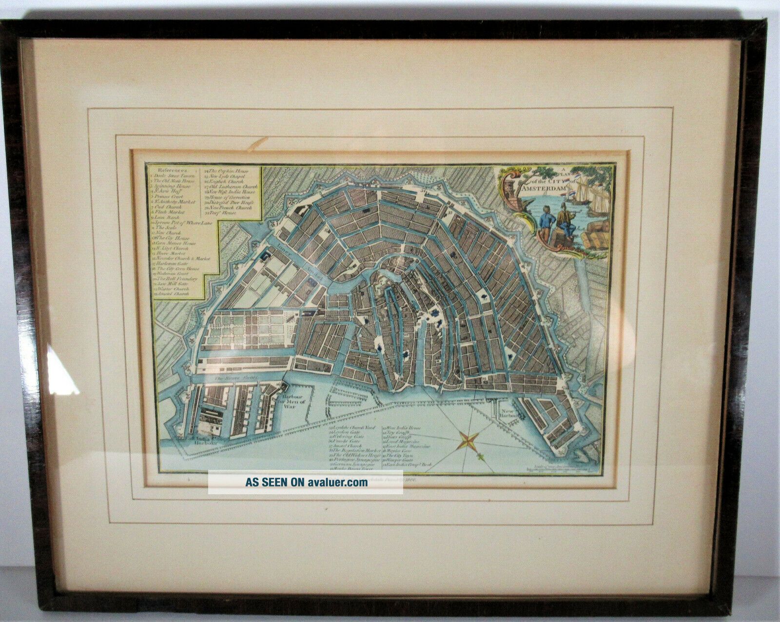
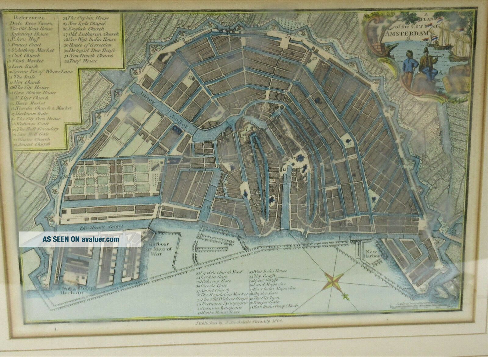
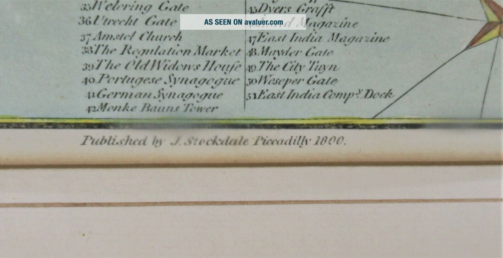
Year 1800 Amsterdam Holland Tinted City Map By John Stockdale


Item History & Price

Information:
Reference Number: Avaluer:27877Printing Technique: Copper Plate
Date Range: 1800Original/Reproduction: Antique Original
City: AmsterdamType: City Map
Country/Region: HollandYear: 1800
Topic: Maps
Original Description:
A city map dated 1800 of Amsterdam, Holland by John Stockdale.Map is hand tinted, framed and matted. Measures framed 16” x 13”, and mapapprox. 12” x 9”. 51 local landmarks or establishments noted. Frame is olderbut not to 1800.Map is in good condition, no damage. Slight loss of veneerto frame.BM#30849


    Similar items


  • 1800 Amsterdam Holland City Plan Antique Map By John Stockdale 219 Years Old

    1800 Amsterdam Holland City Plan Antique Map By John Stockdale 219 Years Old

  • Buffalo,  Ny. ,  1888 City Map By Natthew

    Buffalo, Ny. , 1888 City Map By Natthew ' S, Northrup & Co. 12x18 Inches

  • Year After Marriage - Hand Tinted Stereoview C1850s By Elliott

    Year After Marriage - Hand Tinted Stereoview C1850s By Elliott

  • 1950s Map Of Rome By Instituto Poligrafico Dello Stato & City Map By Twa

    1950s Map Of Rome By Instituto Poligrafico Dello Stato & City Map By Twa

  • Vienna,  Austria - 1908 Inner City Map By Meyers.  Antique

    Vienna, Austria - 1908 Inner City Map By Meyers. Antique

  • London England: 1908 Inner City Map By Meyers.  Antique

    London England: 1908 Inner City Map By Meyers. Antique

  • St Petersburg,  Russia - 1909 City Map By Meyers.  Antique

    St Petersburg, Russia - 1909 City Map By Meyers. Antique

  • Mulhouse France - 1910 City Map By Meyers.  Mulhausenen Im Elsass Alsace

    Mulhouse France - 1910 City Map By Meyers. Mulhausenen Im Elsass Alsace


    • You might also like


    • Hungary & Romania 1579 (1584) Ortelius Unusual Antique Copper Engraved Map

      Hungary & Romania 1579 (1584) Ortelius Unusual Antique Copper Engraved Map

    • Brussels Bruxelles Belfium 1777 De Ferraris & Dupuis Large Antique Map Sheet Xxi

      Brussels Bruxelles Belfium 1777 De Ferraris & Dupuis Large Antique Map Sheet Xxi

    • 1616 Atlas Map Of Iceland.

      1616 Atlas Map Of Iceland.

    • Kazan Russia 1767 Le Clerc/lespinasse Antique Copper Engraved City View

      Kazan Russia 1767 Le Clerc/lespinasse Antique Copper Engraved City View

    • 1899 Stanford,  Folding Map Of Norwich,  Norfolk,  Arthur Collins,  Jarrold & Sons,

      1899 Stanford, Folding Map Of Norwich, Norfolk, Arthur Collins, Jarrold & Sons,

    • 1948 Vintage Linen Colour Map Geological Survey Ten Mile Of Great Britain

      1948 Vintage Linen Colour Map Geological Survey Ten Mile Of Great Britain

    • 1944 Map Flying Bombs Sussex Ww2 Newspaper Military Kent Courier German V1 V2

      1944 Map Flying Bombs Sussex Ww2 Newspaper Military Kent Courier German V1 V2

    • Dated 1638 Vellum Map Of Icklesham Sussex Showing Land Uses Owners Etc

      Dated 1638 Vellum Map Of Icklesham Sussex Showing Land Uses Owners Etc

Avaluer          About Us          Privacy Policy          Contact Us          UP
© 2022, avaluer.net, Inc. or its affiliates