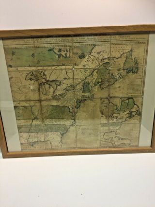
1758 - Colonial America - The English Empire In North America. Bennett
Item History & Price
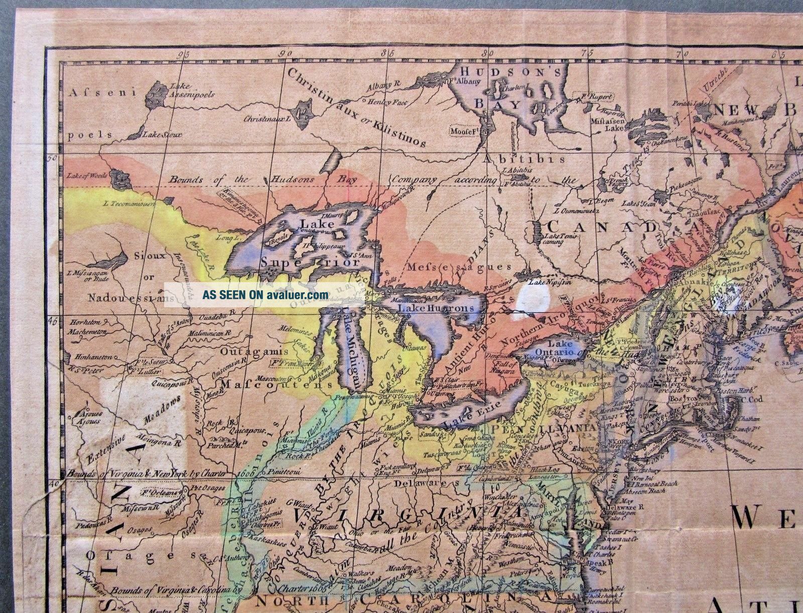
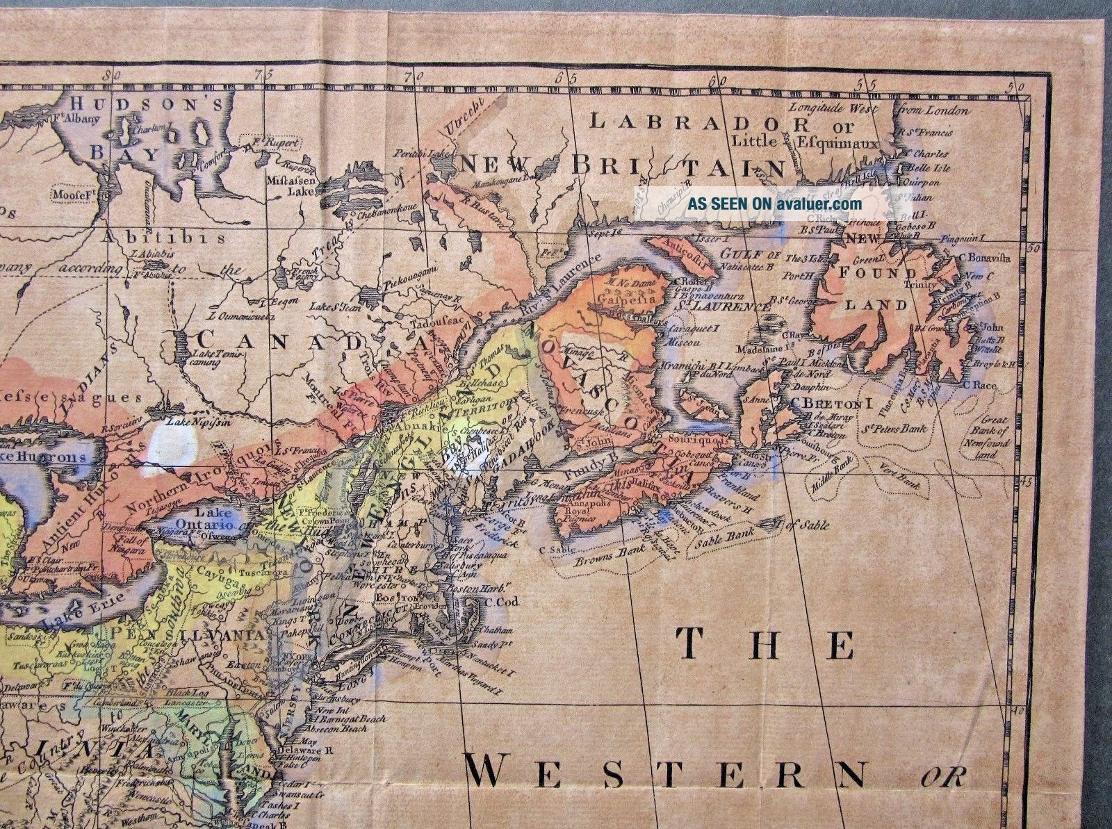
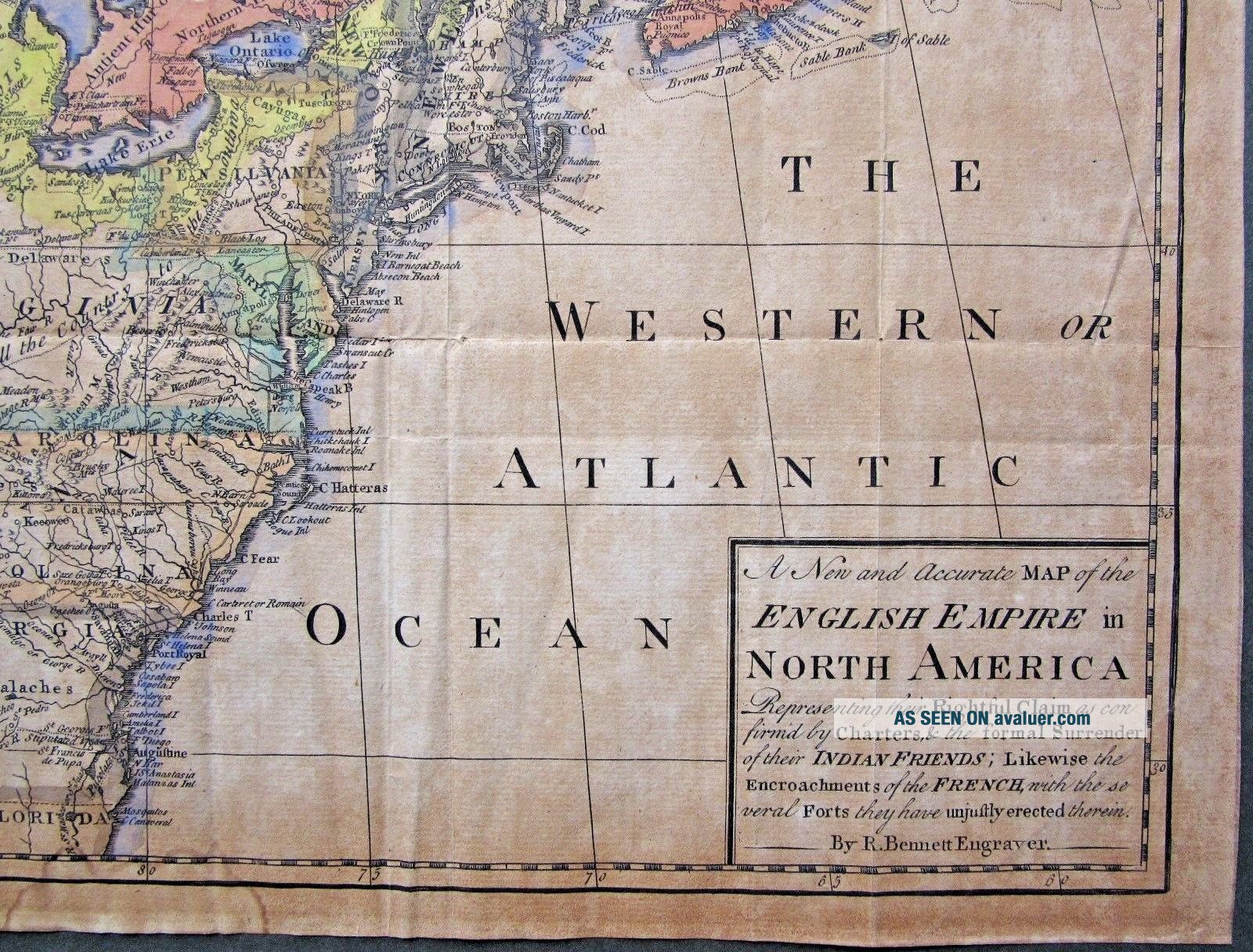
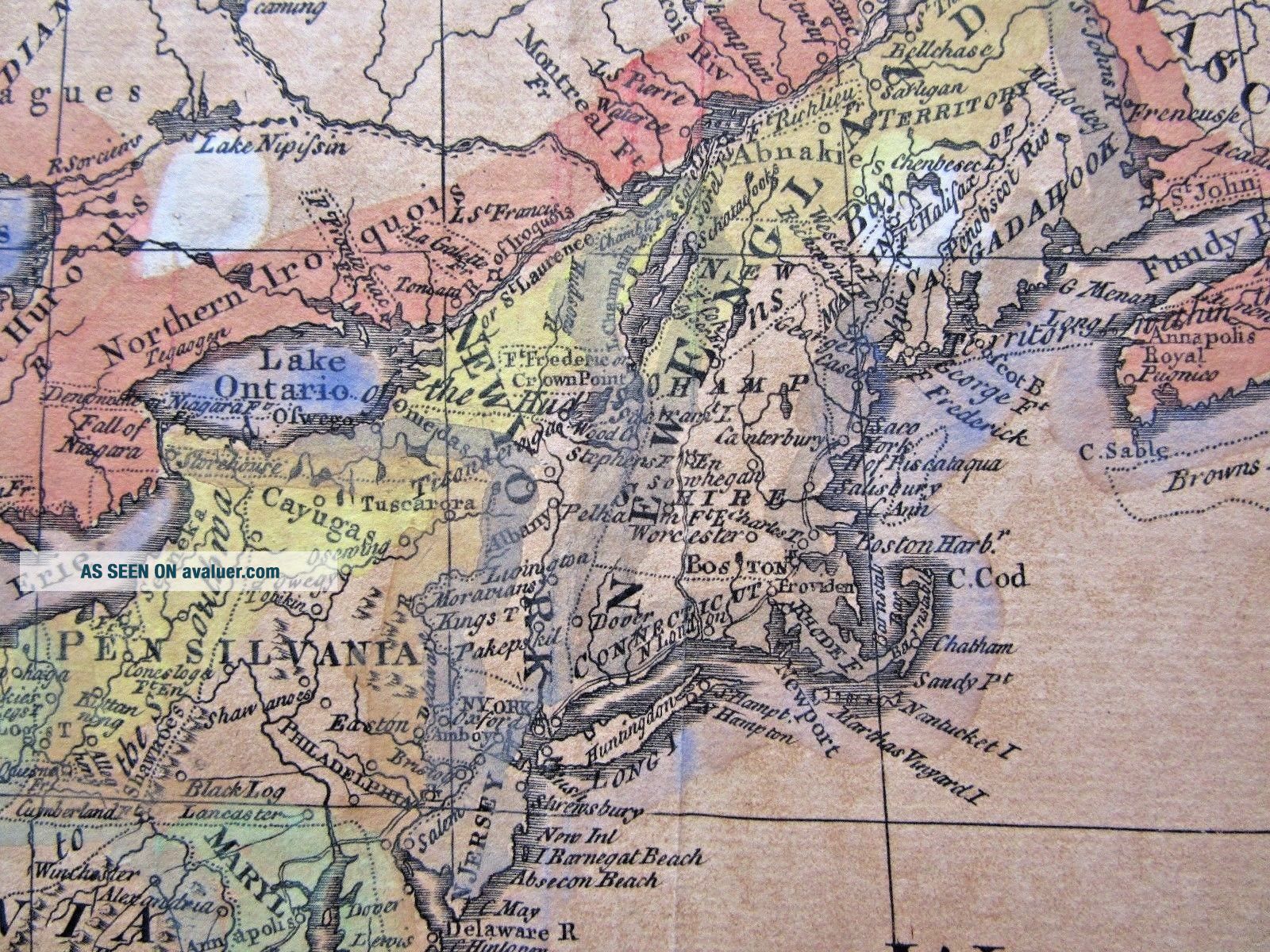
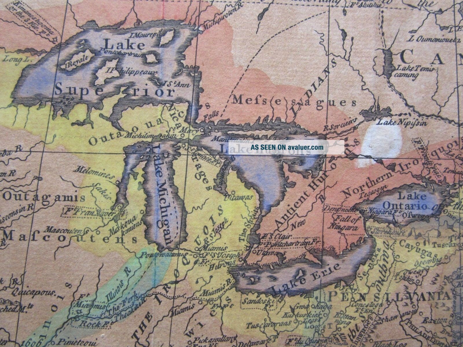
A rare map of Colonial America.
The full title of this original 18th century map from Richard Bennett is:
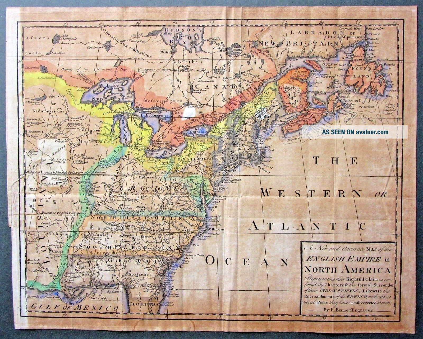
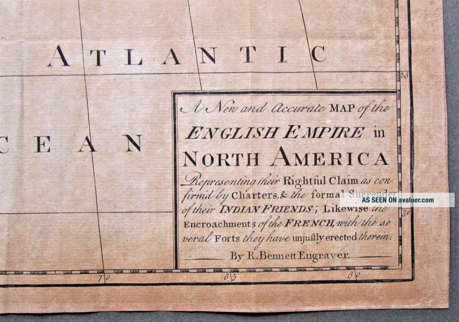
"A New and Accurate Map of the English Empire in North America Representing their Rightful Claim as confirm'd by Charters & the formal Surrender of their Indian Friends; Likewise the Encroachments of the French, with the several Forts they have unjustly erected therein"
The map was published in 1758 and is a reduced size of Bennett's map for the Society of Anti G...allicans. It was published in the Grand Magazine of Universal Intelligence in October 1758.
The map makes a patriotic statement as evidenced by the title.
Size of printed area: 12 3/4 inches wide x 10 inches high.
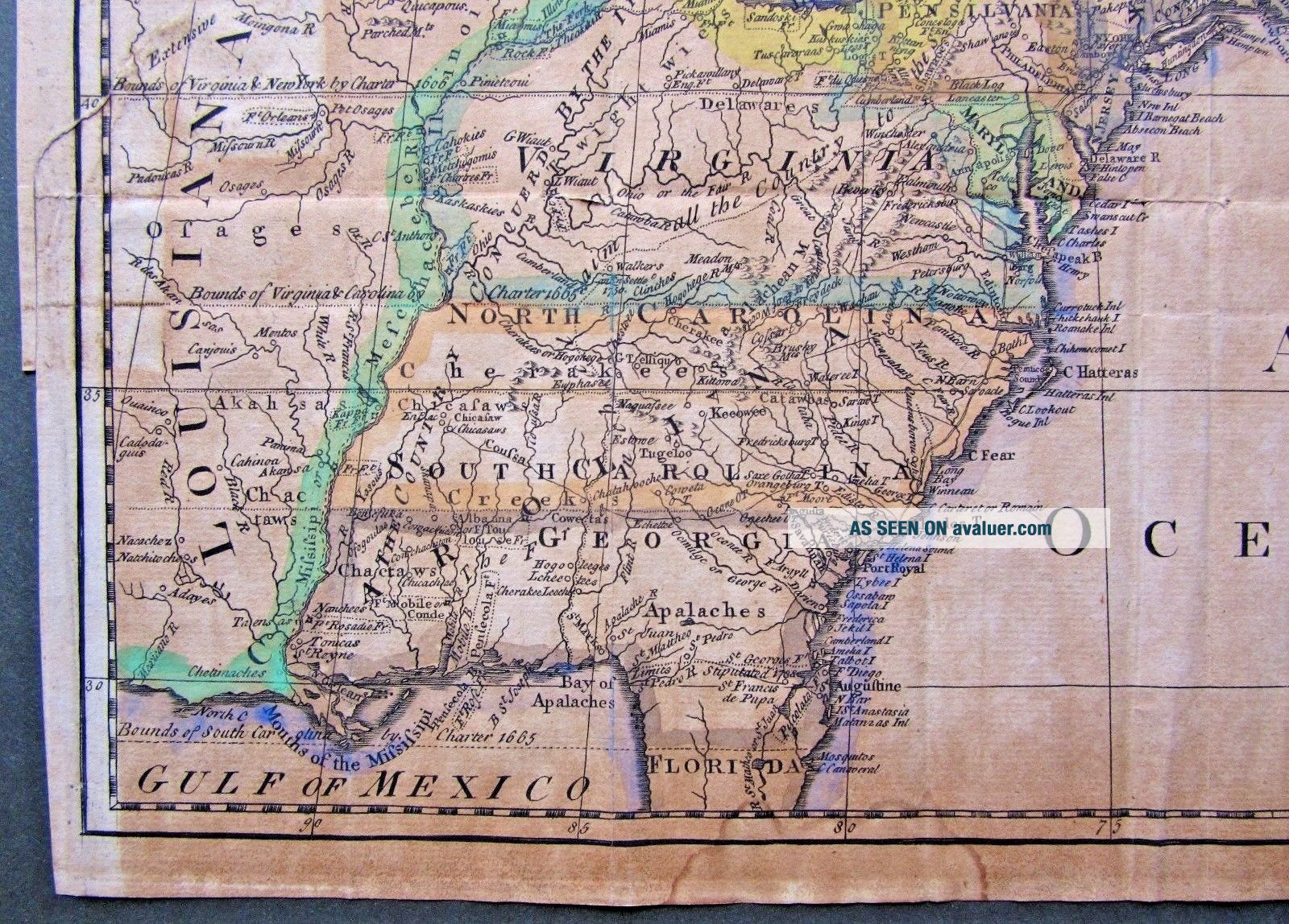
The condition is as follows: Overall toning with age - contrast with left margin which retains more of the original colour.Edge of old water stain to lower margin and almost reaching Florida. Creasing. Two white marks on a horizontal line east of the Great Lakes. Old tape repair left margin and into printed area (more visible on reverse photo.) Please check photos.
Will be sent tracked and signed for.
The full title of this original 18th century map from Richard Bennett is:
"A New and Accurate Map of the English Empire in North America Representing their Rightful Claim as confirm'd by Charters & the formal Surrender of their Indian Friends; Likewise the Encroachments of the French, with the several Forts they have unjustly erected therein"
The map was published in 1758 and is a reduced size of Bennett's map for the Society of Anti G...allicans. It was published in the Grand Magazine of Universal Intelligence in October 1758.
The map makes a patriotic statement as evidenced by the title.
Size of printed area: 12 3/4 inches wide x 10 inches high.
The condition is as follows: Overall toning with age - contrast with left margin which retains more of the original colour.Edge of old water stain to lower margin and almost reaching Florida. Creasing. Two white marks on a horizontal line east of the Great Lakes. Old tape repair left margin and into printed area (more visible on reverse photo.) Please check photos.
Will be sent tracked and signed for.