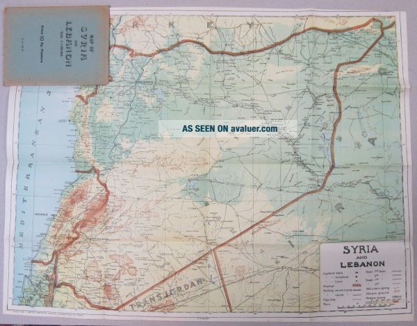
Folding Map Of Of Syria And Lebanon. Ca 1940. Middle East. The Levant.


Item History & Price
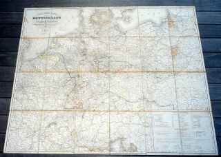
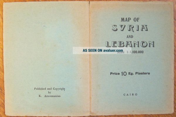
Information:
Reference Number: Avaluer:28324434Printing Technique: Colour Print
Type: Topographical MapOriginal/Reproduction: Vintage Original
Year: 1940Middle East Maps.: Syria Maps.
Date Range: 1940-1949Format: Folding Map
Country/Region: Syria / LebanonLebanon Maps.: The Levant.
Era: 1940s
Original Description:
Map Of
'Syria And Lebanon'
Scale 1: 1.100.000
Printed In Cairo.
No Date ca 1940

The Map Is In Its Original Paper Covers.

Opened out the map measures 19¼" x 25" and folded it measures 6½" x 5".

The map is in very clean, good condition.
For collectors of Folding Maps, Syria Maps, Lebanon Maps and for those interested in The Middle East.
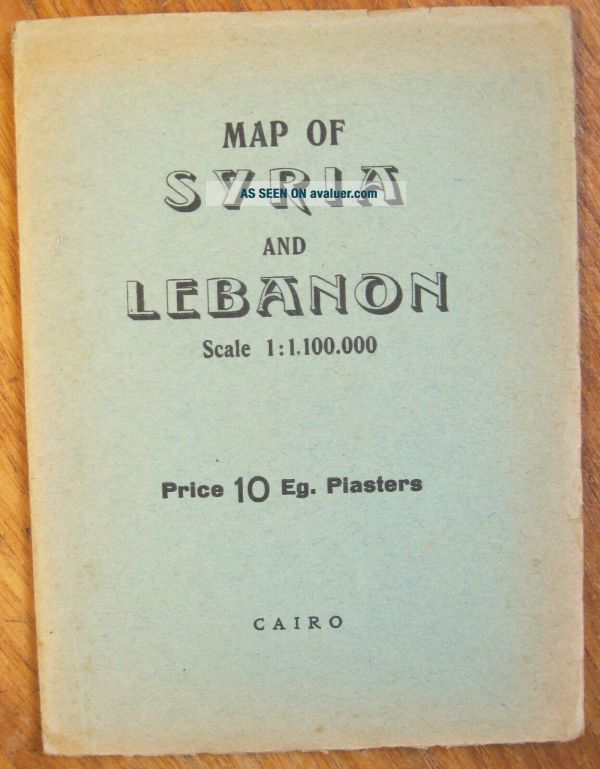

    Similar items


  • 1844 Large Folding Map Of Germany And Nearby States In Case

    1844 Large Folding Map Of Germany And Nearby States In Case

  • Bank Of Syria And Lebanon 1 Livre Lira Libanaise 1939 Rare Bank Note Pick 40

    Bank Of Syria And Lebanon 1 Livre Lira Libanaise 1939 Rare Bank Note Pick 40

  • Bank Of Syria And Lebanon 5 Livres Lira Libanaise 1939 Rare Bank Note Pick 41

    Bank Of Syria And Lebanon 5 Livres Lira Libanaise 1939 Rare Bank Note Pick 41

  • Lebanon 1958 1 Livre Bank Of Syria And Lebanon P - 0055b Crisp Xf

    Lebanon 1958 1 Livre Bank Of Syria And Lebanon P - 0055b Crisp Xf

  • Bank Of Syria And Lebanon 25 Piasters Pick 51 Pcgs 64 Unc 1942 Ruth Hill Collct

    Bank Of Syria And Lebanon 25 Piasters Pick 51 Pcgs 64 Unc 1942 Ruth Hill Collct

  • Huge Folded Map Of Manhattan And Bronx,  N.  Y.  By Geographia Map Co.  Philadelphia

    Huge Folded Map Of Manhattan And Bronx, N. Y. By Geographia Map Co. Philadelphia

  • Three 19th Century Folding Maps Of France,  Italy And The Papal States

    Three 19th Century Folding Maps Of France, Italy And The Papal States


    • You might also like


    • Hungary & Romania 1579 (1584) Ortelius Unusual Antique Copper Engraved Map

      Hungary & Romania 1579 (1584) Ortelius Unusual Antique Copper Engraved Map

    • Brussels Bruxelles Belfium 1777 De Ferraris & Dupuis Large Antique Map Sheet Xxi

      Brussels Bruxelles Belfium 1777 De Ferraris & Dupuis Large Antique Map Sheet Xxi

    • 1616 Atlas Map Of Iceland.

      1616 Atlas Map Of Iceland.

    • Kazan Russia 1767 Le Clerc/lespinasse Antique Copper Engraved City View

      Kazan Russia 1767 Le Clerc/lespinasse Antique Copper Engraved City View

    • 1899 Stanford,  Folding Map Of Norwich,  Norfolk,  Arthur Collins,  Jarrold & Sons,

      1899 Stanford, Folding Map Of Norwich, Norfolk, Arthur Collins, Jarrold & Sons,

    • 1948 Vintage Linen Colour Map Geological Survey Ten Mile Of Great Britain

      1948 Vintage Linen Colour Map Geological Survey Ten Mile Of Great Britain

    • 1944 Map Flying Bombs Sussex Ww2 Newspaper Military Kent Courier German V1 V2

      1944 Map Flying Bombs Sussex Ww2 Newspaper Military Kent Courier German V1 V2

    • Dated 1638 Vellum Map Of Icklesham Sussex Showing Land Uses Owners Etc

      Dated 1638 Vellum Map Of Icklesham Sussex Showing Land Uses Owners Etc

Avaluer          About Us          Privacy Policy          Contact Us          UP
© 2022, avaluer.net, Inc. or its affiliates