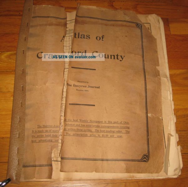
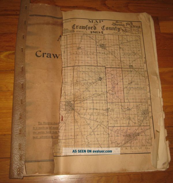
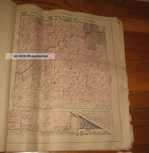
VTG 1894 ATLAS MAP PLAT CRAWFORD COUNTY OHIO Bucyrus Family Names H. L. Weber


Item History & Price

Information:
Reference Number: Avaluer:28599903Format: Atlas Map
Year: 1894Type: Real Photo (RPPC)
US State: Ohio
Original Description:
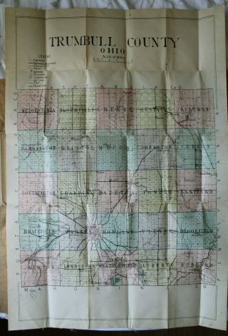
Measures approximately 16" x 18" - areas included:  crawford county, auburn, bucyrus, chatfield, cranberry, holmes, wyandot, todd, monnette, dallas, jefferson, marion, jackson, liberty, wyandot, polk sandusky, vernon and whetstone (this last one was put in upside down) - includes 14 pages.  Damage on outer covers - otherwise all inside pages are intact and in good condition considering age.


    Similar items


  • 1893 Atlas Map Plat Turner County South Dakota Rowley & Peterson Antique Vtg.

    1893 Atlas Map Plat Turner County South Dakota Rowley & Peterson Antique Vtg.

  • Combination Atlas Map Of Montgomery County,  Ohio - L.  H.  Everts - 1972 Facsimile

    Combination Atlas Map Of Montgomery County, Ohio - L. H. Everts - 1972 Facsimile

  • 1875 Combination Atlas Map Of Montgomery County,  Ohio Reprint

    1875 Combination Atlas Map Of Montgomery County, Ohio Reprint

  • Combination Atlas Map Of Trumbull County Ohio First Edition 1874 L.  H.  Everts Vg

    Combination Atlas Map Of Trumbull County Ohio First Edition 1874 L. H. Everts Vg

  • Atlas 1894 Crawford County Ohio Oh History Genealogy Plat Bucyrus,  First

    Atlas 1894 Crawford County Ohio Oh History Genealogy Plat Bucyrus, First

  • Antique Fold Out Road Map Of Trumbull County Ohio Electric Steam Railroad Vtg

    Antique Fold Out Road Map Of Trumbull County Ohio Electric Steam Railroad Vtg

  • Vintage Mountcastle Street Atlas Cleveland And Cuyahoga County Ohio Book 1940

    Vintage Mountcastle Street Atlas Cleveland And Cuyahoga County Ohio Book 1940 ' S

  • Official Street Atlas Lorain And Medina Counties Ohio Guide Map No.  873 - Y

    Official Street Atlas Lorain And Medina Counties Ohio Guide Map No. 873 - Y


    • You might also like


    • 1860 Mitchell Hand Colored Map Colorado,  Nebraska & Kansas - Civil War Era

      1860 Mitchell Hand Colored Map Colorado, Nebraska & Kansas - Civil War Era

    • 18th Century French Map Of North America

      18th Century French Map Of North America

    • Las Vegas Nevada Vintage 1967 Us Geological Survey Quadrangle Map 4 Panels

      Las Vegas Nevada Vintage 1967 Us Geological Survey Quadrangle Map 4 Panels

    • Rare Antique 1845 Maps United States Exploring Expedition Book Antartica Hawaii

      Rare Antique 1845 Maps United States Exploring Expedition Book Antartica Hawaii

    • Vintage 1926 Map Hollywood From The Best Surveys Of The Time

      Vintage 1926 Map Hollywood From The Best Surveys Of The Time

    • American Continent (western Hemisphere) 1747 Bowen Antique Copper Engraved Map

      American Continent (western Hemisphere) 1747 Bowen Antique Copper Engraved Map

    • Gulf Coast Florida Texas United States 1705 De Fer Unusual Antique Engraved Map

      Gulf Coast Florida Texas United States 1705 De Fer Unusual Antique Engraved Map

    • California As Island United States 1700 De Fer Unusual First Edition Antique Map

      California As Island United States 1700 De Fer Unusual First Edition Antique Map

Avaluer          About Us          Privacy Policy          Contact Us          UP
© 2022, avaluer.net, Inc. or its affiliates