EARLY ANTIQUE 1855 IPSWICH ANNISQUAM GLOUCESTER MASSACHUSETTS MARITIME MAP CHART
Item History & Price
| Reference Number: Avaluer:28637996 |

| Reference Number: Avaluer:28637996 |
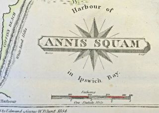
1854 Small Map Of Annisquam Ipswich Bay Gloucester Massachusetts
Early Antique 1855 Doboy Bar Inlet Georgia Island Maritime Map Chart Lighthouse
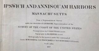
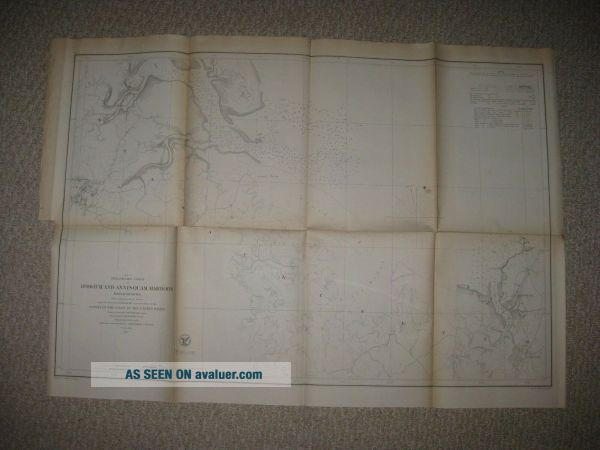
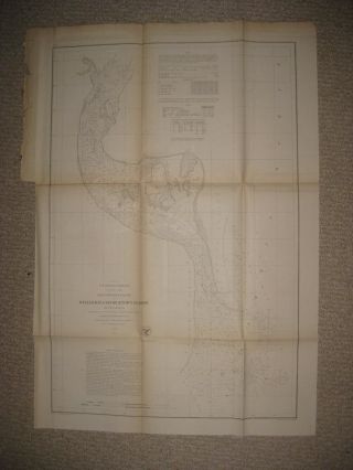
Ipswich & Annisquam Harbors Massachusetts 1857 Map Us Coast Survey

Lrg Antique Amee Davis American Gloucester Harbor Maritime Oil Painting, Nr
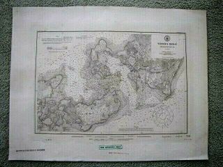
Classic Antique 1911 Famous Woods Hole Massachusetts Maritime Navigational Map
Early Antique 1855 Winyah Bay Georgetown Harbor South Carolina Map Lowcountry Nr

Antique 1855 Franklin Street Boston Massachusetts Print Street Scene Nr
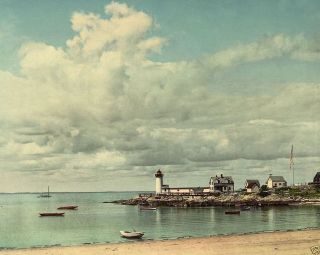
Annisquam Harbor Light Gloucester Massachusetts Lighthouse 8x10 Photo

1860 Mitchell Hand Colored Map Colorado, Nebraska & Kansas - Civil War Era

18th Century French Map Of North America

Las Vegas Nevada Vintage 1967 Us Geological Survey Quadrangle Map 4 Panels

Rare Antique 1845 Maps United States Exploring Expedition Book Antartica Hawaii

Vintage 1926 Map Hollywood From The Best Surveys Of The Time

American Continent (western Hemisphere) 1747 Bowen Antique Copper Engraved Map

Gulf Coast Florida Texas United States 1705 De Fer Unusual Antique Engraved Map

California As Island United States 1700 De Fer Unusual First Edition Antique Map