Antique Civil War Map BATTLE ANTIETAM Sharpsburg VA Virginia Gettysburg


Item History & Price
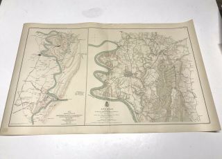
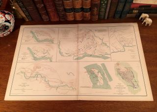
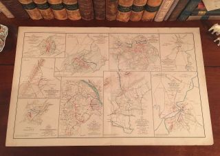
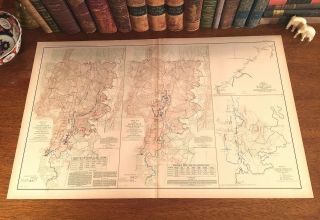
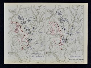
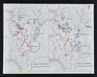
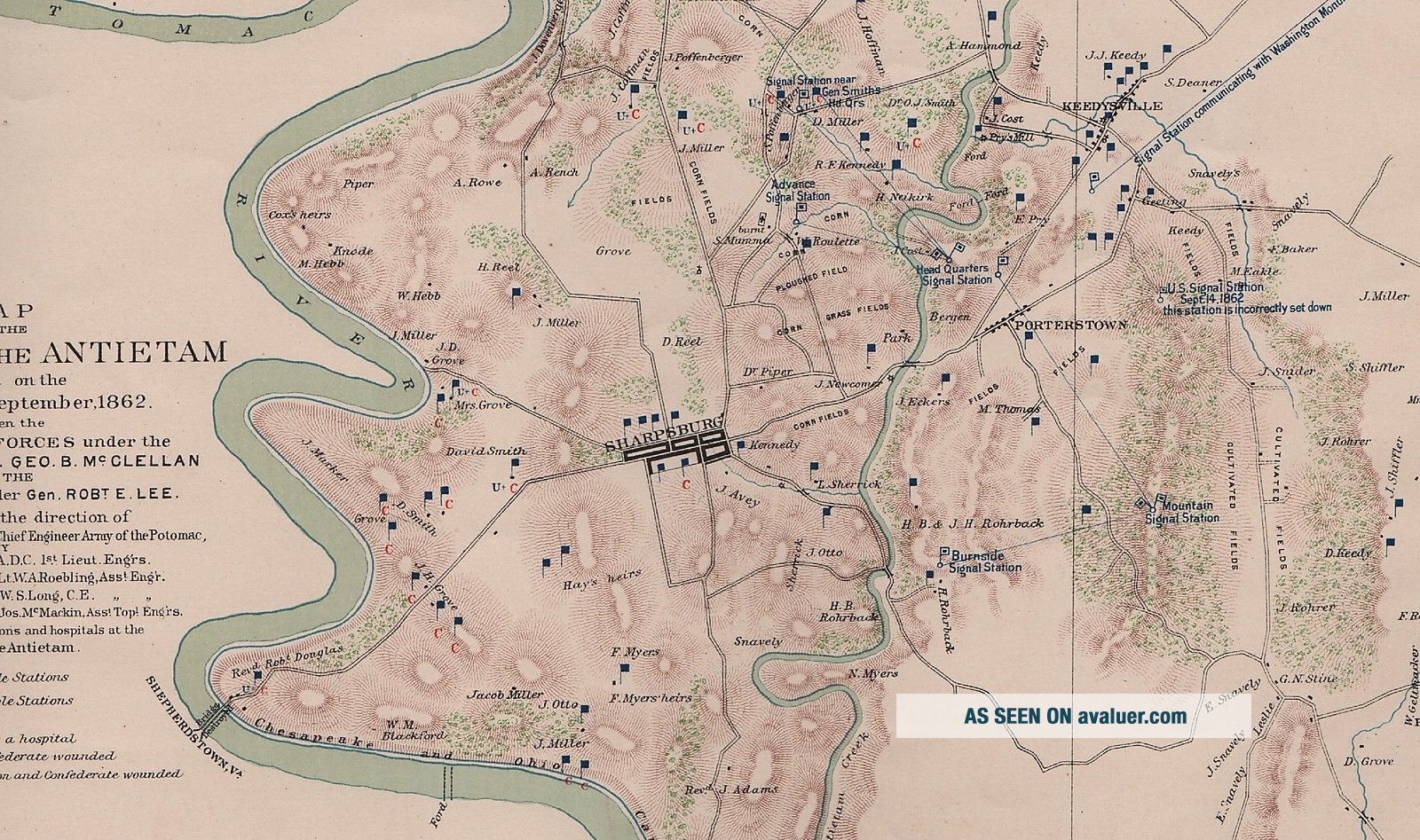
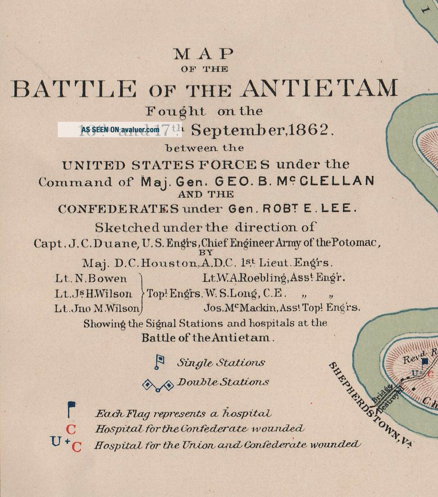
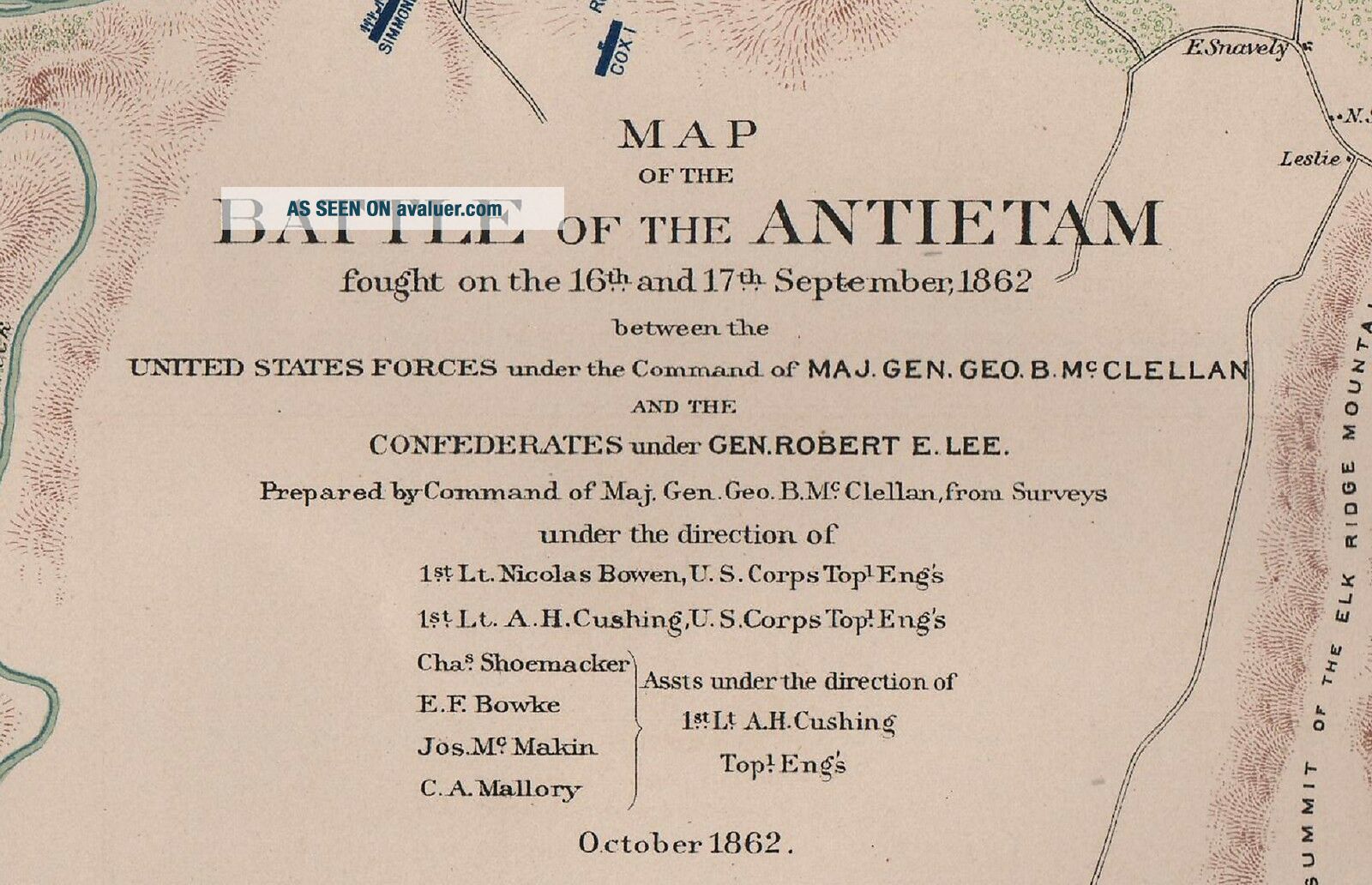
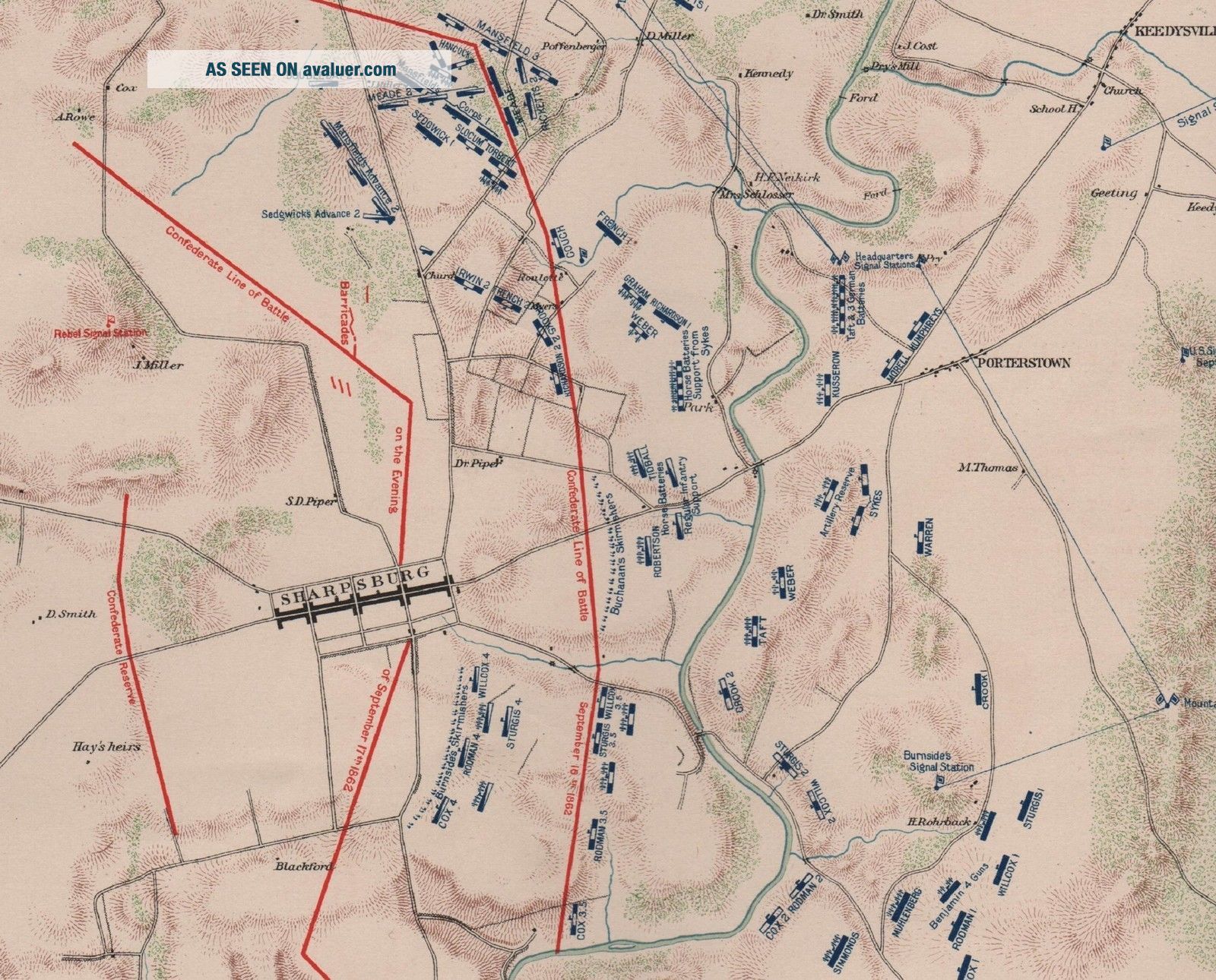
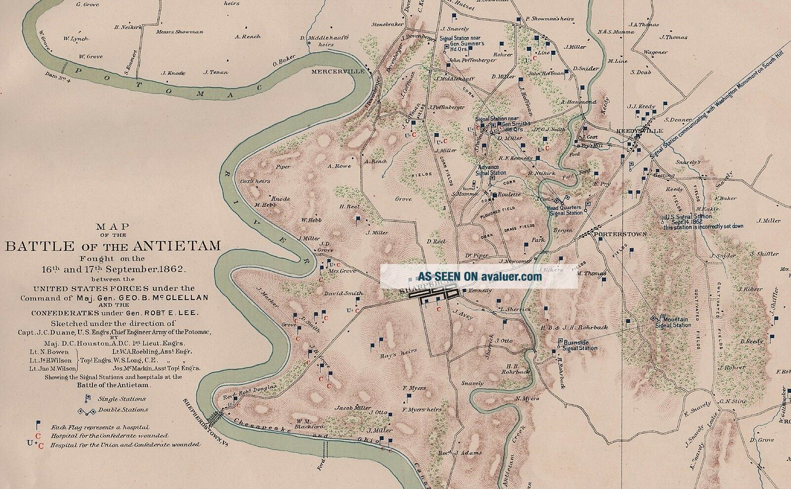
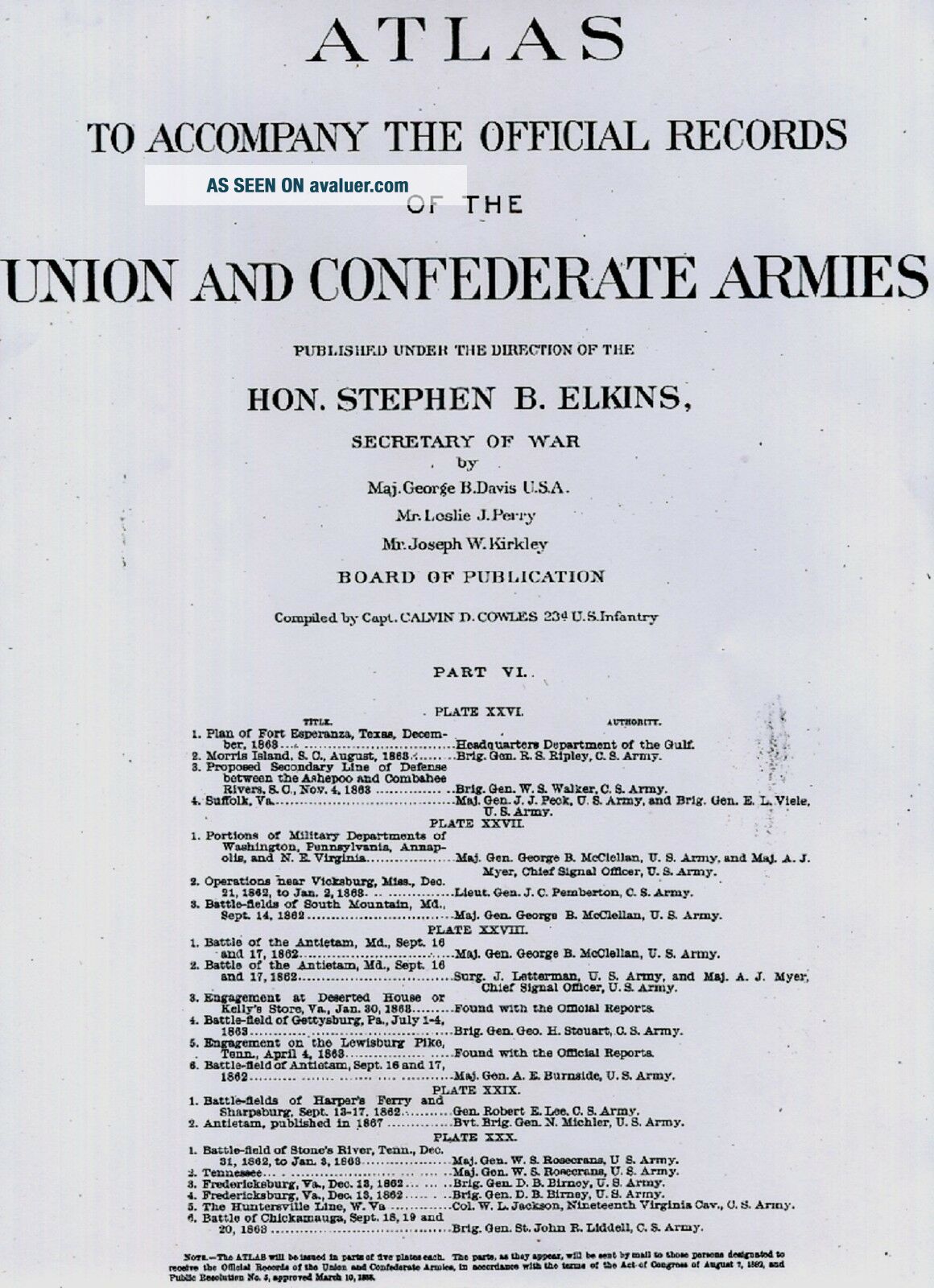
Original Plate of "The Official Atlas to Accompany the Official Records of the Union and Confederate Armies, " Published by Resolution of the U.S. Congress of May 19. 1864, to serve as"The Official Historical Record of The Civil War, to be Accompanied by an Atlas of Battles, Troop Positions, Skirmishes, and Topography." The Atlas was never openly sold, and only distributed to Federal Depositories, Universities, Museums, and various Public Institutions. ...Of the only 10, 000 Published, less than 1, 000 Complete Atlases Remain.Fine Adornment of Civil War History. Impressive on any Home or Office Wall.Map of 1862 Battle of Antietam
September 16 & 17, 1862
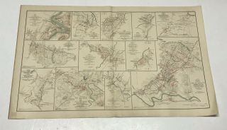
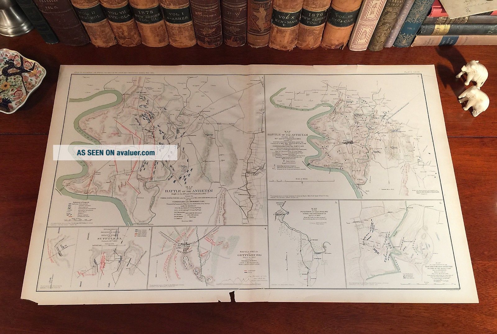
Includes Battlefield of Gettysburg.Original Lithograph Plate XXVIII (#28) of the 175 of The Official Folio Historical Record of The Official Atlas to Accompany the Official Records of the Union and Confederate Armies, Ordered by Act of Congress in 1864; Entered into The Library of Congress; and Published by the U.S. Publishing Office, Containing all Battle Maps, Field Reports, Correspondence, Troop Positions, Skirmishes, Coastal Surveys, Naval Battles, and Topography during the Four Years of the War - The undertaking of Accumulating and Assembling The Atlas taking over 30 years to complete.
Part 6. Plate XXVIII.
Original Plate XXVIII (#28) of the 175 Published.
Original 1892. 125-yrs-old.
Map is in Good/Fair condition. No marks or writings. Mild foxing. Heavy to Moderate fraying along border edges. 1/2" open tear along bottom edge, but only within the border, outside the map area. 1" closed separation along bottom fold indentation. Bottom left corner torn. Single fold as issued. Not a Reproduction. Original Lithograph Engraved by Julius Bien for the "The Official Atlas to Accompany the Official Records of the Union and Confederate Armies;" Commissioned by Resolution of Congress May 19, 1864, in accordance to serve as The Official Historical Record of the War. The Atlas was Never Publicly Sold, with only 10, 000 Volumnes being Exclusively Distributed to Federal Depositories, Universities, Museums, & Various Public Institutions. The Atlas Entered the Public Domain when the Atlases were withdrawn from Libraries and Other Federal Depositories over the past Century. Of the only 10, 000 Published, Less than 1, 000 Complete Atlases Remain.
Impressive On Any
Home or Office Wall
Dimensions: 19" x 29.5"
Fine Adornment of
Civil War HistoryGreat for Family History & Genealogy as Map Shows Towns & Landmarks during the War; Some of Which No Longer Exist Today.
Map Shows Names of Citizens' Homes & Farms, Churches, Taverns, Mills, Schoolhouses, & Many Other Landmarks.
(If you are interested in any particular name, town, home, farm, or other landmark, email me the name and I will look to see if it shown on the map.)Intricate Detail. Julius Bien Engraved.
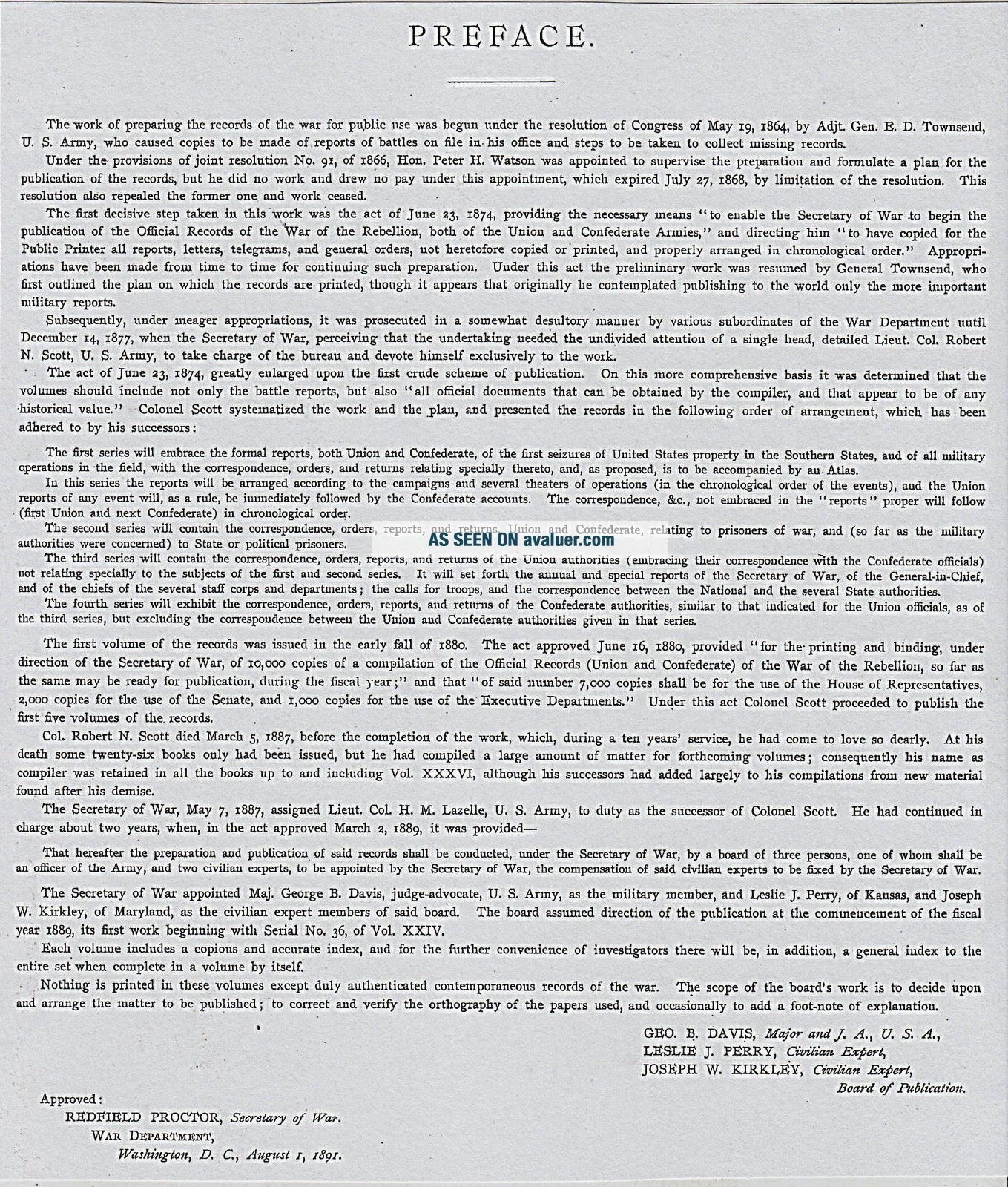
The Atlas to Accompany The Official Records of the Union and Confederate Armies was Commissioned with Resolution of the U.S. Congress in 1864, by which Adjt. General E.D. Townsend was Appointed Directorship of the Collection and Preparation of the Atlas, which was ultimately Completed and Published in 35 Parts in Sets of Five Lithographic Plates by the U.S. Government Publishing Office between 1891-1895. The 175 Plate Volume dedicated to Preserving a Historical Record of the War, each Map portraying a wealth of Knowledge and Information on Division, Corps, and Troop Positions; Battle Lines, Topography, and Military Strategy.
Confederate Forces Shown in Red.
Union Forces Shown in Blue.
The Auction is for the Map itself. A Frame is Not Included. The Framed Map shown is a Personal Lithograph of the Atlas Featured to Show the Beauty of the Maps when Framed.
Visit My eBay Store: Atticus Hutchinson AntiquesFree Shipping Special. Maps are mailed the day after purchase & normally arrive within 2-3 days. All Credit & Debit Cards accepted through Paypal. Please email with any questions.Imaginative & Creative Gift.Greetings from Historical Savannah, Georgia: Founded 1733."Some, to beautify their parlors, chambers, & studies...loveth, getteth, and useth maps, charts, and geographical globes." - John Dee, Advisor to Queen Elizabeth I.
Powered by eBay Turbo Lister
The free listing tool. List your items fast and easy and manage your active items.
00392
September 16 & 17, 1862
Includes Battlefield of Gettysburg.Original Lithograph Plate XXVIII (#28) of the 175 of The Official Folio Historical Record of The Official Atlas to Accompany the Official Records of the Union and Confederate Armies, Ordered by Act of Congress in 1864; Entered into The Library of Congress; and Published by the U.S. Publishing Office, Containing all Battle Maps, Field Reports, Correspondence, Troop Positions, Skirmishes, Coastal Surveys, Naval Battles, and Topography during the Four Years of the War - The undertaking of Accumulating and Assembling The Atlas taking over 30 years to complete.
Part 6. Plate XXVIII.
Original Plate XXVIII (#28) of the 175 Published.
Original 1892. 125-yrs-old.
Map is in Good/Fair condition. No marks or writings. Mild foxing. Heavy to Moderate fraying along border edges. 1/2" open tear along bottom edge, but only within the border, outside the map area. 1" closed separation along bottom fold indentation. Bottom left corner torn. Single fold as issued. Not a Reproduction. Original Lithograph Engraved by Julius Bien for the "The Official Atlas to Accompany the Official Records of the Union and Confederate Armies;" Commissioned by Resolution of Congress May 19, 1864, in accordance to serve as The Official Historical Record of the War. The Atlas was Never Publicly Sold, with only 10, 000 Volumnes being Exclusively Distributed to Federal Depositories, Universities, Museums, & Various Public Institutions. The Atlas Entered the Public Domain when the Atlases were withdrawn from Libraries and Other Federal Depositories over the past Century. Of the only 10, 000 Published, Less than 1, 000 Complete Atlases Remain.
Impressive On Any
Home or Office Wall
Dimensions: 19" x 29.5"
Fine Adornment of
Civil War HistoryGreat for Family History & Genealogy as Map Shows Towns & Landmarks during the War; Some of Which No Longer Exist Today.
Map Shows Names of Citizens' Homes & Farms, Churches, Taverns, Mills, Schoolhouses, & Many Other Landmarks.
(If you are interested in any particular name, town, home, farm, or other landmark, email me the name and I will look to see if it shown on the map.)Intricate Detail. Julius Bien Engraved.
The Atlas to Accompany The Official Records of the Union and Confederate Armies was Commissioned with Resolution of the U.S. Congress in 1864, by which Adjt. General E.D. Townsend was Appointed Directorship of the Collection and Preparation of the Atlas, which was ultimately Completed and Published in 35 Parts in Sets of Five Lithographic Plates by the U.S. Government Publishing Office between 1891-1895. The 175 Plate Volume dedicated to Preserving a Historical Record of the War, each Map portraying a wealth of Knowledge and Information on Division, Corps, and Troop Positions; Battle Lines, Topography, and Military Strategy.
Confederate Forces Shown in Red.
Union Forces Shown in Blue.
The Auction is for the Map itself. A Frame is Not Included. The Framed Map shown is a Personal Lithograph of the Atlas Featured to Show the Beauty of the Maps when Framed.
Visit My eBay Store: Atticus Hutchinson AntiquesFree Shipping Special. Maps are mailed the day after purchase & normally arrive within 2-3 days. All Credit & Debit Cards accepted through Paypal. Please email with any questions.Imaginative & Creative Gift.Greetings from Historical Savannah, Georgia: Founded 1733."Some, to beautify their parlors, chambers, & studies...loveth, getteth, and useth maps, charts, and geographical globes." - John Dee, Advisor to Queen Elizabeth I.
Powered by eBay Turbo Lister
The free listing tool. List your items fast and easy and manage your active items.
00392