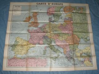
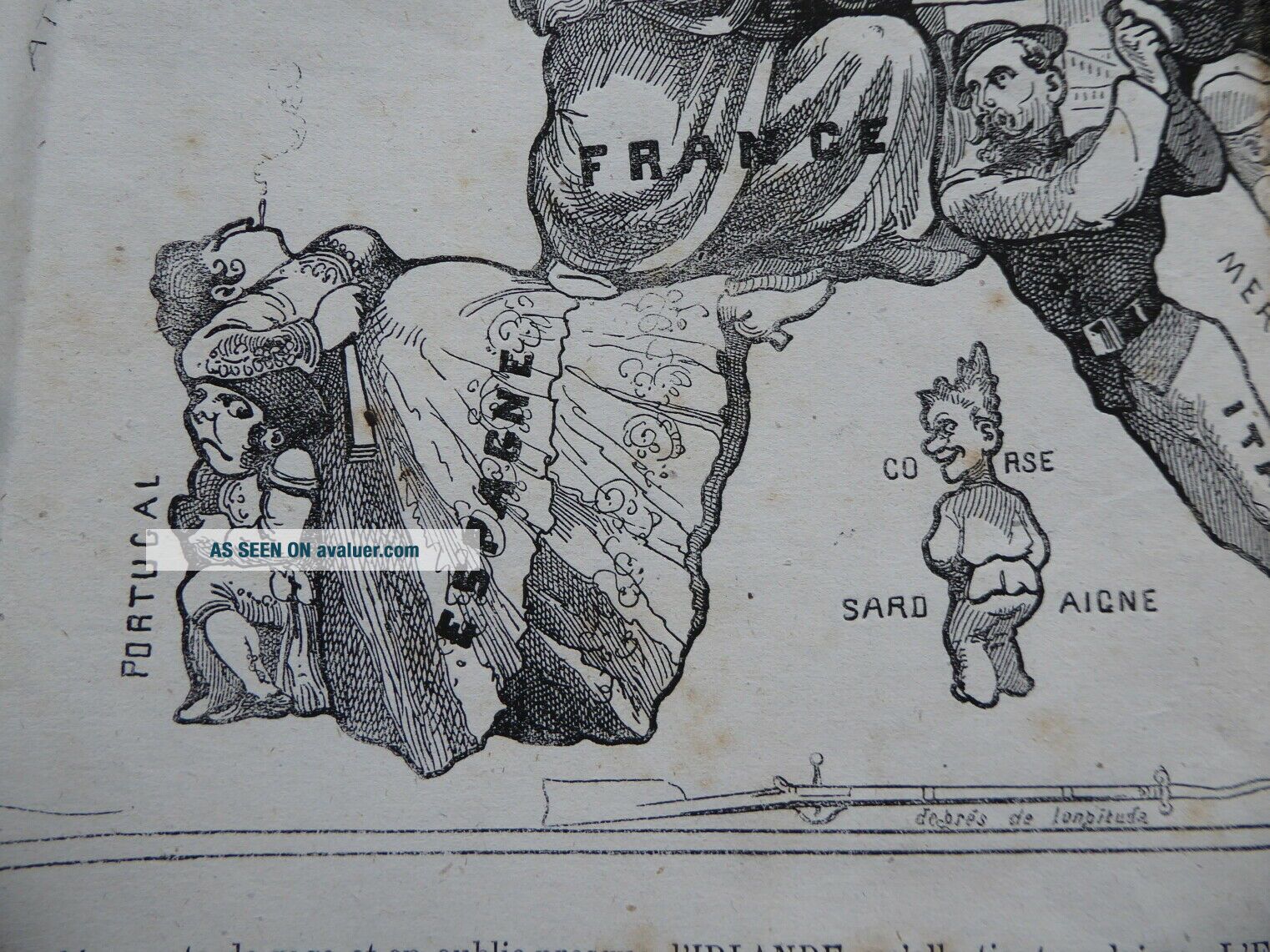
1870 Nouvelle Carte D ' Europe, Satirical Cartoon Map By Paul Hado


Item History & Price
| Reference Number: Avaluer:29738 | Original/Reproduction: Antique Original |
| Year: 1870 | Format: Sheet Map |
| Era: 1800s | Type: Novelty Map |
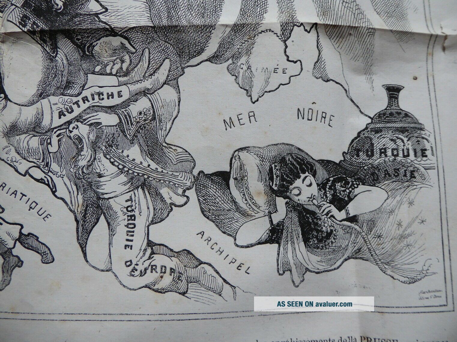
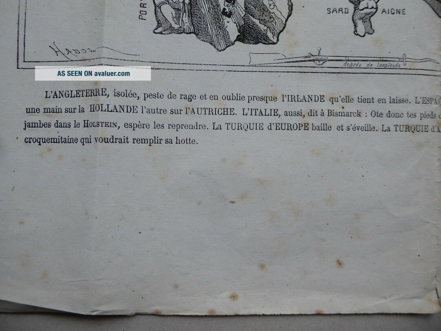
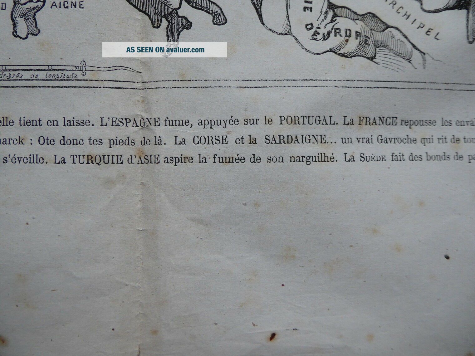
On offer is an original 19th century map.. Nouvelle Carte D 'Europe Dressee Pour 1870.Caricature cartoon map of the countries of Europe with, satirical notes relating to the political / territorial troubles of the time.Drawn by Paul Hado, published by Valle, of Paris.Measures 62cm x 46cm, surface spotting / wear to edges etc, otherwise in good condition for it's age.