C1840 Pocket Map Devon Miniature Antique Old Chapman Hall V SCARCE With Slipcase

Item History & Price
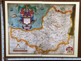
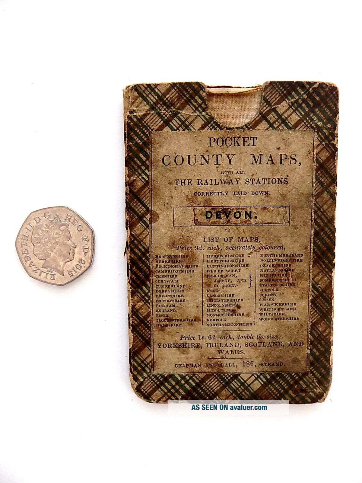
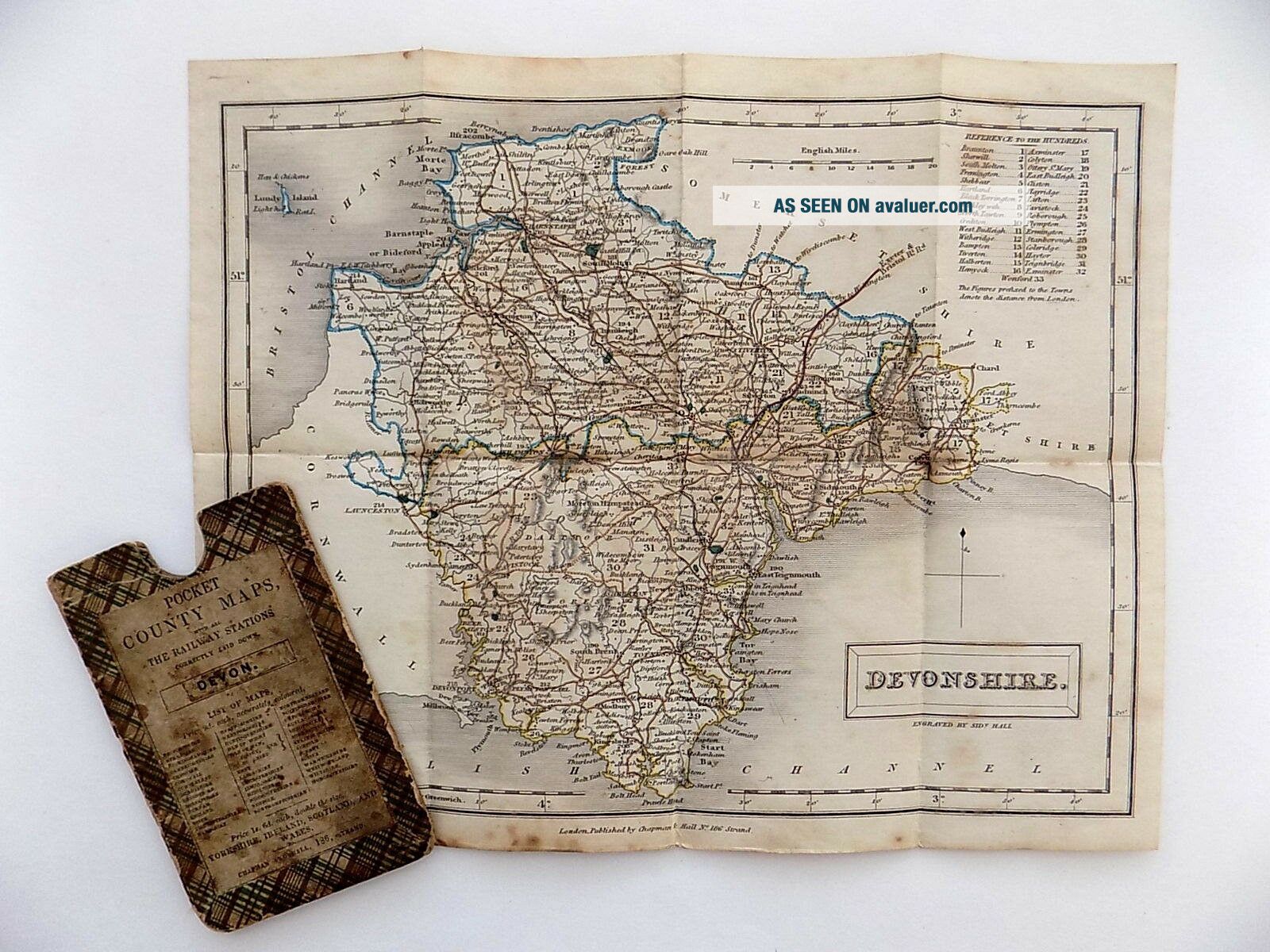
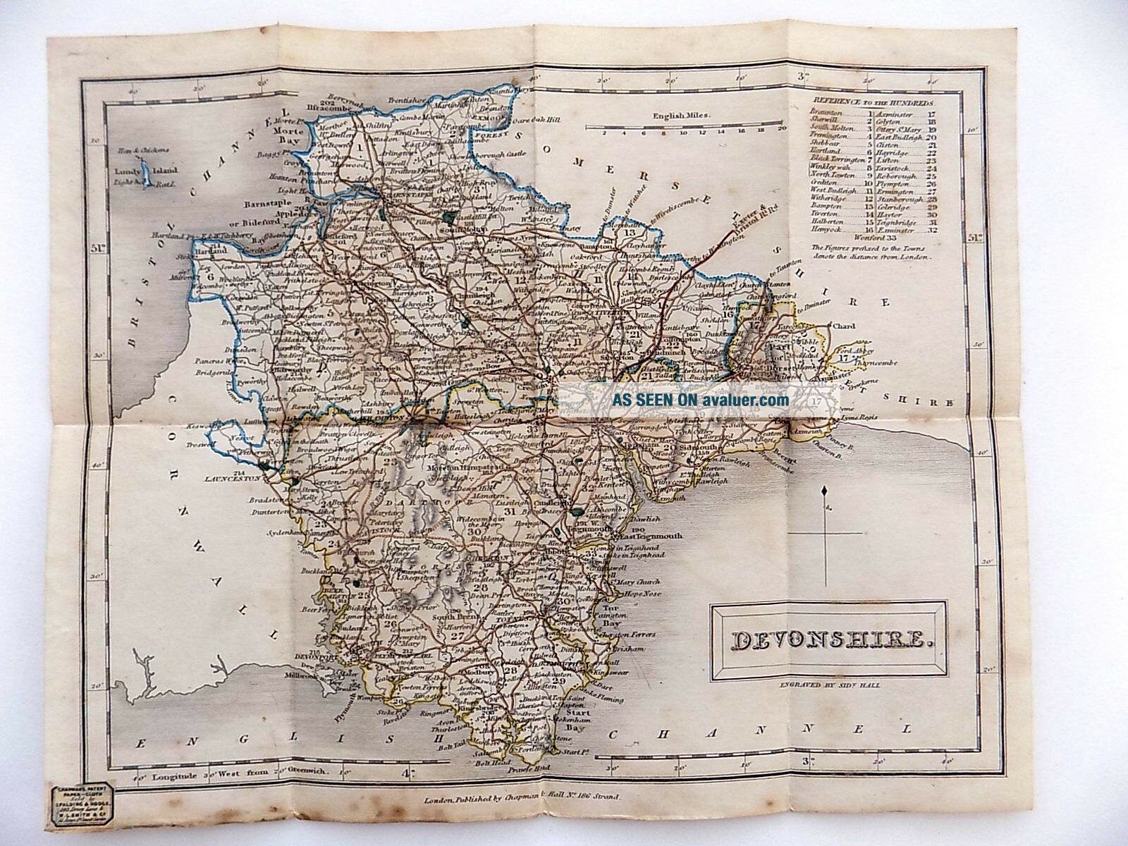
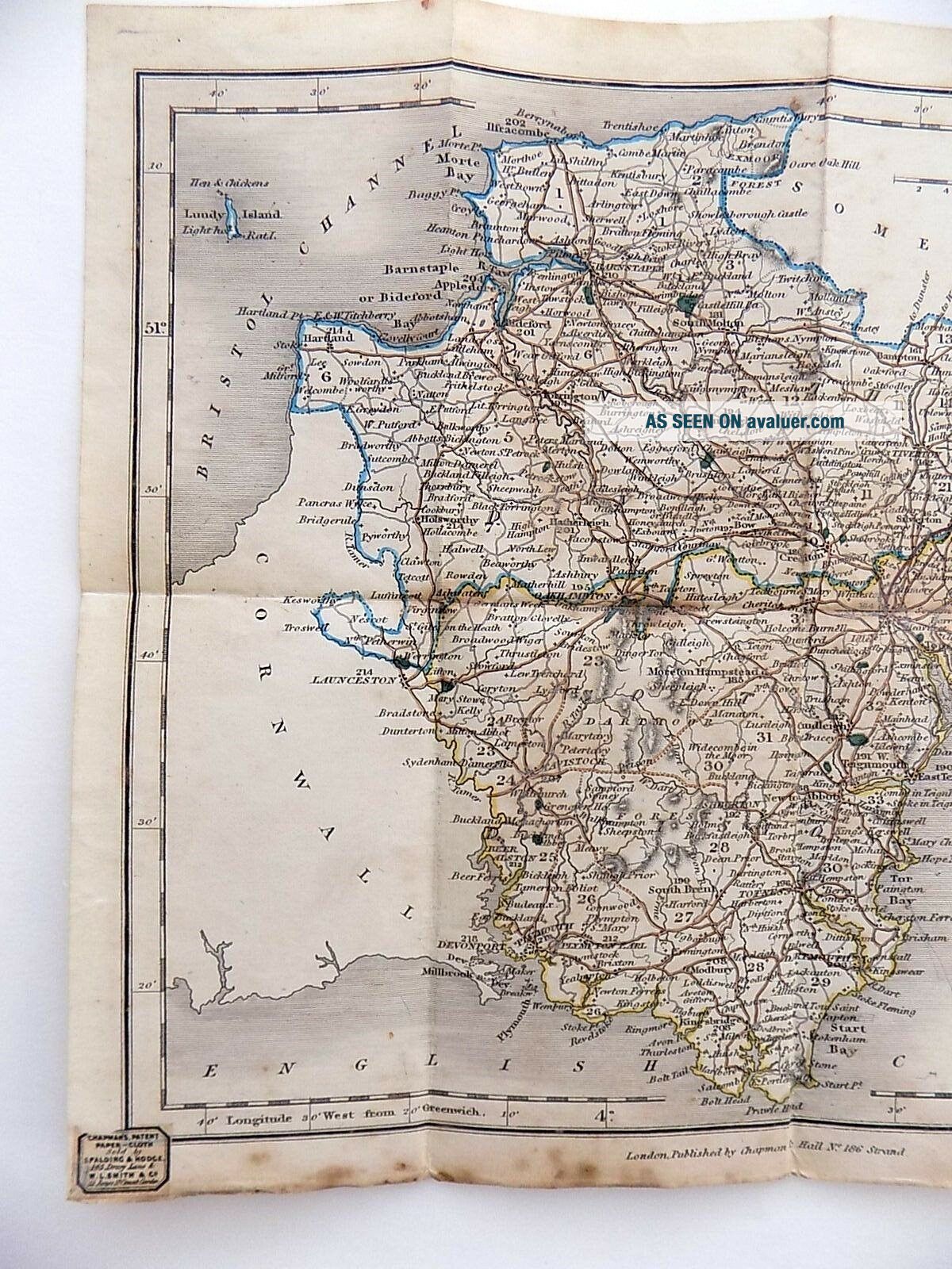
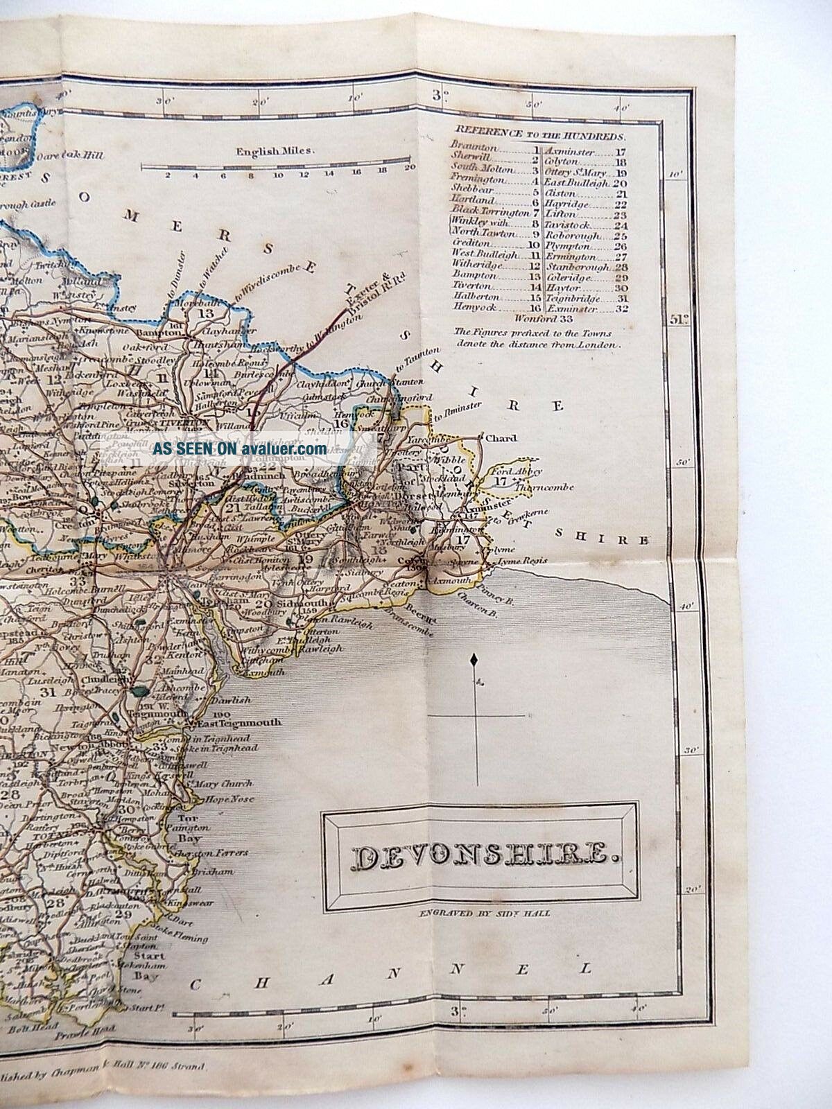
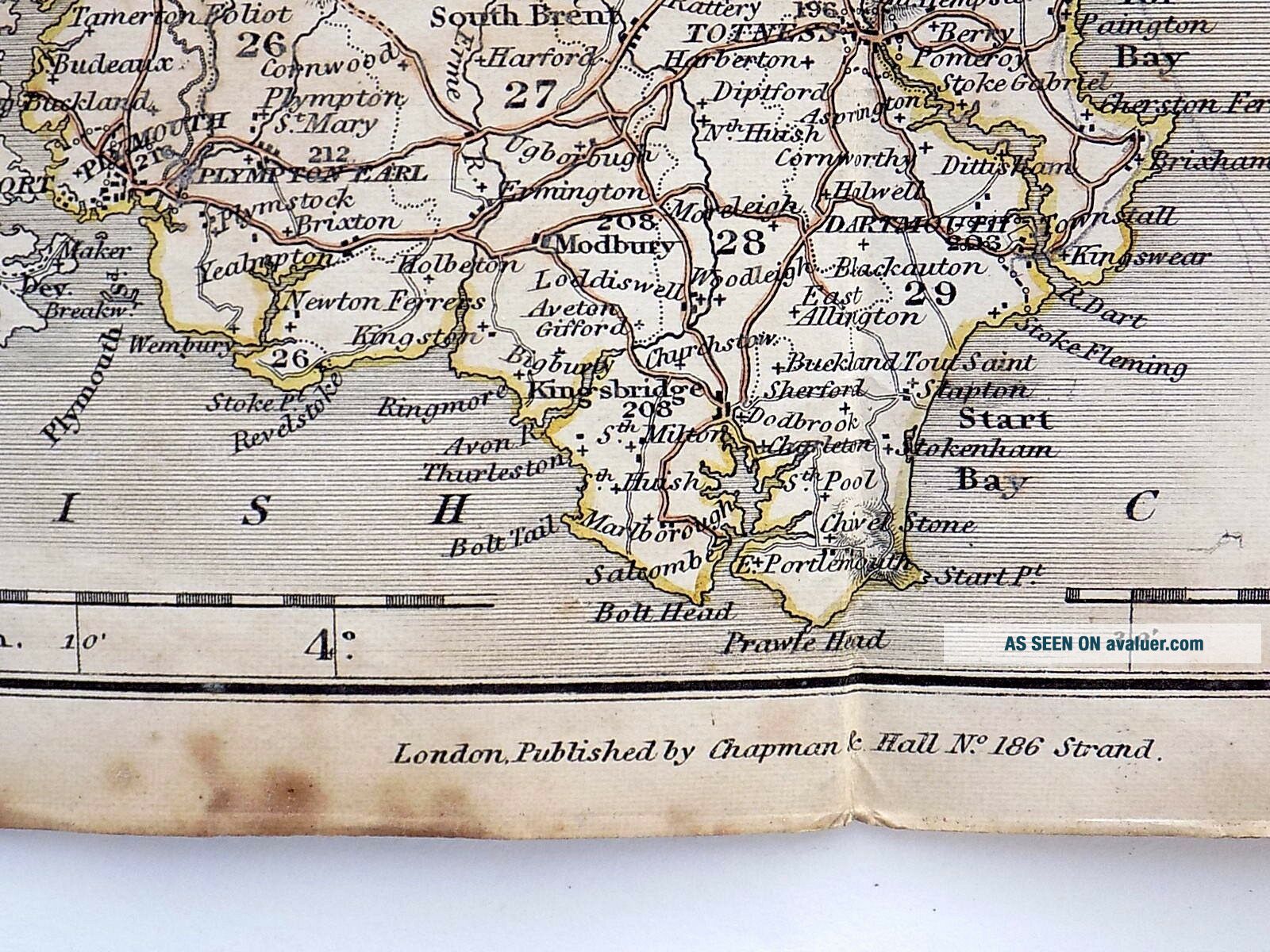
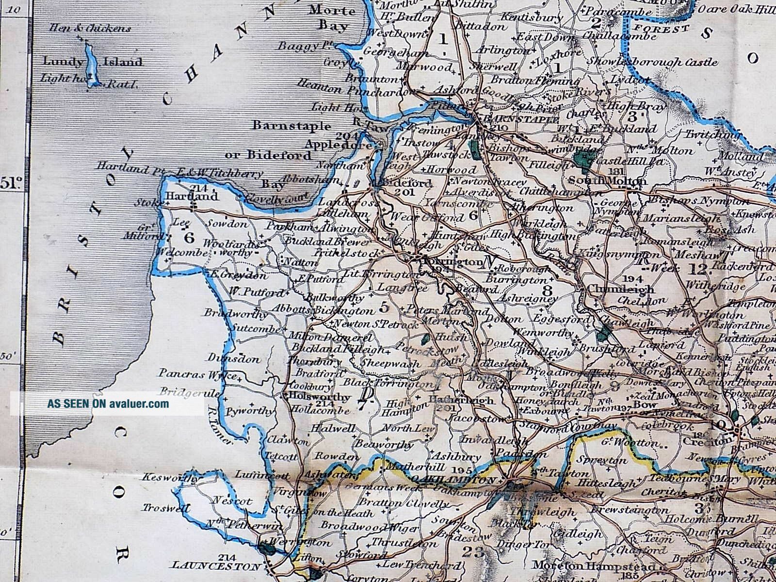
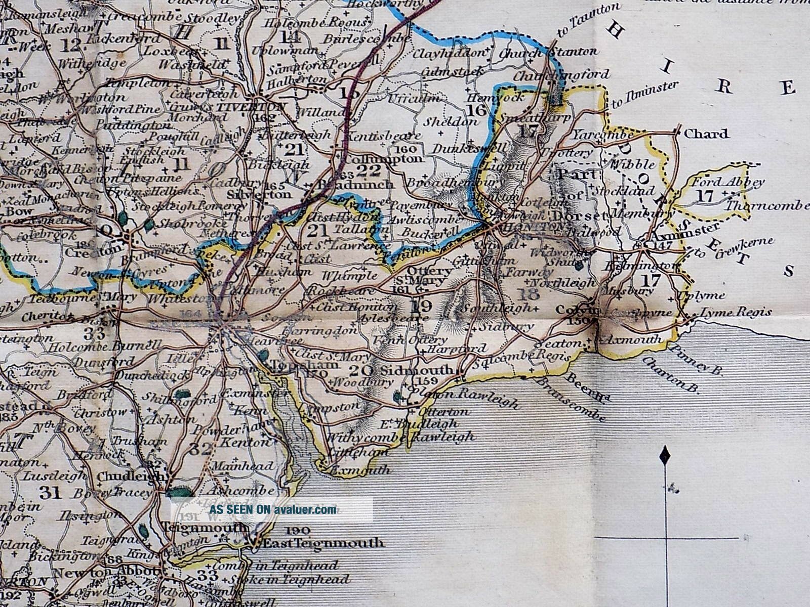
"Pocket County Maps, with all the Railway Stations Correctly laid down. DEVON. ....Chapman and Hall, 186 Strand."
A small folding map which slips into what must be one of the smallest such slipcases, making a bijou item for the map collector. Very scarce - I could find no more in this format online.
Engraved by Sidney Hall. The map was first issued c1833, and seems to have been issued as a folding map from c1842. The Railway information, so important to maps of this time, s...uggests a date in the 1840s, as does the imprint "Chapman & Hall, No. 186, Strand" for by 1852 they had moved to 193, Piccadilly.
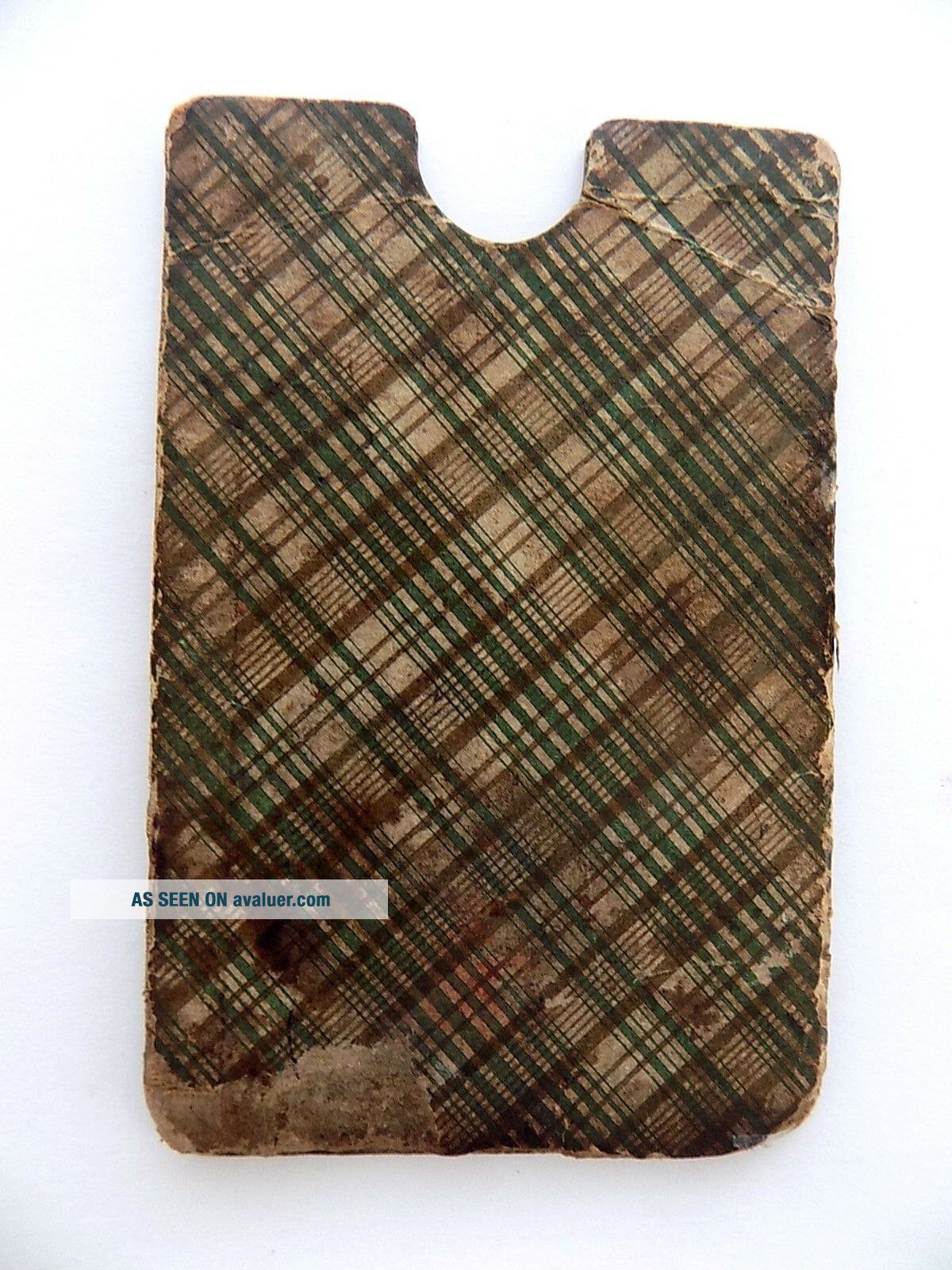
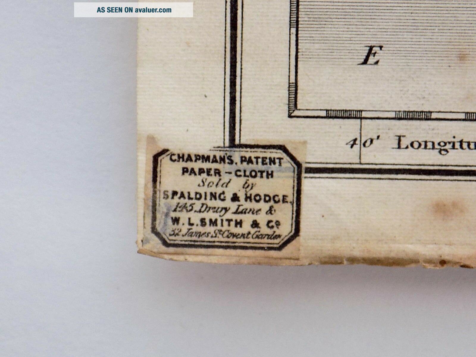
Size: the map measures approx. 26cms x 20.5cms when unfolded. The slipcase measures a mere 11cms x 7cms. The map lists the Hundreds, and has original handcolouring. Linen backed.Condition: Slipcase with signs of wear, but just about holding together at the sides. The map has quite a lot of foxing, at its worst on the back. Please study the photos.
This is a worn, fragile item, but delightful and scarce in this format
Free postage worldwide, with exclusions.
I have other antique maps, books, prints etc. in my ebay shop - please see my other items.
A small folding map which slips into what must be one of the smallest such slipcases, making a bijou item for the map collector. Very scarce - I could find no more in this format online.
Engraved by Sidney Hall. The map was first issued c1833, and seems to have been issued as a folding map from c1842. The Railway information, so important to maps of this time, s...uggests a date in the 1840s, as does the imprint "Chapman & Hall, No. 186, Strand" for by 1852 they had moved to 193, Piccadilly.
Size: the map measures approx. 26cms x 20.5cms when unfolded. The slipcase measures a mere 11cms x 7cms. The map lists the Hundreds, and has original handcolouring. Linen backed.Condition: Slipcase with signs of wear, but just about holding together at the sides. The map has quite a lot of foxing, at its worst on the back. Please study the photos.
This is a worn, fragile item, but delightful and scarce in this format
Free postage worldwide, with exclusions.
I have other antique maps, books, prints etc. in my ebay shop - please see my other items.