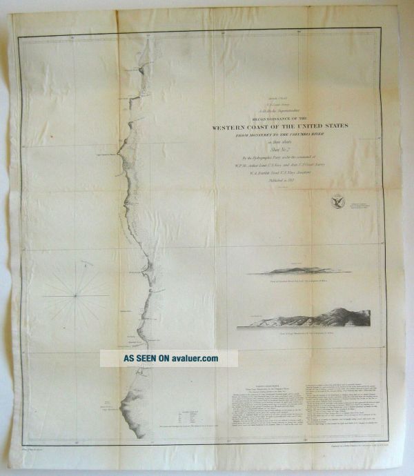
Antique 1851 US COAST SURVEY CALIFORNIA MENDOCINO TRINIDAD CITY HUMBOLDT BAY MAP


Item History & Price

Information:
Reference Number: Avaluer:30346800Original/Reproduction: Antique Original
Year: 1851Type: Coast
US State: California
Original Description:
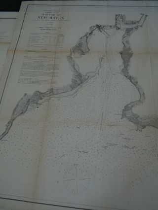
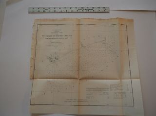
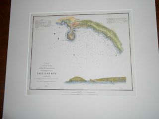
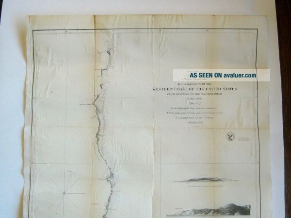
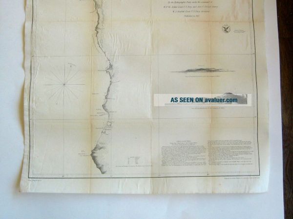
Up for auction is an original antique U.S. Coast Survey Reconnoissance of the Western Coast of the United States from Monterey to the Columbia River map dating from 1851. This is sheet two and shows from Cape Mendocino through Trinidad Head, Humboldt Bay to Umpqua Head. The Superintendent was A.D. Bache. Drawn by W.B. McMurtie and engraved by A. Rolle, F. Dankworth, O.A. Lawson, G. McCoy & W. Smith. Great early image of the California coastline. Has names of rivers, points, ports and areas. ...Also has sailing directions. The map has an acid free backing. In overall nice original condition. Some foxing as seen in the photos. No holes, has the original fold lines, no tears, no damage creases and displays well. Measures approx. 18 1/2" wide by 21 3/4" tall. Rare item and is a must for any collector. Glare spots are from the lights reflection and not on the actual item. Can always combine multiple purchases to save on shipping. Domestic shipping is USPS with Delivery Confirmation. Please email with any questions. Thanks!

00071


    Similar items


  • Antique Map " Us Coast Survey Harbor Of Haven "

    Antique Map " Us Coast Survey Harbor Of Haven "

  • Antique Map " Us Coast Survey.  Progress In York Bay & Hudson River "

    Antique Map " Us Coast Survey. Progress In York Bay & Hudson River "

  • Antique Map " Us Coast Survey.  Sea Coast From Cape Hatteras To Ocracoke Inlet "

    Antique Map " Us Coast Survey. Sea Coast From Cape Hatteras To Ocracoke Inlet "

  • Us Coast Survey Trinidad Bay California 1851 Hand Colored

    Us Coast Survey Trinidad Bay California 1851 Hand Colored

  • 1855 Us Coast Survey & Bache Antique Map Drakes Bay Puerto Los Reyes,  California

    1855 Us Coast Survey & Bache Antique Map Drakes Bay Puerto Los Reyes, California

  • Preliminary Chart Of Half Moon Bay California 1863 Us Coast Survey Map Chart

    Preliminary Chart Of Half Moon Bay California 1863 Us Coast Survey Map Chart

  • 1855 Us Coast Survey & Bache Antique Map Farallon Isles San Francisco California

    1855 Us Coast Survey & Bache Antique Map Farallon Isles San Francisco California

  • San Pablo Bay California 1863 Us Coast Survey Map Chart

    San Pablo Bay California 1863 Us Coast Survey Map Chart


    • You might also like


    • 1860 Mitchell Hand Colored Map Colorado,  Nebraska & Kansas - Civil War Era

      1860 Mitchell Hand Colored Map Colorado, Nebraska & Kansas - Civil War Era

    • 18th Century French Map Of North America

      18th Century French Map Of North America

    • Las Vegas Nevada Vintage 1967 Us Geological Survey Quadrangle Map 4 Panels

      Las Vegas Nevada Vintage 1967 Us Geological Survey Quadrangle Map 4 Panels

    • Rare Antique 1845 Maps United States Exploring Expedition Book Antartica Hawaii

      Rare Antique 1845 Maps United States Exploring Expedition Book Antartica Hawaii

    • Vintage 1926 Map Hollywood From The Best Surveys Of The Time

      Vintage 1926 Map Hollywood From The Best Surveys Of The Time

    • American Continent (western Hemisphere) 1747 Bowen Antique Copper Engraved Map

      American Continent (western Hemisphere) 1747 Bowen Antique Copper Engraved Map

    • Gulf Coast Florida Texas United States 1705 De Fer Unusual Antique Engraved Map

      Gulf Coast Florida Texas United States 1705 De Fer Unusual Antique Engraved Map

    • California As Island United States 1700 De Fer Unusual First Edition Antique Map

      California As Island United States 1700 De Fer Unusual First Edition Antique Map

Avaluer          About Us          Privacy Policy          Contact Us          UP
© 2022, avaluer.net, Inc. or its affiliates