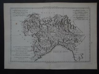
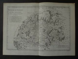
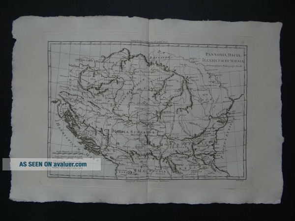
1787 Bonne Desmarest Atlas Map PANNONIA - DACIA - ILLYRIA - MOESIA - ILLYRICUM


Item History & Price

Information:
Reference Number: Avaluer:30531221Printing Technique: Copper Plate
Date Range: 1700-1799Original/Reproduction: Antique Original
Era: 1700sYear: 1787
Original Description:
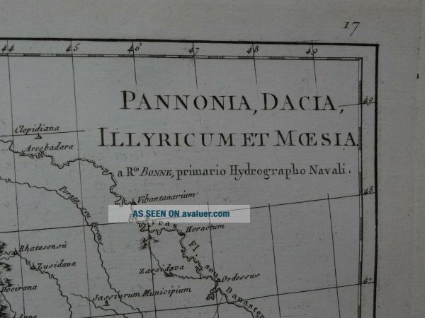
Map title:Pannonia, Dacia, Illyricum et MoesiaA Rto Bonne

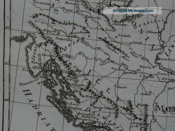
A rare copper engraved antique map of the ancient Balkan regions, Pannonia, Dacia, Illyria and MoesiaBy Rigobert Bonne1787

From the book:Atlas EncyclopediquePar M. Bonne et Par M. Desmarest1787 
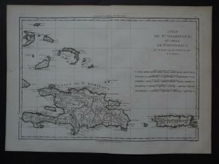
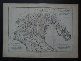
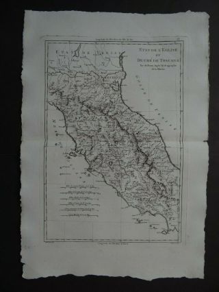
See pictures
Page size 46 x 31.5 cmMap is in good condition for age, engravings are clear, a little ghostingPaper has some browning and handling marks, untrimmed page edgesText in FrenchCentre fold line as issued...Blank on reverseUncoloured

Payments by Paypal please.UK postage £5.50Europe £10.99Worldwide £11.50


    Similar items


  • 1787 Bonne Desmarest Atlas Map Hispaniola - St Domingue - Dominican - Haiti

    1787 Bonne Desmarest Atlas Map Hispaniola - St Domingue - Dominican - Haiti

  • 1787 Bonne Desmarest Atlas Map Genes - Piedmont - Milan Parma - Italy - Italie

    1787 Bonne Desmarest Atlas Map Genes - Piedmont - Milan Parma - Italy - Italie

  • 1787 Bonne Desmarest Atlas Map Venice - Mantua - Modena - Italy - Italie Istria

    1787 Bonne Desmarest Atlas Map Venice - Mantua - Modena - Italy - Italie Istria

  • 1787 Bonne Desmarest Atlas Map Central Italy - Italie Tuscany Duche De Toscane

    1787 Bonne Desmarest Atlas Map Central Italy - Italie Tuscany Duche De Toscane

  • 1787 Bonne Desmarest Atlas Map Denmark - Royaume De Danemark - Danemarck

    1787 Bonne Desmarest Atlas Map Denmark - Royaume De Danemark - Danemarck

  • 1787 Bonne Desmarest Atlas Map Tonga Friendly Islands Carte Des Isles Des Amis

    1787 Bonne Desmarest Atlas Map Tonga Friendly Islands Carte Des Isles Des Amis

  • 1787 Bonne Desmarest Atlas Map Chile - Patagonia - Chili - Argentina - Falkland

    1787 Bonne Desmarest Atlas Map Chile - Patagonia - Chili - Argentina - Falkland

  • 1787 Bonne Desmarest Atlas Map Hungary - Royaume De Hongrie

    1787 Bonne Desmarest Atlas Map Hungary - Royaume De Hongrie


    • You might also like


    • Hungary & Romania 1579 (1584) Ortelius Unusual Antique Copper Engraved Map

      Hungary & Romania 1579 (1584) Ortelius Unusual Antique Copper Engraved Map

    • Brussels Bruxelles Belfium 1777 De Ferraris & Dupuis Large Antique Map Sheet Xxi

      Brussels Bruxelles Belfium 1777 De Ferraris & Dupuis Large Antique Map Sheet Xxi

    • 1616 Atlas Map Of Iceland.

      1616 Atlas Map Of Iceland.

    • Kazan Russia 1767 Le Clerc/lespinasse Antique Copper Engraved City View

      Kazan Russia 1767 Le Clerc/lespinasse Antique Copper Engraved City View

    • 1899 Stanford,  Folding Map Of Norwich,  Norfolk,  Arthur Collins,  Jarrold & Sons,

      1899 Stanford, Folding Map Of Norwich, Norfolk, Arthur Collins, Jarrold & Sons,

    • 1948 Vintage Linen Colour Map Geological Survey Ten Mile Of Great Britain

      1948 Vintage Linen Colour Map Geological Survey Ten Mile Of Great Britain

    • 1944 Map Flying Bombs Sussex Ww2 Newspaper Military Kent Courier German V1 V2

      1944 Map Flying Bombs Sussex Ww2 Newspaper Military Kent Courier German V1 V2

    • Dated 1638 Vellum Map Of Icklesham Sussex Showing Land Uses Owners Etc

      Dated 1638 Vellum Map Of Icklesham Sussex Showing Land Uses Owners Etc

Avaluer          About Us          Privacy Policy          Contact Us          UP
© 2022, avaluer.net, Inc. or its affiliates