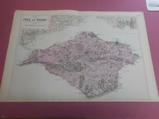
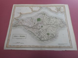
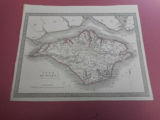
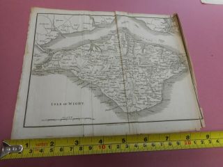
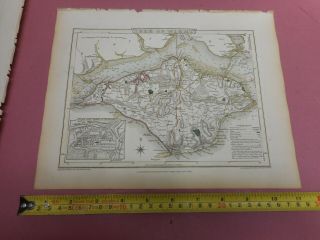
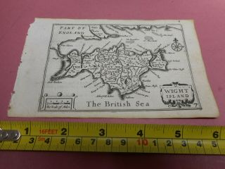
100 ISLE OF WIGHT MAP BY ARCHER C1848 COLOUR VGC


Item History & Price

Information:
Reference Number: Avaluer:30609271Date Range: 1780
Original Description:
100% ORIGINAL ISLE OF WIGHT MAPBY J ARCHER  C1848140MM X 210MM HAND  COLOUREDMAP IN  VERY GOOD CONDITION NO TEARS NO REPAIRS  PART OF A COLLECTION LISTED TO BE LISTED OVER THE NEXT FEW WEEKS !!LOW POSTAGE FOR UK BUYERS 2ND RECORDED DELIVERYCOMBINED  RATE EUROPE 10.00 RECORDED DELIVERYWORLDWIDE COMBINED RATE  £12.00 RECORDED DELIVERY  


    Similar items


  • 100 Isle Of Wight Map By G Bacon C1890 Vgc

    100 Isle Of Wight Map By G Bacon C1890 Vgc

  • 100 Isle Of Wight Map By S Hall C1853 Vgc

    100 Isle Of Wight Map By S Hall C1853 Vgc

  • 100 Isle Of Wight Map By G Phillip C1852 Vgc

    100 Isle Of Wight Map By G Phillip C1852 Vgc

  • 100 Isle Of Wight Map By Cary C1810

    100 Isle Of Wight Map By Cary C1810

  • 100 Isle Of Wight Map By Roper Cole C1809 Vgc Hand Coloured

    100 Isle Of Wight Map By Roper Cole C1809 Vgc Hand Coloured

  • 100 Isle Of Wight Map By Van Den Keere Mini John Speed C1646 Vgc

    100 Isle Of Wight Map By Van Den Keere Mini John Speed C1646 Vgc

  • 100 Hamps Sussex Isle Of Wight Map By John Cary C1794 Vgc H Coloured

    100 Hamps Sussex Isle Of Wight Map By John Cary C1794 Vgc H Coloured

  • 100 Hampshire Isle Of Wight Map By J Pigot C1838 Vgc Low Uk Post

    100 Hampshire Isle Of Wight Map By J Pigot C1838 Vgc Low Uk Post


    • You might also like


    • Hungary & Romania 1579 (1584) Ortelius Unusual Antique Copper Engraved Map

      Hungary & Romania 1579 (1584) Ortelius Unusual Antique Copper Engraved Map

    • Brussels Bruxelles Belfium 1777 De Ferraris & Dupuis Large Antique Map Sheet Xxi

      Brussels Bruxelles Belfium 1777 De Ferraris & Dupuis Large Antique Map Sheet Xxi

    • 1616 Atlas Map Of Iceland.

      1616 Atlas Map Of Iceland.

    • Kazan Russia 1767 Le Clerc/lespinasse Antique Copper Engraved City View

      Kazan Russia 1767 Le Clerc/lespinasse Antique Copper Engraved City View

    • 1899 Stanford,  Folding Map Of Norwich,  Norfolk,  Arthur Collins,  Jarrold & Sons,

      1899 Stanford, Folding Map Of Norwich, Norfolk, Arthur Collins, Jarrold & Sons,

    • 1948 Vintage Linen Colour Map Geological Survey Ten Mile Of Great Britain

      1948 Vintage Linen Colour Map Geological Survey Ten Mile Of Great Britain

    • 1944 Map Flying Bombs Sussex Ww2 Newspaper Military Kent Courier German V1 V2

      1944 Map Flying Bombs Sussex Ww2 Newspaper Military Kent Courier German V1 V2

    • Dated 1638 Vellum Map Of Icklesham Sussex Showing Land Uses Owners Etc

      Dated 1638 Vellum Map Of Icklesham Sussex Showing Land Uses Owners Etc

Avaluer          About Us          Privacy Policy          Contact Us          UP
© 2022, avaluer.net, Inc. or its affiliates