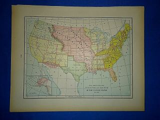
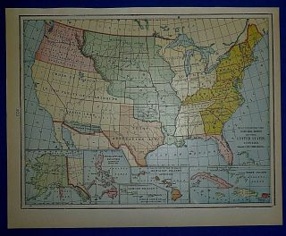
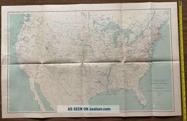
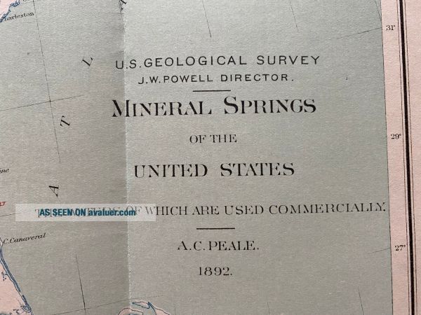
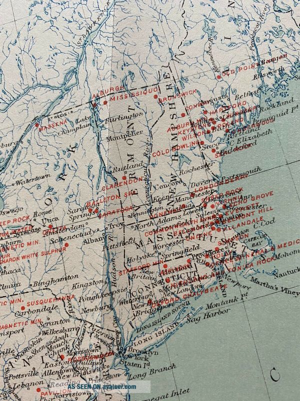
Antique Map - Mineral Springs Of The United States (1892)


Item History & Price

Information:
Reference Number: Avaluer:30646620Year: 1892
Country/Region: United States of AmericaDate Range: 1800-1899
Original Description:
This map, from 1892, shows the locations of Mineral Springs in the United States - “The Waters of Which Are Used Commercially”. The map is from the United States Geological Survey (USGS) and was created by A.C. Peale. This cool and unique map measures approximately 19.5”x30”. Shipped with USPS First Class.


    Similar items


  • Antique Mineral Resources Of The United States 1917 Part Ii.  Nonmetals Maps Coke

    Antique Mineral Resources Of The United States 1917 Part Ii. Nonmetals Maps Coke

  • Antique 1884 Descriptive Atlas Of The United States America Geography State Maps

    Antique 1884 Descriptive Atlas Of The United States America Geography State Maps

  • 1722 Moll Atlas Map 7 Provinces Of The United Netherlands - Holland - Belgium

    1722 Moll Atlas Map 7 Provinces Of The United Netherlands - Holland - Belgium

  • Milton Bradley 1940 Dissected Map On Wood Of The United States No.  4264

    Milton Bradley 1940 Dissected Map On Wood Of The United States No. 4264

  • Vintage 1899 Map Territorial Growth Of The United States Old & Authentic

    Vintage 1899 Map Territorial Growth Of The United States Old & Authentic

  • Vintage 1903 Atlas Map Territorial Growth Of The United States Old Authentic

    Vintage 1903 Atlas Map Territorial Growth Of The United States Old Authentic

  • Maps From History Of The United States 1911 Ridpath Pioneers & Great Voyages

    Maps From History Of The United States 1911 Ridpath Pioneers & Great Voyages

  • Rare Vintage 1883 Map Territorial Growth Of The United States Old Authentic

    Rare Vintage 1883 Map Territorial Growth Of The United States Old Authentic


    • You might also like


    • 1860 Mitchell Hand Colored Map Colorado,  Nebraska & Kansas - Civil War Era

      1860 Mitchell Hand Colored Map Colorado, Nebraska & Kansas - Civil War Era

    • 18th Century French Map Of North America

      18th Century French Map Of North America

    • Las Vegas Nevada Vintage 1967 Us Geological Survey Quadrangle Map 4 Panels

      Las Vegas Nevada Vintage 1967 Us Geological Survey Quadrangle Map 4 Panels

    • Rare Antique 1845 Maps United States Exploring Expedition Book Antartica Hawaii

      Rare Antique 1845 Maps United States Exploring Expedition Book Antartica Hawaii

    • Vintage 1926 Map Hollywood From The Best Surveys Of The Time

      Vintage 1926 Map Hollywood From The Best Surveys Of The Time

    • American Continent (western Hemisphere) 1747 Bowen Antique Copper Engraved Map

      American Continent (western Hemisphere) 1747 Bowen Antique Copper Engraved Map

    • Gulf Coast Florida Texas United States 1705 De Fer Unusual Antique Engraved Map

      Gulf Coast Florida Texas United States 1705 De Fer Unusual Antique Engraved Map

    • California As Island United States 1700 De Fer Unusual First Edition Antique Map

      California As Island United States 1700 De Fer Unusual First Edition Antique Map

Avaluer          About Us          Privacy Policy          Contact Us          UP
© 2022, avaluer.net, Inc. or its affiliates