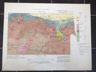
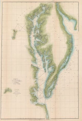
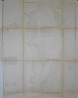
1857 LARGE MAP OF CHESAPEAKE BAY, SURVEY OF THE COAST OF UNITED STATES,


Item History & Price

Information:
Reference Number: Avaluer:30928937Year: 1857
Original Description:
1857 Map of Chesapeake Bay. Survey of the Coast if the United States.. Quite an interesting map including tides and sailing directions and apart from folds in great condition for its' age. A couple of holes in the folds - see pictures. Some discolouration.Please view pictures for a better idea of condition.Measures 100cms x 84cms.
More items up for auction and I do combine auctions to save you on postage.All packages are sent with tracking.
Any questions please email.
...>


    Similar items


  • Vintage Printed Large Map Of 1920 Geological Survey Of England & Wales Woolwich

    Vintage Printed Large Map Of 1920 Geological Survey Of England & Wales Woolwich

  • 1860 Large Map Of California Public Surveys 1860 Surveyor General 31.  5 " X 37 "

    1860 Large Map Of California Public Surveys 1860 Surveyor General 31. 5 " X 37 "

  • Map Of Chesapeake Bay Area - Rare - Printed 1747

    Map Of Chesapeake Bay Area - Rare - Printed 1747

  • 1852 U.  S.  Coast Survey Triangulation Chart Of Chesapeake Bay And Delaware Bay

    1852 U. S. Coast Survey Triangulation Chart Of Chesapeake Bay And Delaware Bay

  • 1855 Us Coast Survey Map Delaware & Chesapeake Bays Inlets Lighthouses

    1855 Us Coast Survey Map Delaware & Chesapeake Bays Inlets Lighthouses

  • Ordnance Survey Map Of Tralee Bay,  Co Kerry (ireland) - Sheet 161,  (1903)

    Ordnance Survey Map Of Tralee Bay, Co Kerry (ireland) - Sheet 161, (1903)

  • Springs Of Florida 1947 Book Plus Large Map Of Springs Florida Geological Survey

    Springs Of Florida 1947 Book Plus Large Map Of Springs Florida Geological Survey

  • Birds Of Chesapeake Bay 3d 16 Oz Heavy Large Coffee Mug Cup

    Birds Of Chesapeake Bay 3d 16 Oz Heavy Large Coffee Mug Cup


    • You might also like


    • 1860 Mitchell Hand Colored Map Colorado,  Nebraska & Kansas - Civil War Era

      1860 Mitchell Hand Colored Map Colorado, Nebraska & Kansas - Civil War Era

    • 18th Century French Map Of North America

      18th Century French Map Of North America

    • Las Vegas Nevada Vintage 1967 Us Geological Survey Quadrangle Map 4 Panels

      Las Vegas Nevada Vintage 1967 Us Geological Survey Quadrangle Map 4 Panels

    • Rare Antique 1845 Maps United States Exploring Expedition Book Antartica Hawaii

      Rare Antique 1845 Maps United States Exploring Expedition Book Antartica Hawaii

    • Vintage 1926 Map Hollywood From The Best Surveys Of The Time

      Vintage 1926 Map Hollywood From The Best Surveys Of The Time

    • American Continent (western Hemisphere) 1747 Bowen Antique Copper Engraved Map

      American Continent (western Hemisphere) 1747 Bowen Antique Copper Engraved Map

    • Gulf Coast Florida Texas United States 1705 De Fer Unusual Antique Engraved Map

      Gulf Coast Florida Texas United States 1705 De Fer Unusual Antique Engraved Map

    • California As Island United States 1700 De Fer Unusual First Edition Antique Map

      California As Island United States 1700 De Fer Unusual First Edition Antique Map

Avaluer          About Us          Privacy Policy          Contact Us          UP
© 2022, avaluer.net, Inc. or its affiliates