RARE Pictorial Map 1935 Theodore Roosevelt Spanish War Memorial Map Buffalo NY


Item History & Price

Information:
Reference Number: Avaluer:31288Cartographer/Publisher: Holling Press, Buffalo
Year: 1935Original/Reproduction: Antique Original
Date Range: 1930-1939Format: Sheet Map
Country/Region: Cuba, Philippines, Puerto Rico, ChinaType: Pictorial Historical
Topic: Spanish American War
Original Description:

(I cannot find any other copy or mention of this map on the internet, so I assume it is very rare.)
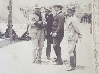
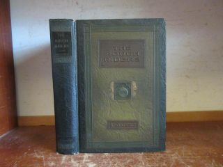
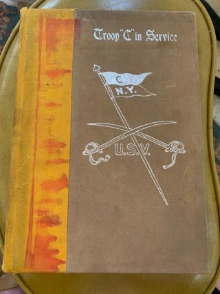
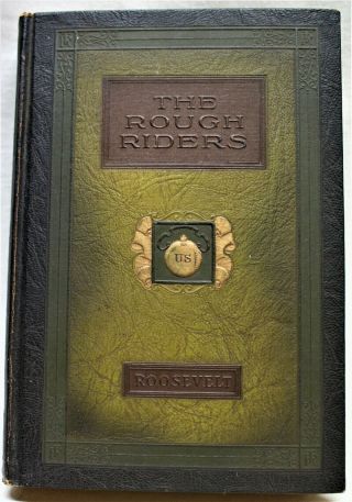
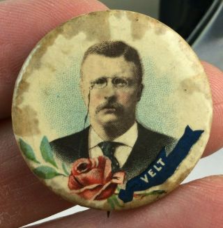
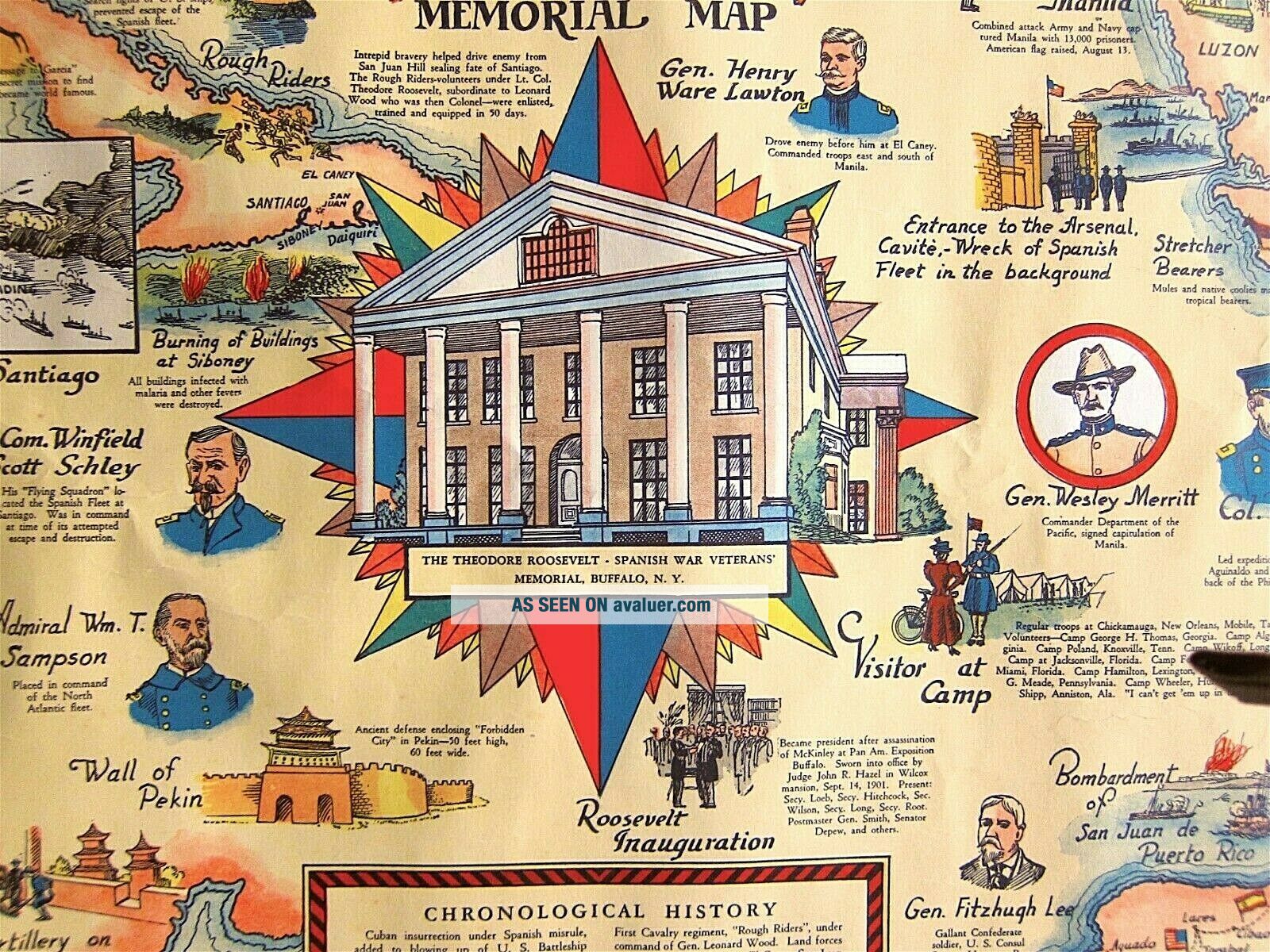
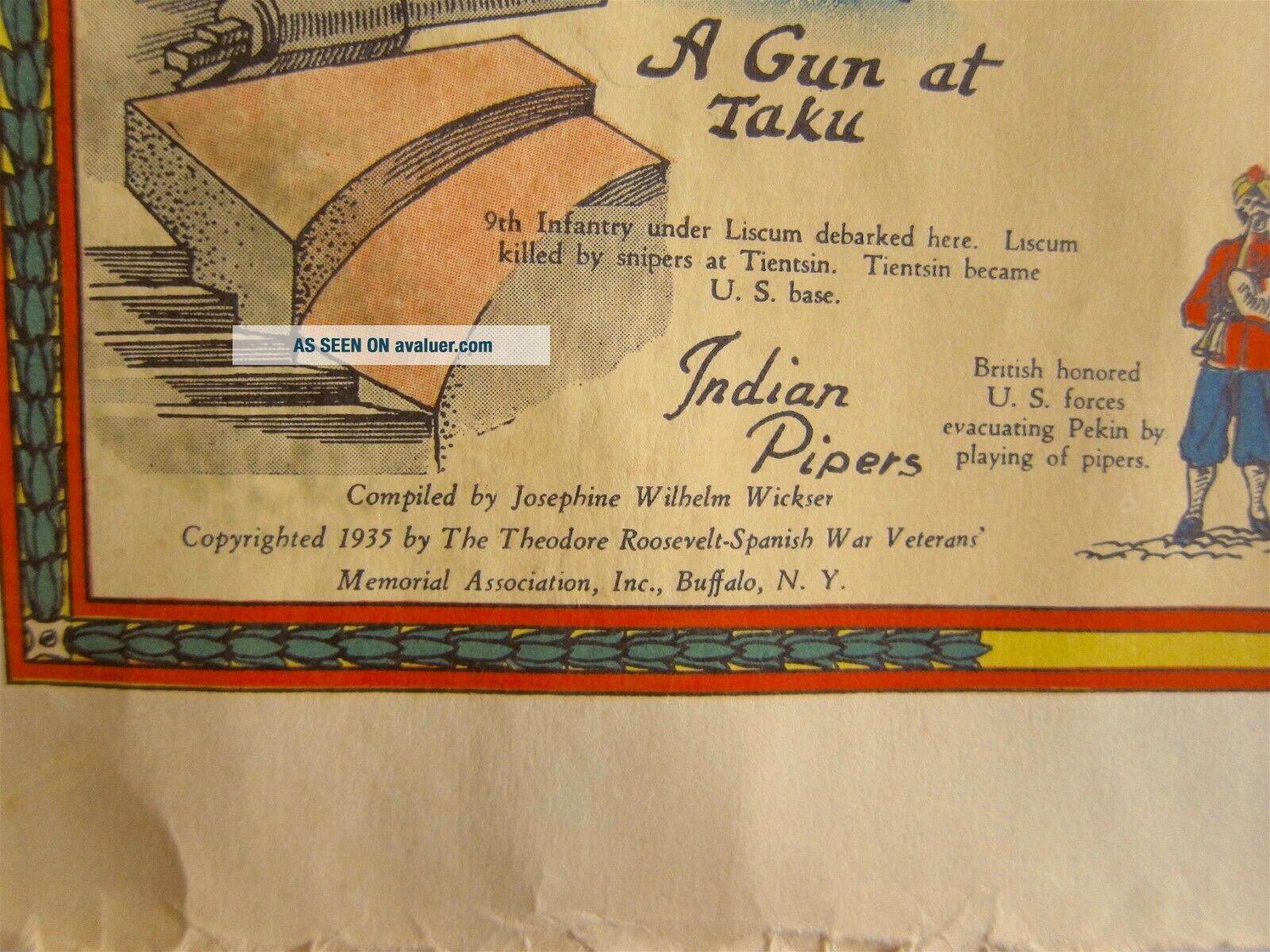
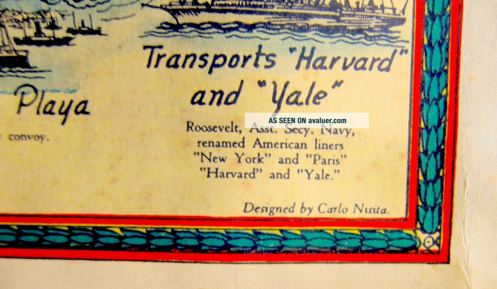
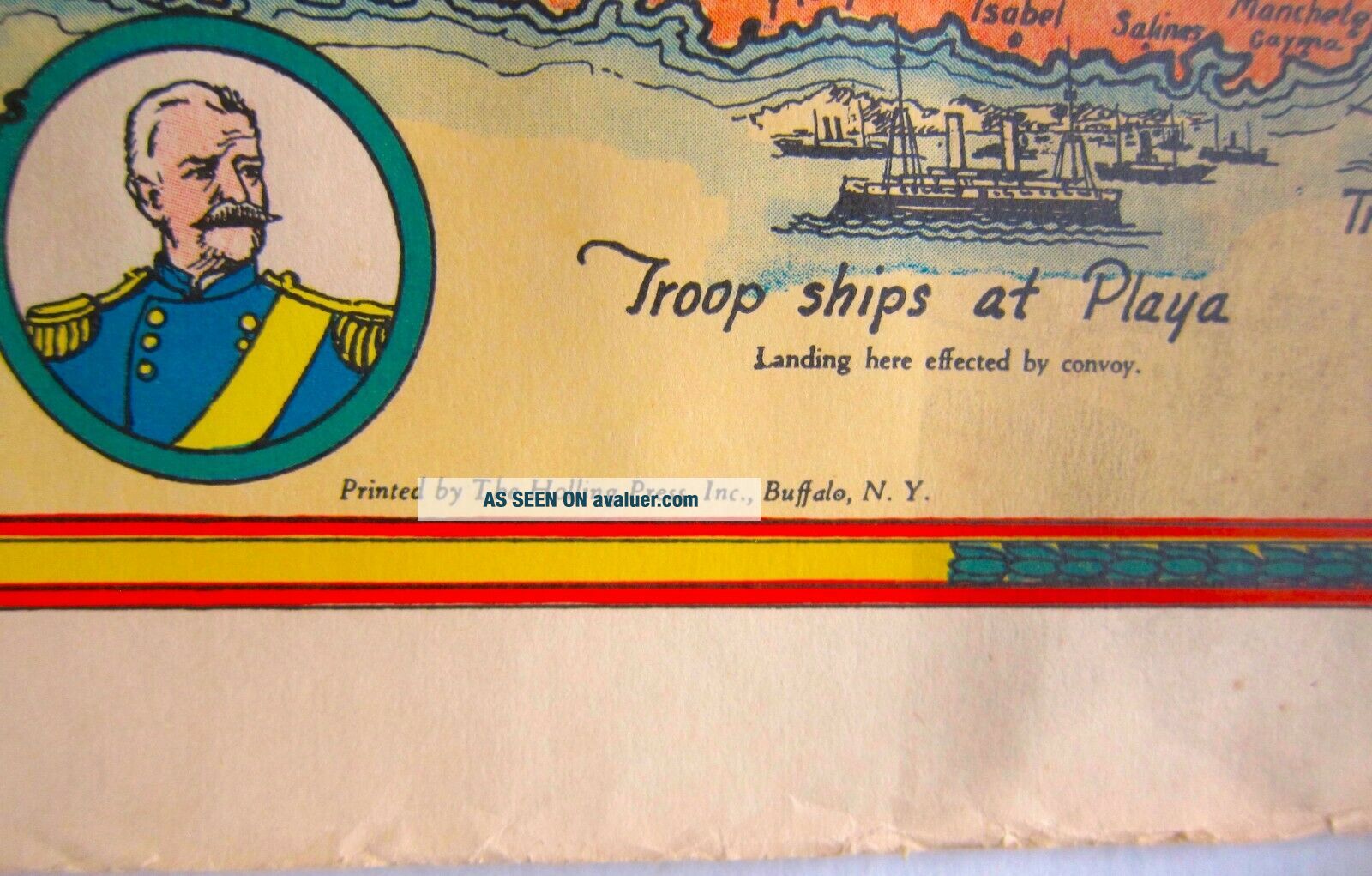
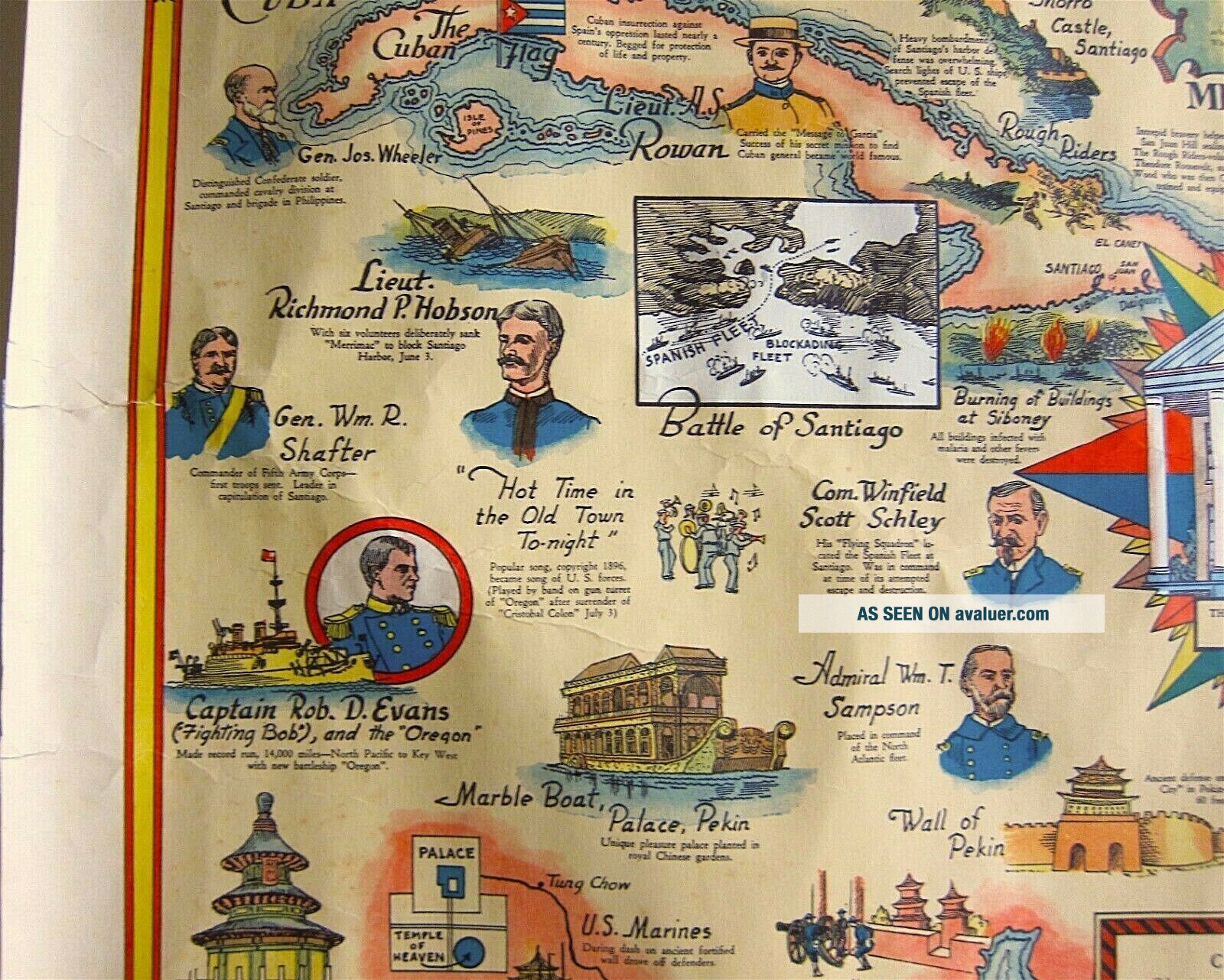
This very densely designed Theodore Roosevelt Spanish War Memorial Map was compiled in 1935 by Josephine Wilhelm Wickser, who was responsible for other interesting Western New York maps.The artist was a prolific and well-known Buffalo artist, Carlo Nisita; it was printed by The Holling Press, Inc., Buffalo NY.The 19” x 25” piece of paper crams in three maps—Cuba, Philippines..., and Puerto Rico—as well a part of China, plus vignettes from the Spanish-American War and a pretty comprehensive history of the life of Theodore Roosevelt.The house featured, the Wilcox mansion, is where Theodore Roosevelt was sworn in as President following the assassination of President William McKinley in 1901.After a very checkered history upon the death of the Wilcox family in 1935, the house is now designated as the Theodore Roosevelt Inaugural National Historic Site, administered by the National Park Service, and is on the Register of Historic Places.The map is in very good condition, with a couple of small repaired edge tears, a bit of minor wrinkling and foxing.
It will be shipped in a sturdy tube.
==================
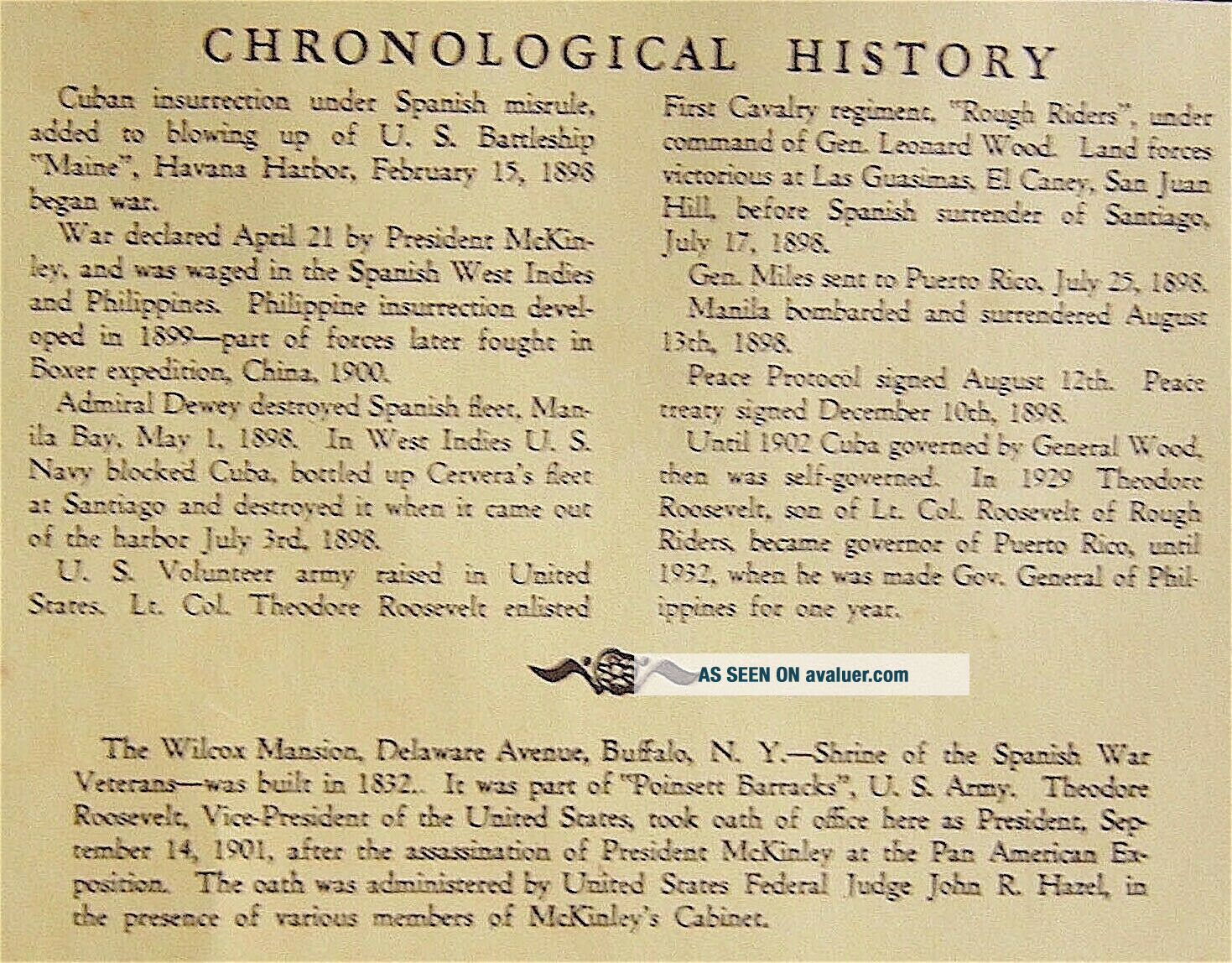
Interestingly, in 1935, the date of this map, when the house was auctioned off, "a campaign led by veterans of the Spanish American War sought to establish the house as the 'Theodore Roosevelt Institute for Better Citizenship.'  This effort failed and there was talk of tearing the house down."  It was never known as the Spanish War Veterans Memorial as far as I can determine, except at the time of this map's creation.  The house became  a restaurant in 1938 and was rescued from demolition by civic groups in 1961.


    Similar items


  • Rare Stereoview Col.  Theodore Roosevelt Spanish American War Rough Riders 1898

    Rare Stereoview Col. Theodore Roosevelt Spanish American War Rough Riders 1898

  • Lt Col.  Theodore Roosevelt Spanish American War Sterling Silver Spoon (lot15)

    Lt Col. Theodore Roosevelt Spanish American War Sterling Silver Spoon (lot15)

  • The Rough Riders By Theodore Roosevelt - Spanish - American War - Hc Book (1902)

    The Rough Riders By Theodore Roosevelt - Spanish - American War - Hc Book (1902)

  • Old Rough Riders Book Theodore Roosevelt Spanish - American War History Cuba,

    Old Rough Riders Book Theodore Roosevelt Spanish - American War History Cuba,

  • Old Rough Riders Book Theodore Roosevelt Spanish - American War Cavalry Roster,

    Old Rough Riders Book Theodore Roosevelt Spanish - American War Cavalry Roster,

  • Rare Htf Troop C Calvary York Signed Maps Illus Porto Rico Spanish War Color

    Rare Htf Troop C Calvary York Signed Maps Illus Porto Rico Spanish War Color

  • The Rough Riders Book By Theodore Roosevelt Spanish American War (1899) 1924

    The Rough Riders Book By Theodore Roosevelt Spanish American War (1899) 1924

  • Rare 1904 " Rose Velt " Theodore Roosevelt 1 1/4 " Pinback Celluloid Button Pin

    Rare 1904 " Rose Velt " Theodore Roosevelt 1 1/4 " Pinback Celluloid Button Pin


    • You might also like


    • 1860 Mitchell Hand Colored Map Colorado,  Nebraska & Kansas - Civil War Era

      1860 Mitchell Hand Colored Map Colorado, Nebraska & Kansas - Civil War Era

    • 18th Century French Map Of North America

      18th Century French Map Of North America

    • Las Vegas Nevada Vintage 1967 Us Geological Survey Quadrangle Map 4 Panels

      Las Vegas Nevada Vintage 1967 Us Geological Survey Quadrangle Map 4 Panels

    • Rare Antique 1845 Maps United States Exploring Expedition Book Antartica Hawaii

      Rare Antique 1845 Maps United States Exploring Expedition Book Antartica Hawaii

    • Vintage 1926 Map Hollywood From The Best Surveys Of The Time

      Vintage 1926 Map Hollywood From The Best Surveys Of The Time

    • American Continent (western Hemisphere) 1747 Bowen Antique Copper Engraved Map

      American Continent (western Hemisphere) 1747 Bowen Antique Copper Engraved Map

    • Gulf Coast Florida Texas United States 1705 De Fer Unusual Antique Engraved Map

      Gulf Coast Florida Texas United States 1705 De Fer Unusual Antique Engraved Map

    • California As Island United States 1700 De Fer Unusual First Edition Antique Map

      California As Island United States 1700 De Fer Unusual First Edition Antique Map

Avaluer          About Us          Privacy Policy          Contact Us          UP
© 2022, avaluer.net, Inc. or its affiliates