C1701 Hand Coloured Map Of British Islands By Robert Morden


Item History & Price
| Reference Number: Avaluer:31674 | Map Type: Regional/ Local |
| Antique/ Modern: Antique |
~ c1701 Hand Coloured Map Of British Islands By Robert Morden ~
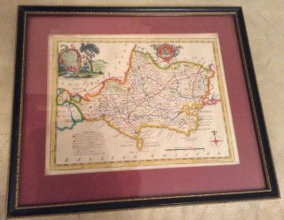
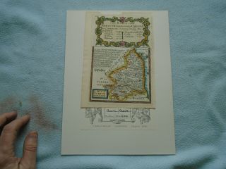
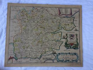
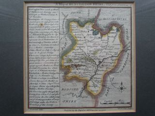
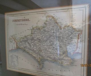
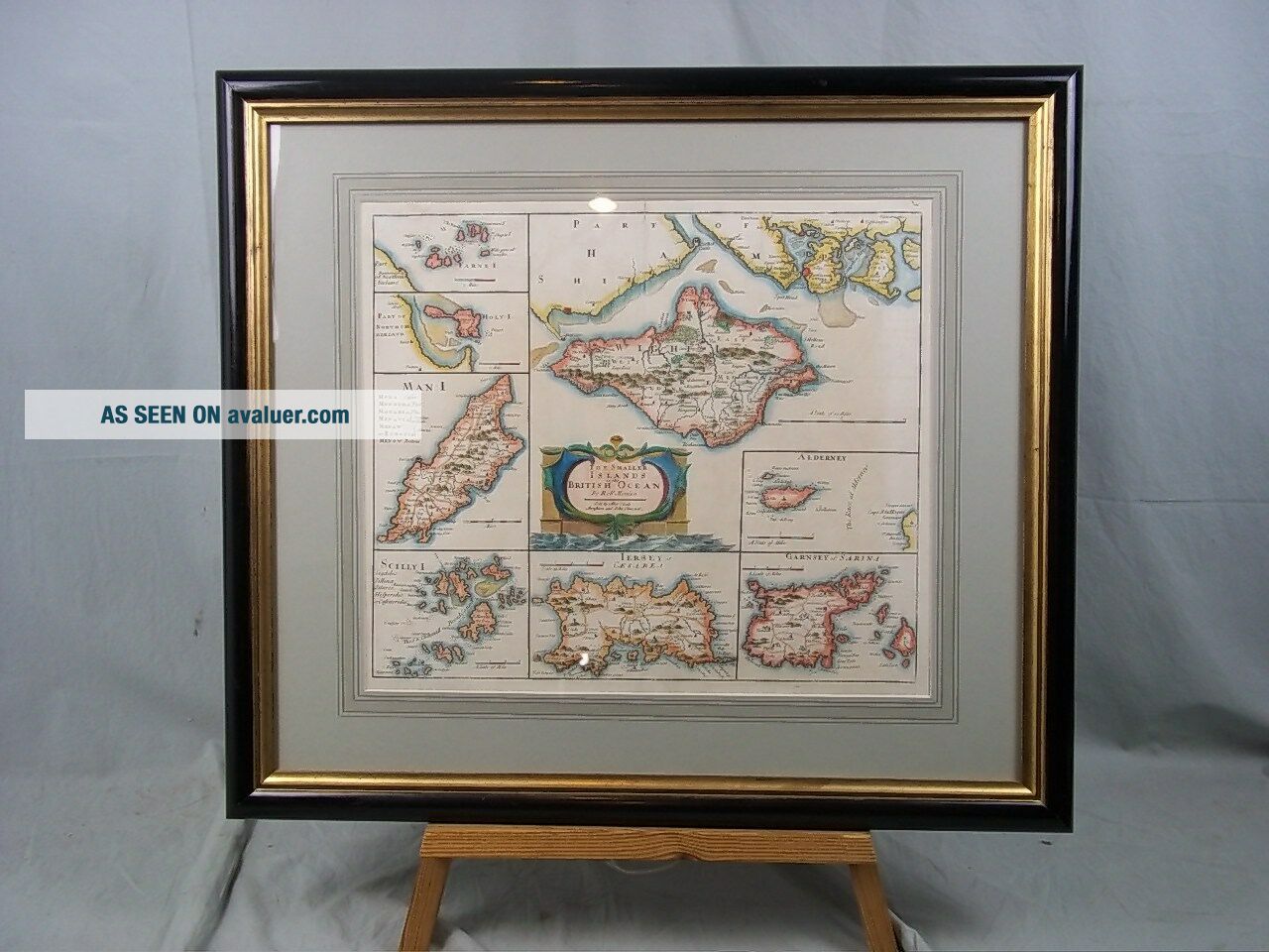
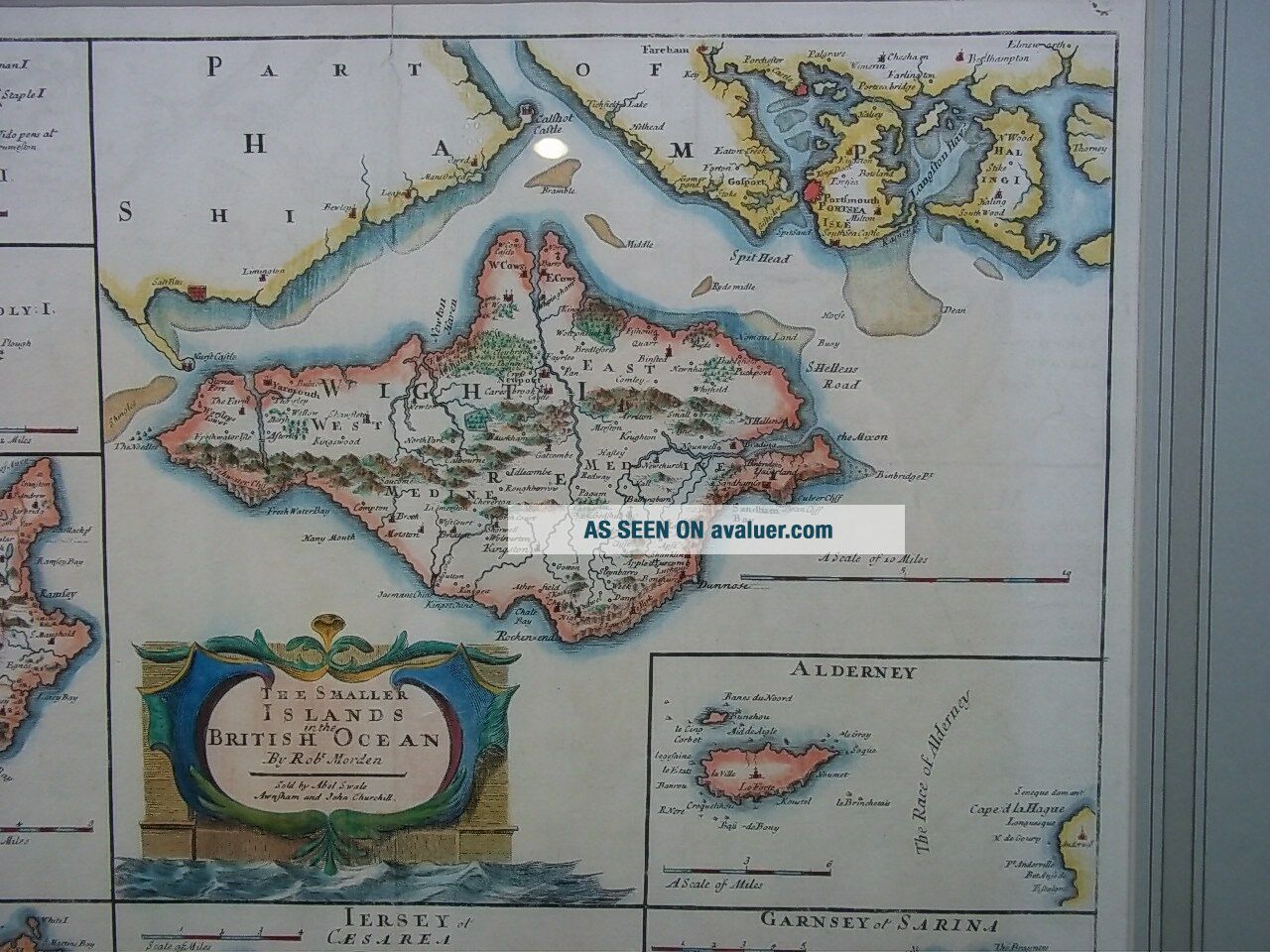
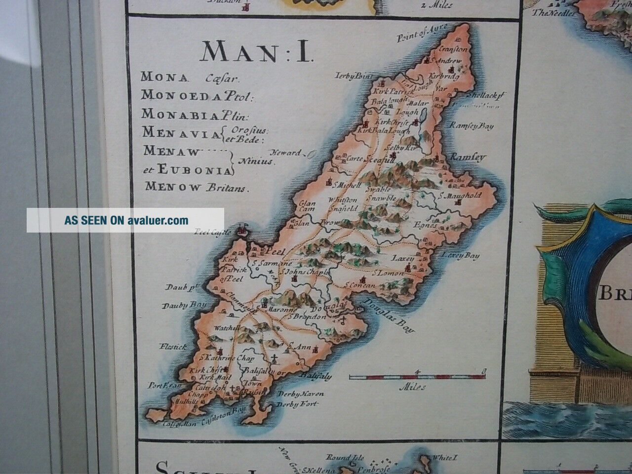
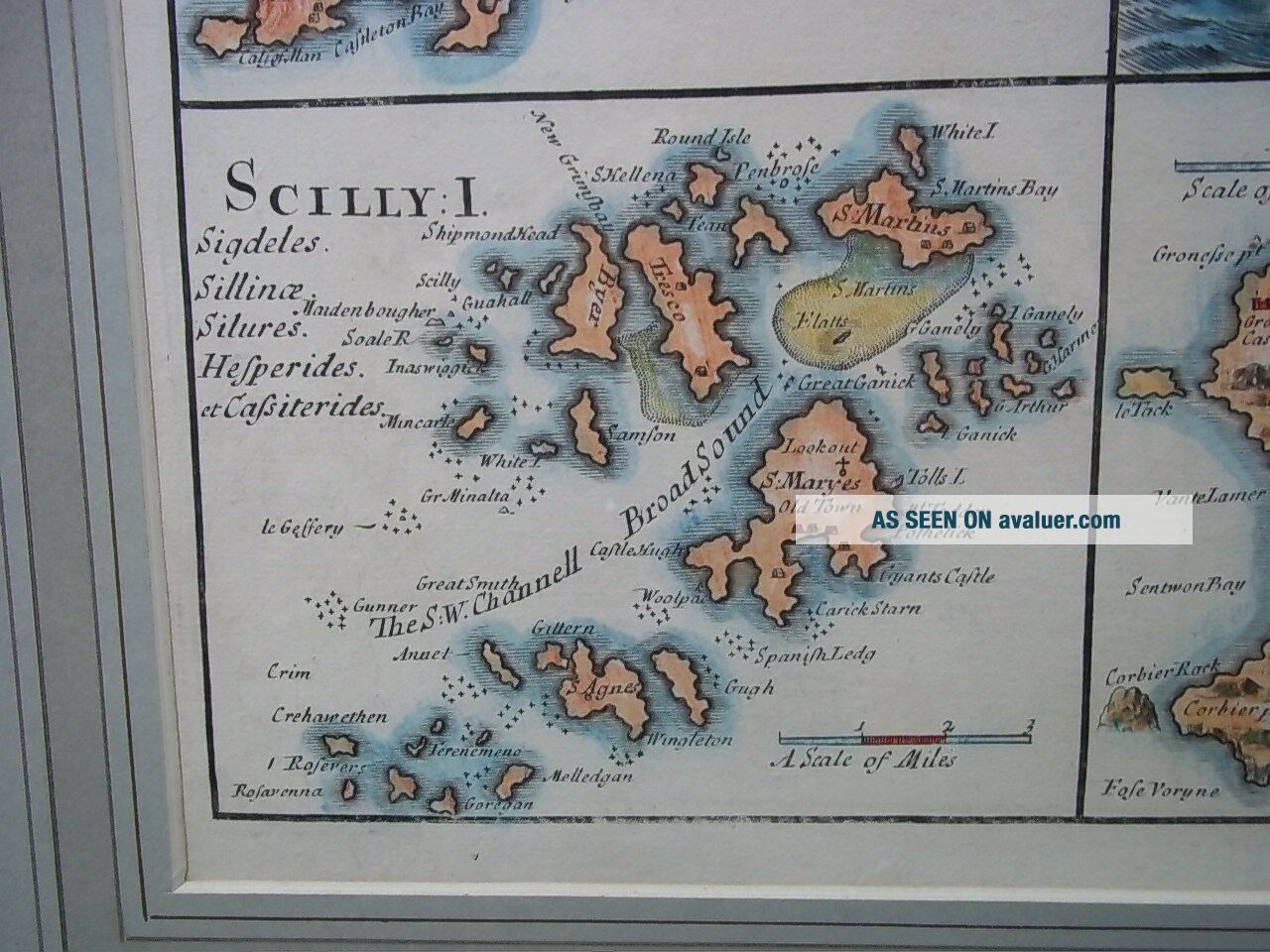
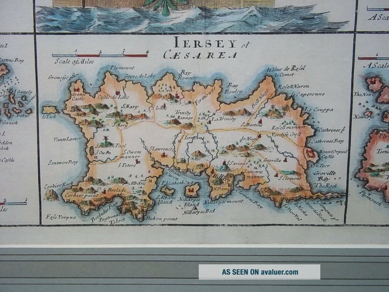
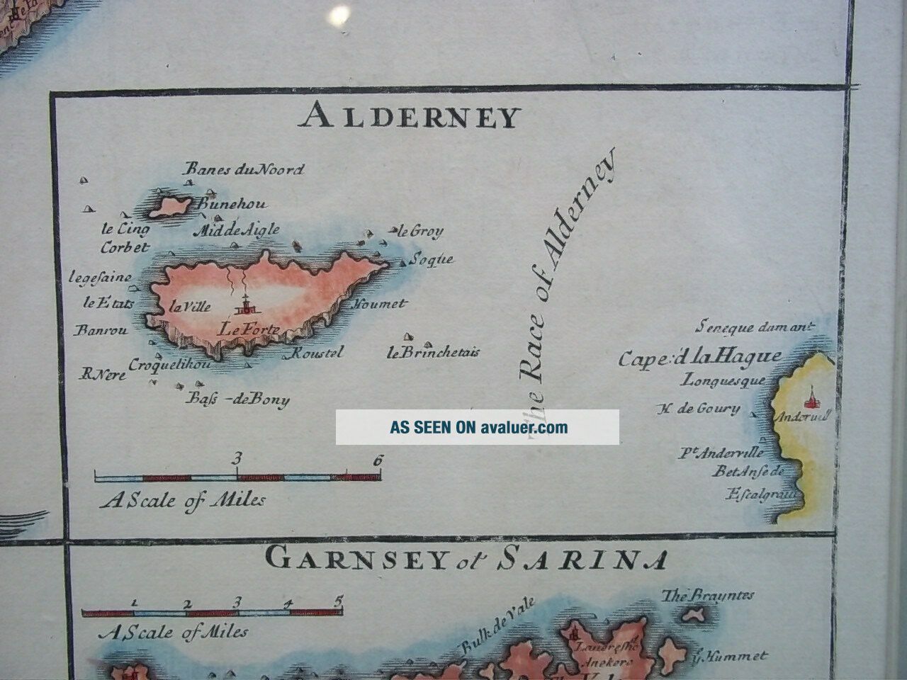
An early hand coloured map of the smaller isles near Britain, c1701, by the famous cartographer Robert Morden (c1650-1703). Featured on the map are the Isle Of Wight, Farne Island (Lindisfarne), Holy Isle, Isle Of Man, Scilly Isles, Jersey, Aldernay and Guernsey. The map has been freshly reframed and mounted.
~ Robert Morden ~
Robert Morden (c.1650-1703) was a British booksel...ler, publisher, and maker of maps and globes. He was among the first successful commercial map makers. Between about 1675 and his death in 1703, he was based under the sign of the Atlas at premises in Cornhill and New Cheapside, London. His catographical output was large and varied. His best known maps are those of English counties first published in a new edition of Camden's "Britannia" in 1695, and subsequently reissued in 1722, 1753 and 1772. These maps were based on new information from gentlemen of each county, and were newly engraved. Each had a decorated cartouche, and showed numerous place names. Morden also produced in 1701 a series of smaller county maps often known as Miniature Mordens.
In 1695 he published a map of Scotland. It is in parts (e.g. Skye and the Western Isles) essentially a copy of the 1654 map done by Robert Gordon of Straloch, published by Blaeu; other parts show evidence of more accurate cartography. He is also known for several very rare early maps of theBritish colonies of North America which are now among the earliest and most sought after maps for collectors of old American maps. He also produced a series of miniature maps of the world, which appeared in both playing card format and in a series of atlases, including his Atlas Terrestris and Geography Anatomiz'd, beginning in 1687.
~ Dimensions ~
The frame has a length of 26 inches (66cm), a height of 23 inches (58.5cm) and a depth of 1 inch (2.5cm).
The map has a length of 17.5 inches (44cm) and a height of 15 inches (38cm).
~ Condition ~
Very crisp condition for its age, clean paper with no foxing. Minor paper repair to top left hand corner and top centre. Small blemish to top right corner.
For further details and conditions see images.