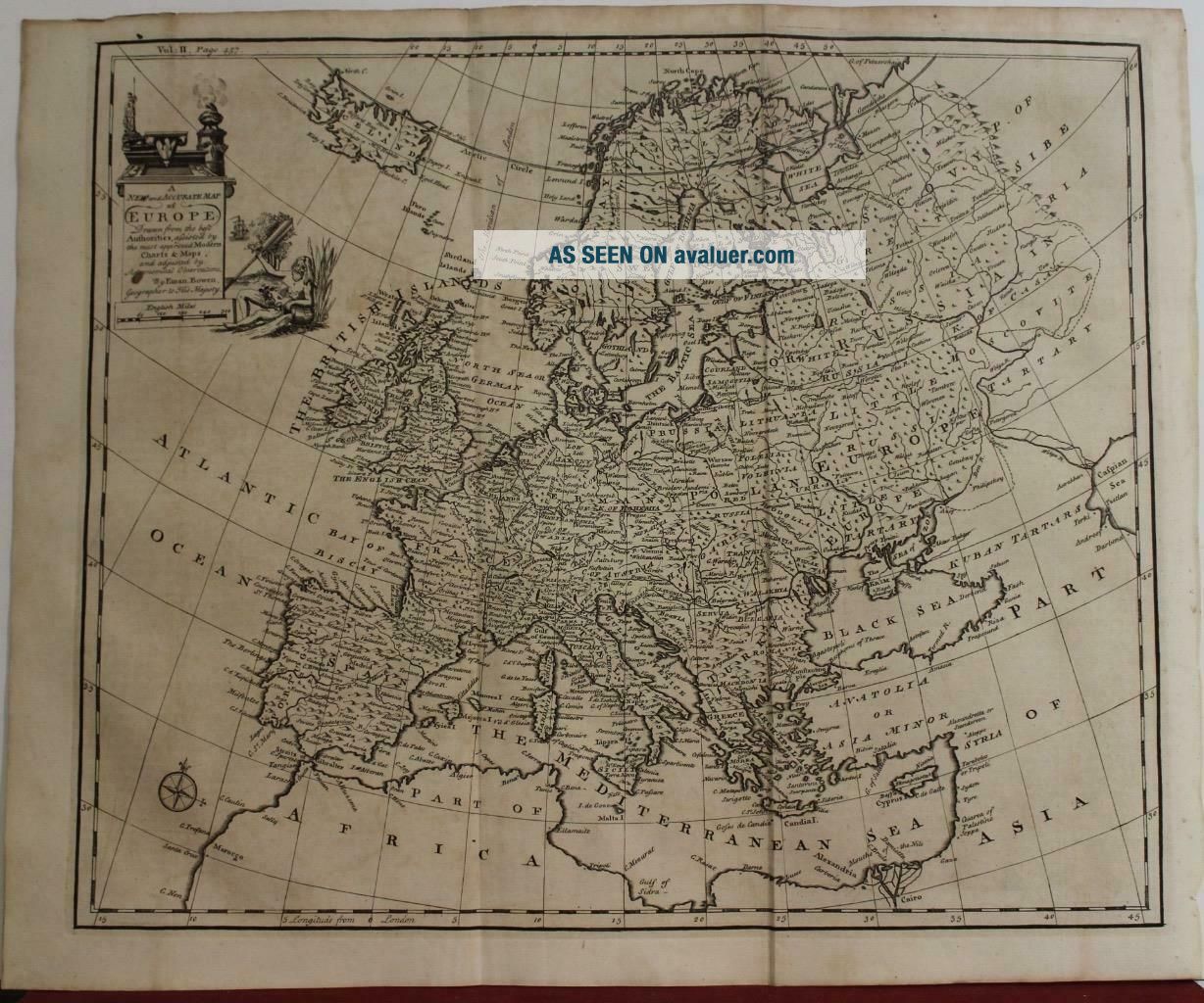
EUROPEAN CONTINENT 1744 EMANUEL BOWEN ANTIQUE COPPER ENGRAVED MAP
Item History & Price
EUROPEAN CONTINENT 1744 EMANUEL BOWEN ANTIQUE ORIGINAL COPPER ENGRAVED MAP

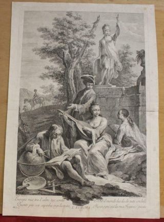
European Continent 1760 Joseph Wagner Antique Copper Engraved Allegorical Plate

American Continent (western Hemisphere) 1747 Bowen Antique Copper Engraved Map
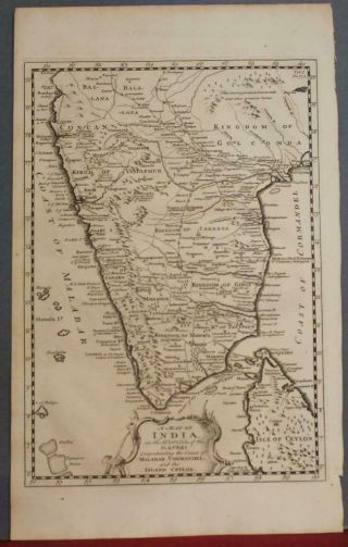
Southern India & North Sri Lanka 1744 Bowen Antique Copper Engraved Map
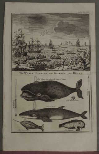
Whales & Bears Hunting Greenland Arctic Lands 1744 Emanuel Bowen Antique Plate
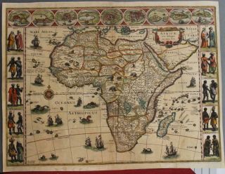
African Continent 1630ca Blaeu Scarce Antique Copper Engraved Map French Edition
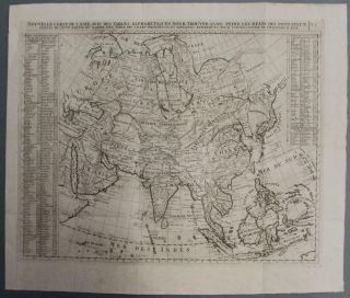
Asian Continent 1719 Chatelain Large Antique Copper Engraved Map
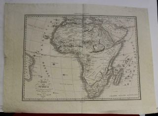
African Continent 1832 Antonelli Unusual Antique Copper Engraved Map
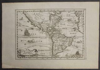
American Continent 1734 Cloppenburgh Unusual Antique Copper Engraved Map

Hungary & Romania 1579 (1584) Ortelius Unusual Antique Copper Engraved Map

Brussels Bruxelles Belfium 1777 De Ferraris & Dupuis Large Antique Map Sheet Xxi

1616 Atlas Map Of Iceland.

Kazan Russia 1767 Le Clerc/lespinasse Antique Copper Engraved City View

1899 Stanford, Folding Map Of Norwich, Norfolk, Arthur Collins, Jarrold & Sons,

1948 Vintage Linen Colour Map Geological Survey Ten Mile Of Great Britain

1944 Map Flying Bombs Sussex Ww2 Newspaper Military Kent Courier German V1 V2

Dated 1638 Vellum Map Of Icklesham Sussex Showing Land Uses Owners Etc