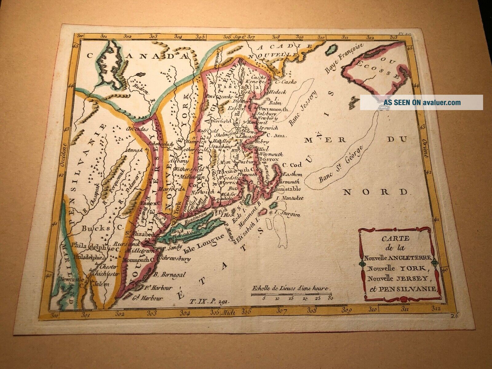
C1755 French Indian War Map America York Jersey England


Item History & Price

Information:
Reference Number: Avaluer:32245
Original Description:
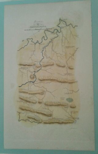
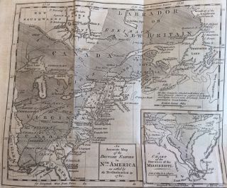
Original Circa 1755French & Indian War Era Map of the American NortheastNew YorkNew JerseyPennsylvaniaNew England
A gorgeous early hand colored French map of America's northeastern area most likely created during and for the French & Indian War.  Map measures 9 1/2" x 7 1/2".  Excellent condition. Map is mounted inside a mat with mounting tape acting as a hinge at the very top of map only.


    Similar items


  • G W Boynton Pa Hand Colored French & Indian War Map - Linonian Library (?)

    G W Boynton Pa Hand Colored French & Indian War Map - Linonian Library (?)

  • Antique York Powder Horn Carved Ny Map French Indian War American Colonial

    Antique York Powder Horn Carved Ny Map French Indian War American Colonial

  • 1756 French Indian War Powderhorn York Map Engraved Fort William Henry Vafo

    1756 French Indian War Powderhorn York Map Engraved Fort William Henry Vafo

  • 1762 John Gibson Map Louisiana Florida West Indies French & Indian War Texas

    1762 John Gibson Map Louisiana Florida West Indies French & Indian War Texas

  • 1762 Lrge Fold Out Early Printing Map American Colonies @ End French Indian War

    1762 Lrge Fold Out Early Printing Map American Colonies @ End French Indian War

  • 1762 Newspaper John Gibson Map O Jamaica Havana Cuba French Indian War Caribbean

    1762 Newspaper John Gibson Map O Jamaica Havana Cuba French Indian War Caribbean

  • Antique York Powder Horn Carved Ny Map French Indian War 1761 J.  Stiles

    Antique York Powder Horn Carved Ny Map French Indian War 1761 J. Stiles

  • West Point Map - French & Indian War Battle Of Quebec St.  Lawrence River Canada

    West Point Map - French & Indian War Battle Of Quebec St. Lawrence River Canada


    • You might also like


    • 1860 Mitchell Hand Colored Map Colorado,  Nebraska & Kansas - Civil War Era

      1860 Mitchell Hand Colored Map Colorado, Nebraska & Kansas - Civil War Era

    • 18th Century French Map Of North America

      18th Century French Map Of North America

    • Las Vegas Nevada Vintage 1967 Us Geological Survey Quadrangle Map 4 Panels

      Las Vegas Nevada Vintage 1967 Us Geological Survey Quadrangle Map 4 Panels

    • Rare Antique 1845 Maps United States Exploring Expedition Book Antartica Hawaii

      Rare Antique 1845 Maps United States Exploring Expedition Book Antartica Hawaii

    • Vintage 1926 Map Hollywood From The Best Surveys Of The Time

      Vintage 1926 Map Hollywood From The Best Surveys Of The Time

    • American Continent (western Hemisphere) 1747 Bowen Antique Copper Engraved Map

      American Continent (western Hemisphere) 1747 Bowen Antique Copper Engraved Map

    • Gulf Coast Florida Texas United States 1705 De Fer Unusual Antique Engraved Map

      Gulf Coast Florida Texas United States 1705 De Fer Unusual Antique Engraved Map

    • California As Island United States 1700 De Fer Unusual First Edition Antique Map

      California As Island United States 1700 De Fer Unusual First Edition Antique Map

Avaluer          About Us          Privacy Policy          Contact Us          UP
© 2022, avaluer.net, Inc. or its affiliates