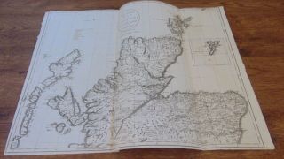
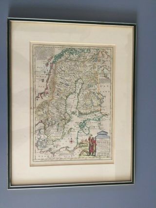
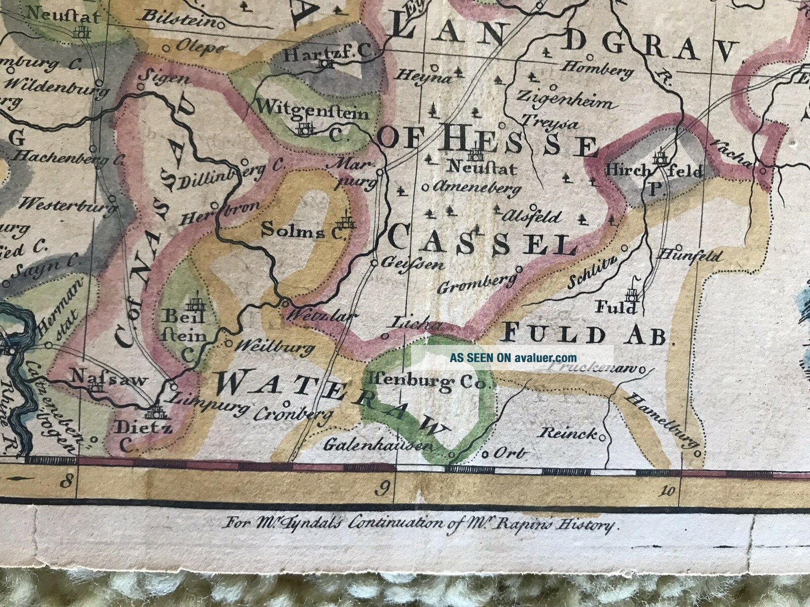
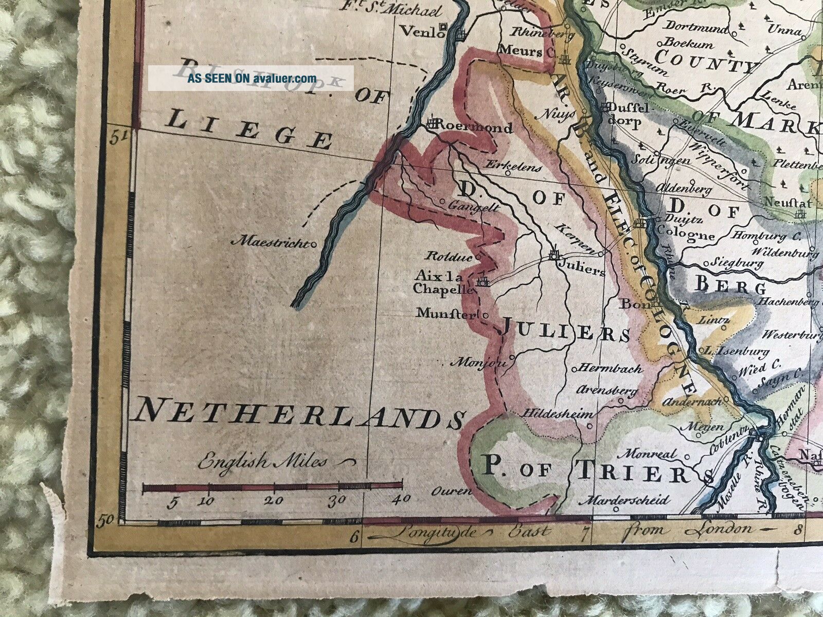
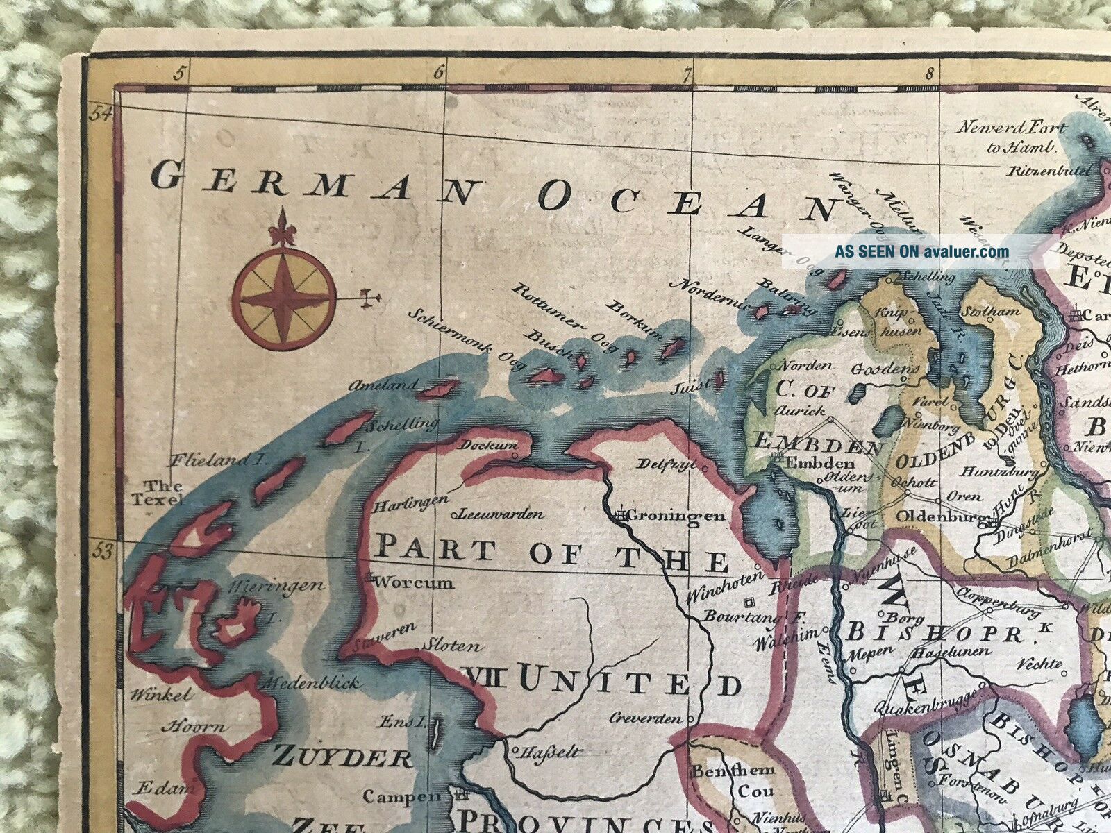
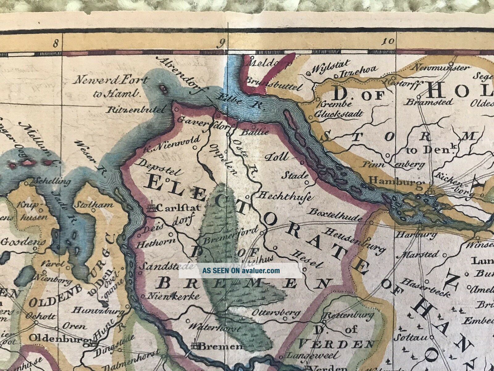
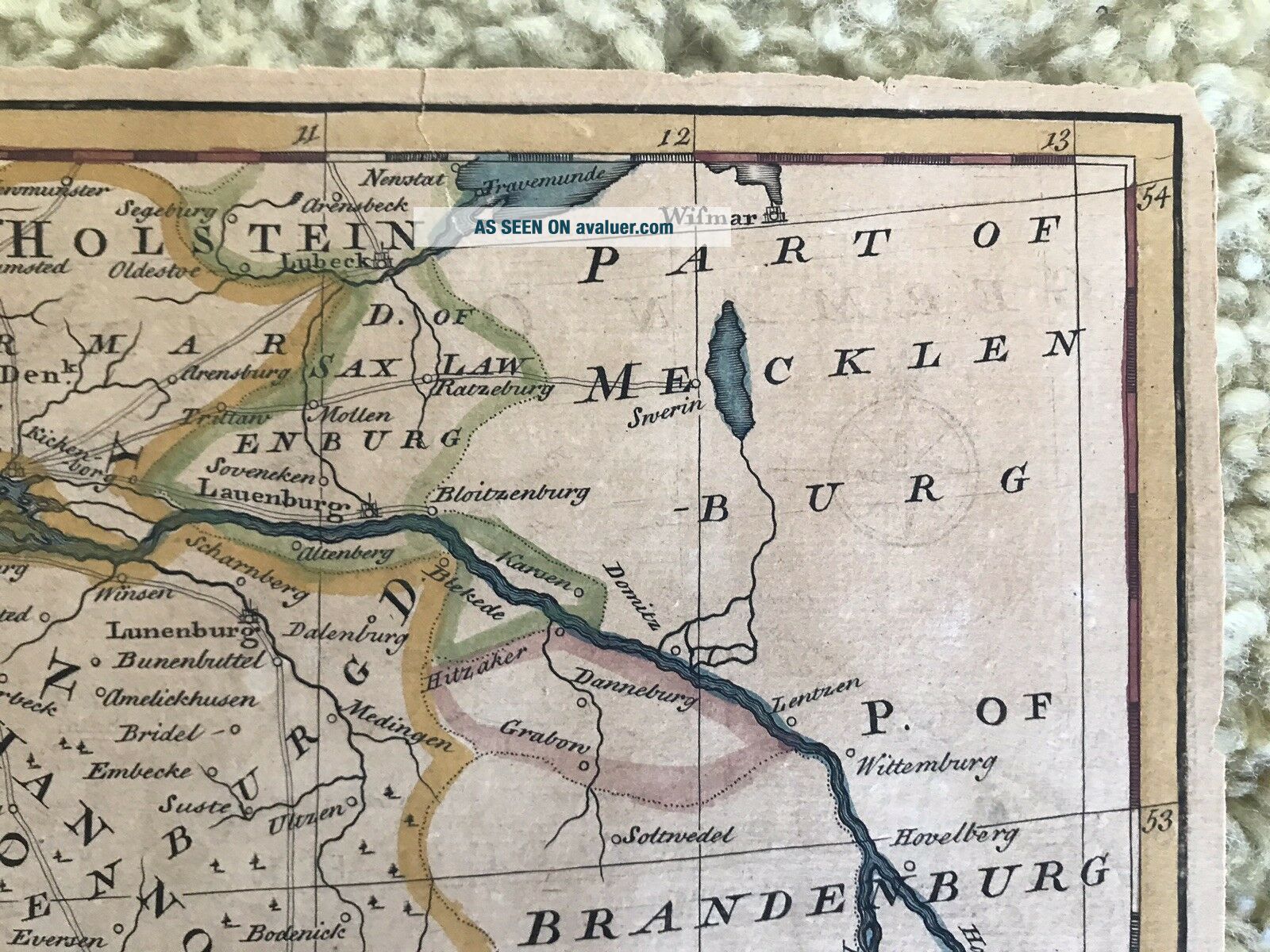
EMAN BOWEN ANTIQUE 1700s A Correct Map North West GERMANY 17” X 14”


Item History & Price

Information:
Reference Number: Avaluer:32615Year: 1770
Original/Reproduction: Antique OriginalFormat: Atlas Map
Date Range: 1700-1799Cartographer/Publisher: Thomas Bowen
Country/Region: GermanyType: County Map


    Similar items


  • 1805 A Correct Map Of The North Part Of Scotland Engraved By J.  Cary

    1805 A Correct Map Of The North Part Of Scotland Engraved By J. Cary

  • Vintage 1847 - A Correct Map Of The Seat Of War In Mexico

    Vintage 1847 - A Correct Map Of The Seat Of War In Mexico

  • 1795 A Correct Map Of Ireland From The Best Authorities

    1795 A Correct Map Of Ireland From The Best Authorities

  • 1748 A Correct Map Of Bedfordshire Pub By Osbourne Bedford Biggleswade Dunstable

    1748 A Correct Map Of Bedfordshire Pub By Osbourne Bedford Biggleswade Dunstable

  • Antique Framed 1747 Map Of Sweden By Cartographer Eman Bowen

    Antique Framed 1747 Map Of Sweden By Cartographer Eman Bowen

  • 1805 A & Correct Map Of The South Part Of Scotland J.  Cary

    1805 A & Correct Map Of The South Part Of Scotland J. Cary

  • 1213 Long Island Sound (western Part) Antique Nautical Chart

    1213 Long Island Sound (western Part) Antique Nautical Chart

  • Topographic Map White Mountains Central Hampshire Antique Cloth 1902

    Topographic Map White Mountains Central Hampshire Antique Cloth 1902


    • You might also like


    • Hungary & Romania 1579 (1584) Ortelius Unusual Antique Copper Engraved Map

      Hungary & Romania 1579 (1584) Ortelius Unusual Antique Copper Engraved Map

    • Brussels Bruxelles Belfium 1777 De Ferraris & Dupuis Large Antique Map Sheet Xxi

      Brussels Bruxelles Belfium 1777 De Ferraris & Dupuis Large Antique Map Sheet Xxi

    • 1616 Atlas Map Of Iceland.

      1616 Atlas Map Of Iceland.

    • Kazan Russia 1767 Le Clerc/lespinasse Antique Copper Engraved City View

      Kazan Russia 1767 Le Clerc/lespinasse Antique Copper Engraved City View

    • 1899 Stanford,  Folding Map Of Norwich,  Norfolk,  Arthur Collins,  Jarrold & Sons,

      1899 Stanford, Folding Map Of Norwich, Norfolk, Arthur Collins, Jarrold & Sons,

    • 1948 Vintage Linen Colour Map Geological Survey Ten Mile Of Great Britain

      1948 Vintage Linen Colour Map Geological Survey Ten Mile Of Great Britain

    • 1944 Map Flying Bombs Sussex Ww2 Newspaper Military Kent Courier German V1 V2

      1944 Map Flying Bombs Sussex Ww2 Newspaper Military Kent Courier German V1 V2

    • Dated 1638 Vellum Map Of Icklesham Sussex Showing Land Uses Owners Etc

      Dated 1638 Vellum Map Of Icklesham Sussex Showing Land Uses Owners Etc

Avaluer          About Us          Privacy Policy          Contact Us          UP
© 2022, avaluer.net, Inc. or its affiliates