1864 Forbes ' And Complete Map Of Richmond And Its Fortifications - Civil War


Item History & Price

Information:
Reference Number: Avaluer:32897Cartographer/Publisher: W.H. Forbes & B.B. Russell
US State: VirginiaFormat: Wall Map
City: RichmondType: Military & War, Civil War, Fortifications
Country/Region: United States of AmericaYear: 1864
Original Description:
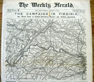
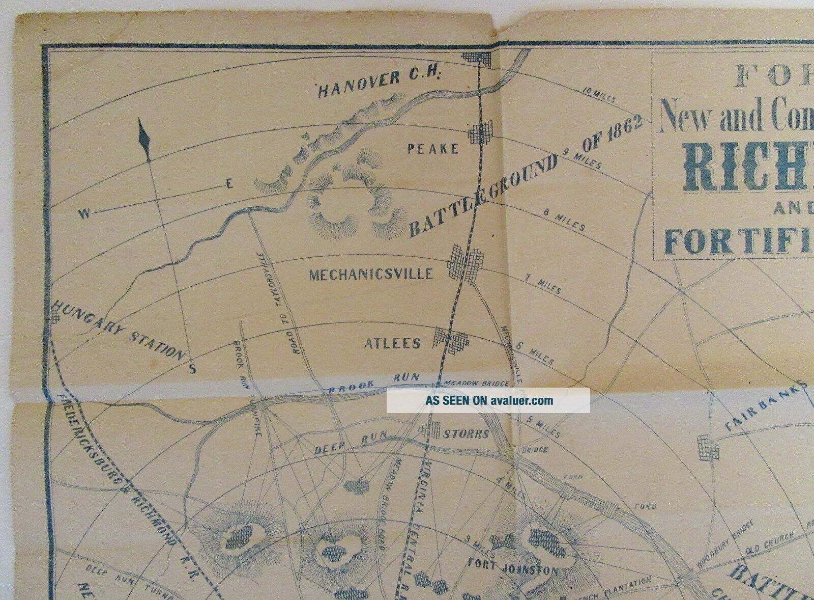
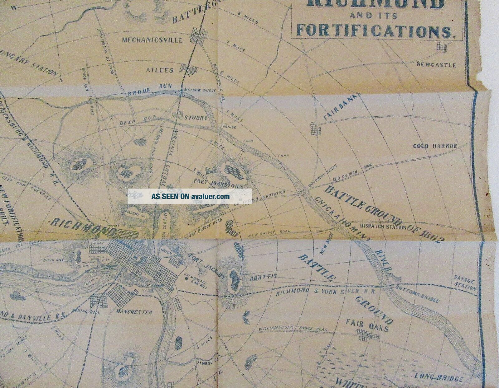
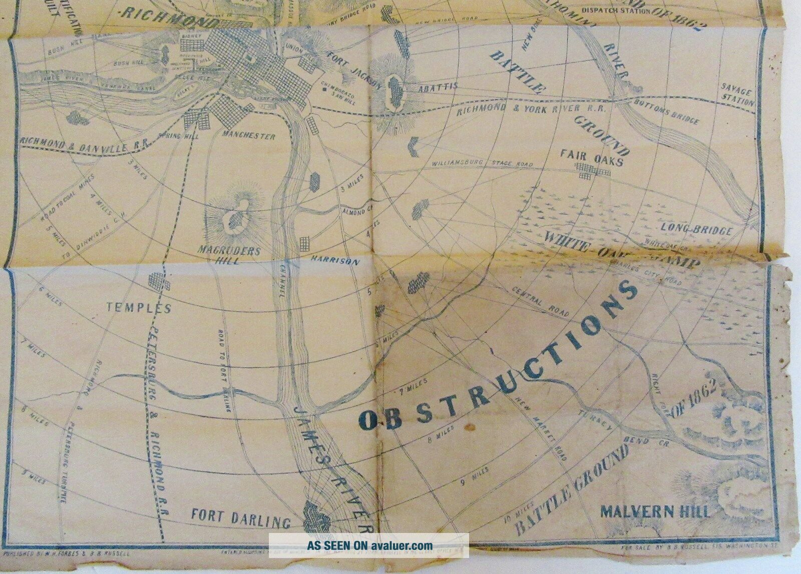
FORBES'New and Complete Map ofRICHMONDand itsFORTIFICATIONS-----Published by:
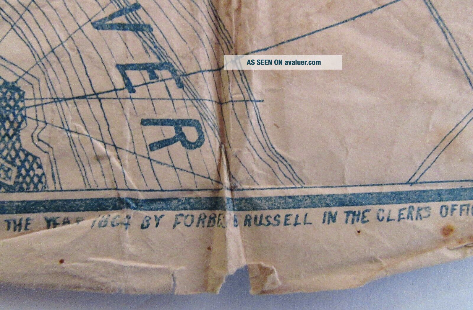
W.H. FORBES & B.B. RUSSELLEntered According to Act of Congress
In the Year of 1864 by Forbes & Russell
In the Clerk's Office of the District
Court of Mass.For Sale by B.B. Russell, 515 Washington St.----------This map measures approximately 24.5" x 18.5"
and is printed in blue ink.The map shows forts, battlegrounds,
street pattern of Richmond,
railroads and roads.This appears to... be an original, civil war era
map from 1864.  No other publication
date is listed.----------Shipping within the U.S. by first class mail is $3.International shipping by first class international mail
is available and varies by location.


    Similar items


  • Serenity Complete And Official Map Of The Verse Qmx Press

    Serenity Complete And Official Map Of The Verse Qmx Press

  • Hitchcock

    Hitchcock ' S And Complete Analysis Of Holy Bible 1873 Maps Illustrated

  • 1864 Civil War Newspaper W Huge Map Of Richmond & Shenendoah Campaigns Virginia

    1864 Civil War Newspaper W Huge Map Of Richmond & Shenendoah Campaigns Virginia

  • 1945 Southern Map Company Complete Map Of Atlanta And Adjacent Territory

    1945 Southern Map Company Complete Map Of Atlanta And Adjacent Territory

  • Spencer

    Spencer ' S Antique Folding Map Of Richmond, Swaledale And Wensleydale. Yorkshire

  • Ptc Street And Transit Guide With Complete Map Of Philadelphia - 1956

    Ptc Street And Transit Guide With Complete Map Of Philadelphia - 1956

  • 1796 A And Complete System Of Universal Geography.  Rare Vol 1 W/maps.  Fair

    1796 A And Complete System Of Universal Geography. Rare Vol 1 W/maps. Fair

  • Vintage Complete Street Guide And Folding Map Of Johnson County Kansas

    Vintage Complete Street Guide And Folding Map Of Johnson County Kansas


    • You might also like


    • 1860 Mitchell Hand Colored Map Colorado,  Nebraska & Kansas - Civil War Era

      1860 Mitchell Hand Colored Map Colorado, Nebraska & Kansas - Civil War Era

    • 18th Century French Map Of North America

      18th Century French Map Of North America

    • Las Vegas Nevada Vintage 1967 Us Geological Survey Quadrangle Map 4 Panels

      Las Vegas Nevada Vintage 1967 Us Geological Survey Quadrangle Map 4 Panels

    • Rare Antique 1845 Maps United States Exploring Expedition Book Antartica Hawaii

      Rare Antique 1845 Maps United States Exploring Expedition Book Antartica Hawaii

    • Vintage 1926 Map Hollywood From The Best Surveys Of The Time

      Vintage 1926 Map Hollywood From The Best Surveys Of The Time

    • American Continent (western Hemisphere) 1747 Bowen Antique Copper Engraved Map

      American Continent (western Hemisphere) 1747 Bowen Antique Copper Engraved Map

    • Gulf Coast Florida Texas United States 1705 De Fer Unusual Antique Engraved Map

      Gulf Coast Florida Texas United States 1705 De Fer Unusual Antique Engraved Map

    • California As Island United States 1700 De Fer Unusual First Edition Antique Map

      California As Island United States 1700 De Fer Unusual First Edition Antique Map

Avaluer          About Us          Privacy Policy          Contact Us          UP
© 2022, avaluer.net, Inc. or its affiliates