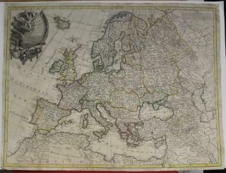
EUROPEAN CONTINENT 1791 SCHNEIDER & WEIGEL UNUSUAL ANTIQUE COPPER ENGRAVED MAP

Item History & Price
EUROPEAN CONTINENT 1791 SCHNEIDER & WEIGEL UNUSUAL ANTIQUE COPPER ENGRAVED MAP

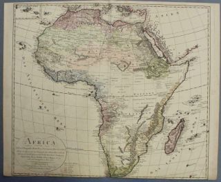
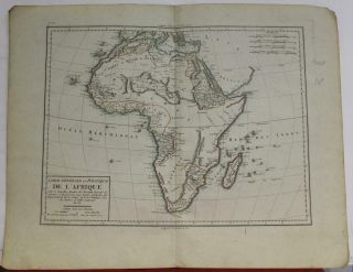
African Continent 1794 Schneider & Weigel Unusual Antique Copper Engraved Map
European Continent 1764 Clouet & Mondhare Unusual Antique Copper Engraved Map
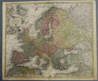
European Continent 1730 Seutter & Probst Unusual Antique Copper Engraved Map
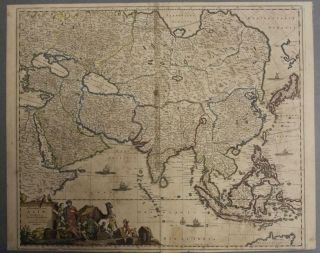
Asian Continent 1680ca De Wit Unusual Antique Copper Engraved Map
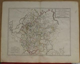
Russia Russian European Empire 1797 Mentelle & Chanlaire Unusual Antique Map
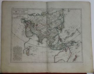
Asian Continent 1797 Mentelle & Chanlaire Unusual Antique Copper Engraved Map
African Continent 1797 Mentelle & Chanlaire Unusual Antique Copper Engraved Map
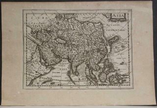
Asian Continent 1738 Cloppenburgh/hondius Unusual Antique Copper Engraved Map

Hungary & Romania 1579 (1584) Ortelius Unusual Antique Copper Engraved Map

Brussels Bruxelles Belfium 1777 De Ferraris & Dupuis Large Antique Map Sheet Xxi

1616 Atlas Map Of Iceland.

Kazan Russia 1767 Le Clerc/lespinasse Antique Copper Engraved City View

1899 Stanford, Folding Map Of Norwich, Norfolk, Arthur Collins, Jarrold & Sons,

1948 Vintage Linen Colour Map Geological Survey Ten Mile Of Great Britain

1944 Map Flying Bombs Sussex Ww2 Newspaper Military Kent Courier German V1 V2

Dated 1638 Vellum Map Of Icklesham Sussex Showing Land Uses Owners Etc