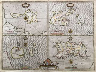
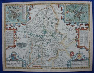
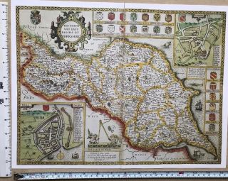
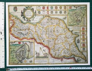
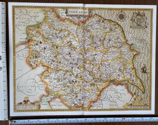
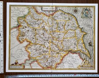
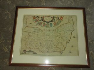
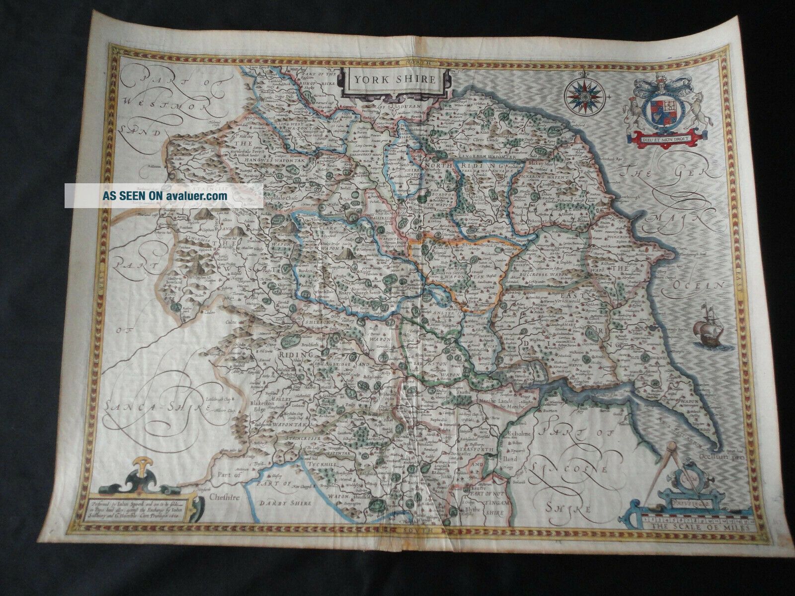
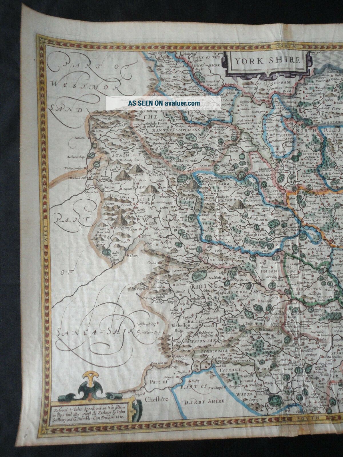
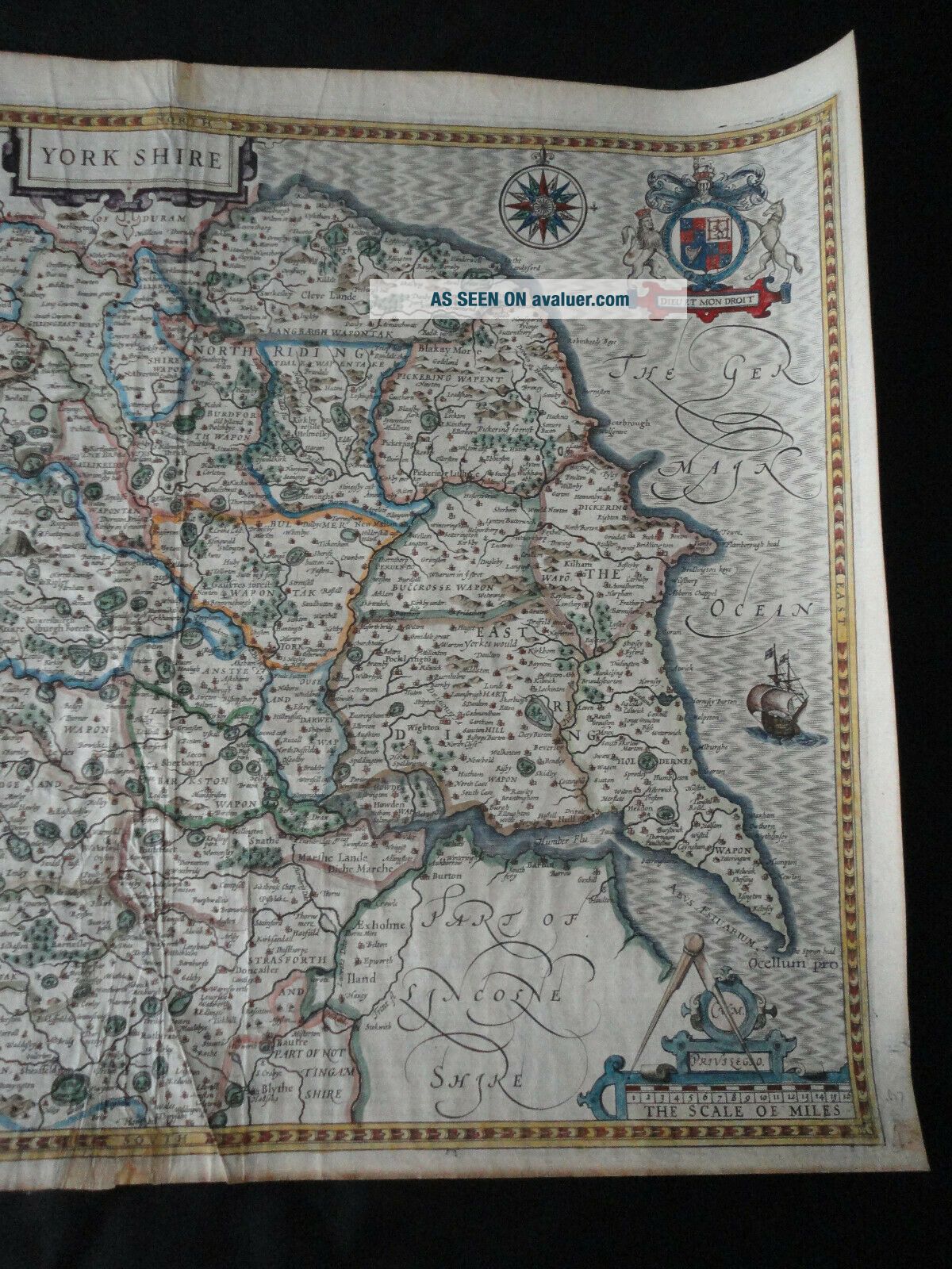
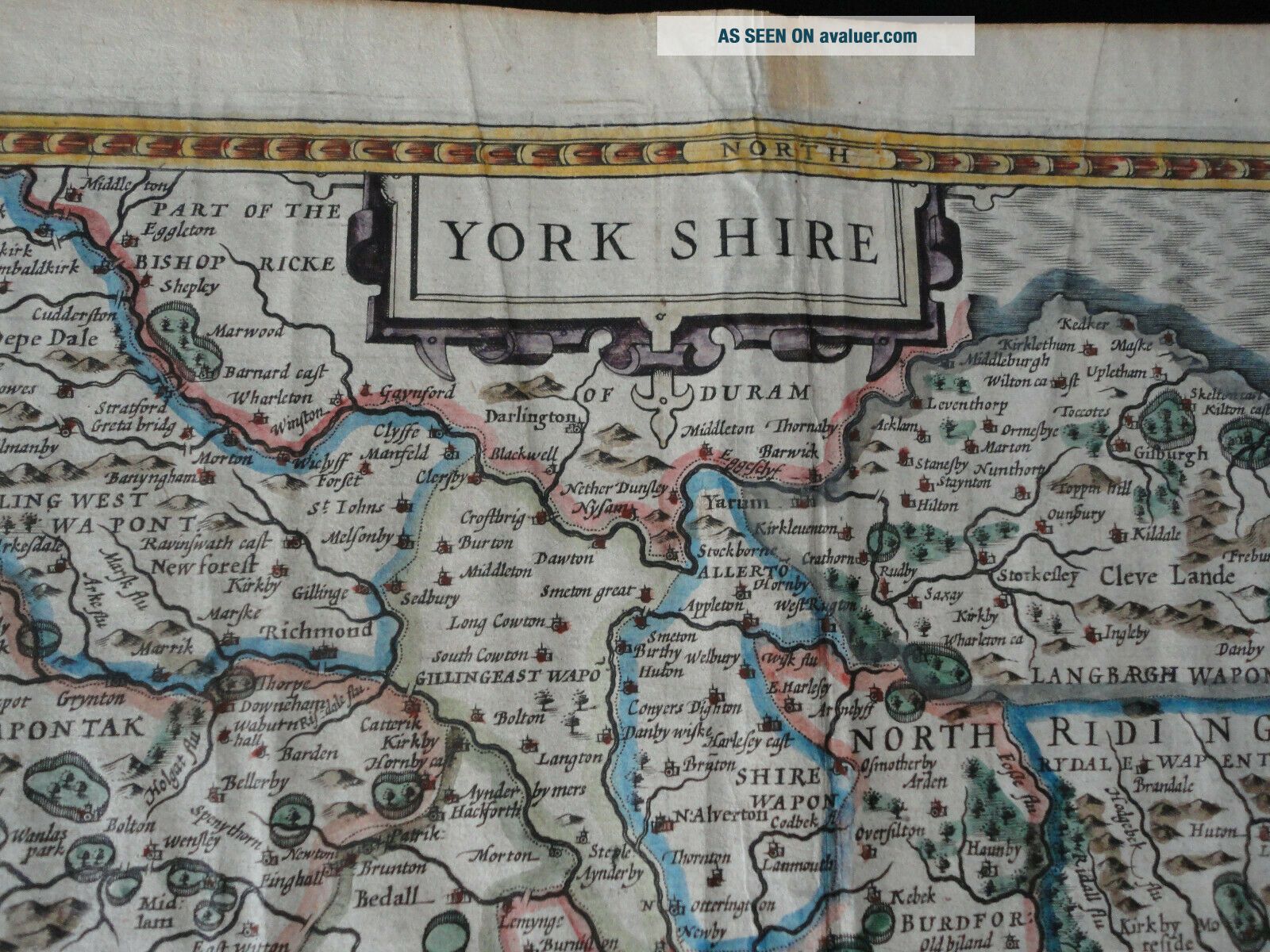
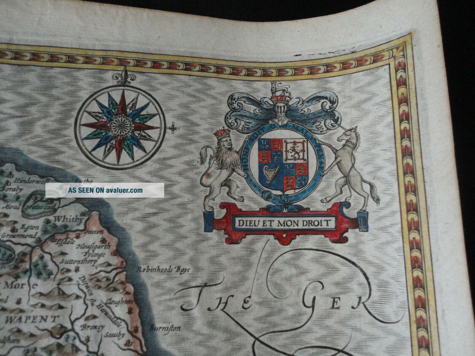
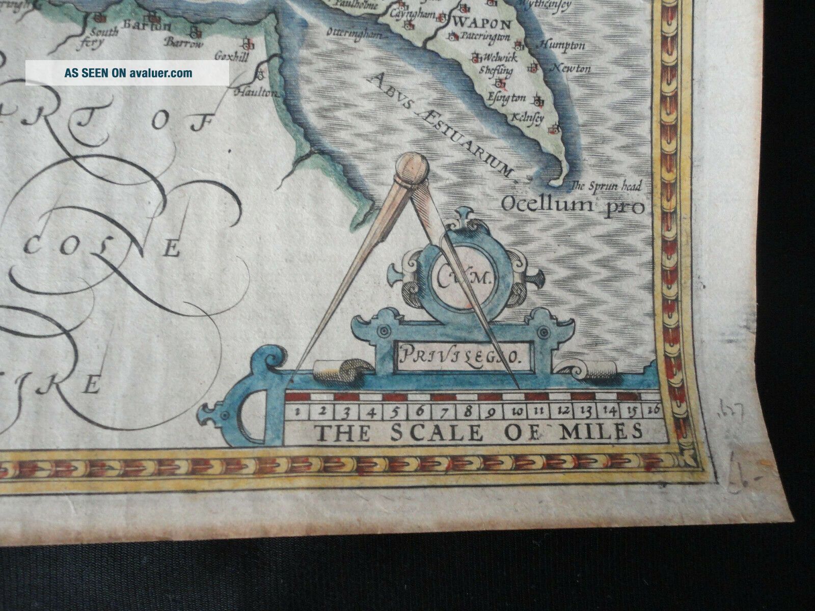
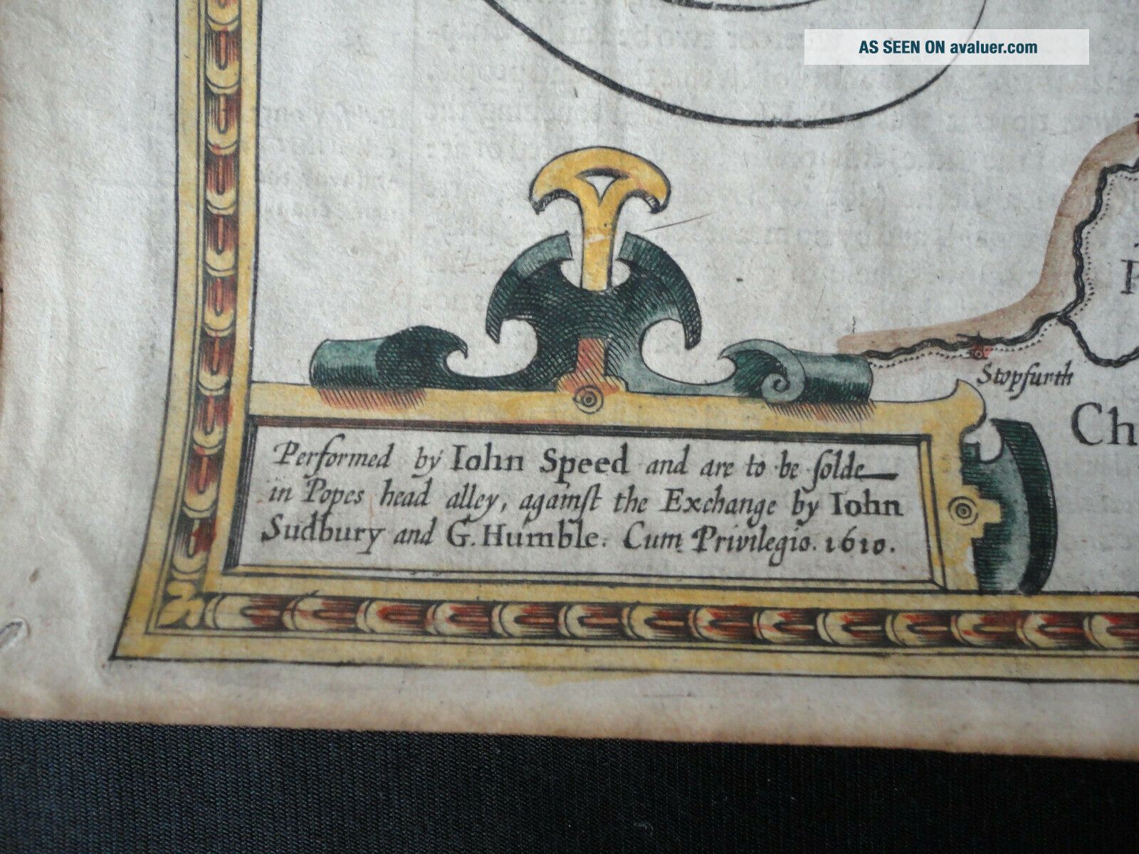
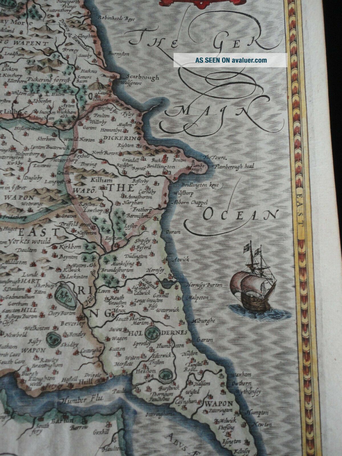
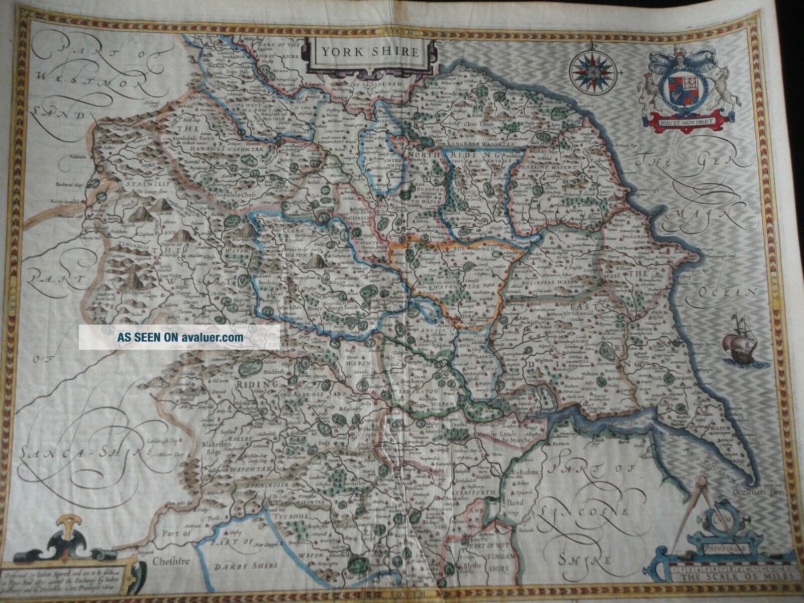
C. 1600 Antique Yorkshire Map John Speed.


Item History & Price

Information:
Reference Number: Avaluer:33090
Original Description:
C.1600 Antique York shire Map John Speed .

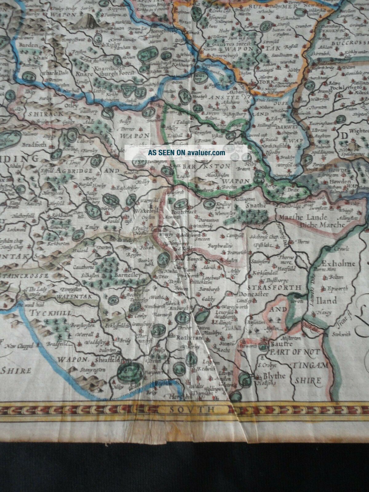
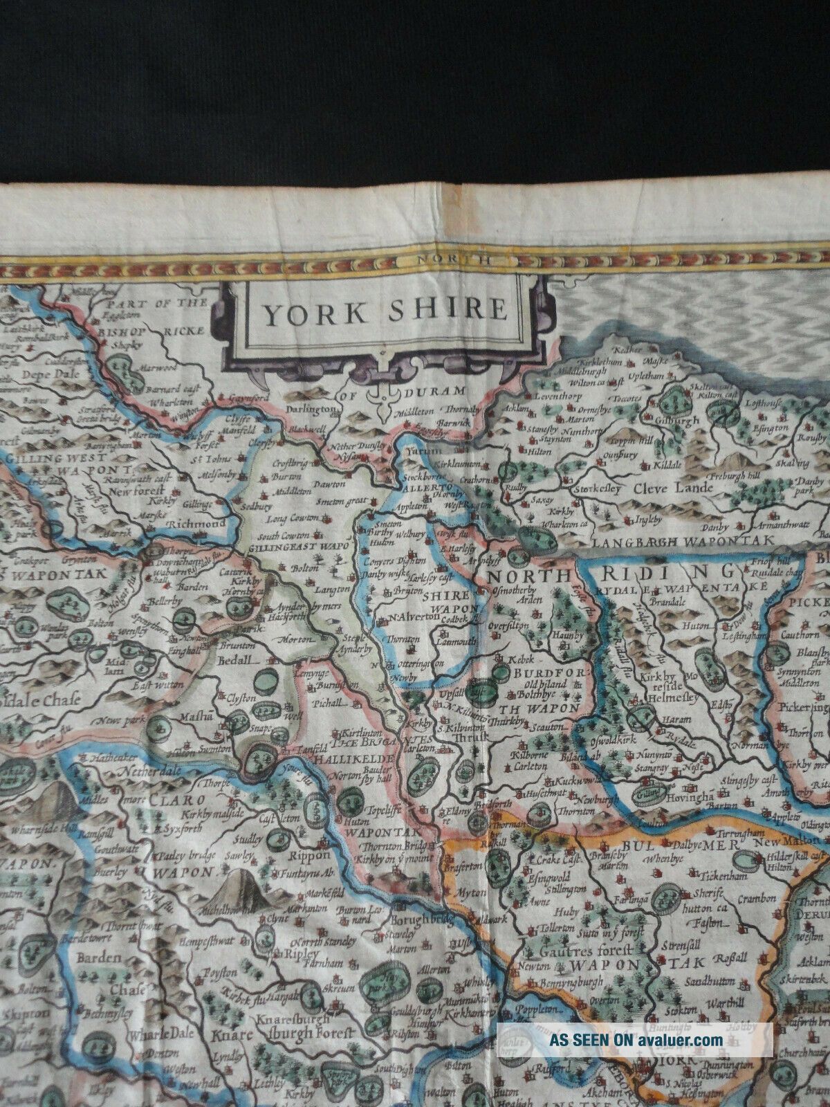
Condition - Overall good condition,
few minute pinholes to lower part of centerfold and one lower left margin, foxing mostly to margins and to foot and head of centerfold.Please see images .
Very Decorative map .approx 21" x 16" .
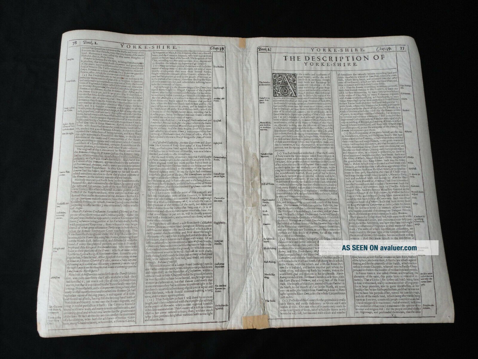
From Speed's "The Theatre of the Empire of Great Britaine"


    Similar items


  • 1676 Antique Rare Map; John Speed: Holy Island; Channel Islands; Farne Island

    1676 Antique Rare Map; John Speed: Holy Island; Channel Islands; Farne Island

  • Staffordshire,  Stafford,  Lichfield,  Antique Atlas Map,  John Speed,  1676

    Staffordshire, Stafford, Lichfield, Antique Atlas Map, John Speed, 1676

  • Old Antique Tudor Map North,  East Yorkshire,  England: John Speed 1600

    Old Antique Tudor Map North, East Yorkshire, England: John Speed 1600 ' S Reprint)

  • Old Antique Tudor Map North,  East Yorkshire,  England: John Speed 1600

    Old Antique Tudor Map North, East Yorkshire, England: John Speed 1600 ' S Reprint

  • Old Antique Tudor Map Of Yorkshire,  England: John Speed 1600

    Old Antique Tudor Map Of Yorkshire, England: John Speed 1600 ' S Reprint: Historic

  • Old Antique Collectable Tudor Map Yorkshire,  England: John Speed 1600

    Old Antique Collectable Tudor Map Yorkshire, England: John Speed 1600 ' S Reprint

  • Old Antique Collectable Tudor Map Yorkshire,  England: John Speed 1600

    Old Antique Collectable Tudor Map Yorkshire, England: John Speed 1600 ' S Reprint

  • Suffolcia Suffolk Ipswich England U.  K.  Britain C.  1600 Jan Jansson Map Framed

    Suffolcia Suffolk Ipswich England U. K. Britain C. 1600 Jan Jansson Map Framed


    • You might also like


    • Hungary & Romania 1579 (1584) Ortelius Unusual Antique Copper Engraved Map

      Hungary & Romania 1579 (1584) Ortelius Unusual Antique Copper Engraved Map

    • Brussels Bruxelles Belfium 1777 De Ferraris & Dupuis Large Antique Map Sheet Xxi

      Brussels Bruxelles Belfium 1777 De Ferraris & Dupuis Large Antique Map Sheet Xxi

    • 1616 Atlas Map Of Iceland.

      1616 Atlas Map Of Iceland.

    • Kazan Russia 1767 Le Clerc/lespinasse Antique Copper Engraved City View

      Kazan Russia 1767 Le Clerc/lespinasse Antique Copper Engraved City View

    • 1899 Stanford,  Folding Map Of Norwich,  Norfolk,  Arthur Collins,  Jarrold & Sons,

      1899 Stanford, Folding Map Of Norwich, Norfolk, Arthur Collins, Jarrold & Sons,

    • 1948 Vintage Linen Colour Map Geological Survey Ten Mile Of Great Britain

      1948 Vintage Linen Colour Map Geological Survey Ten Mile Of Great Britain

    • 1944 Map Flying Bombs Sussex Ww2 Newspaper Military Kent Courier German V1 V2

      1944 Map Flying Bombs Sussex Ww2 Newspaper Military Kent Courier German V1 V2

    • Dated 1638 Vellum Map Of Icklesham Sussex Showing Land Uses Owners Etc

      Dated 1638 Vellum Map Of Icklesham Sussex Showing Land Uses Owners Etc

Avaluer          About Us          Privacy Policy          Contact Us          UP
© 2022, avaluer.net, Inc. or its affiliates