Mitchell ' S Antique Map " Plan Of Boston " 1860 Detailed


Item History & Price
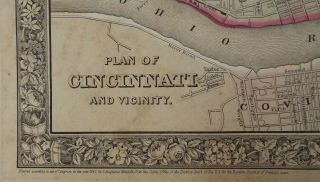
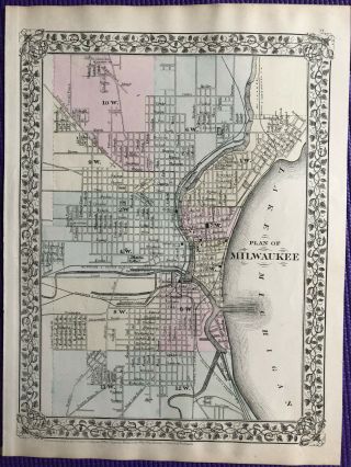
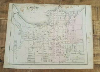
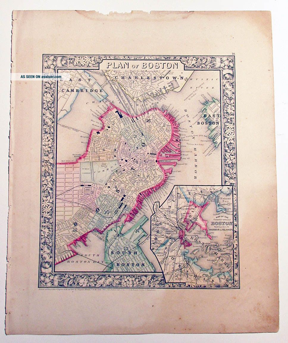
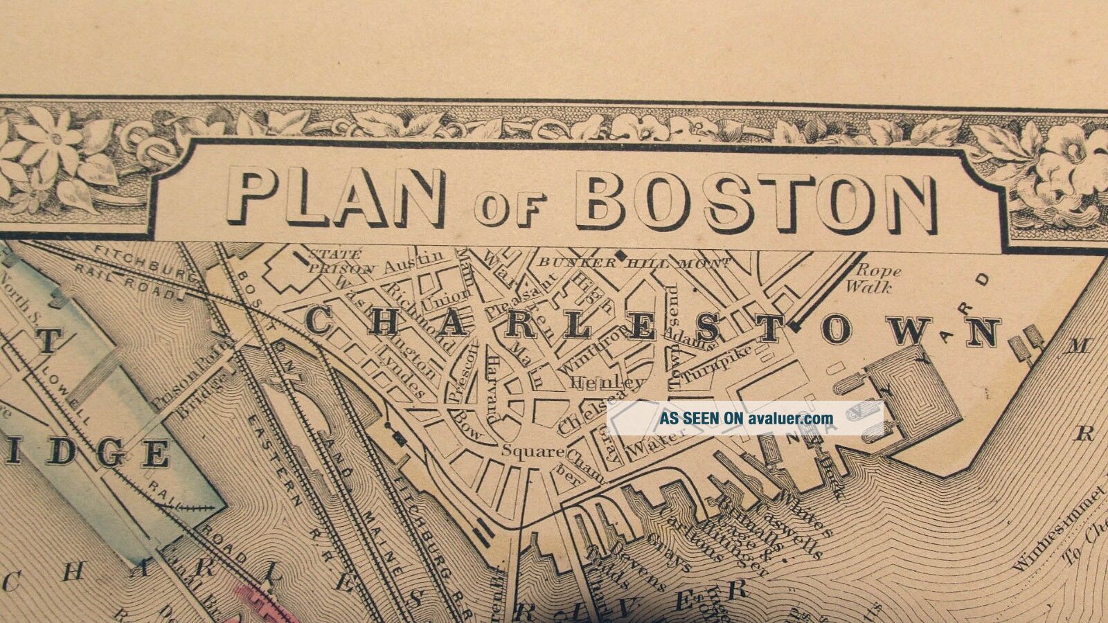
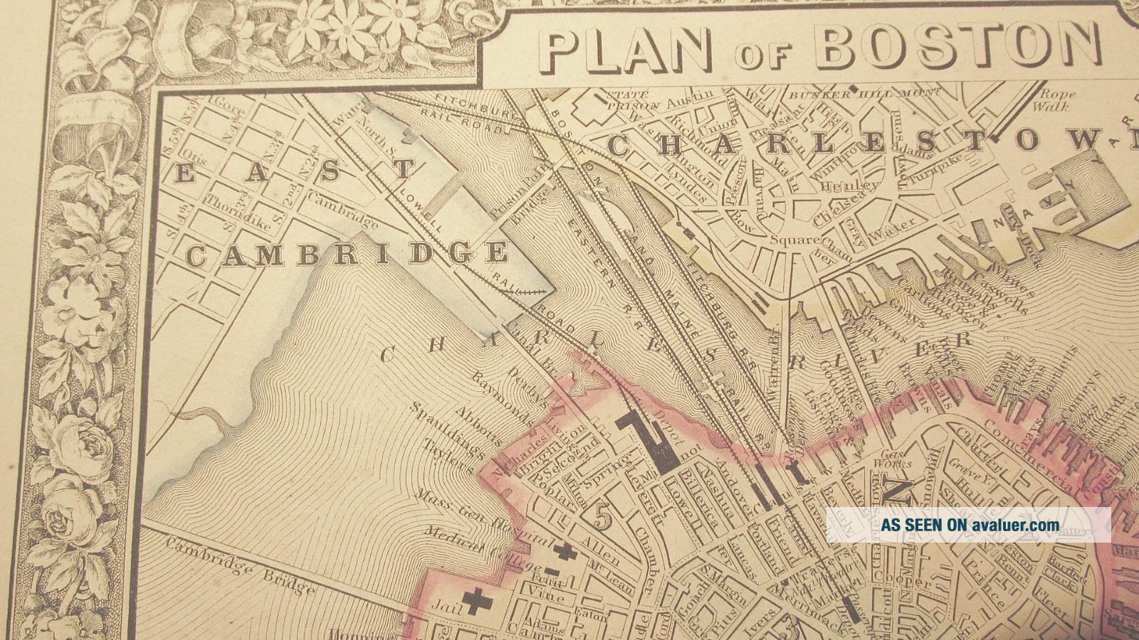
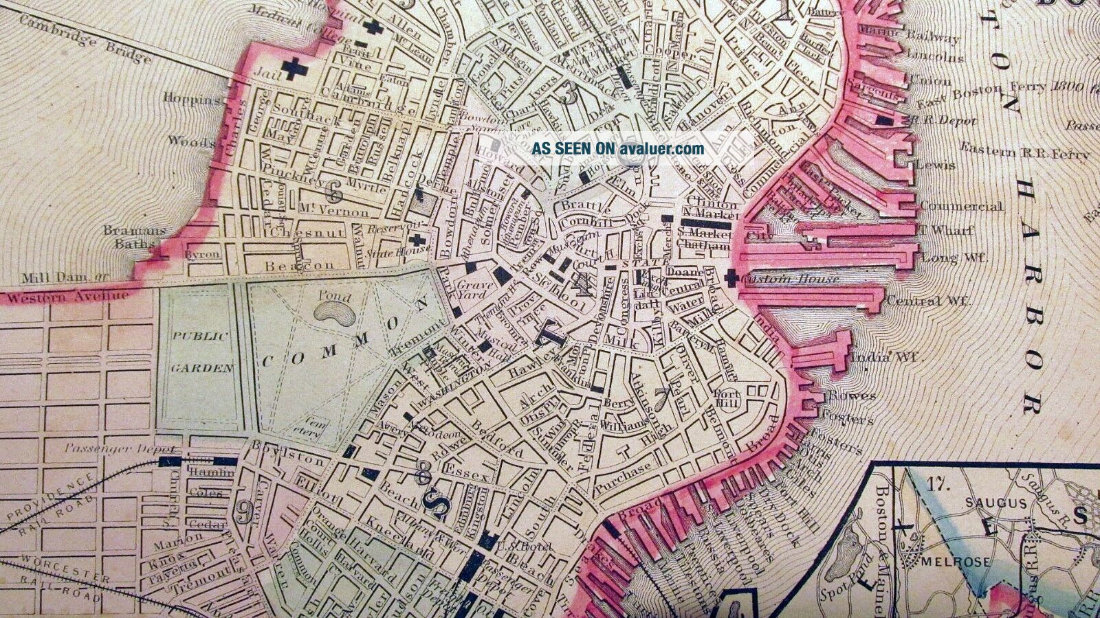
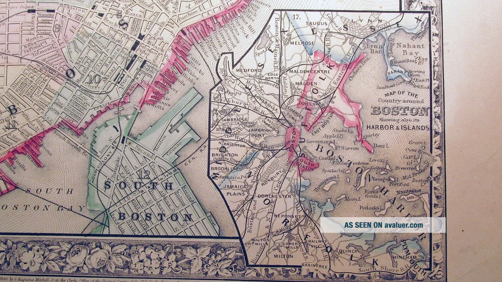
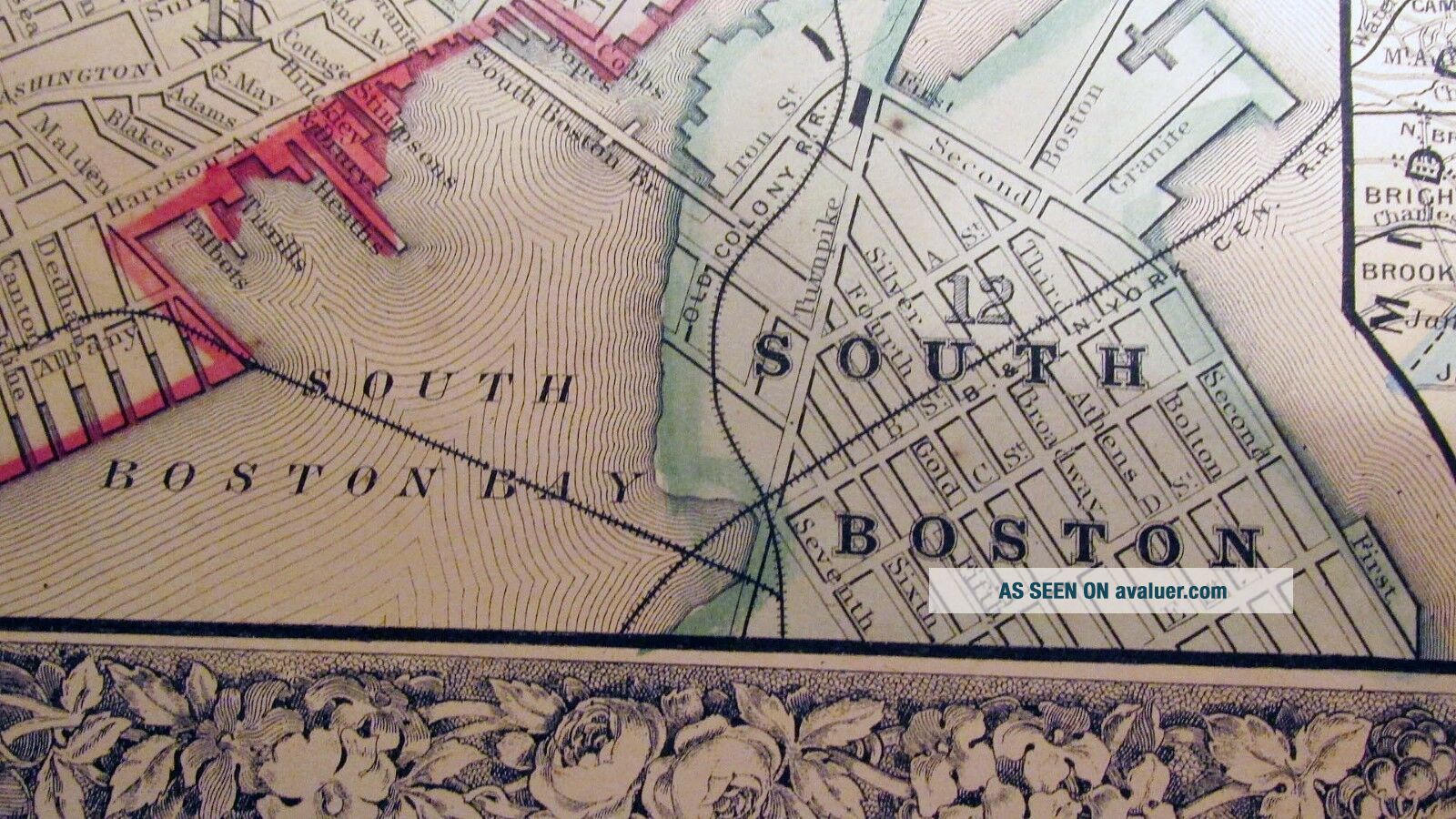
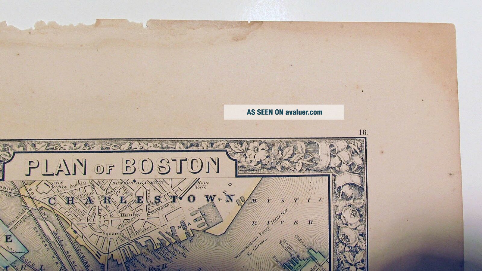
Beautifully hand colored map "Plan of Boston", by one of the most prominent map publishers of the times, S. Augustus Mitchell, 1861. This unique map illustrates the city of Boston in fine detail. The inset in the lower right corner illustrates the "Map of the Country around Boston, showing also its Harbor and Islands"Map illustrates East Cambridge, East Boston, South Boston, South Boston Bay, Charlestown, and Mystic River.This historic antique map is finely ...detailed with the characteristic ornate border surrounding many of Mitchell's maps. Printed map area is in very good condition. No tears. According to an article in CountryLiving magazine, entitled "What to Collect Now: Antique Maps", this map is notable due to its' decorative value as well as its' prominent map maker, Augustus Mitchell....see more information regarding Augustus Mitchell below. Condition as shown in all photographs. SIZE: 12 5/8" X 15 3/8"Perfect for the map collector, or history buff! Please contact me with any questions, or if you are interested in maps of a different geographic location.Biography of Samuel Augustus Mitchell: For over 50 years, Samuel Augustus Mitchell and his successors were one of the most prominent publishers of maps and atlases in the United States. Augustus Mitchell was born in Bristol, Connecticut in 1792. His father emigrated from Scotland in 1773. While little is known about his early schooling, it is known that Mitchell found the quality of early geography text books to be lacking, and determined that he would write and publish better works. This decision led him to relocate to Philadelphia in 1829 or 1830, which was then the center of commercial publishing in America. Mitchell’s first cartographic work was the re-issue of Anthony Finley’s New American Atlas in 1831, issued in serial format from 1818 to 1822 and as a complete work from 1823 onward. Following publication of the New American Atlas, Mitchell began issuing the individual maps in pocket map format. Beginning in 1834, Mitchell began offering reduced sized Tourist Pocket Maps of a number of states in the United States. J.H. Young and D. Haines are listed as the engravers on these maps. In 1832, Mitchell offered the first edition of his Travelers Guide Through the United States, A Map of the Roads, Distances, Steam Boat & Canal Routes, etc. By J.H. Young, this would become one of his most popular and enduring works. The map of the United States was done by steel engraving, one of the earliest uses of a steel engraving in map publishing in America. Beginning in 1839, Mitchell also began publication of his school atlas. This work and variant editions for older and younger students, was issued by Mitchell and his successors from 1839 to 1886. In 1860, Mitchell’s son Samuel Augustus Mitchell Jr. began issuing Mitchell’s New General Atlas. While his father had continued to issue wall maps and other works, this appears to be his son’s first entry into the trade.
01191
01191