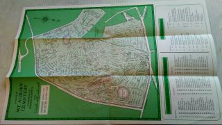
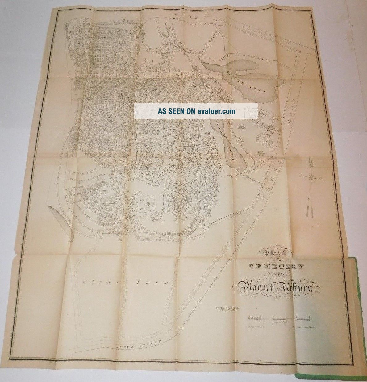
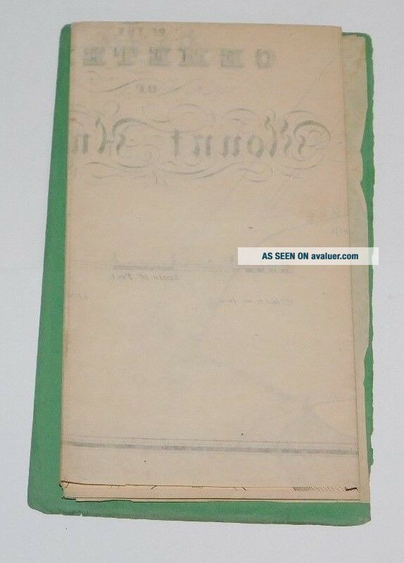
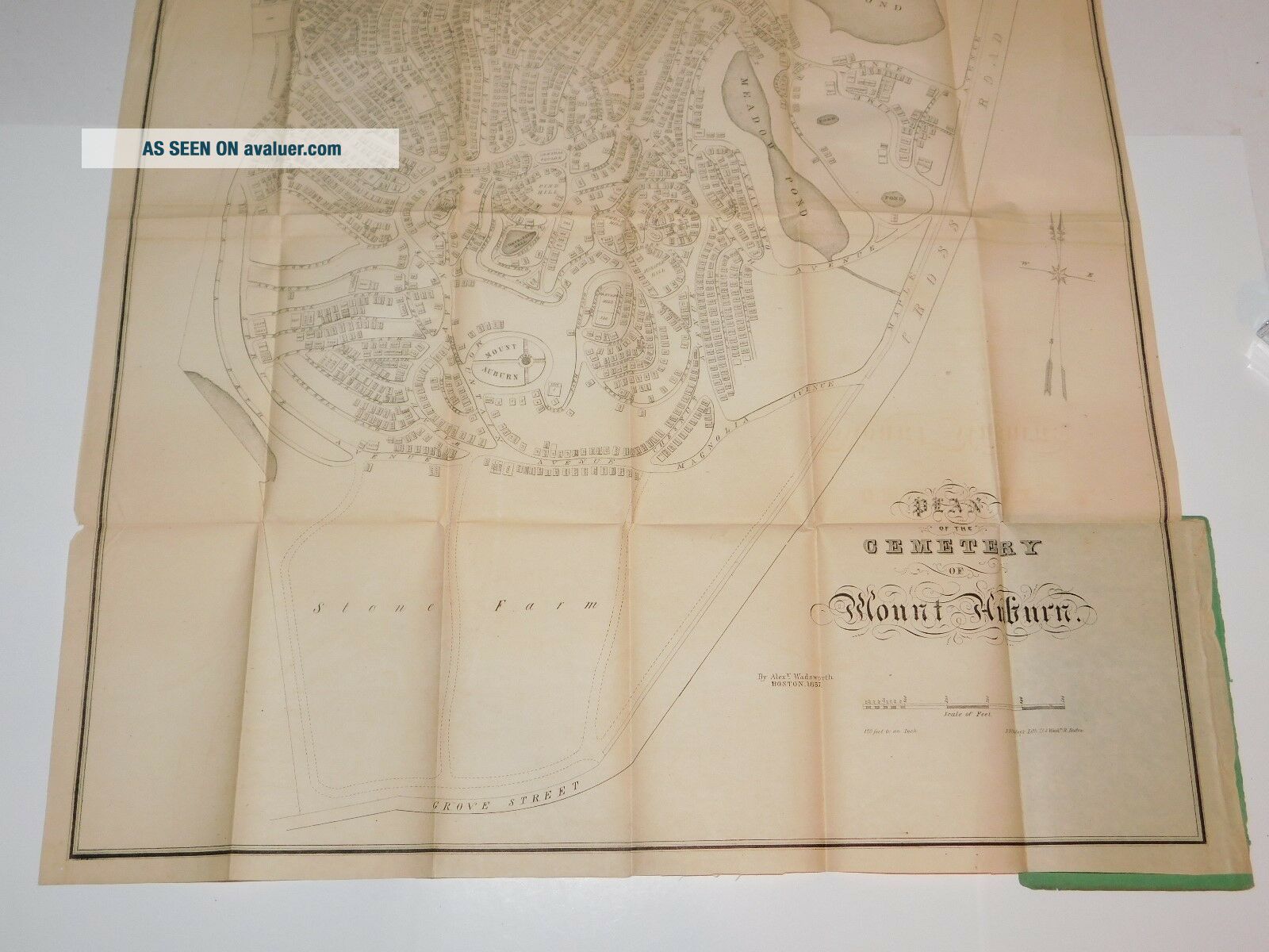
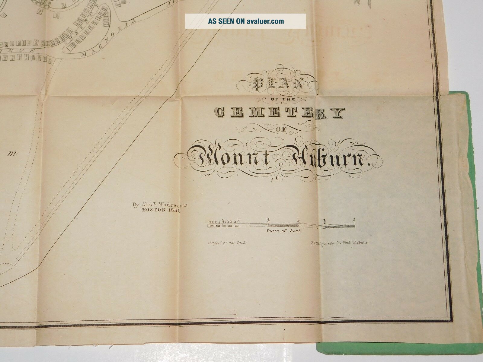
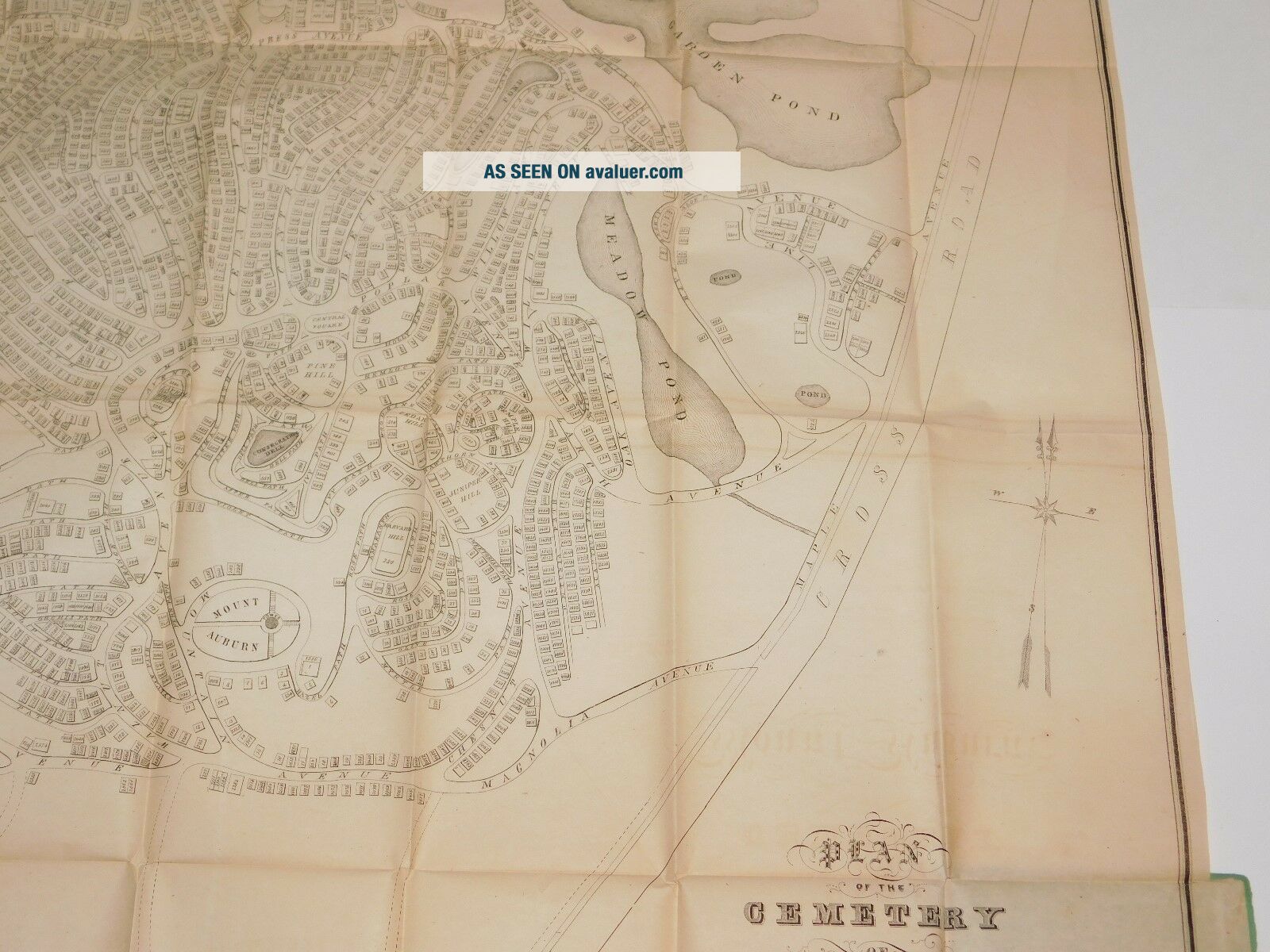
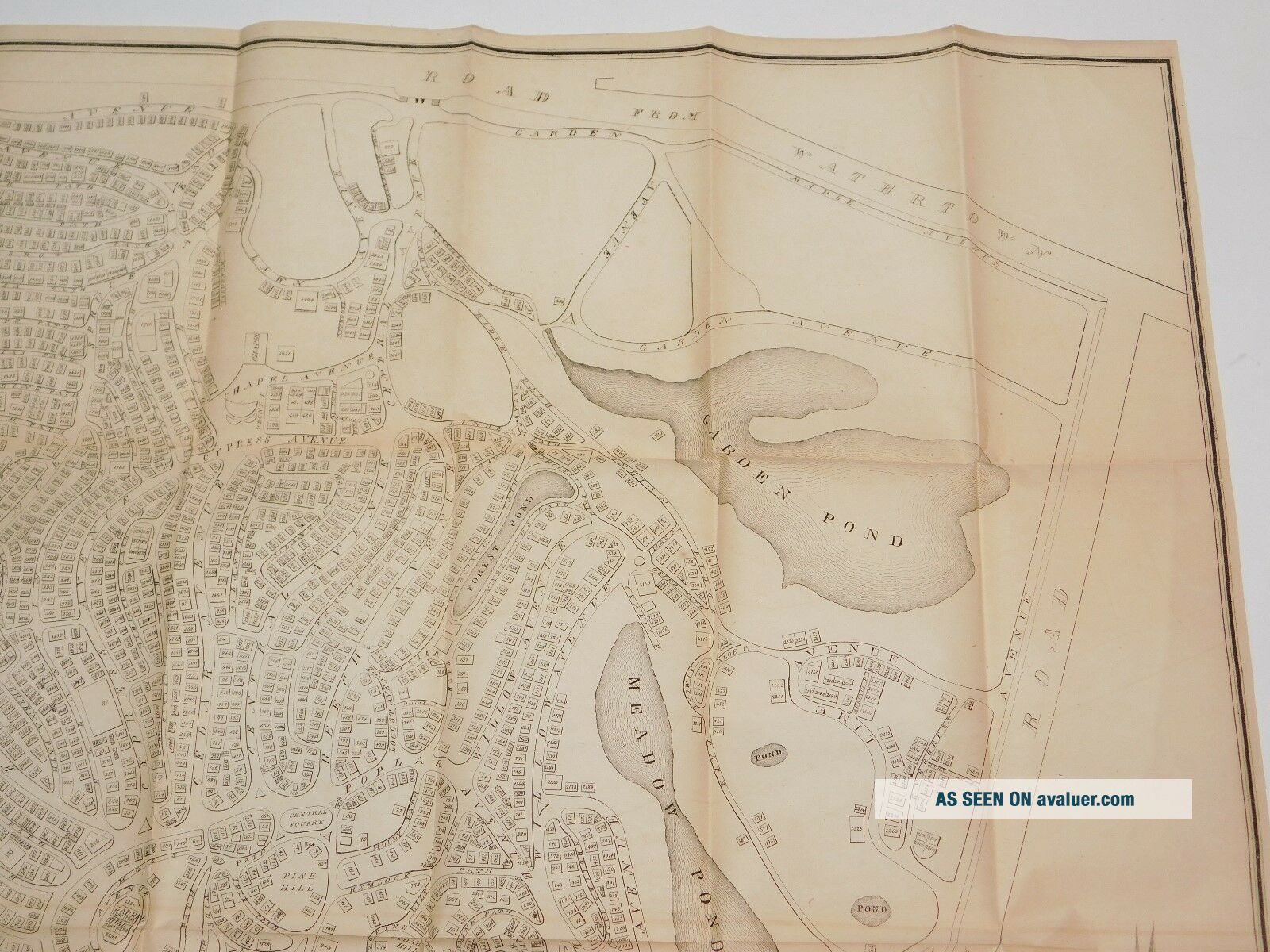
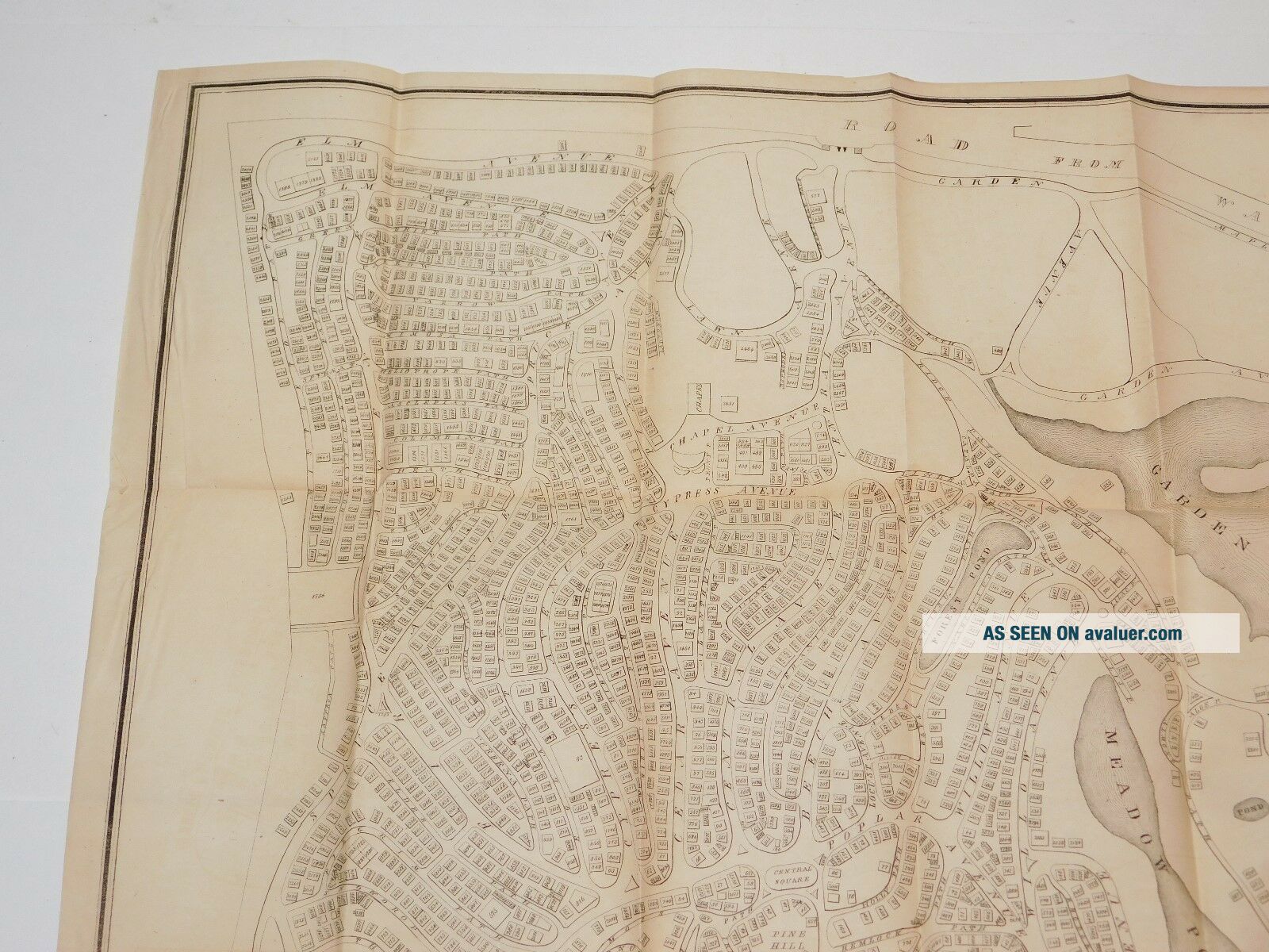
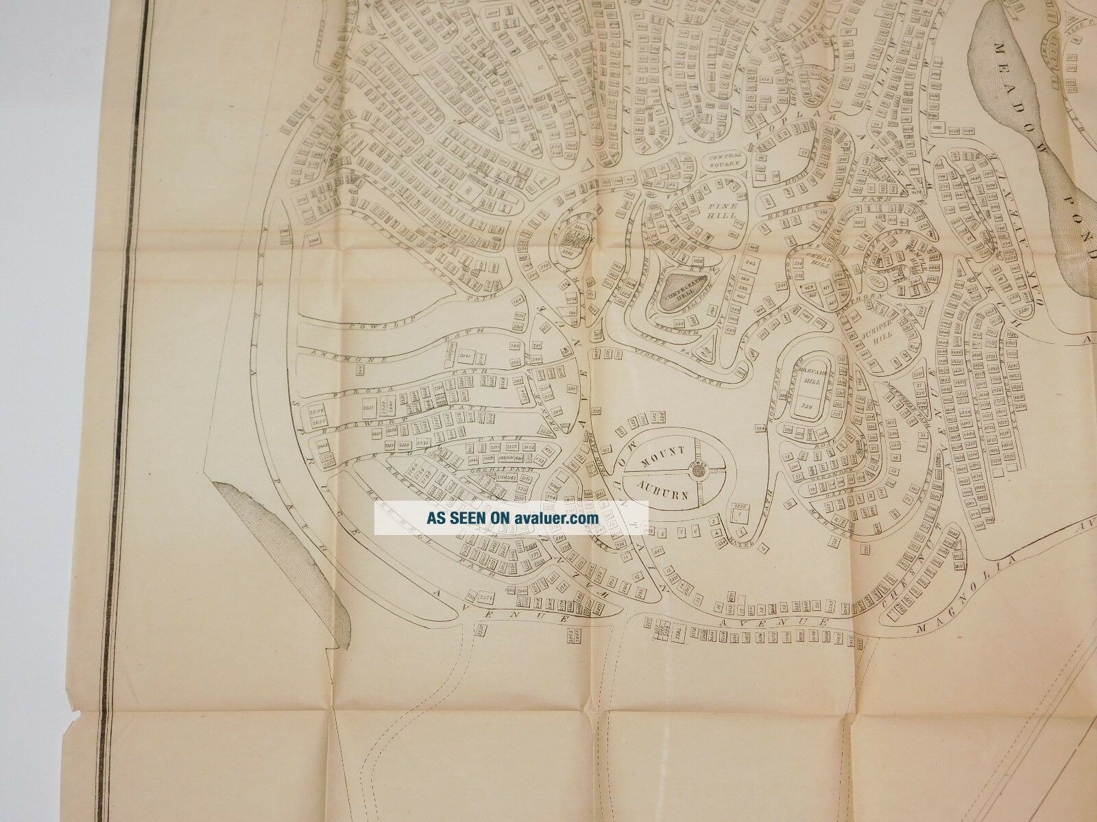
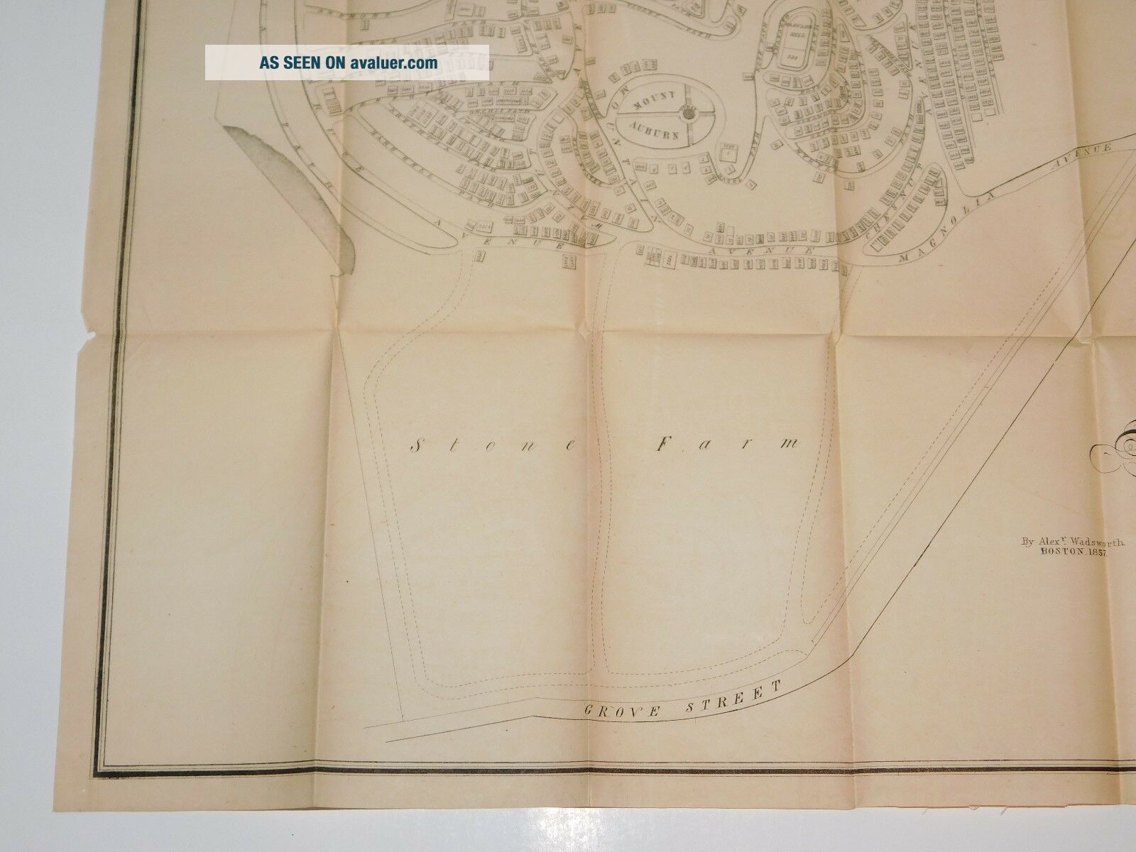
1857 Plan Map Of Mount Auburn Cemetery Cambridge Massachusetts Antique Map 1857


Item History & Price

Information:
Reference Number: Avaluer:34256Year: 1857
US State: MassachusettsTopic: Maps
City: CambridgePublication Year: 1857
Original Description:

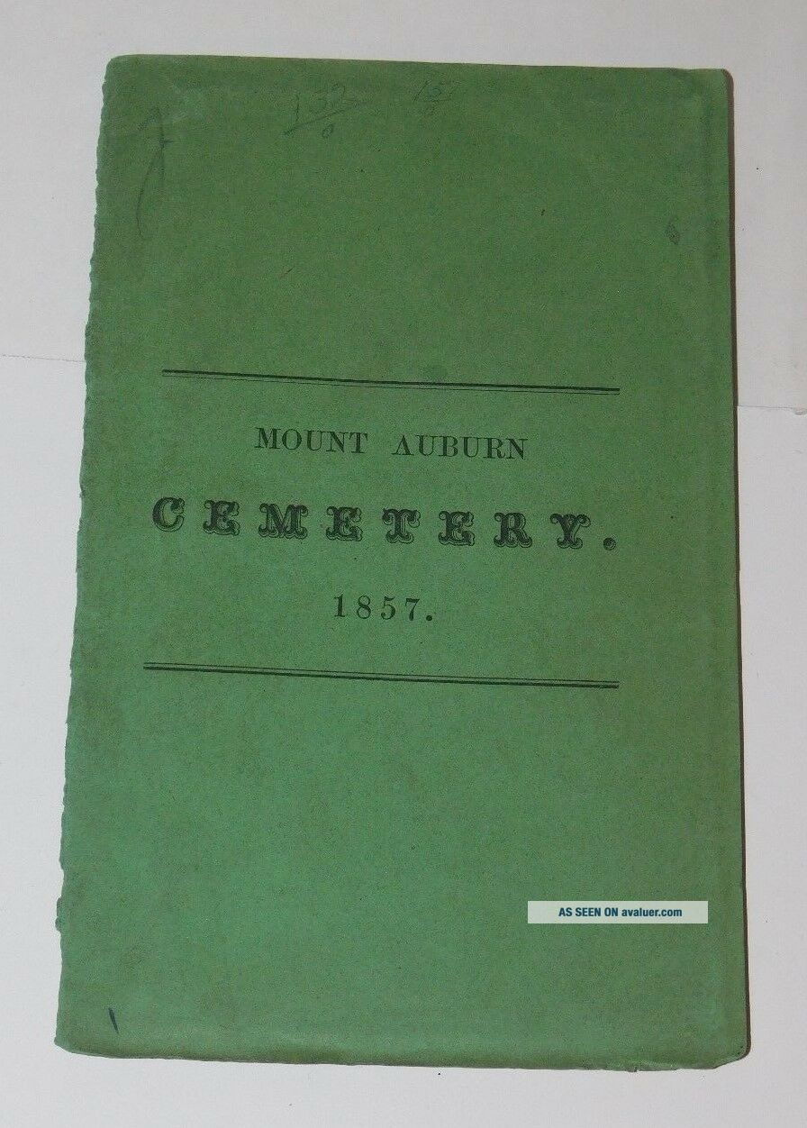
     This is an original antique 1857 Plan Map of Mount Auburn Cemetery in Cambridge Massachusetts. It is about 23.5"X28" and was a folding map that came with a booklet cover. The back cover of the booklet is missing.  There are a few small split on folds and there are a few minor creases and some minor yellowing. The map is in generally very good condition. 


    Similar items


  • Massachusetts Stereoview Photo Cdii Forest Pond Mount Auburn Cemetery Cambridge

    Massachusetts Stereoview Photo Cdii Forest Pond Mount Auburn Cemetery Cambridge

  • Mount Auburn Cemetery,  Cambridge Mass.  1877,  Printed Postal Notice,  Annual Meeting

    Mount Auburn Cemetery, Cambridge Mass. 1877, Printed Postal Notice, Annual Meeting

  • C1880 Stereoview Mount Auburn Cemetery Cambridge,  Ma.

    C1880 Stereoview Mount Auburn Cemetery Cambridge, Ma.

  • Very Rare Vintage Mount Auburn Cemetery Map,  Willow Garden Crypt Booklet Only 1

    Very Rare Vintage Mount Auburn Cemetery Map, Willow Garden Crypt Booklet Only 1

  • 1857 Geological Map Of Eastern Half Of Iowa By Legislature Authority

    1857 Geological Map Of Eastern Half Of Iowa By Legislature Authority

  • " Bird

    " Bird ' S Eye View " Map Of Mount Vernon Ohio In 1870, Library Of Congress Reprint

  • 100 Prospect Plan Map Of Aberdeen Scotland Engraved By Hogg C1784 Vgc

    100 Prospect Plan Map Of Aberdeen Scotland Engraved By Hogg C1784 Vgc

  • 100 Prospect Plan Map Of Carlisle Engraved By Hogg C1784 Vgc

    100 Prospect Plan Map Of Carlisle Engraved By Hogg C1784 Vgc


    • You might also like


    • 1860 Mitchell Hand Colored Map Colorado,  Nebraska & Kansas - Civil War Era

      1860 Mitchell Hand Colored Map Colorado, Nebraska & Kansas - Civil War Era

    • 18th Century French Map Of North America

      18th Century French Map Of North America

    • Las Vegas Nevada Vintage 1967 Us Geological Survey Quadrangle Map 4 Panels

      Las Vegas Nevada Vintage 1967 Us Geological Survey Quadrangle Map 4 Panels

    • Rare Antique 1845 Maps United States Exploring Expedition Book Antartica Hawaii

      Rare Antique 1845 Maps United States Exploring Expedition Book Antartica Hawaii

    • Vintage 1926 Map Hollywood From The Best Surveys Of The Time

      Vintage 1926 Map Hollywood From The Best Surveys Of The Time

    • American Continent (western Hemisphere) 1747 Bowen Antique Copper Engraved Map

      American Continent (western Hemisphere) 1747 Bowen Antique Copper Engraved Map

    • Gulf Coast Florida Texas United States 1705 De Fer Unusual Antique Engraved Map

      Gulf Coast Florida Texas United States 1705 De Fer Unusual Antique Engraved Map

    • California As Island United States 1700 De Fer Unusual First Edition Antique Map

      California As Island United States 1700 De Fer Unusual First Edition Antique Map

Avaluer          About Us          Privacy Policy          Contact Us          UP
© 2022, avaluer.net, Inc. or its affiliates