Rare - MERIONETHSHIRE Antique Ordnance Survey Map 1888. Robert Owen Jones

Item History & Price
Welcome to my Auction.
I have a large collection of Victorian Ordnance Survey Zincography Maps up for sale. These are rare and collectible. I am selling in singles but also take combined postage at no extra cost to you.
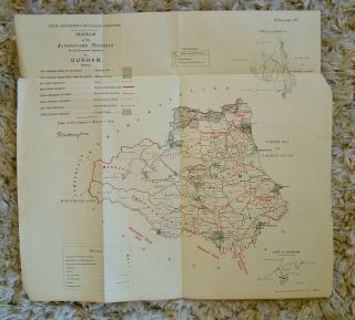
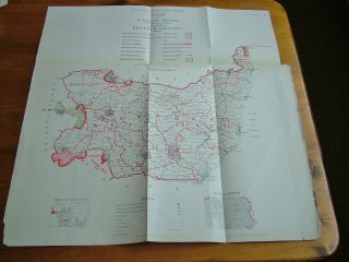
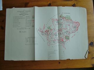
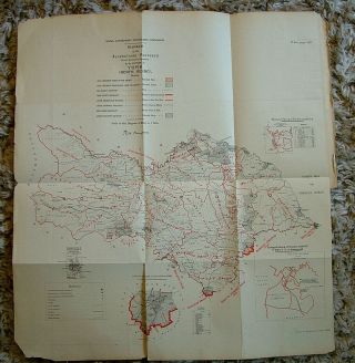
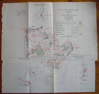
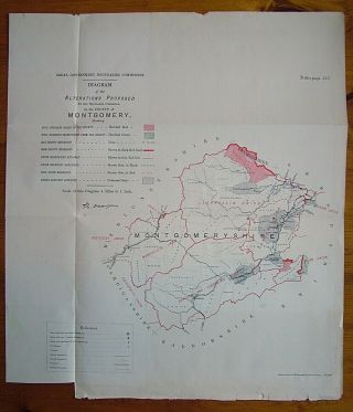
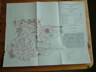
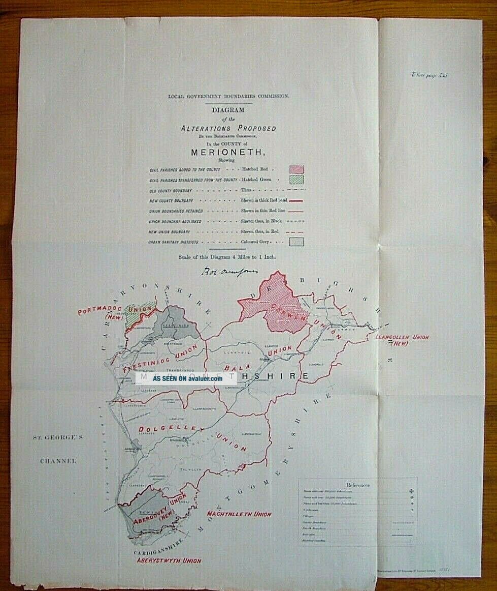
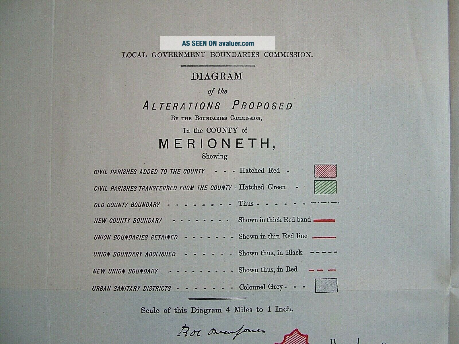
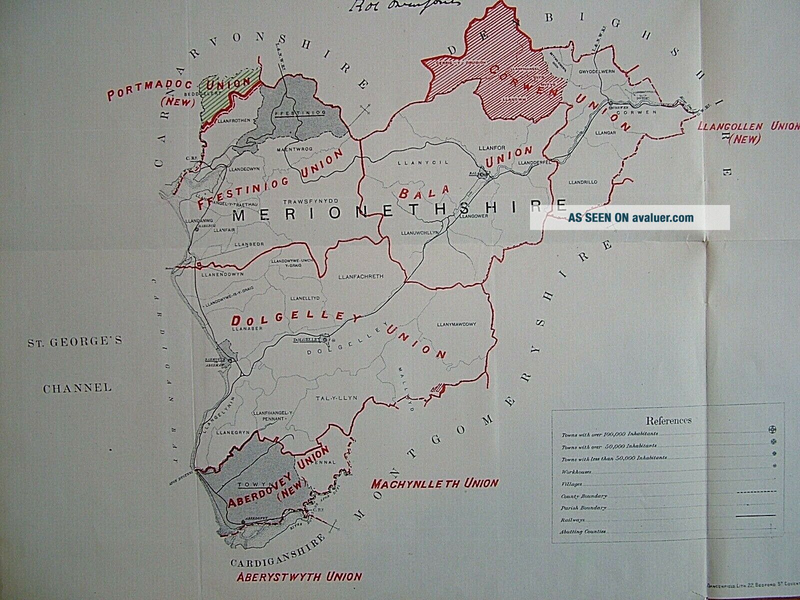
Merionethshire antique map. A rare Ordnance Survey map by Robert Owen Jones, Royal Engineer, produced for the Local Government Boundaries Commission Report, 1888. The map shows the Poor Law Unions of: Ffestioniog, Bala, Dolgelley, Corwen and Aberdovey, ...together with details of County Boundaries, Civil Parishes, and the Urban Sanitary Districts of Ffestiniog, Dolgelley, Barmouth and Towyn.Paper size approx. 17 1/4 x 21 inches. Usual folds are where the map wasoriginally bound into the then Report.
Extra Useful Information.
The Local Government (Boundaries) Act 1887 (50 & 51 Vict. c. 61) was an Act of the Parliament of the United Kingdom. The Act established boundary commissioners to reform the areas of administrative bodies in England and Wales in preparation for the creation of elected councils by the Local Government Act 1888. In the event, the recommendations of the commissioners were not carried out.Zincography was a planographic printing process that used zinc plates. Alois Senefelder first mentioned zinc’s lithographic use as a substitute for Bavarian limestone in his 1801 English patent specifications. In 1834, Federico Lacelli patented a zincographic printing process, producing large maps called géoramas. In 1837-1842, Eugène-Florent Kaeppelin perfected the process to create a large polychrome geologic map. This is a Zinc plate lithograph.
Postage is by Special Delivery and item(s) will be well packaged for you.
Antique Maps, Wales. Tags: ancestry, antiquemaps, Boundaries, cartographer, cartography, countymaps, familyhistory, familytree, Forden, forsale, genealogy, heritage, history, Llandisloes, Llanfyllin, localgovernmentboundariescommission, Machynlleth, Maldwyn, mapping, maps, mapsandantiqueprints, Montgomery, Merioneth, Merionethshire, Montgomeryshire, Newtown, oldmaps, OrdnanceSurvey, OwenJones, roots, RoyalEngineers, SirDrefaldwyn, vintagemaps, Victorian. Welshpool
I have a large collection of Victorian Ordnance Survey Zincography Maps up for sale. These are rare and collectible. I am selling in singles but also take combined postage at no extra cost to you.
Merionethshire antique map. A rare Ordnance Survey map by Robert Owen Jones, Royal Engineer, produced for the Local Government Boundaries Commission Report, 1888. The map shows the Poor Law Unions of: Ffestioniog, Bala, Dolgelley, Corwen and Aberdovey, ...together with details of County Boundaries, Civil Parishes, and the Urban Sanitary Districts of Ffestiniog, Dolgelley, Barmouth and Towyn.Paper size approx. 17 1/4 x 21 inches. Usual folds are where the map wasoriginally bound into the then Report.
Extra Useful Information.
The Local Government (Boundaries) Act 1887 (50 & 51 Vict. c. 61) was an Act of the Parliament of the United Kingdom. The Act established boundary commissioners to reform the areas of administrative bodies in England and Wales in preparation for the creation of elected councils by the Local Government Act 1888. In the event, the recommendations of the commissioners were not carried out.Zincography was a planographic printing process that used zinc plates. Alois Senefelder first mentioned zinc’s lithographic use as a substitute for Bavarian limestone in his 1801 English patent specifications. In 1834, Federico Lacelli patented a zincographic printing process, producing large maps called géoramas. In 1837-1842, Eugène-Florent Kaeppelin perfected the process to create a large polychrome geologic map. This is a Zinc plate lithograph.
Postage is by Special Delivery and item(s) will be well packaged for you.
Antique Maps, Wales. Tags: ancestry, antiquemaps, Boundaries, cartographer, cartography, countymaps, familyhistory, familytree, Forden, forsale, genealogy, heritage, history, Llandisloes, Llanfyllin, localgovernmentboundariescommission, Machynlleth, Maldwyn, mapping, maps, mapsandantiqueprints, Montgomery, Merioneth, Merionethshire, Montgomeryshire, Newtown, oldmaps, OrdnanceSurvey, OwenJones, roots, RoyalEngineers, SirDrefaldwyn, vintagemaps, Victorian. Welshpool