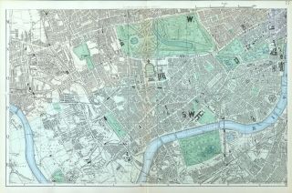
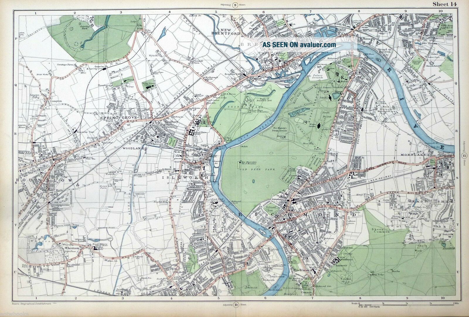
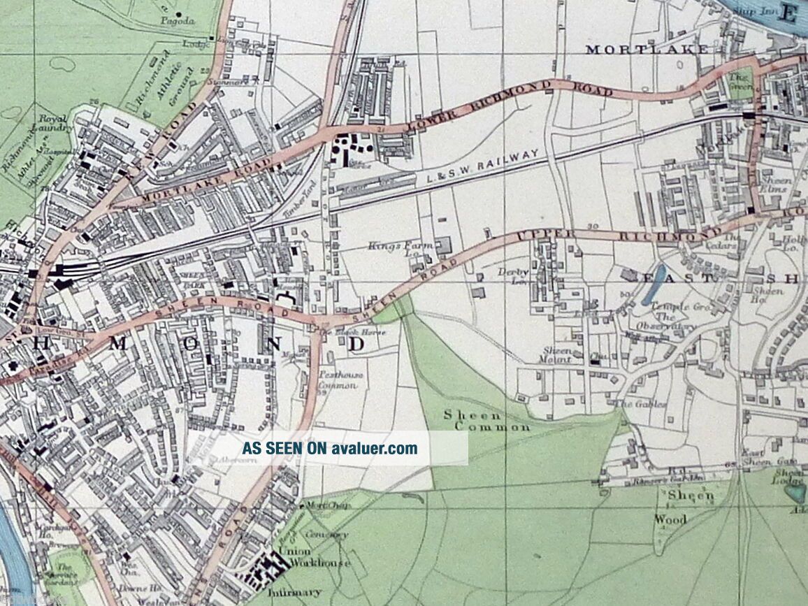
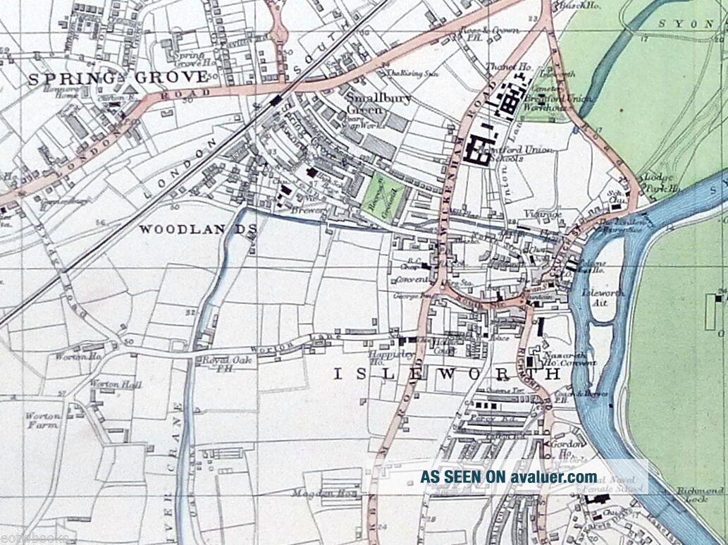
LONDON - Antique Map / Street Plan, RICHMOND, HOUNSLOW, ISLEWORTH - BACON, 1910.
Item History & Price
| Reference Number: Avaluer:35056 | Format: Sheet Map from Atlas |
| Antique/ Modern: Antique | Region: LONDON |
| Map Type: City, Countries/ Borders, Regional/ Local |
[zipedit]
Original Antique Map
of
South-West London
_ RICHMOND, HOUNSLOW ISLEWORTH & BRENTFORD PRINTED :
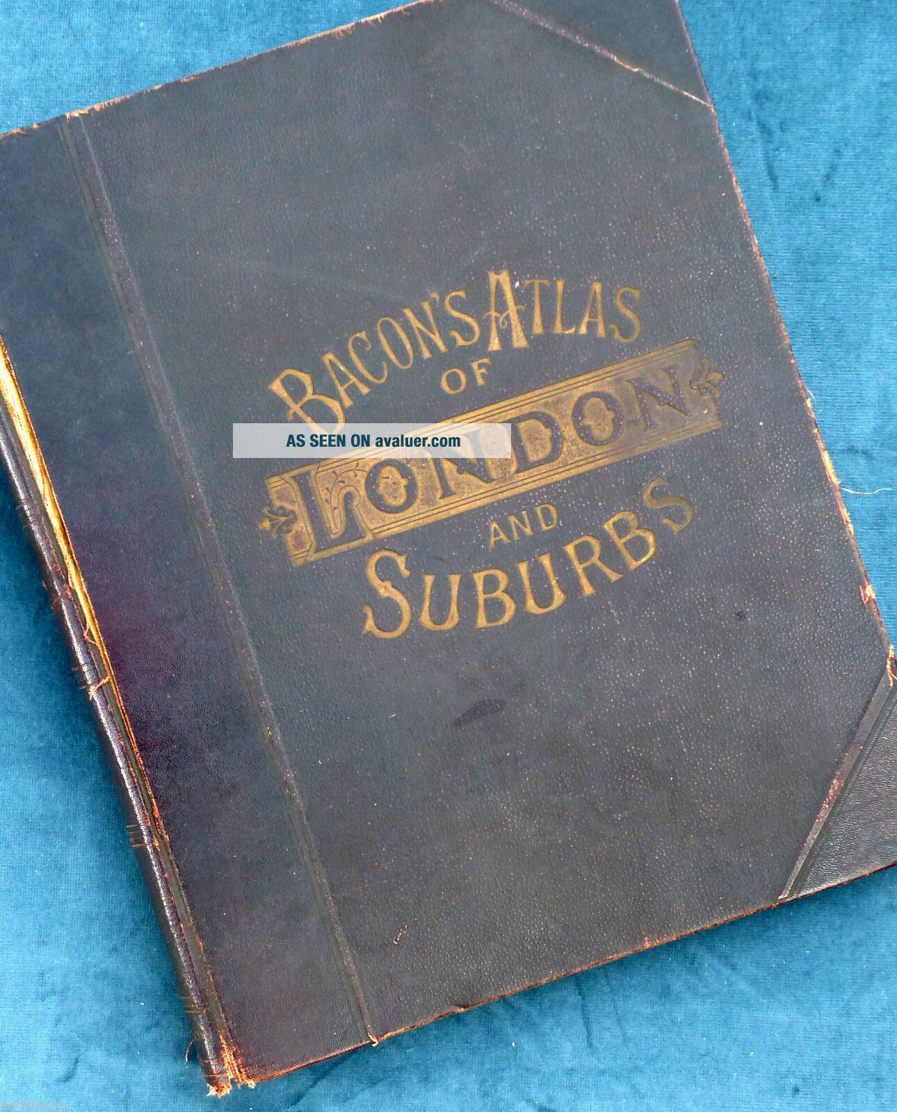
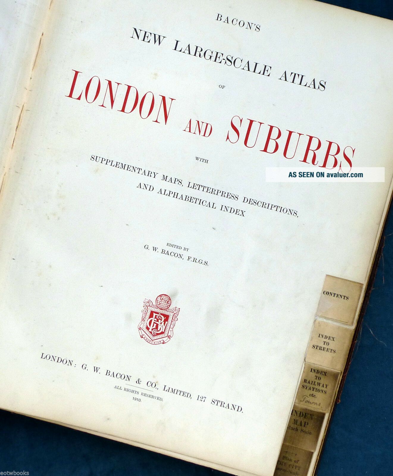
1910 MAP SIZE:Folio : approx 52 x 35 cm, (&nb...sp;20.5 x 13.5 inches.) IMAGE SIZE: Approx 46 x 30 cm, ( 18 x 12 inches.) PROVENANCE: Sourced from the London & Suburbs Published & Edited by G.W. Bacon. ( Please note that virtually all antique and vintage maps and prints have been rescued from old dis-bound from books or atlas's .) MAP DESCRIPTION : A large and original antique map / city street plan sourced from the 1910 edition of Bacon's "London & Suburbs", Lithographic print with original colouring. Scale 4 inch = 1 mile. ( Please note the listing is for the map as described only , any photo's showing the atlas from where the map came from is for information / provenance purposes only.) VERSO: There are no images and/or text printed on the reverse side . CONDITION: A large Original Antique map in Very Good condition - suitable for framing. Large map with centre fold (small repair confined to margin only) . Usual guide remains to back , else clear , with just normal aging / marking confined to map edges, consistent with light usage only. Important Note : Virtually all antiquarian maps and prints are subject to some normal aging due to use and time which is not obtrusive unless otherwise stated. Most higher quality 19th C atlas's mounted maps on" guides" , traces of this will often remain to the back , with no detrimental effect to the map itself.We grade our maps to the following criteria , we do not sell maps below these standards ; Excellent Condition - Clean and bright, with crisp engraved lines. On sound paper with wide margins. Very Good Condition - Clean and bright, with crisp engraved lines. On sound paper with no imperfections in the image. Small tears or minor discoloration in the margin only. Good Condition - No significant imperfections. Minor spotting / foxing, reinforcement / repair to centerfold with no image loss, or light overall age toning may be present. May have narrow margins but paper is still sound. DECLARATION OF AUTHENTICITY: We guarantee the map to be an authentic historic print, published at the date stated above. We do not sell reproductions. We include a photograph of the Atlas the original print has been taken from within the photograph section below as evidence of its provenance. CERTIFICATE OF AUTHENTICITY ISSUED WITH THIS MAP.
Shipping and Payment TermsOur preferred payment method is via Paypal , however Payment may be made via credit / debit card if preferred via Paypal. We regret we no longer are able to accept cheques as payment. Shipping in the Uk is made via Royal Mail 2nd class post unless otherwise specified / requested. Proof of postage is retained. Shipping outside the UK , where allowed, is via Royal Mail Airmail . Countries shipped to are restricted in most cases to North America and countries within the EU. Please contact us for rates for other countries.
Other InformationWe endeavour to ensure that the description of both the Guide Book and its condition are accurate. If you are dissatisfied in the first instance please contact us with full details the issue so we can try to rectify the problem. If this is not possible the item can be returned within 14 days of arrival in its original state and packaging for a refund of the purchase price. ( Return postage will only be refunded where an error has been made on our behalf ). At End of The World Books we endeavour to give detailed and accurate descriptions to all our guide-book auctions. All photographs and descriptions are specific to the guide-book for sale. We do not use library shots. Our assessments of the guide-books condition are made in relation to the standard ebay and industry wide standards. We tell it like it is ...it is in no-ones interest to have a customer dissatisfied with their purchase! About Me My Auctions Add to Favorites Contact Me
DecoBars Design copyright Shipscript © 2006
Powered by eBay Turbo Lister
Track Page Views With
Auctiva's FREE Counter