Three Large Mexico Pictorial Maps By Miguel Gomez Medina & Jo Mora


Item History & Price

Information:
Reference Number: Avaluer:35401Type: Pictorial/Bird's Eye
Country/Region: Mexico
Original Description:
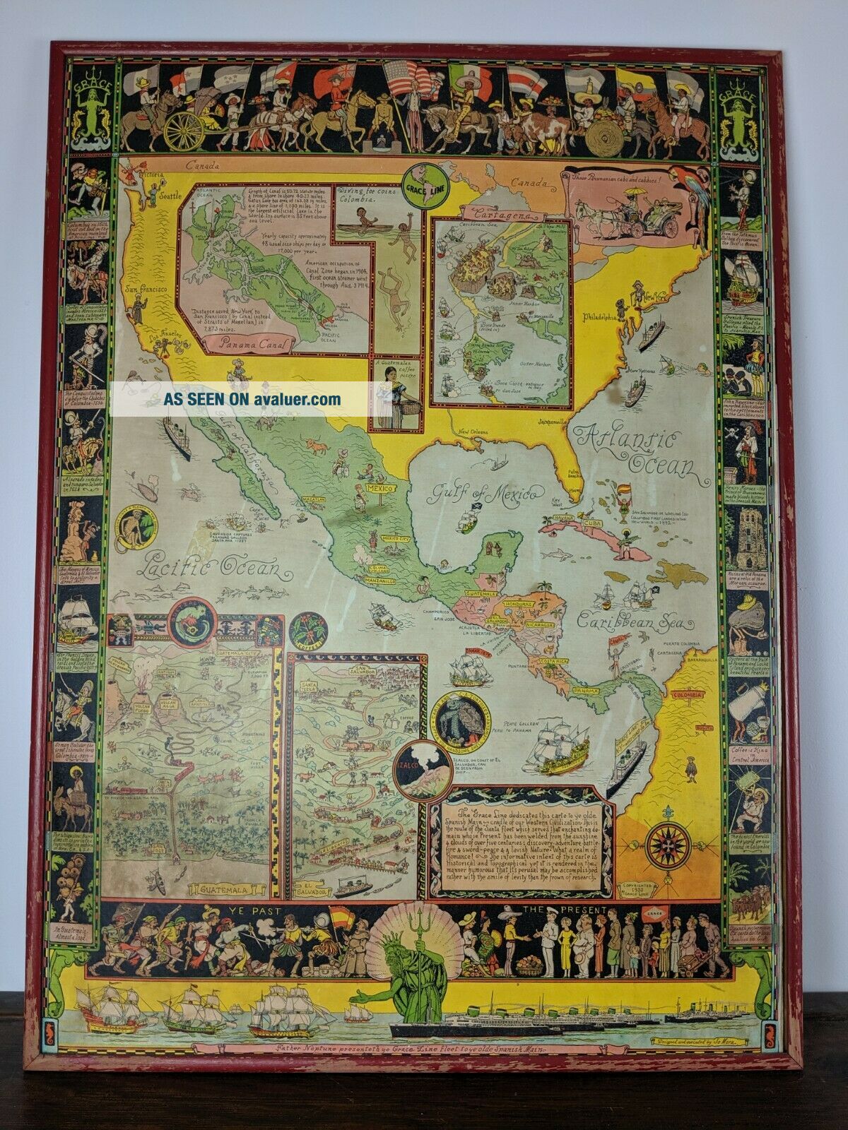
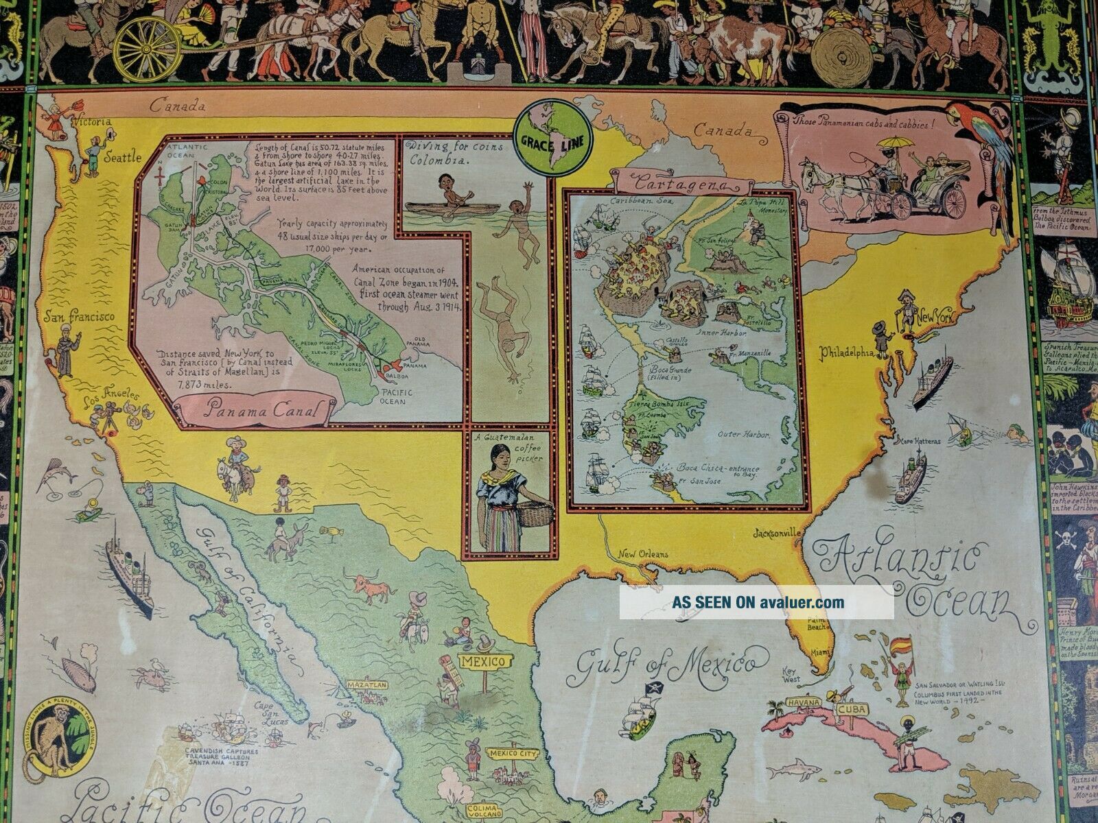
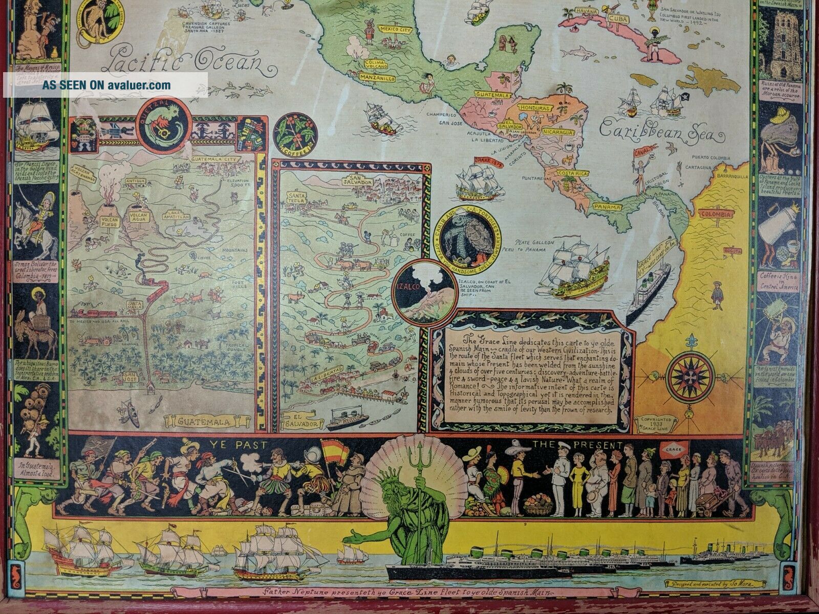
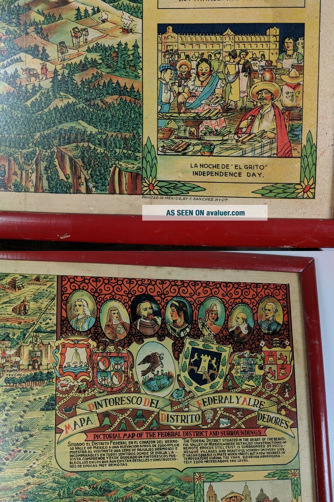
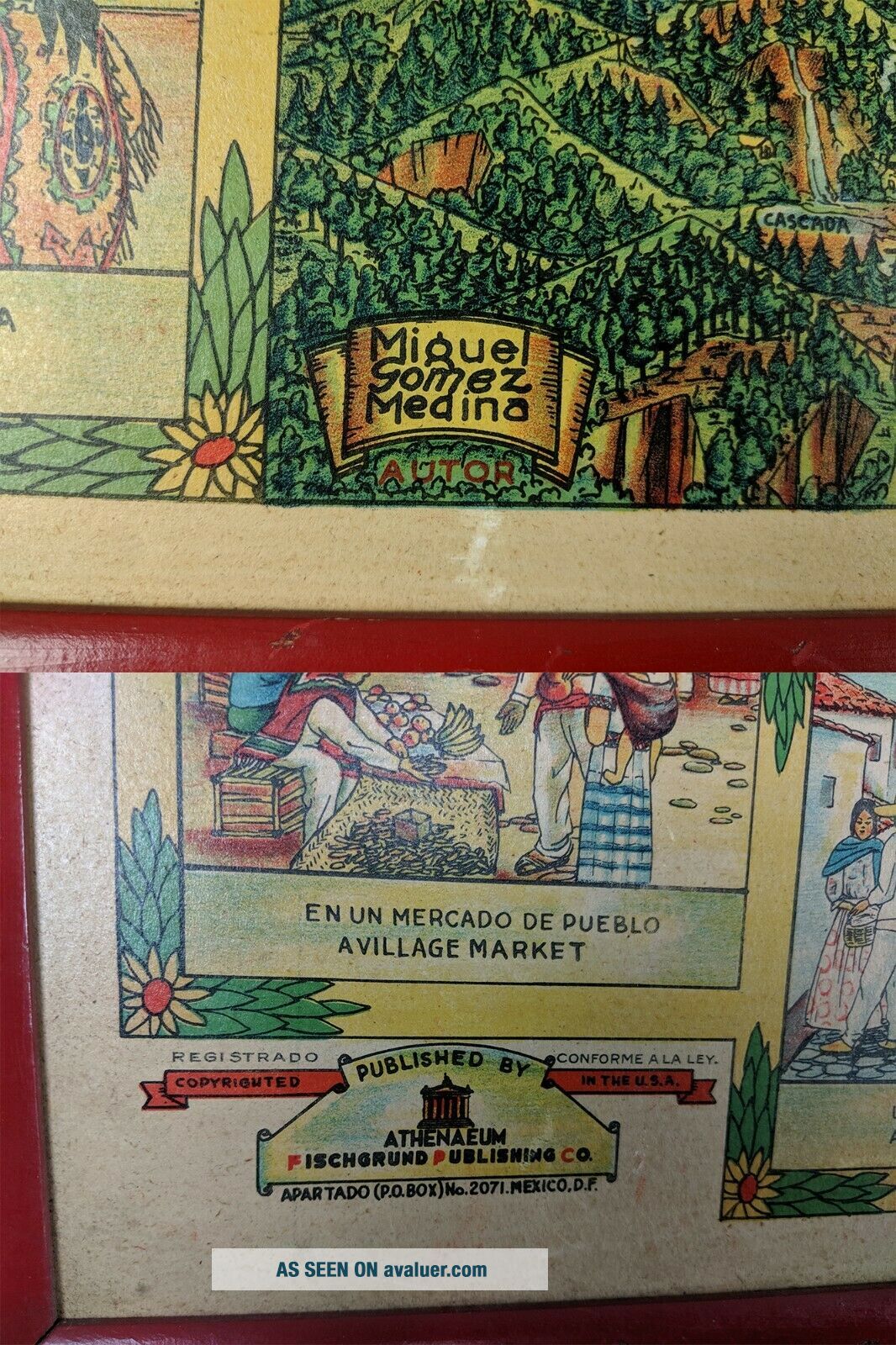
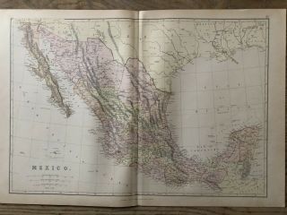
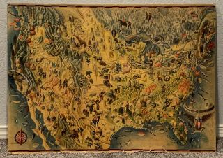
Group of three pictorial maps of Mexico, two by Miguel Gomez Medina and one by Jo Mora for Grace Line. 
MEXICO PICTORIAL MAP by Miguel Gomez Medina - Framed dimensions are 28" wide by 19" tall.GRACE LINE by Jo Mora - Framed dimensions are 24" wide by 32.5" tall.LARGE MAP by Miguel Gomez Medina - Framed dimensions are 40.5" wide by 28" tall.
Had to edit some pictures of the third map into the same image slot to cut down to 12 images. Feel free to contact me with any questions..., or I can provide additional images. 


    Similar items


  • Vintage 1952 Goodyear Mexico Highway Map By Miguel Covarrubias

    Vintage 1952 Goodyear Mexico Highway Map By Miguel Covarrubias

  • Vintage Postcard Mexico Pictorial Map Of Mexico Miguel Gomez Medina

    Vintage Postcard Mexico Pictorial Map Of Mexico Miguel Gomez Medina

  • 1884 Mexico Large Coloured Antique Map By W.  G.  Blackie

    1884 Mexico Large Coloured Antique Map By W. G. Blackie

  • Mexico Pocket Map By Rand Mcnally,  1911,  Large Format,  Quite Rare

    Mexico Pocket Map By Rand Mcnally, 1911, Large Format, Quite Rare

  • Vintage Birds Eye View Art Usa & Mexico Map By Miguel Covarrubias 1942 Print

    Vintage Birds Eye View Art Usa & Mexico Map By Miguel Covarrubias 1942 Print

  • Cambridge: Vintage Pictorial Map By Kerry Lee,  C1948

    Cambridge: Vintage Pictorial Map By Kerry Lee, C1948

  • 100 Large Roman England Map By J Andrews C1797 Colour

    100 Large Roman England Map By J Andrews C1797 Colour

  • Arizona Welcomes You Cartoon Pictorial Map By George M Avey (1942) [16.  75x21]

    Arizona Welcomes You Cartoon Pictorial Map By George M Avey (1942) [16. 75x21]


    • You might also like


    • 1860 Mitchell Hand Colored Map Colorado,  Nebraska & Kansas - Civil War Era

      1860 Mitchell Hand Colored Map Colorado, Nebraska & Kansas - Civil War Era

    • 18th Century French Map Of North America

      18th Century French Map Of North America

    • Las Vegas Nevada Vintage 1967 Us Geological Survey Quadrangle Map 4 Panels

      Las Vegas Nevada Vintage 1967 Us Geological Survey Quadrangle Map 4 Panels

    • Rare Antique 1845 Maps United States Exploring Expedition Book Antartica Hawaii

      Rare Antique 1845 Maps United States Exploring Expedition Book Antartica Hawaii

    • Vintage 1926 Map Hollywood From The Best Surveys Of The Time

      Vintage 1926 Map Hollywood From The Best Surveys Of The Time

    • American Continent (western Hemisphere) 1747 Bowen Antique Copper Engraved Map

      American Continent (western Hemisphere) 1747 Bowen Antique Copper Engraved Map

    • Gulf Coast Florida Texas United States 1705 De Fer Unusual Antique Engraved Map

      Gulf Coast Florida Texas United States 1705 De Fer Unusual Antique Engraved Map

    • California As Island United States 1700 De Fer Unusual First Edition Antique Map

      California As Island United States 1700 De Fer Unusual First Edition Antique Map

Avaluer          About Us          Privacy Policy          Contact Us          UP
© 2022, avaluer.net, Inc. or its affiliates