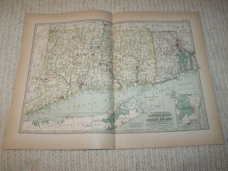
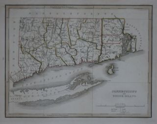
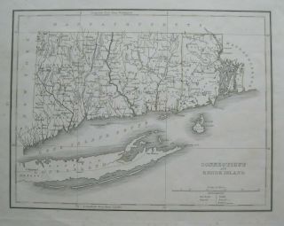
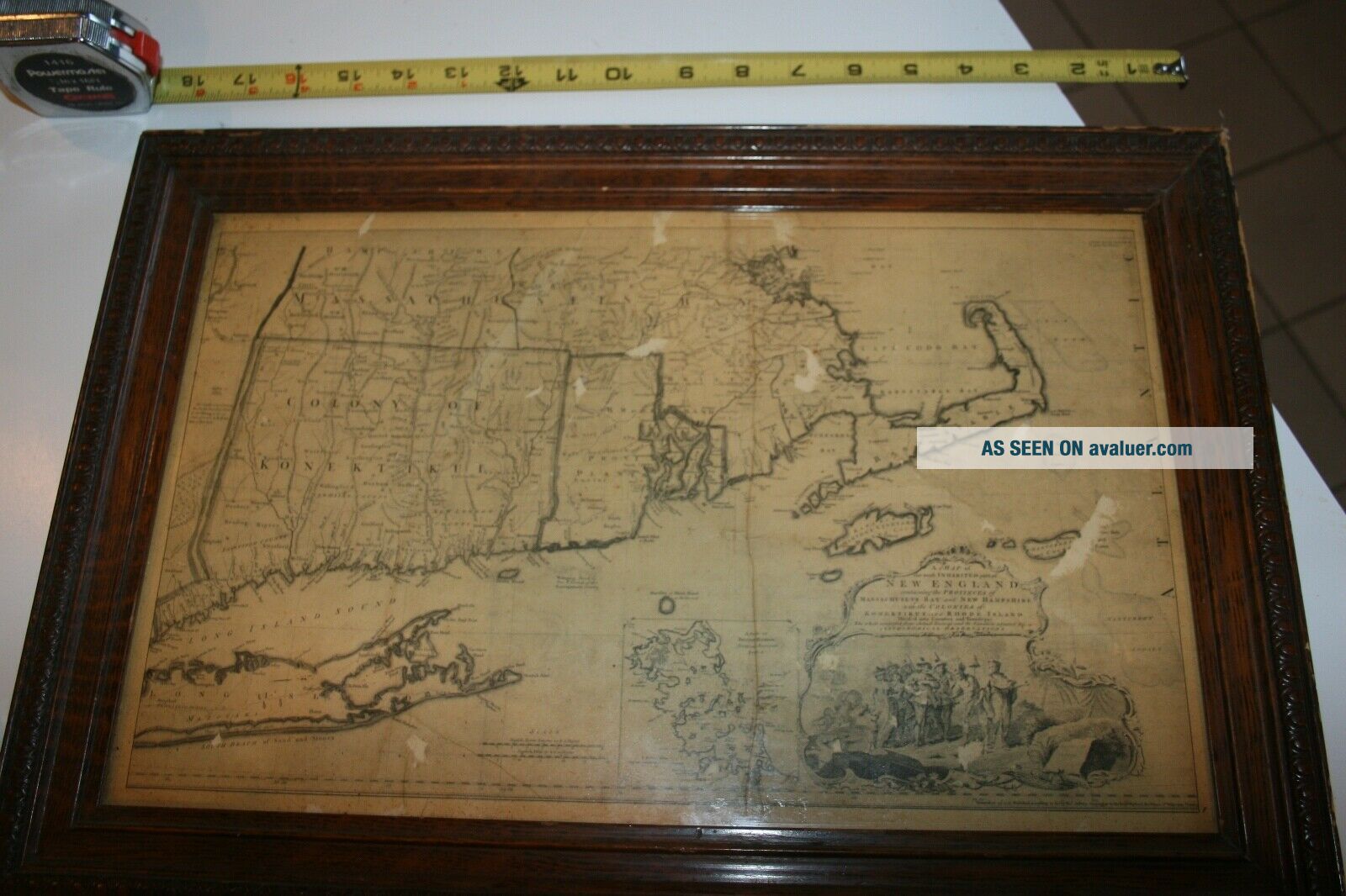
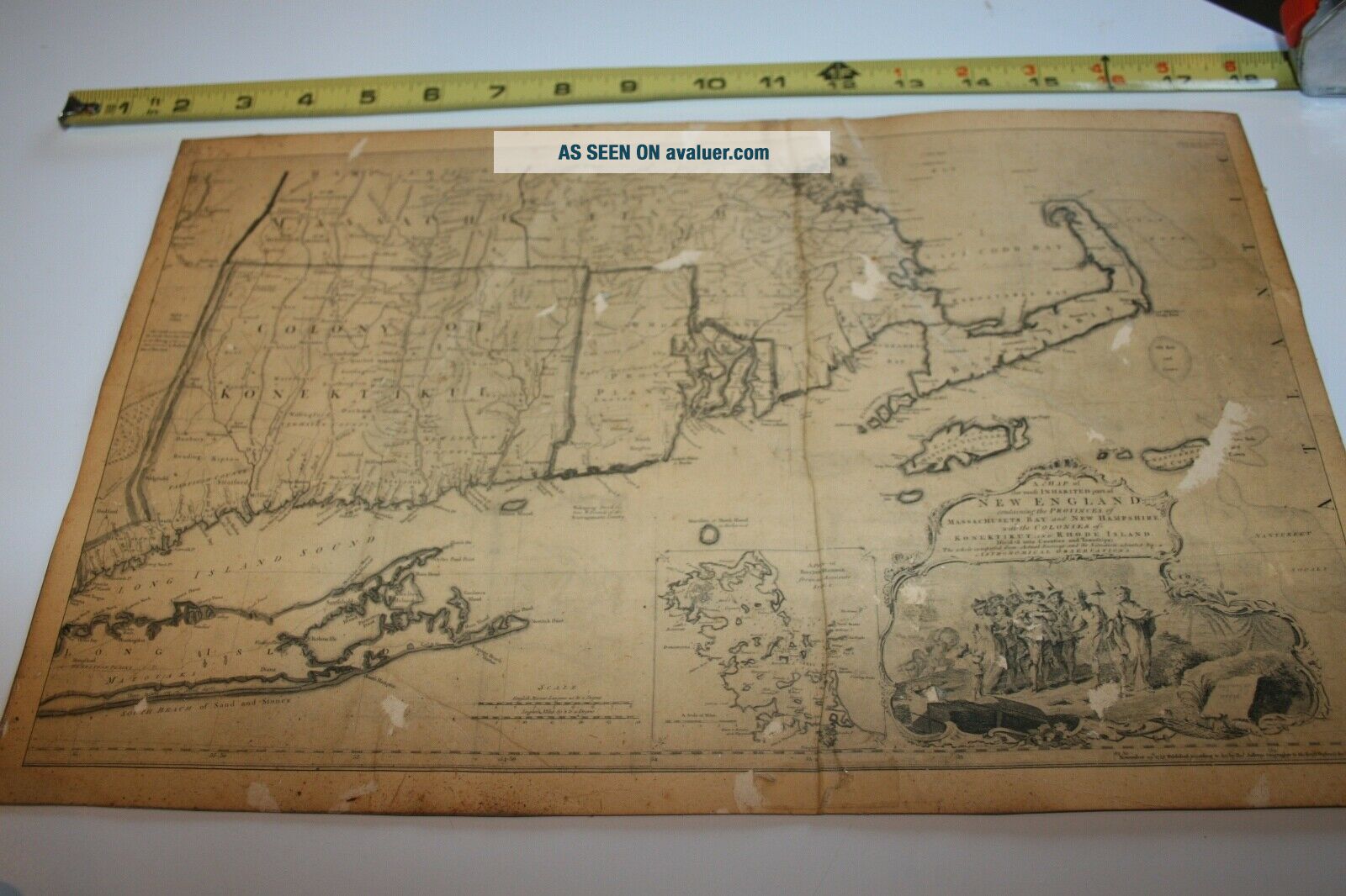
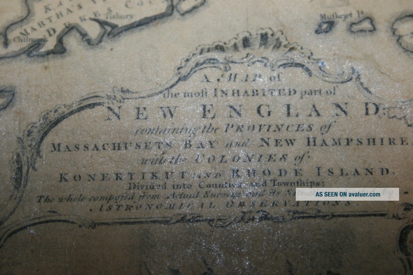
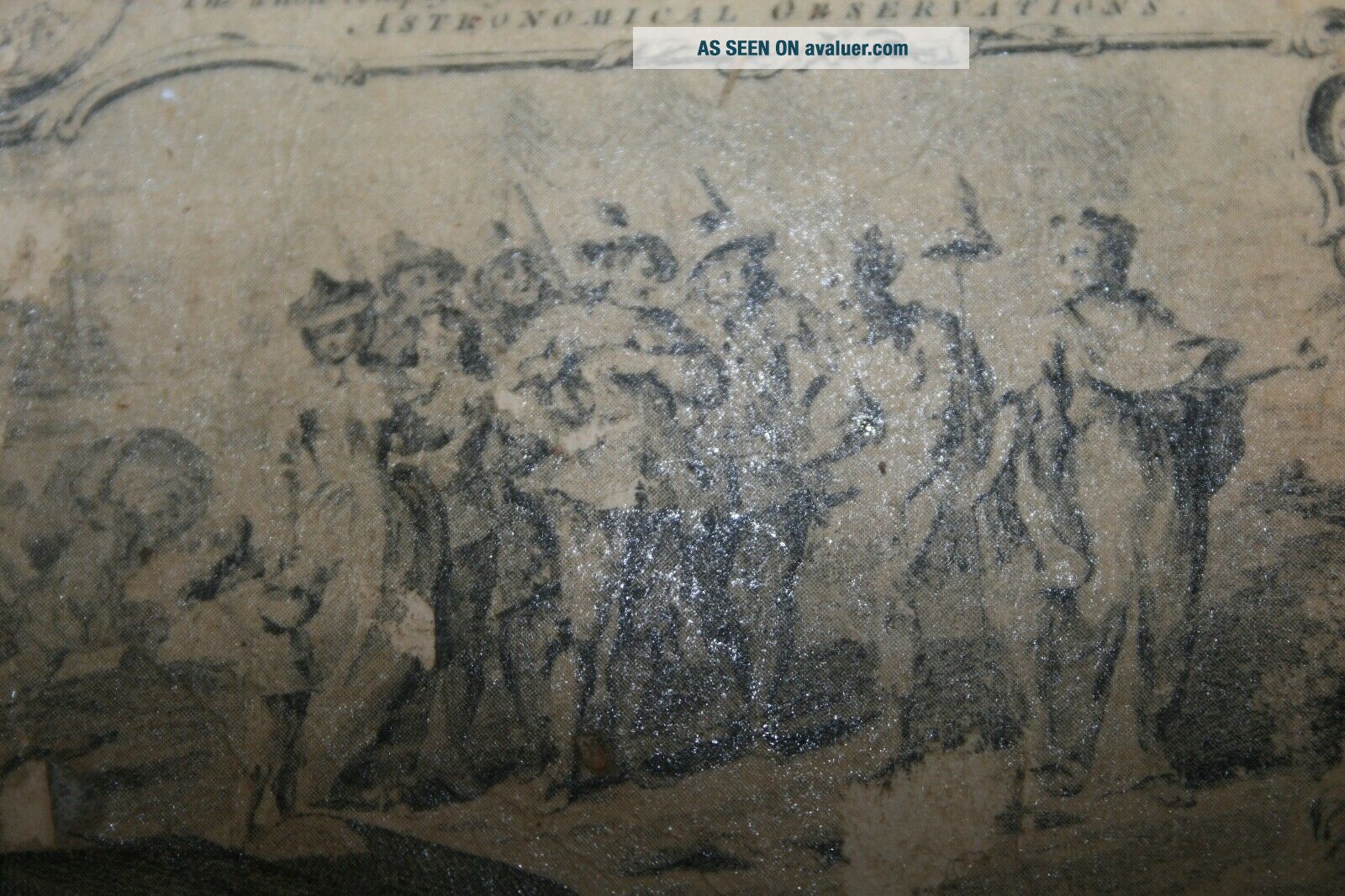
Vintage Thomas Jefferys Map Connecticut, Rhode Island, Massachusetts 1755


Item History & Price

Information:
Reference Number: Avaluer:35751Publication Year: 1755
Year: 1755Features: Vintage
US State: ConnecticutCartographer/Publisher: Thomas Jefferys
Topic: MapsType: Map
Original Description:
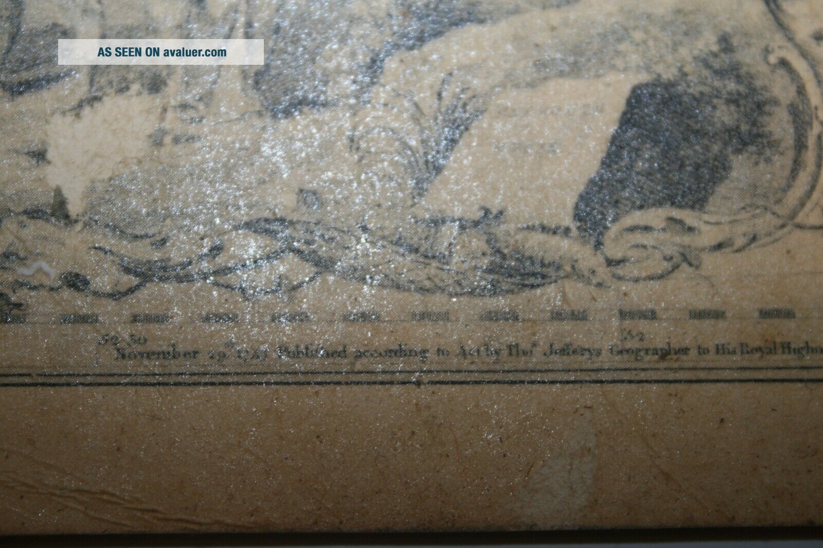
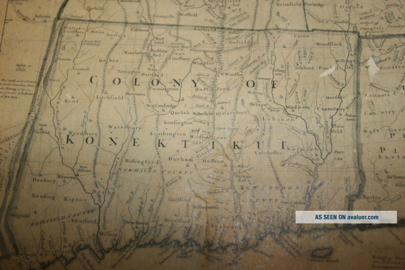
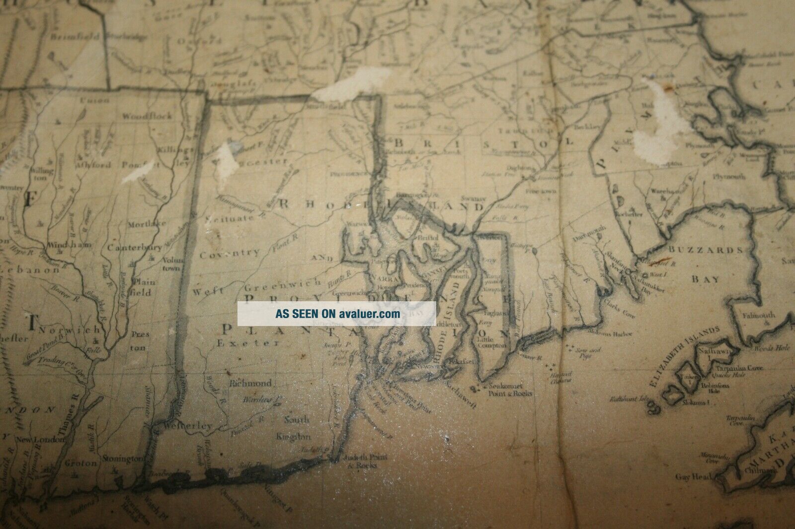
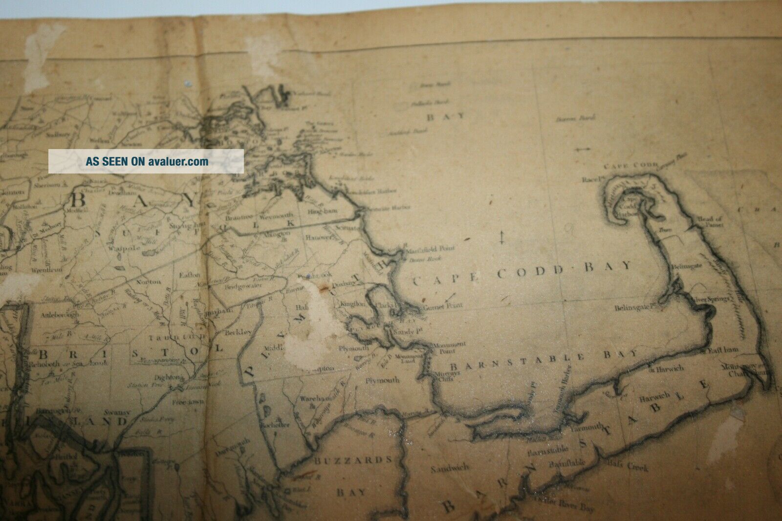
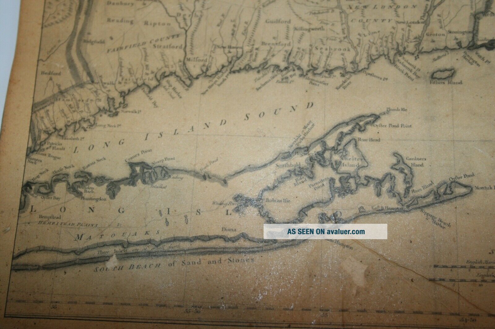
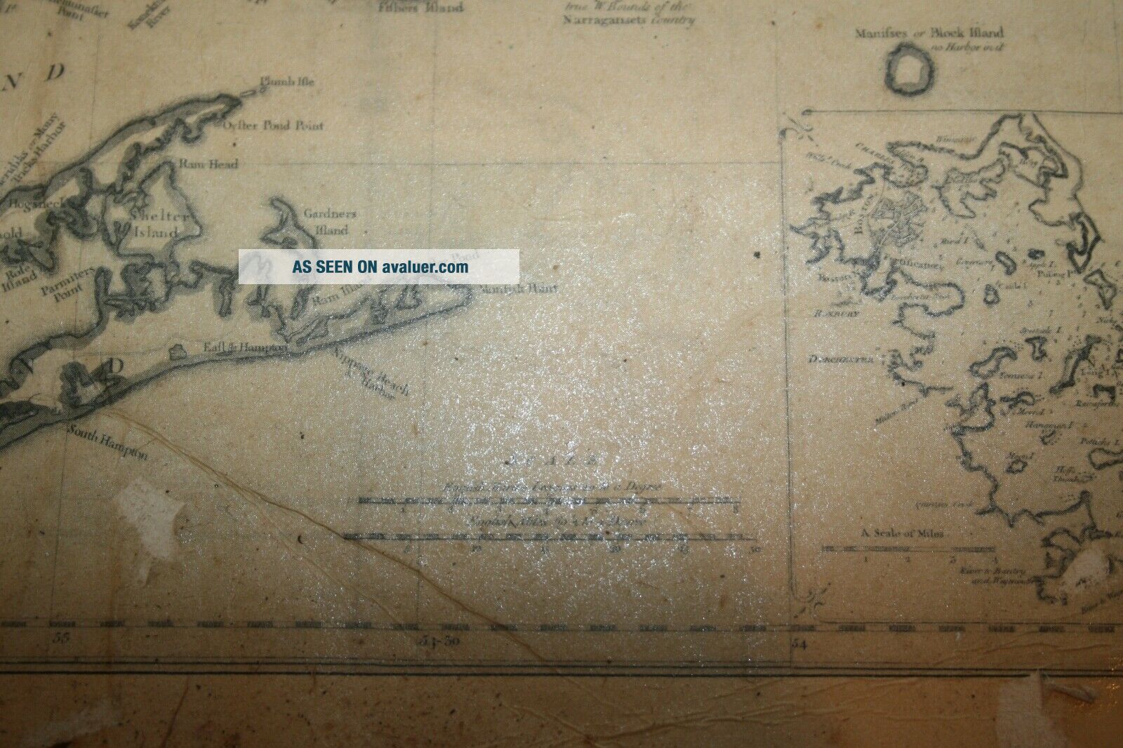
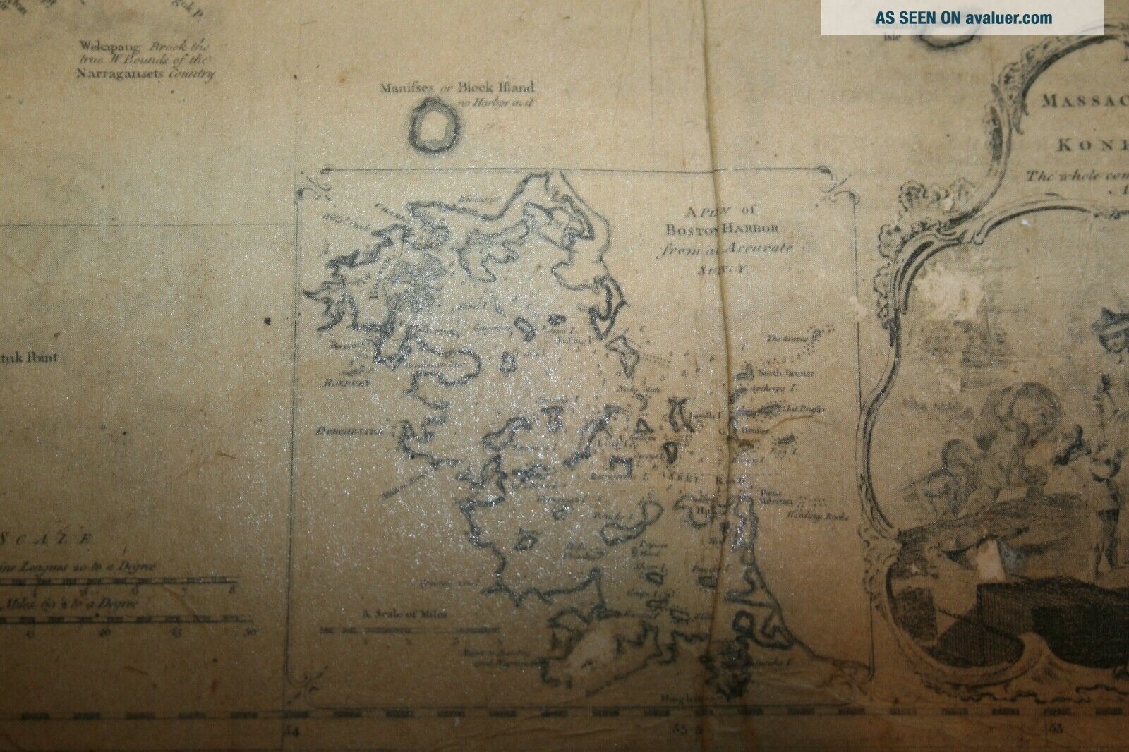
Thomas Jefferys 1755 map of Connecticut (Konnektikut), Rhode Island Plantation, & Massachusetts  (Massachusets Bay).
Has folds & surface losses (see pics).
Original old map.
Framed at 18 1/2 X 12 3/4.


    Similar items


  • Vintage Usgs Topo Map Connecticut Rhode Island York Mystic

    Vintage Usgs Topo Map Connecticut Rhode Island York Mystic

  • Vintage 1933 Gulf Massachusetts Connecticut Rhode Island Gas Station Road Map - P5

    Vintage 1933 Gulf Massachusetts Connecticut Rhode Island Gas Station Road Map - P5

  • Vintage 1897 Map Connecticut & Rhode Island Century Atlas Double Page

    Vintage 1897 Map Connecticut & Rhode Island Century Atlas Double Page

  • Vintage 1973 Shell Massachusetts Connecticut Rhode Island Travel Road Map Box Z

    Vintage 1973 Shell Massachusetts Connecticut Rhode Island Travel Road Map Box Z

  • Vintage Texaco 1965 Massachusetts Connecticut Rhode Island Travel Road Map - Bx 4

    Vintage Texaco 1965 Massachusetts Connecticut Rhode Island Travel Road Map - Bx 4

  • 1835 Bradford Map Connecticut Rhode Island Canals Long Island Railroad

    1835 Bradford Map Connecticut Rhode Island Canals Long Island Railroad

  • 1835 Bradford Map Connecticut Rhode Island Canals Long Island Railroad

    1835 Bradford Map Connecticut Rhode Island Canals Long Island Railroad

  • 1903 Antique Rhode Island State Map Vintage Crams Atlas Map Of Rhode Island 8081

    1903 Antique Rhode Island State Map Vintage Crams Atlas Map Of Rhode Island 8081


    • You might also like


    • 1860 Mitchell Hand Colored Map Colorado,  Nebraska & Kansas - Civil War Era

      1860 Mitchell Hand Colored Map Colorado, Nebraska & Kansas - Civil War Era

    • 18th Century French Map Of North America

      18th Century French Map Of North America

    • Las Vegas Nevada Vintage 1967 Us Geological Survey Quadrangle Map 4 Panels

      Las Vegas Nevada Vintage 1967 Us Geological Survey Quadrangle Map 4 Panels

    • Rare Antique 1845 Maps United States Exploring Expedition Book Antartica Hawaii

      Rare Antique 1845 Maps United States Exploring Expedition Book Antartica Hawaii

    • Vintage 1926 Map Hollywood From The Best Surveys Of The Time

      Vintage 1926 Map Hollywood From The Best Surveys Of The Time

    • American Continent (western Hemisphere) 1747 Bowen Antique Copper Engraved Map

      American Continent (western Hemisphere) 1747 Bowen Antique Copper Engraved Map

    • Gulf Coast Florida Texas United States 1705 De Fer Unusual Antique Engraved Map

      Gulf Coast Florida Texas United States 1705 De Fer Unusual Antique Engraved Map

    • California As Island United States 1700 De Fer Unusual First Edition Antique Map

      California As Island United States 1700 De Fer Unusual First Edition Antique Map

Avaluer          About Us          Privacy Policy          Contact Us          UP
© 2022, avaluer.net, Inc. or its affiliates