Yosemite Pictorial Relief Map 1955


Item History & Price

Information:
Reference Number: Avaluer:36025Topic: Home Decor
Type: Pictorial/Bird's EyeCartographer/Publisher: Della Hoss
Year: 1955Original/Reproduction: Antique Original
US State: AZ, CA, CO, NM, NV, UT, CaliforniaFormat: Sheet Map
Date Range: 1950-1959
Original Description:
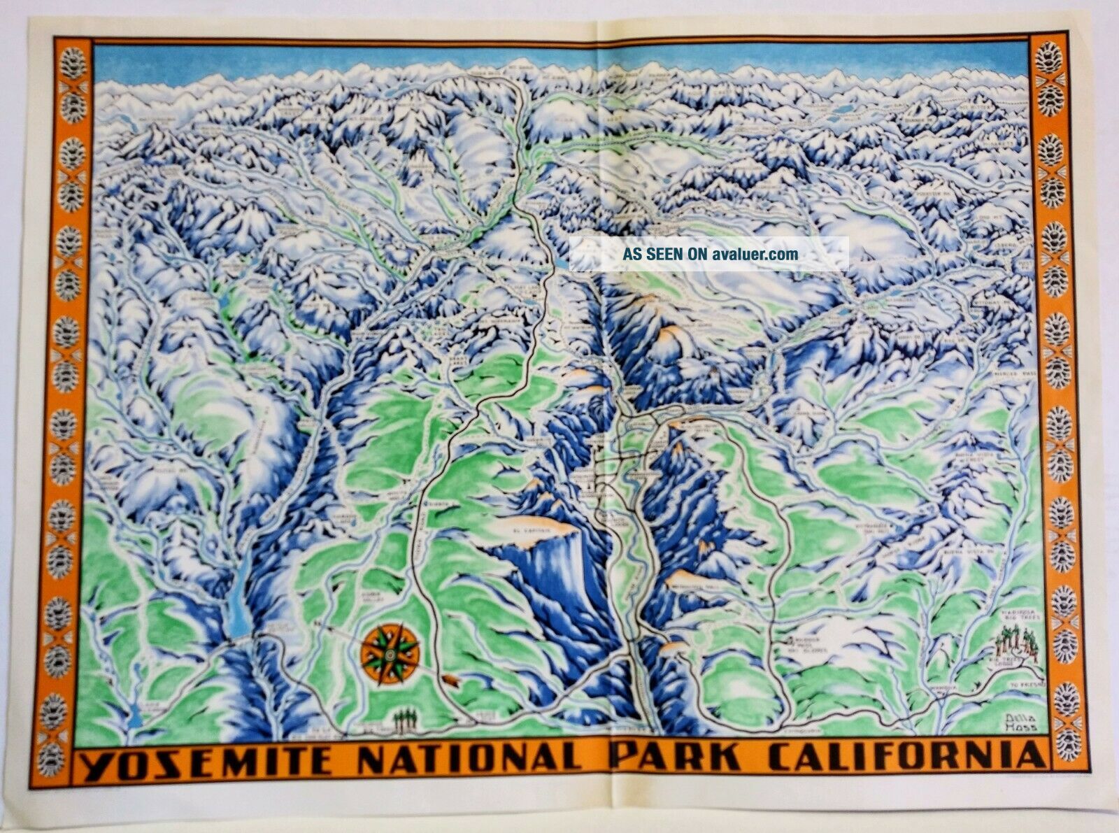
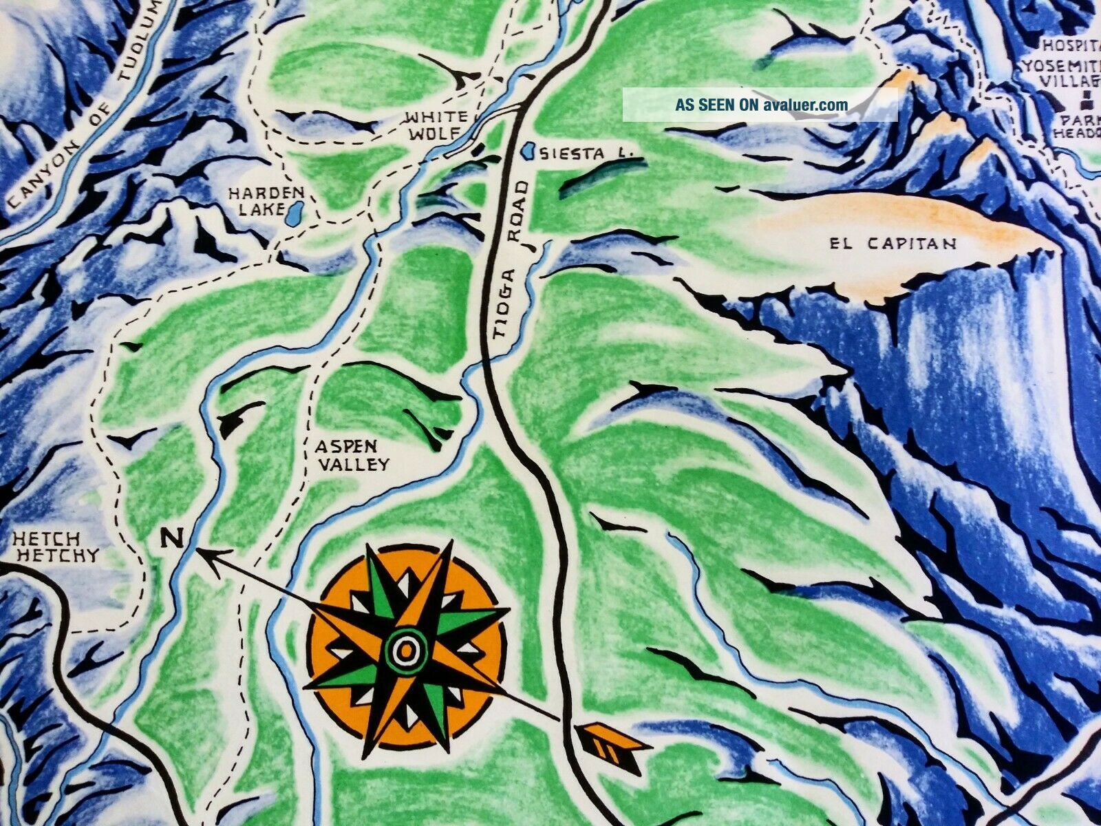
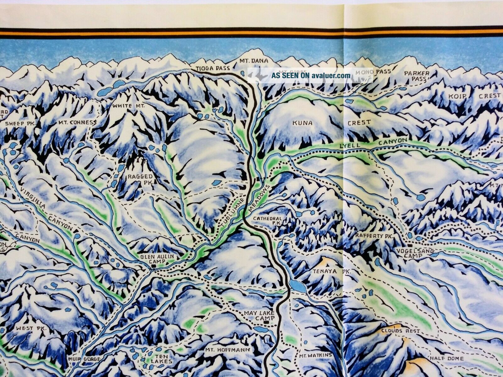
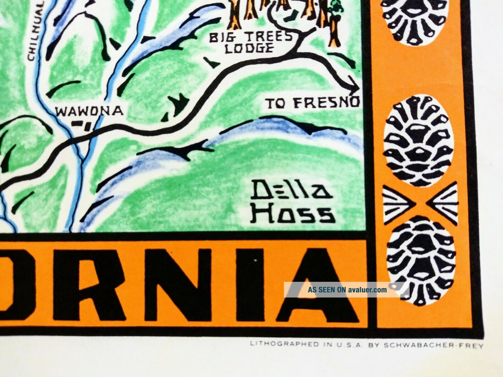
1955 Yosemite Shaded Pictorial Relief Map by Della Hoss. All major attractions shown. Beautiful compass rose and decorative border. In Good condition. 24 x 17 in. 

Any countries out of USA; please contact us for shipping quote.
All our maps & prints are original, we do not sell reproductions!


    Similar items


  • Vintage Pictorial Relief Map North Central Cascades By Martin Pargeter 1964

    Vintage Pictorial Relief Map North Central Cascades By Martin Pargeter 1964

  • Vintage Pictorial Relief Map North Central Cascades By Martin Pargeter 1964

    Vintage Pictorial Relief Map North Central Cascades By Martin Pargeter 1964

  • A.  J.  Nystrom Pictorial Relief Map Of Africa With Merging Colors 1pr4 (f)

    A. J. Nystrom Pictorial Relief Map Of Africa With Merging Colors 1pr4 (f)

  • 1916 Spokane,  Portland & Seattle Railroad,  Pictorial Relief Map

    1916 Spokane, Portland & Seattle Railroad, Pictorial Relief Map

  • Southeast Asia & Australia Pictorial Relief Map No.  Pr83 - 1,  Pull Down,  1965

    Southeast Asia & Australia Pictorial Relief Map No. Pr83 - 1, Pull Down, 1965

  • Rare 1923 Bernese Oberland Switzerland Tourist Brochure 3d Pictorial Relief Map

    Rare 1923 Bernese Oberland Switzerland Tourist Brochure 3d Pictorial Relief Map

  • Vintage Pictorial Olympic Mountains Relief Map By Martin Pargeter 1956

    Vintage Pictorial Olympic Mountains Relief Map By Martin Pargeter 1956

  • A Pictorial Rendu Map Of Michigan State University 1955 - Rare

    A Pictorial Rendu Map Of Michigan State University 1955 - Rare


    • You might also like


    • 1860 Mitchell Hand Colored Map Colorado,  Nebraska & Kansas - Civil War Era

      1860 Mitchell Hand Colored Map Colorado, Nebraska & Kansas - Civil War Era

    • 18th Century French Map Of North America

      18th Century French Map Of North America

    • Las Vegas Nevada Vintage 1967 Us Geological Survey Quadrangle Map 4 Panels

      Las Vegas Nevada Vintage 1967 Us Geological Survey Quadrangle Map 4 Panels

    • Rare Antique 1845 Maps United States Exploring Expedition Book Antartica Hawaii

      Rare Antique 1845 Maps United States Exploring Expedition Book Antartica Hawaii

    • Vintage 1926 Map Hollywood From The Best Surveys Of The Time

      Vintage 1926 Map Hollywood From The Best Surveys Of The Time

    • American Continent (western Hemisphere) 1747 Bowen Antique Copper Engraved Map

      American Continent (western Hemisphere) 1747 Bowen Antique Copper Engraved Map

    • Gulf Coast Florida Texas United States 1705 De Fer Unusual Antique Engraved Map

      Gulf Coast Florida Texas United States 1705 De Fer Unusual Antique Engraved Map

    • California As Island United States 1700 De Fer Unusual First Edition Antique Map

      California As Island United States 1700 De Fer Unusual First Edition Antique Map

Avaluer          About Us          Privacy Policy          Contact Us          UP
© 2022, avaluer.net, Inc. or its affiliates