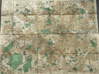
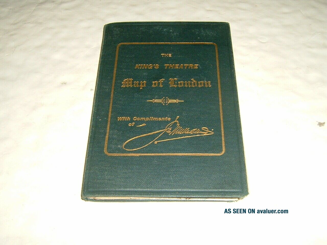
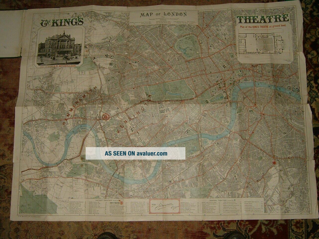
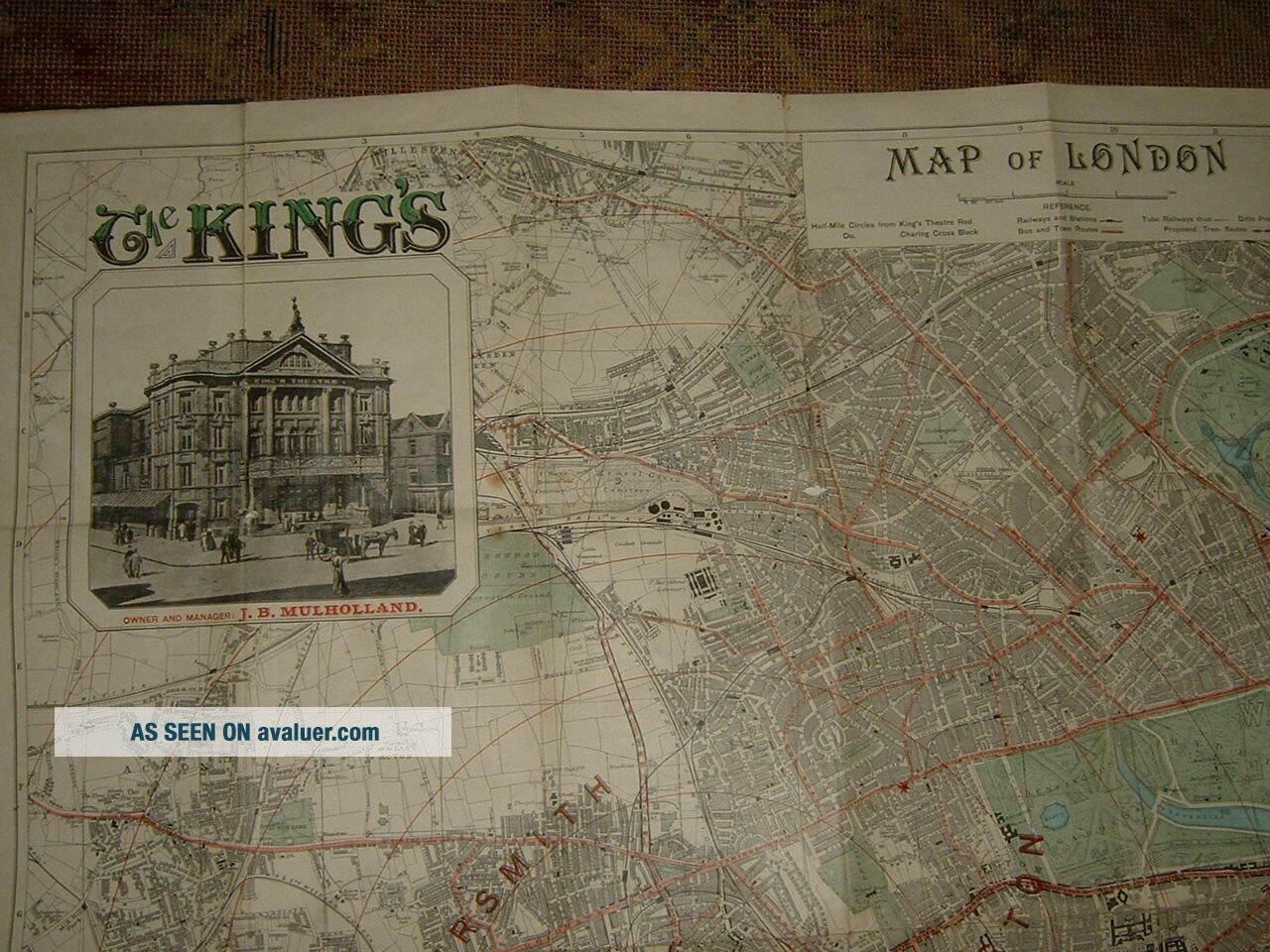
Bacon Map Of London Theatres 1902 Cloth 4 " To Mile Plan Of Kings Hammersmith


Item History & Price

Information:
Reference Number: Avaluer:36036County: London
Date Range: 1902Cartographer/Publisher: Bacon
Country/Region: LondonType: City Map
Original Description:
Unusual map, date 1901 (refers to construction of New Wyndham Theatre) prepared for  and based on Kings Theatre Hammersmith. Wear to one margin, see scans


    Similar items


  • 1930s? Bacon

    1930s? Bacon ' S Large Print Map Of London And Suburbs Cloth Boards

  • 1949 Bacon

    1949 Bacon ' S Large Print Map Of London And Suburbs Cloth Boards

  • Antique Bacon

    Antique Bacon ' S Picture Map Of London 1920 ' S Cloth Folded

  • Bacons Large Print Map Of London And Suburbs Cloth Vintage Map

    Bacons Large Print Map Of London And Suburbs Cloth Vintage Map

  • Vintage E.  J.  Larby " Through Route Map Of London And Suburbs " Cloth Map

    Vintage E. J. Larby " Through Route Map Of London And Suburbs " Cloth Map

  • Gall & Inglis

    Gall & Inglis ' Map Of London ; C. 1890 ? ; Cloth & In Colour.

  • Antique Map Bacons Map Of London Postal Areas Linen Backed Folding Map

    Antique Map Bacons Map Of London Postal Areas Linen Backed Folding Map

  • C1940

    C1940 ' S Bacon ' S Large Print Map Of London & Suburbs, Cloth, Hardback, Guide.


    • You might also like


    • Hungary & Romania 1579 (1584) Ortelius Unusual Antique Copper Engraved Map

      Hungary & Romania 1579 (1584) Ortelius Unusual Antique Copper Engraved Map

    • Brussels Bruxelles Belfium 1777 De Ferraris & Dupuis Large Antique Map Sheet Xxi

      Brussels Bruxelles Belfium 1777 De Ferraris & Dupuis Large Antique Map Sheet Xxi

    • 1616 Atlas Map Of Iceland.

      1616 Atlas Map Of Iceland.

    • Kazan Russia 1767 Le Clerc/lespinasse Antique Copper Engraved City View

      Kazan Russia 1767 Le Clerc/lespinasse Antique Copper Engraved City View

    • 1899 Stanford,  Folding Map Of Norwich,  Norfolk,  Arthur Collins,  Jarrold & Sons,

      1899 Stanford, Folding Map Of Norwich, Norfolk, Arthur Collins, Jarrold & Sons,

    • 1948 Vintage Linen Colour Map Geological Survey Ten Mile Of Great Britain

      1948 Vintage Linen Colour Map Geological Survey Ten Mile Of Great Britain

    • 1944 Map Flying Bombs Sussex Ww2 Newspaper Military Kent Courier German V1 V2

      1944 Map Flying Bombs Sussex Ww2 Newspaper Military Kent Courier German V1 V2

    • Dated 1638 Vellum Map Of Icklesham Sussex Showing Land Uses Owners Etc

      Dated 1638 Vellum Map Of Icklesham Sussex Showing Land Uses Owners Etc

Avaluer          About Us          Privacy Policy          Contact Us          UP
© 2022, avaluer.net, Inc. or its affiliates