Jersey SMALL Map: Dated 1891; Towns, Counties, RRs & 1890 Populations
Item History & Price
| Reference Number: Avaluer:3693631 | UPC: Does not apply |
I have many similar items in my ebay store. Please click to view. 1891 SMALL Engraved Color Map:
New Jersey
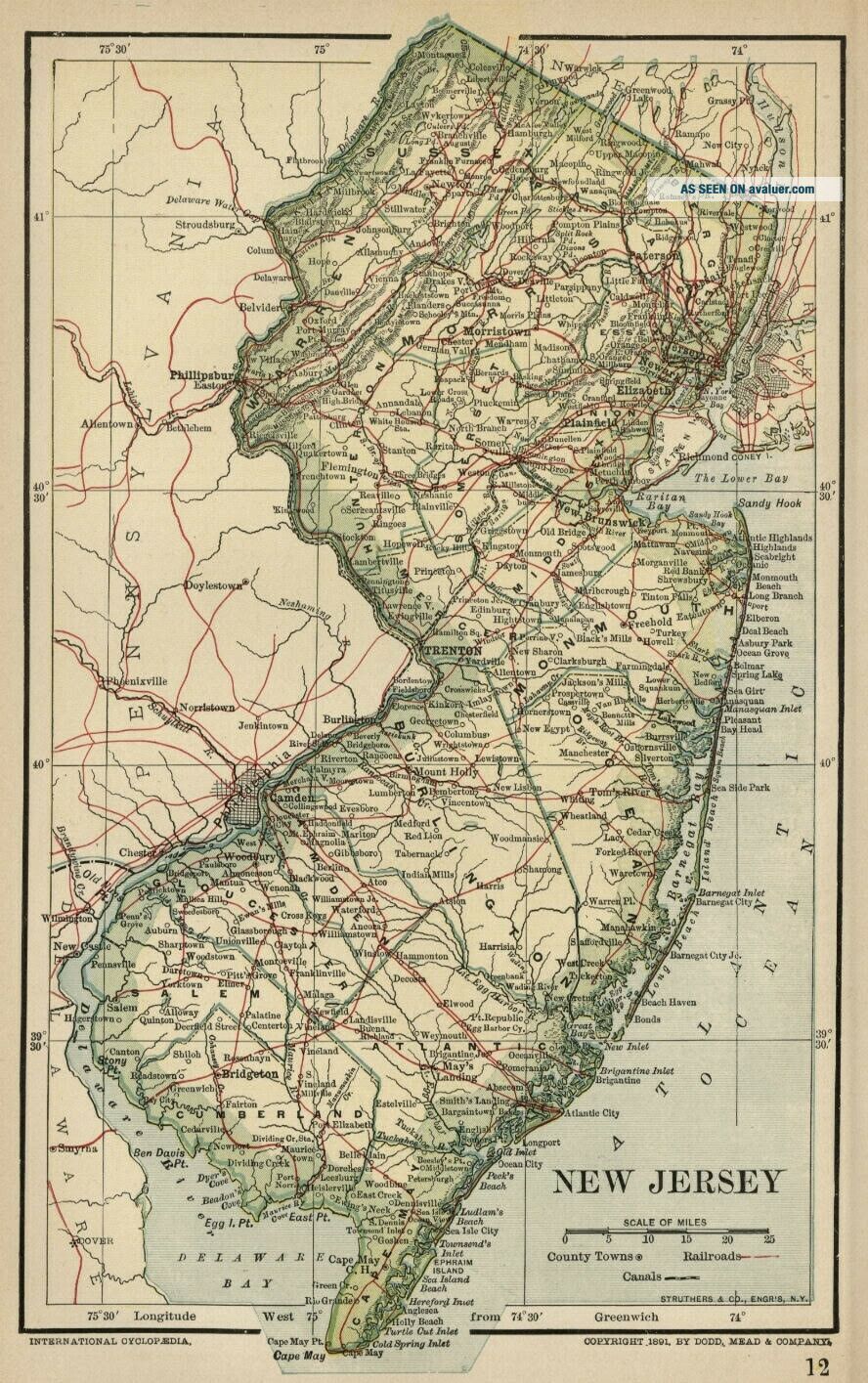
This is a genuine map from 1891 - NOT a Reproduction This SMALL color map of New Jersey is dated 1891 on the face and was included in an encyclopedia set published between 1891 and 1896.
Major railroads are shown and it is interesting to see where they run--and where they don't!
The map is printed on mediu...m weight paper, blank on the reverse with the exception of area and population figures (by county) from the 11th Census of 1890. (Total Population in New Jersey was 1, 444, 933!
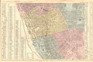
This printing is NOT part of the encyclopedia text, but was printed by the lithographer when the map itself was prepared. Sheet size is 6.5" x 9.75", and the image is approximately 5.25" x 8.5". Condition is Excellent The above illustration is a fairly accurate representation of the map. The close-up image below shows the area around Newark/Jersey City and is included to give an idea of the map's detail and quality.
This is an attractive map and would look good in an antique or contemporary frame.
Bid with confidence--Returnable for any reason within 10 days for prompt refund.
New Jersey
This is a genuine map from 1891 - NOT a Reproduction This SMALL color map of New Jersey is dated 1891 on the face and was included in an encyclopedia set published between 1891 and 1896.
Major railroads are shown and it is interesting to see where they run--and where they don't!
The map is printed on mediu...m weight paper, blank on the reverse with the exception of area and population figures (by county) from the 11th Census of 1890. (Total Population in New Jersey was 1, 444, 933!
This printing is NOT part of the encyclopedia text, but was printed by the lithographer when the map itself was prepared. Sheet size is 6.5" x 9.75", and the image is approximately 5.25" x 8.5". Condition is Excellent The above illustration is a fairly accurate representation of the map. The close-up image below shows the area around Newark/Jersey City and is included to give an idea of the map's detail and quality.
This is an attractive map and would look good in an antique or contemporary frame.
Bid with confidence--Returnable for any reason within 10 days for prompt refund.