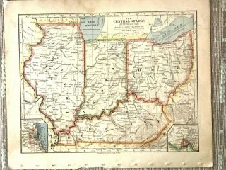
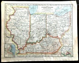
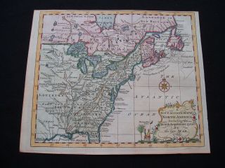
Engraved Antique Map Of The Central States (West. Part) /1883 By Charles M. Green


Item History & Price

Information:
Reference Number: Avaluer:3709078
Original Description:
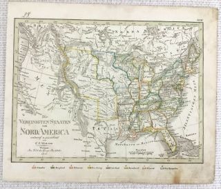
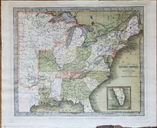
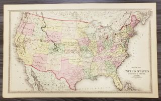
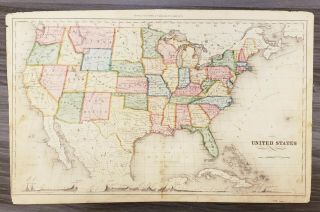
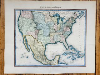
Up for sale is a nice engraved antique colored map of the Central States (Western Part) of the United States from 1883 by Charles M. Green in The American Universal Cyclopedia.  Published by Russell, Struthers & Co., New York.
It measures approximately 10 1/2 x 13 1/2 (including the border areas).  It is blank on the other side.
Will look very nice framed. 
Map is in generally goodcondition with most issues at the border areas where there are some chips and ...acouple of small rips that reach from the edge into the border area.  Some other smallerdiscolorations / expected light browning, but it does not affect the map.
There is a crease down the middle where it was originally bound.  
Please see my store for other great items. 
Inventory R-13

00420


    Similar items


  • 1842 Antique Map Of The United States Of America Rare Hand Coloured Engraving

    1842 Antique Map Of The United States Of America Rare Hand Coloured Engraving

  • Vintage Color Map Of The Central States - In,  Il,  Oh,  Ky Printed 1883

    Vintage Color Map Of The Central States - In, Il, Oh, Ky Printed 1883

  • Vintage Color Map Of The Central States Illinois,  Indiana,  Kentucky Printed 1883

    Vintage Color Map Of The Central States Illinois, Indiana, Kentucky Printed 1883

  • Antique Map Of The United States - Drawn & Engraved By John Rapkin (c.  1850 - 60)

    Antique Map Of The United States - Drawn & Engraved By John Rapkin (c. 1850 - 60)

  • Antique Map Of The United States By: David Burr,  1835

    Antique Map Of The United States By: David Burr, 1835

  • Antique Map Of The United States By: Warner & Beers,  1872

    Antique Map Of The United States By: Warner & Beers, 1872

  • Antique Map Of The United States By: Rand Mcnally,  1880

    Antique Map Of The United States By: Rand Mcnally, 1880

  • Antique Map Of The United States And Mexico By: Furne 1851

    Antique Map Of The United States And Mexico By: Furne 1851


    • You might also like


    • French Armillary Sphere Zodiac Orrery Solar System Space Astrology Astronomy

      French Armillary Sphere Zodiac Orrery Solar System Space Astrology Astronomy

    • 30” Antique Terrestrial Globe Manufactured By Weber Costello Co.

      30” Antique Terrestrial Globe Manufactured By Weber Costello Co.

    • Huge Vintage Military Aviation World Globe Denoyer Geppert Industrial - Antique

      Huge Vintage Military Aviation World Globe Denoyer Geppert Industrial - Antique

    • Denoyer Geppert 1940

      Denoyer Geppert 1940 ' S Vintage Chalkboard Globe -

    • Vintage Exceptional Trippensee Planetarium Complete,  All.

      Vintage Exceptional Trippensee Planetarium Complete, All.

    • Vintage Cram’s Universal Terrestrial Globe - 12 Inch

      Vintage Cram’s Universal Terrestrial Globe - 12 Inch

    • Antique 1880’s A.  H.  Andrews 6” Globe With Stand

      Antique 1880’s A. H. Andrews 6” Globe With Stand

    • 1763 Entick Map Colonial United States Canada Louisiana British Colonies Rare

      1763 Entick Map Colonial United States Canada Louisiana British Colonies Rare

Avaluer          About Us          Privacy Policy          Contact Us          UP
© 2022, avaluer.net, Inc. or its affiliates