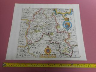
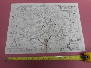
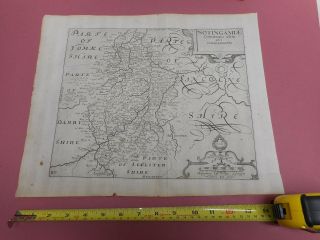
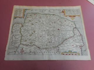
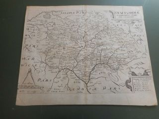
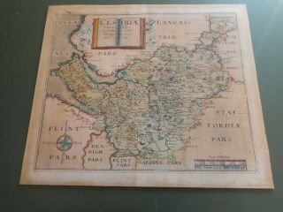
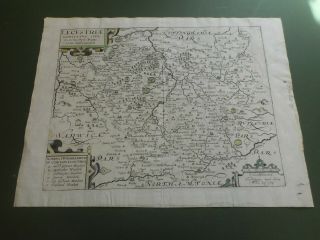
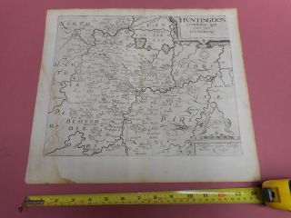
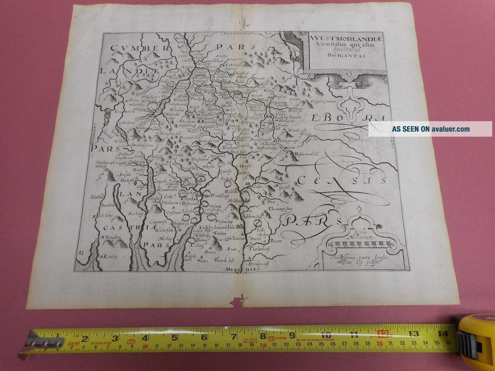
100 WESTMORLAND MAP BY SAXTON KIP C1637 SCARCE


Item History & Price

Information:
Reference Number: Avaluer:3718542Year: 1637
Original Description:
100% ORIGINAL WESTMORLAND  MAPBY SAXTON W KIP  C1637 EDITION 380MM X 280M   MAP IN  GOOD CONDITION NO TEARS NO REPAIRS   MINOR WORMING TO LOWER MARGIN ONLY  PART OF A COLLECTION LISTED TO BE LISTED OVER THE NEXT FEW WEEKS !!LOW POSTAGE FOR UK BUYERS COURIER RECORDED DELIVERYEUROPE £10.00 RECORDED DELIVERY ANY AMOUNT OF MAPSWORLDWIDE £12.00 RECORDED DELIVERY ANY AMOUNT OF MAPS  


    Similar items


  • 100 Oxfordshire Map By Saxton Kip C1637 Scarce Hand Coloured

    100 Oxfordshire Map By Saxton Kip C1637 Scarce Hand Coloured

  • 100 Staffordshire Map By Saxton Kip C1637 Scarce

    100 Staffordshire Map By Saxton Kip C1637 Scarce

  • 100 Nottinghamshire Map By Saxton Kip C1637 Scarce

    100 Nottinghamshire Map By Saxton Kip C1637 Scarce

  • 100 Norfolk Map By Saxton Kip C1637 Scarce Hand Coloured Vgc

    100 Norfolk Map By Saxton Kip C1637 Scarce Hand Coloured Vgc

  • 100 Staffordshire Map By Saxton Kip C1637 Scarce

    100 Staffordshire Map By Saxton Kip C1637 Scarce

  • 100 Cheshire Map By Saxton Kip C1610 Scarce Hand Coloured

    100 Cheshire Map By Saxton Kip C1610 Scarce Hand Coloured

  • 100 Leicestershire Map By Saxton Kip C1607 Scarce Latin Text Verso

    100 Leicestershire Map By Saxton Kip C1607 Scarce Latin Text Verso

  • 100 Huntingdonshire Map By Saxton Kip C1610 Scarce

    100 Huntingdonshire Map By Saxton Kip C1610 Scarce


    • You might also like


    • Hungary & Romania 1579 (1584) Ortelius Unusual Antique Copper Engraved Map

      Hungary & Romania 1579 (1584) Ortelius Unusual Antique Copper Engraved Map

    • Brussels Bruxelles Belfium 1777 De Ferraris & Dupuis Large Antique Map Sheet Xxi

      Brussels Bruxelles Belfium 1777 De Ferraris & Dupuis Large Antique Map Sheet Xxi

    • 1616 Atlas Map Of Iceland.

      1616 Atlas Map Of Iceland.

    • Kazan Russia 1767 Le Clerc/lespinasse Antique Copper Engraved City View

      Kazan Russia 1767 Le Clerc/lespinasse Antique Copper Engraved City View

    • 1899 Stanford,  Folding Map Of Norwich,  Norfolk,  Arthur Collins,  Jarrold & Sons,

      1899 Stanford, Folding Map Of Norwich, Norfolk, Arthur Collins, Jarrold & Sons,

    • 1948 Vintage Linen Colour Map Geological Survey Ten Mile Of Great Britain

      1948 Vintage Linen Colour Map Geological Survey Ten Mile Of Great Britain

    • 1944 Map Flying Bombs Sussex Ww2 Newspaper Military Kent Courier German V1 V2

      1944 Map Flying Bombs Sussex Ww2 Newspaper Military Kent Courier German V1 V2

    • Dated 1638 Vellum Map Of Icklesham Sussex Showing Land Uses Owners Etc

      Dated 1638 Vellum Map Of Icklesham Sussex Showing Land Uses Owners Etc

Avaluer          About Us          Privacy Policy          Contact Us          UP
© 2022, avaluer.net, Inc. or its affiliates