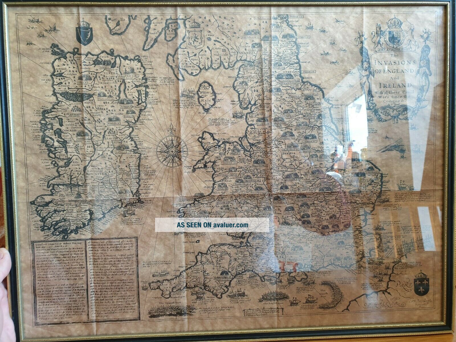
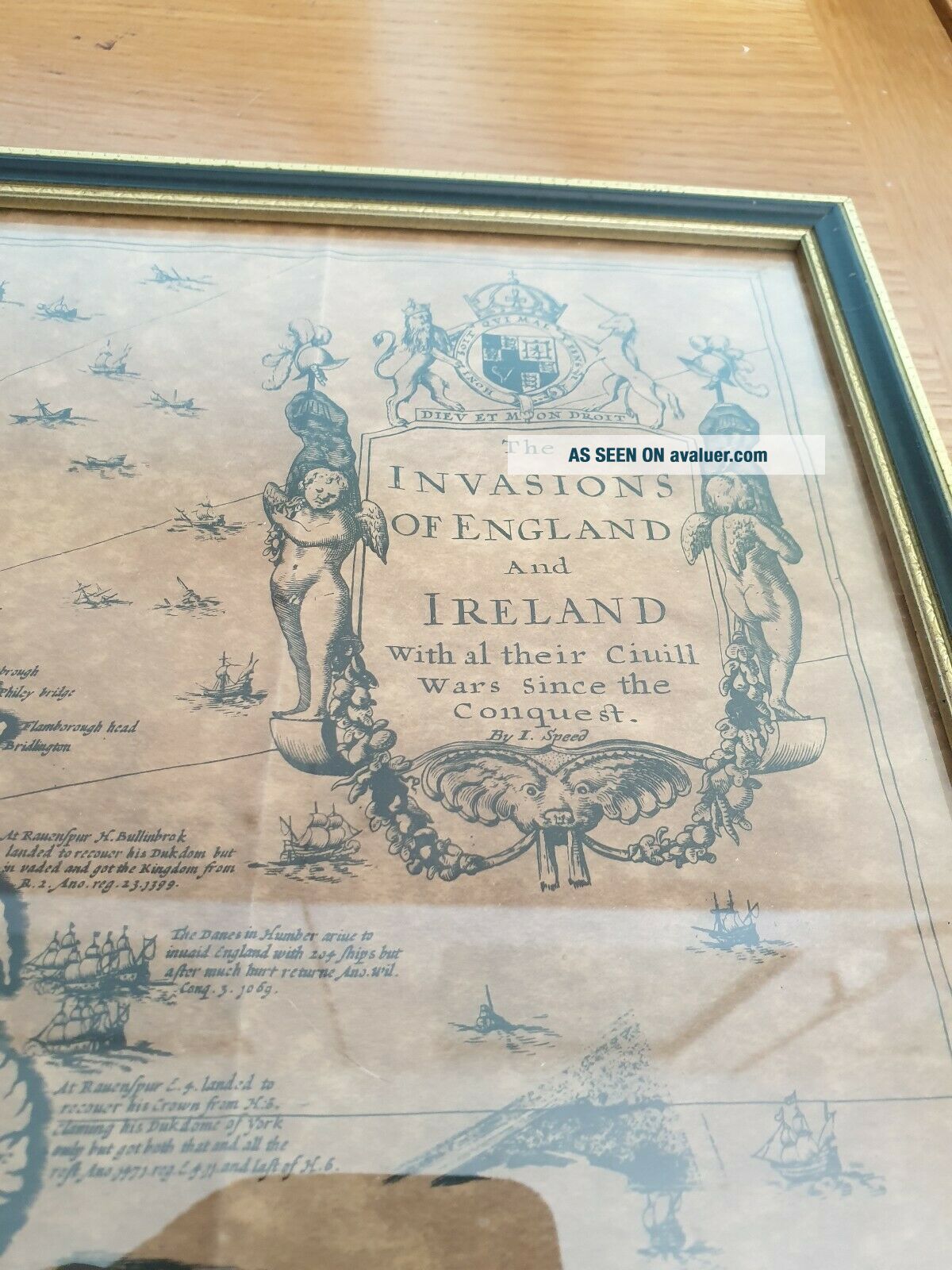
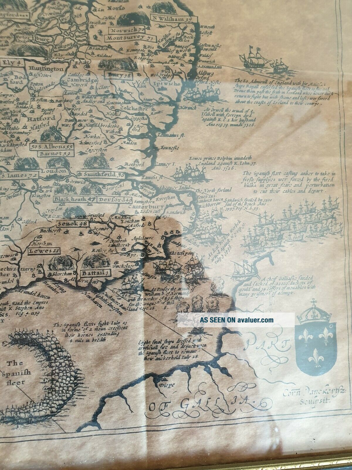
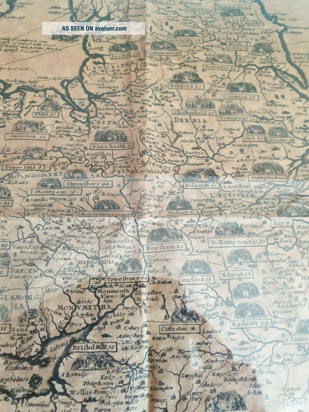
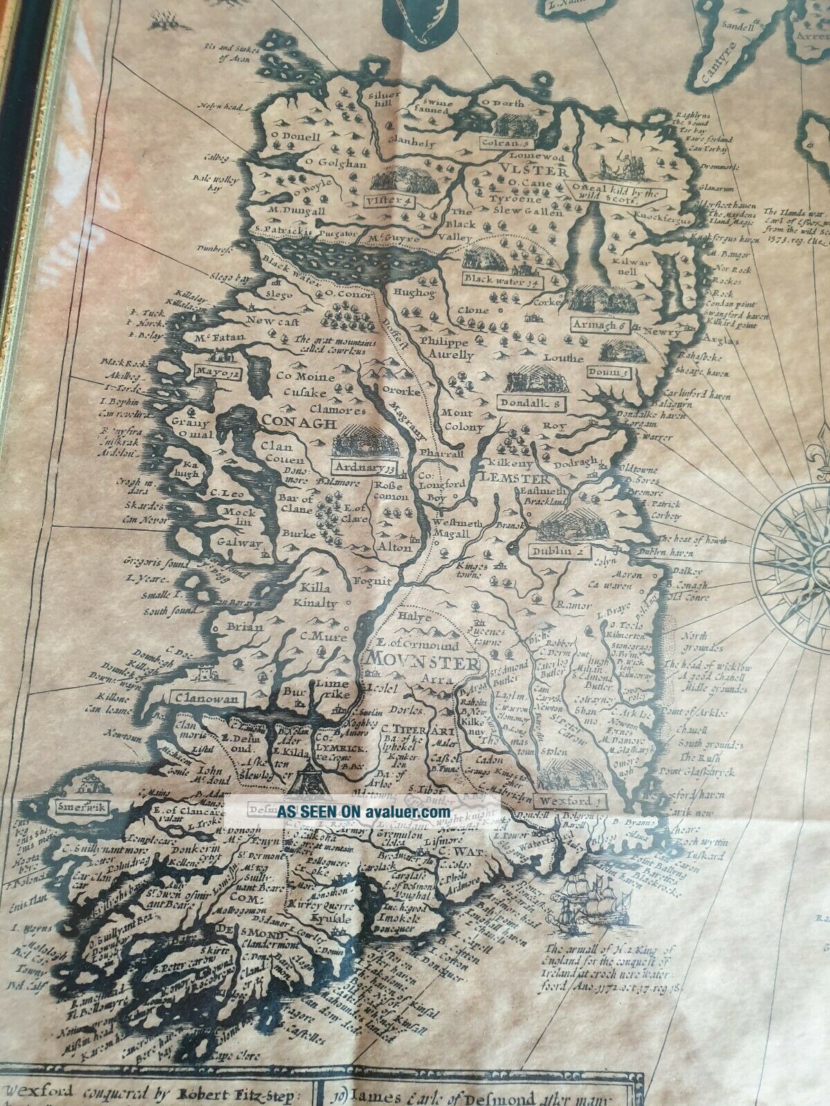
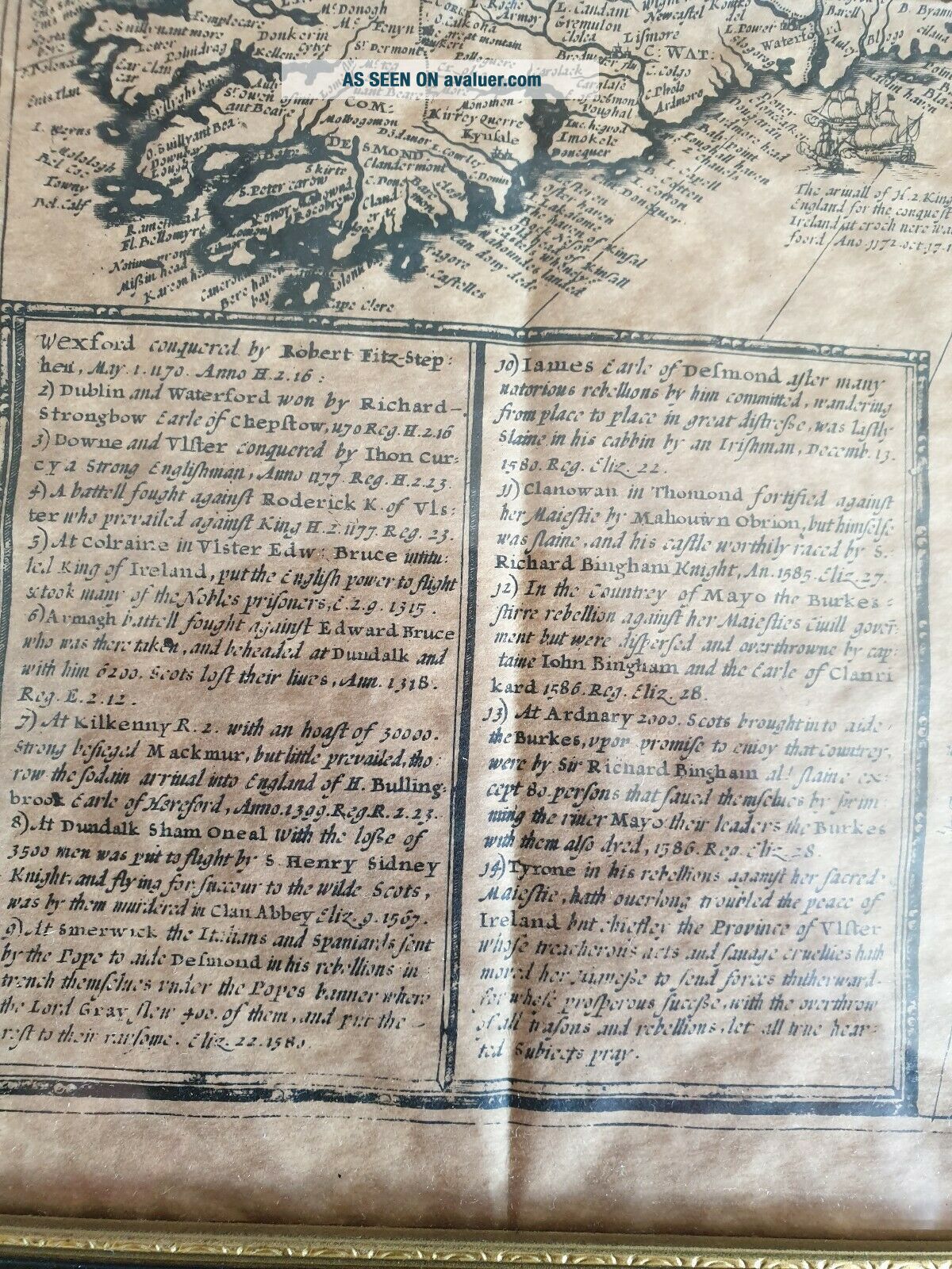
Antique John Speede ' The Invasions Of England And Ireland Map On Parchment


Item History & Price

Information:
Reference Number: Avaluer:3724103Cartographer/Publisher: John Speed
Original Description:
Antique John Speede 'The Invasions of England and Ireland Map On Patchment Framed

Fantastic condition framed.no damage or tears

Approx size 39cm x 59cm


    Similar items


  • Antique Vintage 1889 The Beginnings Of England John Fiske Hc Book

    Antique Vintage 1889 The Beginnings Of England John Fiske Hc Book

  • Antique Jacques & Son The Counties Of England 4th Series Southern Card Game 1910

    Antique Jacques & Son The Counties Of England 4th Series Southern Card Game 1910

  • Antique Jacques & Son The Counties Of England 2nd Series Midlands Card Game 1870

    Antique Jacques & Son The Counties Of England 2nd Series Midlands Card Game 1870

  • Antique Jacques & Son The Counties Of England 1st Series Northern Card Game 1910

    Antique Jacques & Son The Counties Of England 1st Series Northern Card Game 1910

  • King Penguin (k61) : John Speed’s Atlas Of England & Wales

    King Penguin (k61) : John Speed’s Atlas Of England & Wales

  • John Speed

    John Speed ' S Atlas Of England And Wales (king Penguin 61)

  • Antique John Ruskin The Stones Of Venice 2 Travellers Edition 1905 George Allen

    Antique John Ruskin The Stones Of Venice 2 Travellers Edition 1905 George Allen

  • 1908 Antique History Books " The Government Of England "

    1908 Antique History Books " The Government Of England "


    • You might also like


    • Hungary & Romania 1579 (1584) Ortelius Unusual Antique Copper Engraved Map

      Hungary & Romania 1579 (1584) Ortelius Unusual Antique Copper Engraved Map

    • Brussels Bruxelles Belfium 1777 De Ferraris & Dupuis Large Antique Map Sheet Xxi

      Brussels Bruxelles Belfium 1777 De Ferraris & Dupuis Large Antique Map Sheet Xxi

    • 1616 Atlas Map Of Iceland.

      1616 Atlas Map Of Iceland.

    • Kazan Russia 1767 Le Clerc/lespinasse Antique Copper Engraved City View

      Kazan Russia 1767 Le Clerc/lespinasse Antique Copper Engraved City View

    • 1899 Stanford,  Folding Map Of Norwich,  Norfolk,  Arthur Collins,  Jarrold & Sons,

      1899 Stanford, Folding Map Of Norwich, Norfolk, Arthur Collins, Jarrold & Sons,

    • 1948 Vintage Linen Colour Map Geological Survey Ten Mile Of Great Britain

      1948 Vintage Linen Colour Map Geological Survey Ten Mile Of Great Britain

    • 1944 Map Flying Bombs Sussex Ww2 Newspaper Military Kent Courier German V1 V2

      1944 Map Flying Bombs Sussex Ww2 Newspaper Military Kent Courier German V1 V2

    • Dated 1638 Vellum Map Of Icklesham Sussex Showing Land Uses Owners Etc

      Dated 1638 Vellum Map Of Icklesham Sussex Showing Land Uses Owners Etc

Avaluer          About Us          Privacy Policy          Contact Us          UP
© 2022, avaluer.net, Inc. or its affiliates