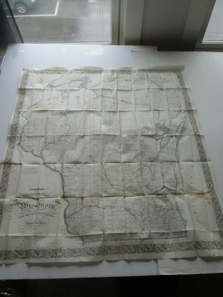
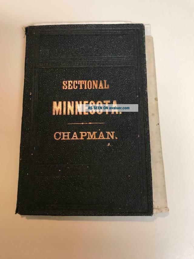
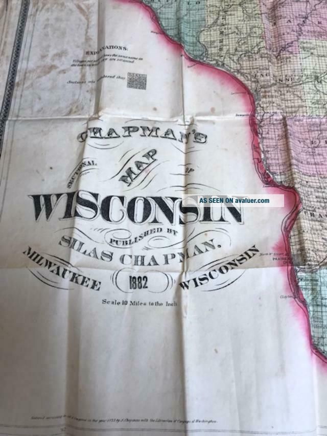
Antique Rare 1882 Silas Chapmans Sectional Map Wisconsin Silas Minnesota Cover


Item History & Price

Information:
Reference Number: Avaluer:37364Cartographer/Publisher: Silas Chapman
Year: 1882Original/Reproduction: Antique Original
US State: Wisconsin/Minnesota, KansasCanadian Province: State Map
Date Range: 1800-1899Format: Folding Map
Country/Region: United States of America
Original Description:
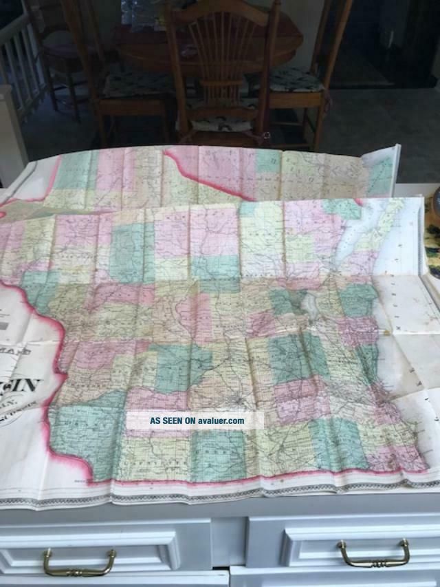
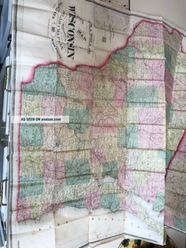
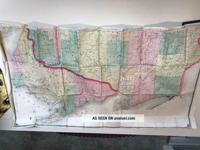
Picture Speaks for itself
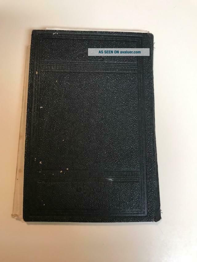
BUT, The strangest and which makes it unique IS.........The HARD COVER states: Minnesota, but the actual map is WISCONSIN
1882 Sectional map by Silas Chapman
as-is
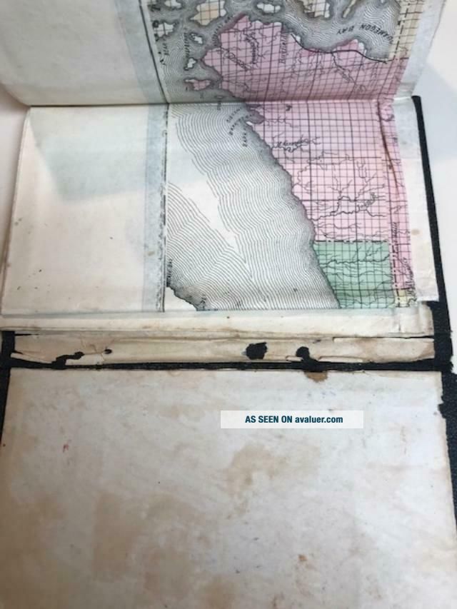
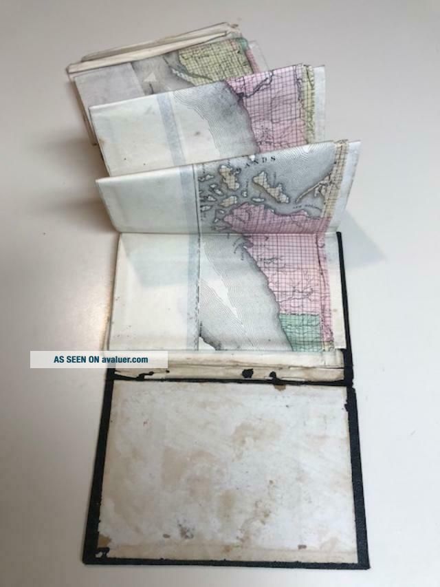
Book is in tender shape where map attaches, but map is bin good condition for age, od course it smells a little old, but it is from 1882
Folded, and a little puffy outside cover


    Similar items


  • 1856 Folding Map,  By Silas Chapman " Sectional Map Of Wisconsin ",  Pocket Map

    1856 Folding Map, By Silas Chapman " Sectional Map Of Wisconsin ", Pocket Map

  • Antique Rare 1882 Ansonia 8 Day Open Escapement Mantel Clock

    Antique Rare 1882 Ansonia 8 Day Open Escapement Mantel Clock

  • Sorrows Of Werther Johann Wolfgang Von Goethe Antique Rare 1882?

    Sorrows Of Werther Johann Wolfgang Von Goethe Antique Rare 1882?

  • Antique Rare 1882 M.  K.  Paine’s Celery Compound Semi Cabin Bottle

    Antique Rare 1882 M. K. Paine’s Celery Compound Semi Cabin Bottle

  • Antique Rare 1882 Hand Painted Poultons Paintings 1 Titled December Joy

    Antique Rare 1882 Hand Painted Poultons Paintings 1 Titled December Joy

  • Antique Rare Printer Wood Block Plate Map 1796 District Of Geneseo Ny

    Antique Rare Printer Wood Block Plate Map 1796 District Of Geneseo Ny

  • Antique Rare 1882 Illustrierte Heilige Schrift Familien Bibel

    Antique Rare 1882 Illustrierte Heilige Schrift Familien Bibel

  • Antique Rare 1918 Clason’s War Map Of The Western Front

    Antique Rare 1918 Clason’s War Map Of The Western Front


    • You might also like


    • 1860 Mitchell Hand Colored Map Colorado,  Nebraska & Kansas - Civil War Era

      1860 Mitchell Hand Colored Map Colorado, Nebraska & Kansas - Civil War Era

    • 18th Century French Map Of North America

      18th Century French Map Of North America

    • Las Vegas Nevada Vintage 1967 Us Geological Survey Quadrangle Map 4 Panels

      Las Vegas Nevada Vintage 1967 Us Geological Survey Quadrangle Map 4 Panels

    • Rare Antique 1845 Maps United States Exploring Expedition Book Antartica Hawaii

      Rare Antique 1845 Maps United States Exploring Expedition Book Antartica Hawaii

    • Vintage 1926 Map Hollywood From The Best Surveys Of The Time

      Vintage 1926 Map Hollywood From The Best Surveys Of The Time

    • American Continent (western Hemisphere) 1747 Bowen Antique Copper Engraved Map

      American Continent (western Hemisphere) 1747 Bowen Antique Copper Engraved Map

    • Gulf Coast Florida Texas United States 1705 De Fer Unusual Antique Engraved Map

      Gulf Coast Florida Texas United States 1705 De Fer Unusual Antique Engraved Map

    • California As Island United States 1700 De Fer Unusual First Edition Antique Map

      California As Island United States 1700 De Fer Unusual First Edition Antique Map

Avaluer          About Us          Privacy Policy          Contact Us          UP
© 2022, avaluer.net, Inc. or its affiliates